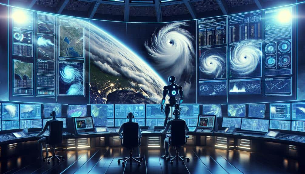
We've seen significant advancements in hurricane tracking technology, enhancing our prediction and response capabilities. Satellite imagery provides real-time, high-resolution data on storm formation, while Doppler radar and enhanced storm detection systems improve forecast accuracy. Drones and UAVs offer detailed storm surge and wind speed data, and supercomputers enable precise modeling and simulation. Mobile weather stations and ocean buoys provide vital real-time data, and reconnaissance aircraft deliver high-resolution in-situ measurements. AI and machine learning refine predictive models, and social media data adds real-time ground-level insights. These innovations represent a leap forward in our understanding and tracking of hurricanes, and there's more to uncover.
Key Points
- Satellite imagery provides real-time, high-resolution data on storm formation and movement.
- Drones and UAVs offer continuous monitoring and high-resolution data in adverse conditions.
- Supercomputers enhance hurricane tracking with accurate modeling and real-time simulations.
- AI and machine learning enable precise predictions and real-time data analysis.
Satellite Imagery
Satellite imagery has revolutionized the way we monitor and predict hurricanes by providing real-time data on storm formation and movement. The high resolution of modern satellite imagery allows us to detect even the smallest changes in cloud formation and sea surface temperatures, essential for accurate storm tracking. With advancements in remote sensing technology, we can now gather detailed information from various spectral bands, enhancing our understanding of hurricane dynamics.
By leveraging satellite imagery resolution, we can monitor hurricanes from their nascent stages to their peak intensity. This continuous stream of data enables us to predict potential landfall zones and issue timely warnings, granting communities the freedom to prepare and evacuate if necessary. Additionally, the integration of remote sensing data with numerical weather models improves the precision of our forecasts, reducing uncertainty and enhancing public safety.
Incorporating satellite data into hurricane monitoring systems also allows us to assess the impact of storms on affected regions. By analyzing imagery before and after a hurricane, we can evaluate damage, track recovery, and optimize resource allocation. This proactive approach not only saves lives but also empowers us to build more resilient communities in the face of nature's most formidable challenges.
Doppler Radar
Let's examine Doppler radar's role in hurricane tracking. Its enhanced storm detection capabilities allow us to monitor wind patterns with remarkable precision. This technology provides real-time data analysis, enabling meteorologists to make timely decisions.
Consequently, we achieve improved forecast accuracy, ultimately aiding in better preparedness and response efforts.
Enhanced Storm Detection
Doppler radar technology has revolutionized our ability to detect and analyze the intensity and movement of hurricanes in real-time. By emitting radio waves and measuring their reflection off precipitation particles, Doppler radar provides crucial data on wind speed, direction, and storm structure. This technology enhances storm tracking by allowing us to pinpoint the exact location and trajectory of a hurricane with unprecedented accuracy.
We can now identify the formation of storm cells earlier, which is vital for effective emergency response. With Doppler radar, emergency management teams gain valuable lead time to implement evacuation plans and other safety measures, ultimately safeguarding lives and property. The detailed data we obtain is invaluable for meteorologists as well, enabling them to issue more precise warnings and advisories.
Moreover, the integration of dual-polarization Doppler radar has further improved our capabilities. This advancement allows us to differentiate between types of precipitation, such as rain, hail, and snow, providing a more comprehensive understanding of a storm's characteristics.
Real-Time Data Analysis
Building on the enhanced detection capabilities, real-time data analysis through Doppler radar allows us to continuously monitor and interpret the evolving dynamics of hurricanes with remarkable accuracy. By leveraging Doppler radar, we can visualize the internal structure of a hurricane in high detail, providing essential insights into wind speed, direction, and precipitation patterns. This data visualization enables us to construct predictive models that forecast the storm's trajectory and intensity with greater precision.
With every radar sweep, Doppler technology captures a wealth of data that feeds directly into our analytical systems. This real-time influx of information allows us to track changes in hurricane behavior minute by minute, empowering emergency response teams with the latest intel. This immediacy is important for disaster preparedness, allowing for timely evacuations and resource allocation to areas likely to be hardest hit.
Furthermore, the integration of Doppler radar data into our predictive modeling frameworks means we can produce more robust simulations. These simulations inform not only emergency response strategies but also long-term planning for communities in hurricane-prone regions. By harnessing the power of real-time data analysis, we can make informed, data-driven decisions that safeguard lives and property, providing a sense of freedom from the unpredictability of nature's most formidable storms.
Improved Forecast Accuracy
Harnessing Doppler radar technology, we achieve unprecedented forecast accuracy by meticulously analyzing real-time data on wind patterns, precipitation, and storm structure. This advanced radar system sends out pulses of energy, which bounce back when they encounter precipitation. By measuring the time delay and frequency shift of these returned signals, we can construct detailed images of storm dynamics.
Our improved forecast modeling leverages this data to enhance prediction accuracy significantly. Doppler radar provides high-resolution snapshots of storm evolution, enabling us to project future paths with greater reliability. This precision is important for timely and effective evacuation planning and emergency response. With accurate predictions, communities gain the freedom to make informed decisions, minimizing the impact of hurricanes on lives and property.
Moreover, Doppler radar's ability to analyze wind velocity helps us identify key storm features such as eyewalls and rainbands. These insights are integrated into our forecast models, refining our understanding of storm intensity and potential landfall locations.
Drones and UAVs
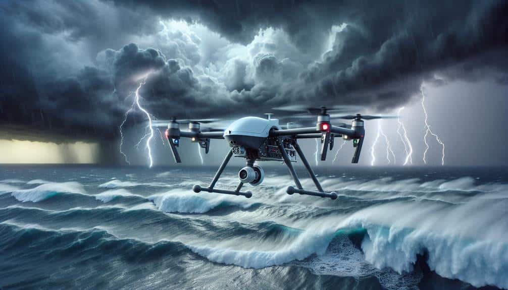
Let's turn our focus to drones and UAVs, which greatly enhance hurricane tracking capabilities. By providing real-time data collection and improved storm monitoring, these technologies offer unprecedented insights.
Additionally, they facilitate aerial damage assessment, allowing us to gauge the impact swiftly and accurately.
Real-time Data Collection
Advancements in drone and UAV technology now allow us to gather real-time data with unparalleled precision and immediacy, revolutionizing hurricane tracking methods. By deploying these aerial systems directly into storm environments, we can collect a wealth of meteorological data that was previously unreachable. This data is essential for enhancing data visualization and predictive analytics, enabling us to create more precise storm models.
Real-time data collection with drones and UAVs greatly enhances our emergency response and disaster preparedness efforts. Here's how:
- Instant Data Transmission: Drones send live data directly to monitoring stations, allowing for immediate analysis and quicker decision-making.
- High-Definition Imagery: Enhanced cameras provide detailed images of storm development, improving our understanding and predictive capabilities.
- Multi-sensor Payloads: Equipped with various sensors, drones measure wind speed, humidity, temperature, and atmospheric pressure, offering a thorough data set for predictive analytics.
- Accessibility to Hazardous Zones: Drones can safely enter risky areas that are off-limits to manned aircraft, ensuring continuous data flow during severe weather conditions.
With these advancements, we can visualize data more effectively and enhance our predictive analytics, directly impacting our ability to prepare for and respond to hurricanes. This technology empowers us, giving us the freedom to act swiftly and efficiently in the face of natural disasters.
Enhanced Storm Monitoring
By leveraging state-of-the-art drone and UAV technologies, we can greatly enhance storm monitoring capabilities, ensuring more precise and timely data collection during hurricane events. These advancements allow us to gather high-resolution data on storm surge, wind speeds, and atmospheric pressure in real-time, which is essential for making informed decisions.
Drones equipped with sophisticated sensors can fly into the heart of hurricanes, capturing data that was previously unattainable. This granular information enhances our ability to predict storm surge levels, a key factor in planning emergency response strategies. By analyzing this data, we can better anticipate the areas most at risk and deploy resources more effectively.
Furthermore, UAVs provide continuous monitoring capabilities, even in adverse conditions where traditional methods fall short. They offer the flexibility to adjust flight paths dynamically, ensuring we don't miss vital data points. This adaptability is pivotal for updating emergency response plans on the fly, maximizing our response efficiency.
In essence, the integration of drones and UAVs into storm monitoring not only improves our understanding of hurricane dynamics but also empowers us with the freedom to make quicker, smarter decisions to protect lives and property.
Aerial Damage Assessment
In the aftermath of a hurricane, drones and UAVs enable rapid and detailed aerial damage assessments, providing critical data for disaster relief and recovery efforts. Utilizing drone technology, we can conduct thorough aerial surveys that offer real-time insights into the extent of damage. This technological advancement is pivotal for efficient infrastructure evaluation, ensuring that resources are allocated where they're needed most.
Here's how drone technology enhances our damage assessment capabilities:
- Rapid Deployment: Unlike traditional methods, drones can be quickly deployed to affected areas, minimizing delays in damage assessment.
- High-Resolution Imagery: Drones capture high-detail images, allowing us to analyze structural damages with precision and identify hazards that ground teams might miss.
- Cost-Effective Operations: Aerial surveys via drones are more cost-efficient compared to manned aircraft, reducing financial strain on disaster response budgets.
- Accessibility: Drones can access hard-to-reach areas, providing thorough data from locations that are otherwise difficult or dangerous for human surveyors.
Supercomputers
Supercomputers allow us to model intricate atmospheric dynamics with unparalleled accuracy, thereby enhancing hurricane tracking capabilities to a significant extent. These powerful machines have revolutionized weather prediction, thanks to their ability to process vast amounts of data and execute highly sophisticated algorithms. Recent advancements in computational power have allowed us to refine our models, resulting in more precise forecasts that are essential for timely evacuations and disaster preparedness.
Our tracking software has seen significant development, leveraging the computational prowess of supercomputers to simulate various atmospheric conditions in real-time. By integrating data from satellites, radar, and other observational tools, these systems can predict a hurricane's path, intensity, and potential impact zones with greater reliability. This ability to anticipate changes in a storm's trajectory offers us a broader window for implementing life-saving measures.
Furthermore, supercomputers facilitate ensemble forecasting, where multiple simulations are run to account for uncertainties in initial conditions. This approach provides a range of possible outcomes, enhancing our understanding of the storm's potential behavior. Essentially, the synergy between supercomputers and advanced tracking software empowers us to mitigate the devastating effects of hurricanes more effectively.
Mobile Weather Stations
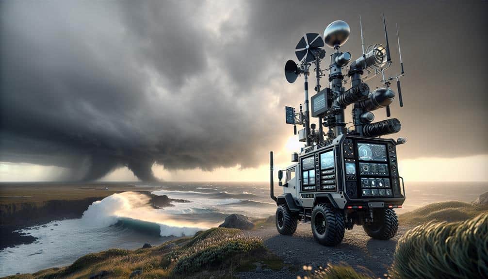
Mobile weather stations enable us to gather real-time atmospheric data from multiple locations, enhancing the accuracy and immediacy of hurricane tracking. By deploying these stations, we can perform remote monitoring and obtain essential metrics such as wind speed, barometric pressure, and humidity. This data is crucial for making timely, informed decisions during emergency response efforts.
Mobile weather stations offer several advantages:
- Portability: These stations can be quickly deployed to various locations, allowing us to remain flexible and adaptive as a hurricane progresses.
- Real-Time Data: Continuous data transmission ensures we have the most current information, which is vital for accurate forecasting and preparation.
- Remote Monitoring: Even in harsh conditions, we can monitor key atmospheric parameters without putting personnel at risk.
- Enhanced Coordination: The data collected can be shared with emergency response teams in real-time, facilitating more effective and coordinated relief efforts.
Through the integration of mobile weather stations, we enhance our capabilities in hurricane tracking and emergency response. This technology empowers us to act swiftly and accurately, guaranteeing the safety and freedom of affected communities.
LIDAR Systems
Let's explore how LIDAR systems enhance our hurricane tracking capabilities.
By providing high-resolution, three-dimensional data, these systems allow us to collect more accurate and detailed atmospheric measurements.
This real-time analysis greatly improves our predictive models, enabling better preparedness and response efforts.
Enhanced Data Collection
LIDAR systems have revolutionized hurricane tracking by providing high-resolution, real-time data on storm structure and intensity. These advanced remote sensing tools allow us to collect detailed information about hurricanes without being in the storm's path, minimizing environmental impact.
By using LIDAR, we generate precise three-dimensional models that enhance our understanding of storm dynamics and behavior.
Data visualization plays an important role in translating this information into actionable insights. With LIDAR data, we create detailed visual models that help meteorologists and researchers analyze how hurricanes evolve. This capability is essential, especially as climate change continues to alter storm patterns and intensity.
Here's how LIDAR systems enhance data collection:
- High-Definition Imaging: Captures fine details of storm structures, allowing for better predictive models.
- Real-Time Data: Provides instantaneous updates, enabling quicker, more informed decision-making.
- Remote Sensing: Collects data from a safe distance, reducing the risk to human life and equipment.
- Environmental Impact: Minimizes disturbance to natural ecosystems while gathering critical climate data.
Real-Time Analysis
Building on the precise three-dimensional models generated by LIDAR systems, real-time analysis allows us to monitor and predict hurricane behavior with unparalleled accuracy. By integrating LIDAR data with advanced algorithms, we can track the storm's eye, wind patterns, and precipitation in real time. This capability is crucial for anticipating storm surges, which often cause the most damage during hurricanes.
Using LIDAR, we can map coastal topography and underwater features with high resolution, enabling precise surge predictions. This data-driven approach helps us estimate the height and impact zone of the storm surge, providing essential information for emergency response teams. Being able to predict these surges in real time means we can issue timely warnings and implement evacuation plans more effectively.
Moreover, real-time LIDAR data supports dynamic adjustments to emergency response strategies. As the hurricane evolves, so does our analysis, allowing us to allocate resources and personnel where they're needed most. This continuous feedback loop guarantees that we stay ahead of the storm, maximizing safety and minimizing damage.
In essence, leveraging LIDAR for real-time analysis transforms our ability to respond to hurricanes, making our emergency response more agile and informed.
Ocean Buoys

How do ocean buoys revolutionize hurricane tracking with their real-time data collection and transmission capabilities?
Ocean buoys are critical in enhancing our understanding and prediction of hurricanes. By strategically placing buoys in key oceanic locations—known as buoy deployment—we can collect extensive ocean data tracking. These buoys measure various parameters such as sea surface temperature, wave height, and barometric pressure, transmitting this data in real-time to meteorological centers.
The integration of ocean buoys into hurricane tracking systems offers several advantages:
- Real-Time Data: Immediate access to oceanic conditions allows for timely updates and more accurate storm path predictions.
- Extensive Coverage: A network of buoys ensures broad spatial coverage, capturing data from remote and otherwise inaccessible areas.
- Improved Predictive Models: With continuous data streams, predictive models can be refined, improving the accuracy of hurricane forecasts and enabling better preparedness.
- Cost-Efficient: Compared to other methods, such as satellite observations or aircraft reconnaissance, ocean buoys provide a cost-effective solution for continuous monitoring.
Reconnaissance Aircraft
Reconnaissance aircraft play an important role in hurricane tracking by providing high-resolution, in-situ data that ground-based and satellite systems can't capture. These aircraft, often referred to as 'hurricane hunters,' fly directly into the storm, enabling us to measure vital parameters such as wind speed, pressure, temperature, and humidity. This weather reconnaissance is essential for improving the accuracy of hurricane forecasts and understanding storm dynamics.
Modern aircraft technology has greatly enhanced our ability to gather precise data. Equipped with advanced radar systems, dropsondes, and other meteorological instruments, these aircraft can penetrate the eyewall of a hurricane, where conditions are most extreme. The high-frequency data they collect allows meteorologists to analyze storm structure in real-time, providing invaluable insights that satellite imagery alone can't offer.
Moreover, these reconnaissance missions offer a level of detail and immediacy that other methods lack. For instance, they can capture rapid changes in storm intensity and direction, which are crucial for issuing timely warnings and evacuation orders. This data-driven approach empowers us to make informed decisions, ultimately enhancing our resilience to these natural disasters.
In an age where freedom and safety are paramount, reconnaissance aircraft remain an indispensable tool in our hurricane-tracking arsenal.
AI and Machine Learning
Artificial intelligence and machine learning are revolutionizing hurricane tracking by enabling more precise predictions and real-time data analysis. We're leveraging these technologies to forecast storm paths, intensity, and potential impact zones with unprecedented accuracy.
Here's how AI and machine learning are transforming hurricane tracking:
- Predictive Analytics: Machine learning algorithms analyze extensive datasets, including historical hurricane data and real-time atmospheric conditions, to forecast storm trajectories and intensity with greater precision than traditional models.
- Bias Detection and Ethical Implications: AI systems can detect and correct biases in data, ensuring fair distribution of resources and warnings. However, we must remain vigilant about the ethical consequences of relying heavily on automated systems, including the risk of perpetuating existing biases.
- Data Privacy and Transparency Measures: Given the sensitivity of the data involved, we implement strict data privacy protocols. Transparency measures guarantee that stakeholders understand how data is collected, processed, and used, fostering trust in AI-driven forecasts.
- Real-time Analysis: AI enables real-time analysis of incoming data from satellites, sensors, and other sources. This rapid processing allows for swift adjustments to predictions as new information becomes available, improving situational awareness.
Social Media Data
By leveraging social media data, we can enhance our hurricane tracking efforts by gathering real-time, ground-level information from affected areas. Platforms like Twitter, Facebook, and Instagram become invaluable sources, providing immediate updates that traditional methods can't match. By analyzing posts, images, and videos, we obtain a detailed view of the storm's impact.
Through sentiment analysis, we can gauge public perception and emotional responses, which helps prioritize resources and emergency responses. This technique enables us to identify distress signals and areas in urgent need of aid. Additionally, trend tracking on social media platforms allows us to map the spread of information, recognizing patterns and hotspots of hurricane activity.
Our analytical tools can sift through vast amounts of social media data, extracting crucial insights that inform our decision-making processes. We identify not only the physical damage but also the psychological and social impacts on communities. This dual approach enhances our situational awareness and enables more effective disaster management.
Incorporating social media data into our hurricane tracking arsenal empowers us to respond swiftly and efficiently, ensuring that the information we act on is as current and thorough as possible. This fusion of technology and real-time data drives our mission to protect and serve communities more effectively.
Frequently Asked Questions
How Do Hurricane Tracking Technologies Impact Emergency Response Times?
Our emergency response times greatly improve with tracking advancements. The technology impact guarantees we can predict storm paths more accurately, enabling quicker, more efficient evacuations and resource deployment, ultimately saving lives and preserving the freedom of affected communities.
What Role Does International Collaboration Play in Hurricane Tracking Improvements?
International collaboration plays an essential role in hurricane tracking improvements. By fostering data sharing and research partnerships, global cooperation accelerates technology advancements, enhancing our predictive capabilities and ultimately reducing emergency response times. Let's continue prioritizing this collective effort.
Can Hurricane Tracking Tech Predict Storm Surges Accurately?
We can predict storm surges more accurately with advanced storm surge modeling and accuracy assessment techniques. This enhances emergency preparedness and risk communication, empowering communities to make informed decisions and maintain their freedom in crisis situations.
How Is Public Awareness About Hurricane Risks Enhanced Through New Technologies?
We're harnessing the power of social media and mobile apps to amplify community engagement and public education. By delivering real-time data and forecasts, we empower communities to make informed decisions, enhancing awareness and reducing hurricane risks.
What Are the Costs Associated With Deploying Advanced Hurricane Tracking Systems?
We've conducted a cost analysis, revealing significant expenses in deploying advanced hurricane tracking systems. Implementation challenges include high initial investment, maintenance, and training. Despite these, the benefits in lives saved and property protected justify the costs.