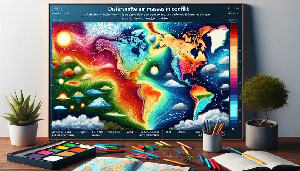
Understanding air masses is essential for predicting severe weather. Air masses, large bodies of air with uniform temperature and humidity, play a pivotal role in weather dynamics. We classify them based on their source regions and properties, such as maritime tropical and continental polar. These air masses interact at fronts, which are critical for forecasting weather changes. By analyzing air mass stability, temperature gradients, and moisture content, we can anticipate weather conditions accurately. Tracking their movement using satellite imagery and meteorological models further refines our predictions, allowing us to foresee severe weather events with precision. Let's explore how these interactions shape our forecasts.
Key Points
- Air masses are large bodies of air with uniform temperature and humidity, crucial for weather predictions.
- Interactions between different air masses often lead to severe weather events like thunderstorms.
- Analyzing air mass stability helps predict calm or severe weather conditions.
- Fronts, boundaries between air masses, trigger significant weather changes and severe weather.
Defining Air Masses
Air masses, which are large bodies of air with uniform temperature and humidity characteristics, play an important role in weather patterns and forecasts. By understanding these properties, we can predict how weather will behave.
Air mass boundaries, known as fronts, are pivotal in determining where weather changes will occur. These boundaries often lead to the development of storms and other severe weather events.
We classify air masses based on their source regions and properties, such as temperature and moisture content. The classification helps us anticipate how an air mass will affect the weather as it moves.
Air mass stability is another essential factor. Stable air masses tend to suppress vertical motion, leading to calmer weather, while unstable air masses can enhance vertical motion, resulting in thunderstorms and other severe weather.
Air mass modification occurs when an air mass moves away from its source region, interacting with the surface and other air masses. This modification can change its temperature and moisture characteristics, impacting weather predictions.
Types of Air Masses
To accurately predict severe weather, we must categorize air masses based on their source regions and inherent properties. This air mass classification allows us to understand and anticipate how different air masses interact and modify one another, which is essential for accurate weather forecasting.
Air mass origins are typically classified into four primary types: continental polar (cP), maritime polar (mP), continental tropical (cT), and maritime tropical (mT).
Continental polar air masses originate over large land masses in high latitudes, bringing cold and dry conditions. Maritime polar air masses, forming over cold ocean waters, are moist and cool.
Continental tropical air masses develop over hot, arid regions, contributing to hot and dry weather. Lastly, maritime tropical air masses, which form over warm ocean waters, are warm and humid.
Understanding air mass interaction is vital to predict severe weather. For instance, when a warm, moist maritime tropical air mass meets a cool, dry continental polar air mass, the potential for severe thunderstorms increases.
Air mass modification occurs when an air mass moves away from its source region, gradually taking on the characteristics of the underlying surface. Monitoring these changes helps us forecast shifts in weather patterns, ultimately enhancing our ability to anticipate severe weather events.
Air Mass Characteristics
Characterizing air masses requires a thorough examination of their temperature, humidity, and stability profiles to understand their impact on weather systems. We need to analyze air mass stability, which indicates the potential for vertical movement within the atmosphere. Stable air masses resist vertical movement, often leading to clear skies and calm conditions. Conversely, unstable air masses can result in turbulent weather, as they promote vertical convection, potentially causing thunderstorms and severe weather events.
Temperature gradients within air masses are vital in determining their interaction with surrounding environments. Sharp temperature gradients often occur at frontal boundaries, where two different air masses meet. These boundaries can be hotbeds for severe weather, as the contrasting temperatures create dynamic atmospheric conditions.
Moisture content is another significant factor. Air masses originating over oceans typically have higher moisture content, contributing to higher humidity levels. In contrast, those formed over land, especially deserts, tend to be drier. High moisture content in an unstable air mass can notably enhance the potential for convective activity, leading to severe weather patterns.
Tracking Air Mass Movement
We analyze satellite imagery and meteorological models to track the movement of air masses, which is essential for predicting severe weather events. By leveraging advanced forecasting techniques, we can decipher complex atmospheric dynamics that dictate weather patterns.
Satellite imagery provides a continuous stream of high-resolution data, allowing us to monitor temperature gradients, moisture levels, and cloud formations in real-time.
Our approach involves integrating satellite data with sophisticated meteorological models to predict the trajectory and evolution of air masses. These models simulate atmospheric dynamics by incorporating variables like wind speed, pressure changes, and thermal contrasts. This integration enables us to generate accurate, short-term forecasts critical for anticipating severe weather conditions.
Tracking air mass movement isn't just about observing current conditions; it's about understanding the underlying mechanisms driving these changes. For instance, the interaction between polar and tropical air masses can trigger significant weather events. By analyzing these interactions, we can identify patterns and trends that might indicate impending severe weather.
Air Masses and Severe Weather
Analyzing the interactions between different air masses reveals their significant role in the genesis of severe weather phenomena. When we examine how warm, moist air masses from tropical regions collide with cold, dry air masses from polar regions, we uncover the mechanics of storm development. These interactions create fronts, which are boundaries that often serve as the breeding ground for severe weather patterns.
By understanding these dynamics, we can enhance our forecasting techniques, allowing us to predict severe weather with greater accuracy. Key atmospheric conditions, such as temperature gradients and humidity levels, provide critical data points for meteorologists.
Let's break down the essential factors for storm development:
- Temperature Contrasts: Sharp differences in temperature between colliding air masses intensify atmospheric instability.
- Humidity Levels: High moisture content in the air fuels severe storms by providing the necessary energy for storm clouds to form.
- Wind Shear: Variations in wind speed and direction with altitude can organize and strengthen storm systems.
- Pressure Systems: Low-pressure areas encourage upward motion, fostering storm growth.
Frequently Asked Questions
How Do Air Masses Influence Global Climate Patterns?
Have you ever wondered how air masses shape our climate? They drive atmospheric circulation, influencing weather patterns globally. Their interactions with ozone depletion and greenhouse gases are critical in understanding our planet's changing climate.
What Tools Do Meteorologists Use to Predict Air Mass Changes?
To predict air mass changes, we utilize weather balloons, satellites, radar, and computer models. These tools provide precise data, allowing us to analyze patterns and forecast shifts, ensuring timely and accurate weather predictions for greater autonomy.
How Does Climate Change Affect Air Mass Formation?
Oh, because who wouldn't love a bit of extra chaos, right? Climate change messes with our atmospheric circulation and greenhouse gases, altering temperature gradients and precipitation patterns, making air mass formation more unpredictable. Freedom, indeed.
Can Air Masses Impact Air Quality and Pollution Levels?
Yes, air masses can greatly impact air quality and pollution levels. When air masses stagnate, they trap pollutants, leading to poor air quality. Conversely, moving air masses can disperse pollutants, improving air quality.
What Are Some Historical Examples of Severe Weather Caused by Air Masses?
Imagine a weather time machine: Hurricane Katrina's devastation, Tornado Alley's twisters, the Dust Bowl's droughts, and Polar Vortex's chills. These extreme events highlight how air masses can drastically influence severe weather, impacting our freedom to thrive.