You’ll sabotage your chase before storms even form by skipping forecast preparation, ignoring moisture analysis, and relying solely on radar instead of visual observations. Poor team role assignments put inexperienced drivers behind the wheel during hydroplaning conditions, while neglected vehicle maintenance creates roadside disasters. You’re compounding these errors by winging decisions rather than following systematic processes, misinterpreting radar signatures, and switching targets impulsively. Understanding these critical mistakes and their prevention strategies will transform your dangerous enthusiasm into calculated positioning that keeps you alive.
Key Takeaways
- Rushing into the field without analyzing moisture, CAPE thresholds, wind shear, and Storm Prediction Center discussions creates dangerous positioning vulnerabilities.
- Relying solely on radar instead of visual observations misses critical cues like rear-flank downdrafts and wall cloud rotation patterns.
- Assigning navigator and driver roles based on passion rather than skills, composure, and technical proficiency causes operational failures.
- Neglecting vehicle maintenance and emergency equipment checks leads to preventable breakdowns during critical chase moments.
- Lacking systematic decision-making processes results in missed intercepts, dangerous positioning, and inadequate escape route planning.
Skipping Pre-Chase Weather Analysis and Forecast Preparation
While experienced meteorologists spend hours analyzing atmospheric parameters before deploying mobile radars, beginner storm chasers often rush into the field with nothing more than a radar app and enthusiasm. This inadequate moisture analysis leaves you vulnerable to core-punching through large hail and violent winds.
Disregarding CAPE thresholds means you’ll position yourself in tornado paths without understanding instability requirements. Without studying wind shear on Skew-T diagrams, you can’t anticipate tornadic potential. Skipping Storm Prediction Center discussions eliminates your knowledge of escape routes and storm movement patterns.
The result? You’ll face collision risks from poor visibility, erratic chasers, and wet roads—all while threatening professional spotters and public safety. Free resources like COMET MetEd‘s 1000+ modules exist specifically to prevent these dangerous gaps.
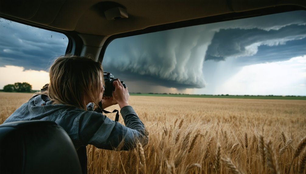
Relying Too Heavily on Radar Instead of Visual Observations
Armed with forecast knowledge, many beginners make their next critical error: they drive straight under a supercell with eyes glued to their smartphone radar instead of the sky above them. Overconfidence in radar interpretations blinds you to critical visual cues like rear-flank downdrafts signaling tornado formation.
Radar resolution decreases with distance, velocity couplets hide in rain cores, and algorithms like VIL underestimate hail near domain edges. Technology can’t detect every hazard—that’s why trained spotters exist. Dismissing spotter reports as superfluous ignores ground truth that validates tornadic vortex signatures forecasters recognize on screens.
When you’re close to the storm, your eyes outperform any app. Watch the cloud base, monitor wall rotation, and observe inflow bands. Radar guides your approach; visual observation keeps you alive.
Even perfect technology and radar interpretation mean nothing if your driver panics in zero-visibility hail or your navigator can’t read a road map under pressure. Dividing roles between navigator and driver demands careful personnel selection based on actual skills, not enthusiasm alone.
Skills and composure under pressure matter more than passion when assigning critical navigator and driver roles during storm chasing.
Critical role assignments:
- Driver qualification – Select someone who remains calm during hydroplaning, hail cores, and blinding rain. Prioritizing driving skills over chasing excitement keeps everyone alive.
- Navigator competency – Assign map-reading duties to someone proficient with GPS, custom mapping software, and real-time route adjustments.
- Task separation – Driver focuses exclusively on vehicle operation while navigator handles all positioning decisions.
- Experience matching – Place beginners in support roles, not high-pressure positions requiring split-second judgment calls.
Solo chasers must pull over completely for any non-driving activity.
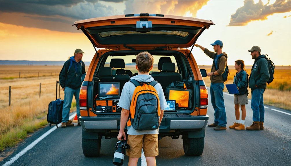
Neglecting Vehicle Maintenance and Equipment Checks
Storm chasers often obsess over meteorological preparation while their vehicles deteriorate into roadside hazards. You’ll find yourself stranded when worn-out tires hydroplane on wet roads or fail mid-chase because you didn’t replace them before the season.
Pre-chase inspections aren’t optional—check your radiator, cooling fan, fuel pump, and serpentine belt religiously. Monitor fluid levels maintenance and brake system components before every trip.
Your emergency kit should include spare tires, fix-a-flat, air pump, and road flares. Don’t forget Rain-X treatments to prevent fogging and clear plastic film for emergency window repairs.
Power failures kill chases too—maintain charged devices with portable solutions like EcoFlow Delta Pro and power inverters with surge protection. Dedicated GPS units and paper maps provide essential navigation redundancy when technology fails.
Failing to Develop a Systematic Decision-Making Process
Many chasers fall into the trap of winging their decisions rather than following a proven systematic approach, which consistently leads to missed intercepts and dangerous positioning.
Failing to use systematic weather data analysis leaves you vulnerable to careless assumptions instead of verified forecasts. Develop this framework:
Systematic data analysis protects against dangerous assumptions—verified forecasts trump gut feelings when positioning for intercepts.
- Days before: Consult SPC Convective Outlooks and model trends to identify potential setups
- Morning of: Review NWS models, mesoscale analysis, and ingredient forecasting thoroughly
- During chase: Continuously monitor radar, satellite, surface charts, and radiosondes to refine targets
- Team coordination: Assign clear roles—navigation, data analysis, safety monitoring—to prevent disorganized decisions
Dismissing the value of team decision making amplifies individual judgment errors. Quick yet careful evaluation, not rushed impulses, keeps you positioned ahead of developing storms while maintaining escape routes.
Chasing Without Proper Storm Theory Education or Mentorship
A systematic decision-making process means nothing if you’re basing those decisions on inadequate storm theory knowledge. While 44.7% of storm chasers hold bachelor’s degrees in meteorology or atmospheric sciences, many beginners skip pivotal educational foundations. You’ll find insufficient mentorship opportunities and lack of formal training programs create dangerous knowledge gaps. Theoretical understanding of atmospheric dynamics, thermodynamics, and mesoscale meteorology directly impacts your intercept success and safety margins.
Free resources exist—Skywarn spotter programs and meted.ucar.edu offer accessible training without degree requirements. Universities provide severe storms field observation courses emphasizing evidence-based practices and safety protocols. Post-chase analysis routines separate successful chasers from reckless ones. Don’t rely solely on passion and driving skills. Seek experienced mentors, invest in foundational education, and develop systematic post-chase evaluation habits. Your freedom depends on competence.
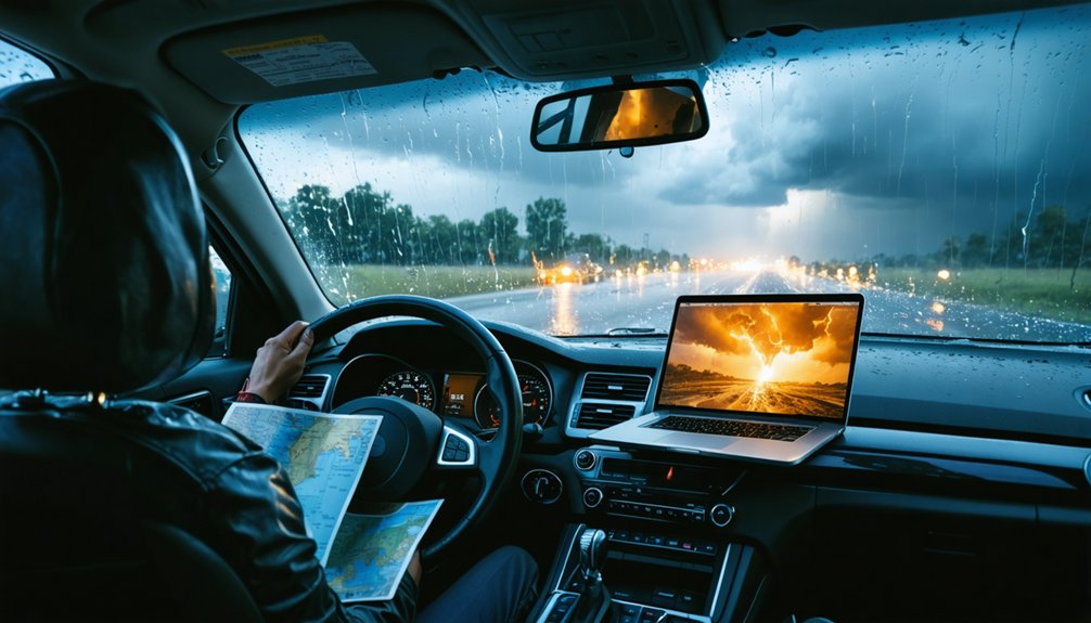
Misinterpreting Radar Data and Map Orientation
While fundamental storm theory provides the framework for successful chasing, radar interpretation errors kill that advantage instantly. You’ll compromise your safety and miss opportunities without mastering radar product interpretation and understanding beam propagation effects.
Critical mistakes destroying beginner chase success:
- Confusing high reflectivity aloft with surface precipitation—that bright red signature often represents hail or snow at altitude, not ground-level rain
- Ignoring Storm Relative Velocity—base velocity shows 70 mph when reality is 40 mph internal winds plus 30 mph storm motion
- Misidentifying hook echoes—velocity aliasing creates false rotation signatures that aren’t actual tornadoes
- Trusting distant radar coverage—beam propagation effects cause missed precipitation and severely underestimated echo tops
Cross-reference multiple products with NWS alerts before committing to dangerous intercept positions.
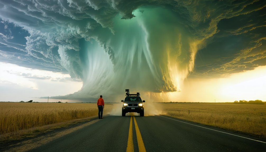
Switching Storm Targets Without Analyzing Atmospheric Conditions
Switching storm targets mid-chase without reassessing atmospheric conditions sabotages your intercept success and compromises safety. You’ll abandon productive systems showing sustained instability, lift, and moisture—the three critical ingredients—only to pursue weakening storms that lack verified vertical atmospheric support.
This incomplete analysis forces you into hazardous positioning while chasing non-viable targets that current weather balloon data and model updates would have flagged as futile.
Abandoning Productive Storm Systems
When beginners chase storms, they often succumb to the temptation of abandoning their current target for distant radar echoes that appear more promising. This impulsive switching sabotages your freedom to operate effectively.
Recognizing predictive factors like sustained CAPE and vorticity trends prevents you from leaving storms with high tornado potential. Evaluating long term data value keeps your equipment deployed where it matters most.
Abandoning productive systems costs you:
- Continuous sensor data streams essential for model validation
- Ground truth observations across complete storm lifecycle stages
- Optimal positioning on pre-scouted intercept routes
- Scientific contributions that justify chase operations
Each abandoned storm represents wasted fuel, fragmented datasets, and increased road hazards. Stay committed to systems showing persistent instability rather than chasing fleeting radar signatures.
Ignoring Critical Atmospheric Parameters
Because atmospheric conditions determine storm behavior far more reliably than radar appearance alone, switching targets without analyzing critical parameters transforms you from a prepared chaser into a reactive gambler. You’re ignoring the moisture shear balance that separates photogenic supercells from disorganized rain blobs.
Without checking MLCAPE values (1500+ j/kg ideal), wind shear profiles, and Skew-T soundings, you’ll chase storms lacking tornadic potential. Radar limitations mean VIL alone won’t identify hail producers—you need reflectivity height analysis relative to temperature levels. High moisture without adequate shear creates flash flooding setups, not tornado opportunities.
Follow the proven workflow: SPC regional analysis, composite parameters, sounding confirmation. Skipping these steps means you’re chasing blind, wasting fuel on atmospheric configurations that physically can’t produce what you’re seeking.
Incomplete Analysis Costs Intercepts
During target shifts, radar wavelength limitations create blind spots that transform promising intercepts into missed opportunities. You’re chasing freedom on the open road, but stagnant data integration chains you to outdated predictions.
When you switch targets without synthesizing real-time observations, you’ll intercept decaying storms instead of developing tornadoes.
Critical errors include:
- Ignoring surface wind shifts before abandoning your current target
- Skipping upper air profile analysis that reveals updraft sustainability
- Failing radar fusion between mobile units and fixed installations
- Neglected model validation through ground-truthing observations
Your incomplete analysis costs you the shot you’ve driven hundreds of miles to capture. Multi-instrument synthesis takes minutes, but premature abandonment wastes hours. Verify atmospheric conditions before switching—your next intercept depends on it.
Forgetting to Create and Use Forecasting Checklists
You’ll miss critical atmospheric parameters during high-stress chase situations without a systematic forecasting checklist. Overlooking moisture convergence, cap strength, or helicity values can send you toward storms that won’t produce or away from ones that will.
Building a personalized checklist from your forecast failures guarantees you don’t repeat the same analytical mistakes when conditions turn favorable.
Why Checklists Matter Most
Without a systematic forecasting checklist, even experienced chasers miss critical data that separates successful intercepts from busted forecasts. You’re gambling with your safety and success when you skip structured verification steps that professional forecasters use daily.
Checklists force systematic forecast verification against SPC outputs, revealing your blind spots before they cost you intercepts. Utilizing community resources like StormTrack discussions and Bart Comstock’s illustrated setups becomes second nature when you’ve got a repeatable process.
Your freedom to chase depends on executing these steps:
- Morning sequence: Satellite analysis, model review, then radar refinement for target selection
- Real-time recalibration: Update targets upon arrival using fresh satellite and boundary data
- Skew-T mastery: Link vertical profiles to surface parameters before chase day
- Post-chase review: Document forecasting methodology, successes, and failures for continuous improvement
Common Overlooked Atmospheric Parameters
Your checklist means nothing if it excludes the parameters most beginners ignore until they’ve wasted entire chase seasons. Neglecting moisture and instability analysis kills your forecast before you leave home—dew points below 60°F won’t support severe storms regardless of shear values.
You’re overlooking mesoscale boundary interactions when you focus solely on synoptic-scale features, missing the convergence zones where storms actually fire. LCL heights above 1500 m signal weak low-level moisture that limits tornado potential. Lapse rates matter too; anything below 6.0 C/km drastically reduces severe weather chances.
Balance shear with instability—40 kts of bulk shear won’t save a forecast lacking buoyancy. Stop chasing models alone. Analyze Skew-T diagrams, monitor boundaries on radar, and verify moisture profiles independently.
Building Your Personal Checklist
Because storm chasing demands simultaneous evaluation of dozens of atmospheric variables under time pressure, creating a structured forecasting checklist isn’t optional—it’s the difference between consistent intercepts and random luck.
Your personal checklist must systematically address critical decision points:
- Morning baseline: Compare your independent forecast against SPC outlooks before gathering regional data insights
- Data collection sequence: Surface observations, tropospheric soundings, local NWS discussions, mesoscale analysis, satellite imagery
- Model evaluation protocol: Review GFS/EURO for synoptic patterns, then HRRR/NAM3K for mesoscale details while utilizing forecast comparison tools
- Parameter verification: Confirm moisture, instability, shear, and lift thresholds meet regional requirements
Document what you’ve missed after each chase. Your checklist evolves through calibration cycles, transforming scattered information into systematic analysis that prevents overlooked features.
Poor Route Planning and Road Selection for Chase Days
How often do storm chasers find themselves trapped on dead-end roads as a supercell bears down on their position? You’ll face seasonal storm path variations that demand pre-planned escape routes and alternative positioning strategies. Understanding region specific road network challenges prevents dangerous situations—Tornado Alley’s 35 distinct zones differ vastly from Dixie Alley‘s chess-like requirements where 50-60 knot storm speeds leave zero margin for error.
Interstates restrict your freedom during active chasing phases with limited access points. Study local road networks beforehand, identifying single-bridge crossings, construction zones, and state line boundaries that differentiate terrain. Recent rainfall creates muddy traps near supercells, while debris-strewn roads follow tornado paths. Always carry paper maps as backup when cell data fails, and maintain adequate fuel reserves to avoid stranding yourself in remote areas.
Frequently Asked Questions
What Essential Safety Gear Should Storm Chasers Carry in Their Vehicles?
You’ll need safety glasses, helmets, work gloves, and basic first aid kits for protection. Don’t forget portable power sources like inverters and jump batteries to keep communication devices running when you’re miles from civilization during severe weather.
How Much Does Storm Chasing Equipment Typically Cost for Beginners?
“Don’t put the cart before the horse”—you’ll need $2,000-$5,000 per chase for budget planning. Start with smartphone cameras and essential safety gear before equipment financing larger investments like signal boosters ($550) or professional cameras.
What Are the Best Weather Apps and Resources for Storm Chasers?
You’ll need RadarScope or MyRadar for real-time weather monitoring, plus Weather Underground’s crowd-sourced storm data from 250,000+ stations. Don’t rely on single sources—cross-reference multiple apps and NWS alerts to maintain situational awareness and chase safely.
How Do You Get Proper Storm Chasing Certification or Licenses?
You don’t need storm chasing licenses—that’s the myth. Reality requires SKYWARN certification for proper safety protocols. Complete free NWS training, learn severe weather recognition, and understand licensing requirements only apply to ham radio operation, not chasing itself.
What Insurance Considerations Should Storm Chasers Be Aware Of?
You’ll need broad liability coverage and property damage protection before chasing storms. Without proper insurance, you’re personally liable for accidents, injuries, and equipment damage. Don’t let one mistake financially ruin your independence and storm-chasing freedom.