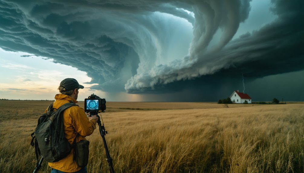
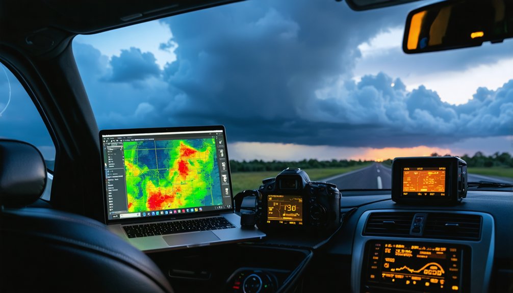
You’ll need professional-grade Doppler radar tools that process WSR-88D Level II data streams for accurate storm interception. RadarScope delivers the same products NWS forecasters use, while Radaromega provides high-resolution single-site data with MRMS integration. Stormradar offers 72-hour projections and velocity visualization, whereas WeatherBug operates 250,000+ monitoring stations with sub-minute updates. StormWatch+ provides five-minute radar refreshes with warning polygon precision, and Weather Underground leverages hyper-local PWS networks. The sections below detail each platform’s mesocyclone detection capabilities, data refresh rates, and field-tested intercept advantages.
Key Takeaways
- RadarScope processes raw NEXRAD data and activates storm detection algorithms used by National Weather Service forecasters for professional-grade analysis.
- Radaromega integrates MRMS Reflectivity with GPS-enabled alert parameters and maintains maximum resolution within each radar’s effective range.
- Stormradar provides 72-hour future radar projections and wind stream velocity visualization for precise hook echo identification during tornadoes.
- WeatherBug operates 250,000+ proprietary stations delivering sub-minute updates with synchronized radar, lightning, and satellite data layers.
- GRLevel3 offers advanced GIS layering and vector-format processing capabilities for experienced chasers requiring detailed data correlation.
RadarScope: Professional-Grade Radar Application for Serious Storm Chasers
RadarScope processes raw Level II and Level III data streams directly from NEXRAD WSR-88D sites, delivering the same radar products National Weather Service forecasters view but rendered on mobile devices with minimal latency. You’ll access reflectivity, velocity, VIL, and dual-polarization products including correlation coefficient and differential reflectivity.
The Pro Tier 2 subscription activates storm detection algorithms that generate derived contours and advanced tracking metrics showing storm paths and speeds. You can overlay lightning strike data from the U.S. Lightning Network, tornado watches, and local storm reports filtered by type.
The dual-pane display lets you compare products simultaneously, while custom color tables optimize contrast. Though satellite data integration isn’t native, RadarScope‘s 50-frame loops and real-time processing make it essential for intercepting severe weather independently.
Radaromega: High-Resolution Global Radar Data With Advanced Customization
Radaromega delivers WSR-88D single-site radar data at higher resolutions than composite products, enabling you to identify mesocyclones and hook echoes during rapidly evolving severe weather.
The platform integrates MRMS Reflectivity with volumetric scanning capabilities across global radar networks, providing unprecedented spatial coverage for multi-target storm chasing operations. Lightning detection operates within radar range using ground-based networks, while GLM (Geostationary Lightning Mapper) satellite data extends your monitoring to mesoscale convective systems beyond traditional tower coverage.
Global Coverage And Resolution
When storm chasers require maximum spatial detail around specific radar installations, single-site radar data delivers resolution that composite mosaics can’t match. Radaromega provides high-resolution radar access across the United States, Canada, Germany, Australia, and South Korea, with worldwide data access to single-site reflectivity, velocity, and dual-polarization products. You’ll receive faster updates on rapidly evolving mesocyclones and hook echoes than standard applications provide.
The platform supplements radar coverage with global model quality through GFS and ECMWF datasets, ensuring thorough atmospheric analysis where ground-based sensors aren’t available. Tropical models HWRF and HMON extend storm-tracking capabilities across ocean basins.
Single-site data maintains maximum resolution within each radar’s effective range, while MRMS reflectivity with customizable smoothing options bridges coverage gaps. This dual approach gives you unrestricted access to precision meteorological intelligence regardless of your intercept location.
Lightning Detection And Mapping
Lightning strikes provide critical real-time information about convective intensity and electrification processes within thunderstorm cells. You’ll access density displays showing strike frequency across specific intervals, enabling mesoscale analysis when combined with METARS and GLM data.
The custom lightning configuration supports targeted monitoring through personalized range zones and alert parameters tied to GPS coordinates. Network integration capabilities merge lightning overlays with reflectivity products, velocity data, and storm-based warnings across dual-view frames. You’ll organize monitoring through 10 location lists with 150 customizable sites.
Animated strikes appear on-map during active storms, with audible alerts triggering when new radar scans detect electrical activity. Push notifications deliver real-time warnings for up to three locations, while quad-view displays present lightning layers alongside high-resolution single-site radar for thorough storm structure analysis.
Stormradar: Real-Time Storm Tracking With User-Friendly Interface
For storm chasers requiring immediate access to meteorological data without sacrificing analytical depth, Stormradar delivers high-resolution radar visualization powered by The Weather Channel’s proven infrastructure. You’ll access advanced single-site radar technology providing crystal-clear storm detail, complementing your satellite imagery analysis and weather sonde data interpretation workflows.
The platform’s capabilities include:
- 72-hour future radar projections extending your chase planning beyond immediate threats
- Wind stream velocity visualization enabling precise hook echo identification during tornadic development
- NOAA-integrated severe weather warnings delivering official alerts without delay
- Customizable map layers overlaying hail zones, tropical tracks, and real-time lightning strikes
You’ll leverage AI Weather Assistant™ for personalized meteorological insights while maintaining complete control over notification preferences—eliminating alert fatigue while preserving situational awareness during active pursuit operations.
WeatherBug: Comprehensive All-Rounder Platform for Storm Chasing Adventures
WeatherBug operates the world’s largest proprietary weather observation network with over 250,000 monitoring stations, delivering granular atmospheric data aggregated from terrestrial sensors, satellite feeds, and lightning detection arrays.
You’ll access multi-layered data correlation that synthesizes precipitation radar, temperature gradients, barometric pressure trends, and wind velocity vectors into unified storm trajectory models.
The platform provides professional-grade tracking tools including high-resolution Doppler radar with adjustable opacity, color-coded lightning proximity alerts calibrated to 10-mile increments, and forecast models updated every 15 minutes for precision chase positioning.
Quarter-Million Station Network
When severe weather threatens, storm chasers require access to high-density meteorological data that updates faster than traditional National Weather Service observation networks. WeatherBug’s quarter-million station network delivers nationwide station coverage with real time data quality you won’t find elsewhere. Each station captures 27 weather variables refreshed every two seconds, enabling mesoscale observations across states and cities.
This infrastructure supports independent forecasting of thunderstorms, squall lines, and fronts:
- Lightning strike data integrated through WTLN detects both intracloud and cloud-to-ground activity
- Sub-minute updates eliminate dangerous data gaps during rapidly evolving conditions
- Unrestricted access to professional-grade sensors without government bureaucracy delays
- Mesoscale resolution reveals microbursts and rotation signatures invisible to sparse conventional networks
You’ll intercept severe weather with precision previously available only to research meteorologists.
Multi-Layered Data Correlation
Because atmospheric phenomena develop across multiple spatial and temporal scales, effective storm interception demands simultaneous analysis of radar reflectivity, lightning strike density, surface observations, and satellite imagery. WeatherBug’s platform enables multi radar data fusion through 20+ synchronized layers, correlating base reflectivity with Spark™ lightning data to identify electrically active storm cores.
You’ll access GOES satellite imagery revealing convective initiation before radar detection, while velocity data confirms mesocyclonic rotation. This integration supports predictive storm modeling by combining real-time strike proximity (tracked to 0.1-mile accuracy), storm movement vectors, and atmospheric pressure gradients.
Professional chasers leverage these correlated datasets to anticipate supercell evolution, positioning themselves ahead of tornado genesis. The system updates every 2.5 minutes, providing the temporal resolution necessary for intercept decision-making without restrictive data interpretation barriers.
Professional Storm Tracking Tools
For field deployment requiring thorough meteorological intelligence, WeatherBug’s integrated platform delivers 19+ synchronized map layers spanning radar reflectivity, Total Lightning Network visualization, and NWS alert polygons through a unified interface. The system’s data integration architecture consolidates observations from 8,000+ tracking stations with aviation-grade instrumentation, ensuring data quality control through professional-grade sensors monitoring temperature, wind vectors, and barometric pressure in real-time.
Operational advantages for autonomous storm intercepts:
- StreamerRT GIS monitoring eliminates dependency on fragmented information sources during critical chase windows
- Dangerous Thunderstorm Alerts arrive 50% faster than conventional notifications, maximizing your positioning freedom
- Minute-by-mile Spark Lightning Alerts provide GPS-based proximity warnings within 10-mile thresholds
- PulseRad® Radar integration extends Total Lightning Network coverage to international deployments beyond domestic constraints
This ecosystem supports unrestricted operational decision-making across 2.6 million global forecast points.
StormWatch+: Data-Driven Weather Monitoring for Professional Enthusiasts
StormWatch+ delivers precipitation data through nationwide radar displays that measure reflected energy intensities in dBZ (decibels of Z), differentiating between rain, snow, and ice via color-coded echoes. You’ll receive radar updates every five minutes with interactive satellite mapping that enables future-animated tracking independent of restrictive interfaces.
The GPS-based EnRoute system provides real-time location updates every 30 feet, cross-referencing your coordinates against polygon-defined warning boundaries with block-level precision. Mobile data syncing compares your trajectory to active Tornado and Severe Thunderstorm Warning polygons, delivering alerts in under two seconds—occasionally faster than National Weather Service iNWS transmission.
You can configure monitoring for five independent locations while accessing layered datasets including storm tracks, satellite imagery, air quality indices, and National Weather Service seven-day forecasts without model-based interpolation constraints.
Weather Underground: Extensive Personal Weather Station Network Integration
When conventional radar sweeps miss microscale atmospheric variations between 4km grid points, Weather Underground’s integration of over 250,000 personal weather stations (PWS) worldwide delivers hyper-local observations at neighborhood resolution. You’ll access data updates every 2.5 seconds after quality control safeguards verify accuracy, complemented by 26,000 MADIS and 2,000 ASOS stations.
Personal weather stations fill critical data gaps between traditional observation points, delivering real-time atmospheric intelligence at unprecedented neighborhood-level granularity.
BestForecast™ capabilities providing autonomous chase decisions:
- 36% more forecast points than NWS through 4km spatial resolution
- 15-minute temporal updates versus NWS 4-hour intervals
- WunderMap layering: radar, satellite, fronts, severe storm tracks
- Station interrogation for temperature, wind, dew point, precipitation metrics
You’ll integrate hardware like RainWise, Netatmo, or AcuRite 5-in-1 through WeatherBridge USB connections, with Vantage Vue transmitting 300 meters to WiFi cloud for remote streaming during active pursuits.
Choosing the Right Doppler Radar Tool for Your Storm Chasing Needs
Personal weather station networks provide granular surface observations, but your storm interception success depends equally on selecting radar tools that match your technical proficiency and chase methodology. RadarScope’s $9.99 mobile platform delivers super-resolution Level II data with 99% reliability—ideal for beginners requiring quick hook echo identification.
Advanced chasers favor GRLevel3’s $79.95 laptop software for GIS layering and vector-format processing. RadarOmega excels with GPS enabled tracking, pairing your phone’s location with remote computers for live streaming coordination. Baron Mobile Threat Net provides professional-grade radar data quality comparable to RadarScope.
Enhance signal stability using WeBoost cell boosters—critical for maintaining data streams in remote territories. Avoid marine radars; they’re FCC-illegal on land and compromise radar data quality through interference. Match your tool selection to operational requirements, not marketing hype.
Frequently Asked Questions
Can Multiple Doppler Radar Apps Run Simultaneously on One Device Without Interference?
Yes, you’ll find multiple Doppler radar apps run simultaneously without interference on one device. Device compatibility guarantees separate data streams, while radar data accuracy remains unaffected since apps independently access remote servers rather than generating local signals.
Do These Radar Apps Work Offline in Areas With Poor Cellular Coverage?
RadarScope offers genuine offline coverage through pre-downloaded radar data and remote data access capabilities, enabling you to view reflectivity and velocity products independently. MyRadar and Storm Shield require continuous connectivity, limiting your operational freedom in remote locations.
What Internet Speed Is Required for Real-Time Radar Data Streaming While Chasing?
You’ll need 10–15 Mbps upload for 1080p radar streaming, though cellular network performance often falls short. Ideal bandwidth allocation demands 25+ Mbps for 4K data with 1.5x headroom, ensuring uninterrupted real-time transmission during active chases.
Are Radar Apps Battery-Intensive During Extended Storm Chasing Sessions in the Field?
Yes, you’ll experience significant battery drain during extended sessions. Implement battery life optimization through reduced refresh rates and screen brightness. Deploy data management strategies like selective alerts and widget usage to maximize field operation independence without external power sources.
Do Storm Chasing Radar Tools Require Special Permits or Professional Meteorology Credentials?
You’re free to chase storms without storm chasing permit requirements or meteorology expertise qualifications. Radar apps access public NEXRAD data legally. However, operating mobile radar antennas demands FCC licensing—violations incur $8,000+ fines under Communications Act regulations.