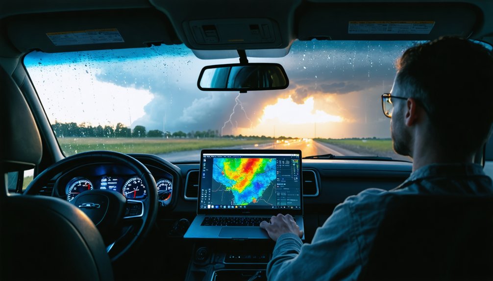
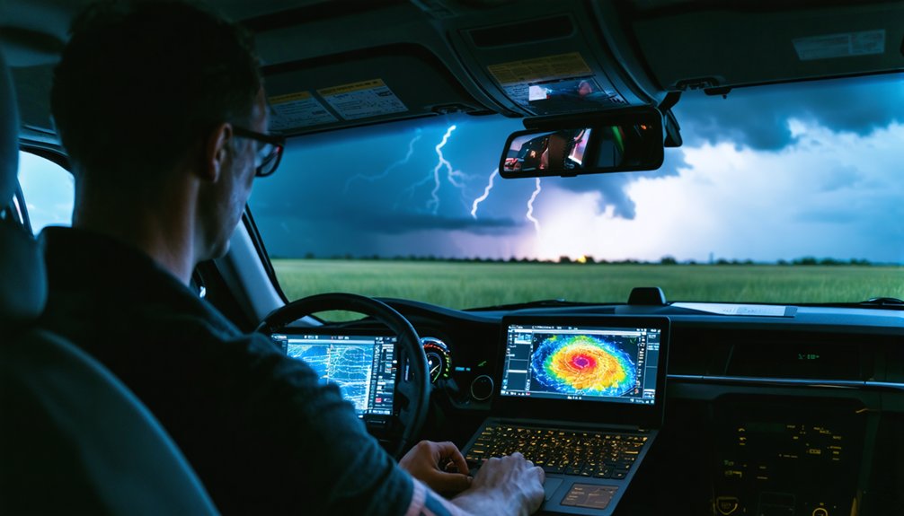
Focus on reflectivity values above 60 dBZ to identify large hail and intense precipitation cores, while watching for hook echoes that signal mesocyclone development. You’ll need to analyze velocity couplets—tight red-green pixel pairs that persist across multiple vertical levels for 10+ minutes—to confirm rotation. Look for correlation coefficient values below 0.8 paired with high reflectivity to verify tornado debris signatures. Level 2 super-resolution data provides superior refresh rates and dense vertical sampling, enabling faster warning lead times. The following detailed analysis explores each signature’s specific characteristics and interpretation techniques.
Key Takeaways
- Look for hook echoes and bounded weak echo regions together to identify rotating supercells with tornado potential.
- Identify velocity couplets with tight red-green pixel pairs persisting 10+ minutes across multiple elevations indicating mesocyclones.
- Reflectivity values exceeding 60 dBZ indicate large hail, while three-body scatter spikes confirm giant hailstones.
- Use correlation coefficient below 0.8 with high reflectivity to detect tornado debris signatures in rain-wrapped storms.
- Leverage super-resolution Level 2 data for faster refresh rates and improved velocity couplet detection during storm tracking.
Master Reflectivity Patterns to Identify Severe Storm Signatures
Reflectivity patterns serve as the primary diagnostic tool for identifying severe storm signatures on weather radar, with specific thresholds and configurations indicating hazardous conditions. You’ll detect severe weather by monitoring values above 60 dBZ, which indicate large hailstones or intense precipitation cores.
Sharp reflectivity gradient recognition enables you to pinpoint updraft locations where wind shear concentrates energy. These gradients shift from weak to extreme returns over short distances, marking supercell boundaries you shouldn’t penetrate.
Hook echoes on the right-rear flank signal mesocyclone development and tornado potential. Watch for three-body scatter spikes extending radially from high-reflectivity cores—they’re definitive hail markers.
V-shaped configurations with embedded weak echo regions reveal powerful updrafts. Track persistent reflectivity trends exceeding 65 dBZ to anticipate extreme precipitation and large hail production.
Decode Velocity Couplets to Spot Rotating Thunderstorms
While reflectivity data reveals where precipitation exists, velocity measurements expose the motion within storms—the dynamic signatures that separate benign rainfall from life-threatening rotating systems. You’ll identify rotational couplets by their parallel interface to the radar beam, where tight red-green pixel pairs indicate concentrated vorticity. Mesocyclones persist across multiple vertical levels for ten-plus minutes, signaling tornado potential.
To resolve velocity couplet variations, distinguish rotational patterns from divergent microburst signatures—the latter displays outward-spreading velocities at surface level. When you analyze non rotating storm convergence dynamics, you’ll observe outbound velocities positioned closer to the radar than inbound returns. This systematic differentiation enables precise classification of storm threats, transforming raw Doppler data into actionable intelligence that keeps you positioned safely yet effectively.
Recognize Supercell Characteristics Using Hook Echoes and Storm-Relative Motion
Hook echoes manifest on radar displays as curved reflectivity appendages extending from a thunderstorm’s southwestern flank—the defining structural signature that separates supercells from multicellular complexes. You’ll identify these features by using the lowest beam angle to observe hook echoes, which form when rear flank downdrafts wrap precipitation around the updraft base. The adjacent weak echo region marks where strong updrafts prevent hydrometeor descent, indicating mesocyclone presence.
Monitor fine scale storm evolution dynamics by tracking the persistent hook appendage and bounded weak echo region aloft—these coupled signatures confirm deep rotating updraft structure. Storm-relative motion analysis reveals how RFD circulation enhances rotation while maintaining updraft-downdraft separation, extending supercell longevity and maximizing tornado potential within the mesocyclone’s core.
Leverage Dual-Polarization Data to Confirm Tornado Debris Signatures
When you’re chasing at night or in rain-wrapped conditions where visual confirmation is impossible, dual-polarization radar provides objective evidence of tornado occurrence through debris signatures. Focus on correlation coefficient (CC) values dropping below 0.8 co-located with reflectivity exceeding 51 dBZ and a tight velocity couplet—this combination confirms debris lofting rather than meteorological targets.
You’ll achieve detection confidence exceeding 80% by requiring precise spatial overlap of low CC, high reflectivity, near-zero differential reflectivity, and rotational velocity signatures that characterize the PTDS algorithm.
Correlation Coefficient Debris Detection
Dual-polarization radars revolutionized tornado detection by transmitting both horizontal and vertical electromagnetic beams, enabling storm chasers to identify tornado debris signatures with unprecedented accuracy. When interpreting debris ball characteristics, you’ll observe roundish high-reflectivity areas (51-72 dBZ) coupled with distinctively low correlation coefficient values below 0.80, appearing as blue shades on CC maps amid red backgrounds of uniform precipitation.
Recognizing low correlation coefficient signatures requires understanding that irregular debris—structural fragments, vegetation, soil—produces near-zero CC readings due to varying sizes, shapes, and dielectric constants. Cross-reference these signatures with near-zero differential reflectivity and velocity couplets for confirmation. The PTDS algorithm achieves >80% probability of detection, verifying tornadoes 70-80% of time when debris balls manifest. This data-driven approach empowers you to confirm rain-wrapped tornadoes independently, enhancing situational awareness without relying solely on visual confirmation.
Nighttime Tornado Confirmation Methods
Since visual confirmation becomes impossible after sunset, you’ll rely on dual-polarization radar data to verify tornado presence with measurable confidence during nighttime operations. ZDR values near or below zero combined with reflectivity readings of 45-57 dBZ indicate lofted debris signatures characteristic of active tornadoes.
Automated debris detection algorithms process correlation coefficient drops and cross-sectional particle data to distinguish random-shaped targets like insulation and vegetation from precipitation. This technology delivers improved tornado warning lead times by eliminating dependence on spotter networks during darkness.
You’ll analyze multiple variables simultaneously—reflectivity, velocity couplets, differential reflectivity, and correlation coefficients—to achieve high-confidence tornado confirmation. Rural tornado events particularly benefit from radar-based debris detection, where ground-truth damage assessment mightn’t occur for hours after touchdown.
Utilize Level 2 Super-Resolution for Detailed Real-Time Storm Analysis
Level 2 super-resolution data provides 8 times greater spatial resolution than legacy systems, delivering up to 13.5 million observation points every 4-5 minutes for precise storm feature identification. You’ll detect mesocyclone signatures and velocity couplets earlier with enhanced reliability, as the reduced variance in radar fields enables faster recognition of rotation indicators within developing storms.
The improved temporal resolution through SAILS and MRLE functions repeats lowest elevation scans 3-4 times per volume, ensuring you capture rapid intensification events and tornadic development that traditional scanning intervals miss.
Enhanced Storm Feature Detection
While base reflectivity scans provide fundamental storm structure information, you’ll achieve substantially improved spatial resolution and feature detection by accessing Level 2 super-resolution data streams. This enhanced resolution enables precise storm mode identification through composite reflectivity analysis across multiple tilt angles—revealing intensity trends and vertical development characteristics invisible in base scans.
You’ll leverage dual-polarization capabilities for differential reflectivity analysis, distinguishing precipitation types and detecting hail signatures with superior accuracy compared to traditional methods. Monitor VIL density values exceeding 3.5 as reliable hail indicators, while examining echo tops for convective intensity evaluation.
Recognize hail spike patterns—weak reflectivity areas extending radially from high-intensity cores—and analyze hook echoes using polarimetric data to identify tornadic features and severe wind associations.
Superior Data Refresh Rates
When analyzing rapidly evolving severe weather, you’ll gain critical operational advantages through Level 2 super-resolution‘s superior data refresh rates, particularly when utilizing Volume Coverage Pattern 12, which completes 14 elevation angles and 17 azimuthal scans in just 4.5 minutes. This detailed VCP analysis enables you to capture 4D datasets of latitude, longitude, altitude, and time with precipitation mode updates cycling every 4-10 minutes.
The denser vertical sampling at lower elevation angles provides the temporal resolution necessary for fine scale mesocyclone identification before traditional systems detect rotation signatures. You’ll observe extended velocity data ranges that deliver faster lead times on warnings, while VCP 112’s multi-pulse repetition frequency detection mitigates range and velocity aliasing. These capabilities let you track supercells and hailstorms in near-real-time without institutional constraints.
Improved Velocity Couplet Identification
Zeroing in on velocity couplets requires you to recognize the characteristic pairing of inbound (green) and outbound (red) radial velocities that indicate mesocyclonic rotation. Level 2 Super-Resolution data delivers 0.25 km gate spacing, enabling you to detect tight proximity between velocity maxima that legacy resolution misses.
Confirm couplets persist across multiple tilts for 10+ minutes while pairing with reflectivity hook echoes. Watch for velocity data aliasing when radial winds exceed Nyquist limits, remapping values that obscure rotation signatures. Beam height issues compromise distant storm analysis by overshooting mid-level rotation. Higher tilts clarify ambiguous low-level patterns.
Correlation Coefficient drops below 0.85 signal debris lofting, confirming tornadic potential when combined with persistent couplets near surface elevation.
Track Storm Movement and Speed to Optimize Your Chase Position
Storm positioning success depends fundamentally on your ability to extract movement vectors from radar data with quantitative precision. Analyze reflectivity displays to determine directional travel through precipitation pattern orientation and hook echo positioning relative to motion vectors.
Doppler velocity scans provide radial speed measurements by detecting phase changes in reflected radio waves, giving you exact approach or retreat rates. Environmental feature tracking through reflectivity fine lines reveals drylines and fronts that steer storm development.
Boundary pattern recognition requires combining surface observations with radar signatures for ideal positioning strategy. Always verify timestamps to prevent navigation errors from outdated data—delays between observation and display can compromise safety protocols.
Dual-Doppler systems enhance velocity calculations when available, improving your predictive accuracy during active chase operations.
Identify Three-Body Scatter Signatures for Giant Hail Detection
When you’re analyzing S-band radar data, look for a weak reflectivity spike (<20 dBZ) extending 10-30 km radially downrange from an intense core exceeding 63 dBZ—this Three-Body Scatter Spike (TBSS) definitively indicates large hail through Mie scattering rather than typical Rayleigh returns.
The artifact forms when radar energy scatters through hail, reflects off wet ground, and forward-scatters back through the hail column, creating delayed echoes that appear as radial extensions behind the core. You’ll recognize genuine TBSS by confirming it exists almost exclusively aloft, starts at a distance matching the core’s height above ground, and doesn’t show increasing reflectivity values at longer ranges along the radial.
Understanding TBSS Radar Appearance
Three-Body Scatter Spike (TBSS) represents a distinctive radar artifact extending 10-30 km radially downrange from intense thunderstorm cores, characterized by anomalously weak reflectivities below 20 dBZ. You’ll identify this S-band signature by its precise radial alignment with cores exceeding 63 dBZ, appearing exclusively aloft rather than at ground level.
The spike originates from Mie scattering mechanics, beginning at distances matching the core’s height above ground. Critical detection parameters include consistent low reflectivity without downstream intensification and positioning through the 0 to -30°C layer. Unlike distinguishing lightning channels or detecting storm electrification through conventional means, TBSS provides direct evidence of large hail presence.
S-band radars enable reliable hail inference, while C-band frequencies generate similar signatures without definitive large hail correlation. Verify authenticity by excluding sun spikes, topographic returns, and legitimate precipitation echoes.
Interpreting Hail Size Indicators
Large hail detection through radar signatures relies on identifying the distinctive 10-30 km low reflectivity spike extending radially downrange from cores exceeding 63 dBZ. You’ll find these TBSS features displaying reflectivities below 20 dBZ at mid-levels, positioned aloft at distances matching the core’s height above ground. Detecting polarimetric signatures enhances your analysis when combined with traditional reflectivity patterns.
Position your vertical cross-section through the maximum reflectivity within the 0 to -30°C layer, then verify the weak echo extends along the same radial. Recognizing hail characteristic patterns means differentiating authentic TBSS from sun spikes, precipitation returns, or terrain echoes. Multiple signatures within one storm indicate separate hail cores.
This electromagnetic artifact from Mie scattering gives you advance warning of giant hailstones threatening your chase position.
Distinguish Between Bow Echoes and Squall Lines for Wind Threat Assessment

Several critical distinctions separate bow echoes from squall lines on weather radar, directly impacting your wind threat assessment during storm chasing operations. You’ll identify bow echoes as crescent-shaped segments measuring 20-120 km long within broader linear systems, while squall lines extend hundreds of miles as straight or wavy arrangements.
The dynamics behind bow echoes involve rear-inflow jet descent creating forward bulges with book-end vortices at edges—your key signature for severe straight-line wind potential at the apex. Radar determined wind threats intensify when bowing segments develop, indicating faster forward motion and enhanced surface winds comparable to tornado strength.
Mini bow echoes represent localized intensifications within squall lines. Track these evolving features closely, as mature bow echoes persisting 3-6 hours may evolve into widespread derecho events.
Combine Multiple Radar Sites to Avoid Echotop Underestimation
When relying on a single radar site, you’ll consistently underestimate storm top heights by 5,000-15,000 feet due to beam overshooting, earth curvature limitations, and cone of silence effects directly above the antenna.
Radar mosaics eliminate these blind spots by integrating overlapping coverage zones from adjacent stations, capturing storm structures from multiple angles and heights. You’ll identify seasonal echotop patterns more accurately when cross-validating measurements across multiple sites, reducing individual sensor errors that compromise height estimates.
Analyze multi sensor fusion techniques by combining radar radial velocity data with satellite infrared brightness temperatures—this simultaneous assimilation produces superior storm characterization than either dataset alone. Statistical data assimilation methods merge these inputs, establishing the most accurate atmospheric representation available.
Multiple perspectives reveal boundary-layer features and mesocyclone development that single-site data obscures, extending your warning lead times substantially.
Integrate Surface Observations and Satellite Imagery With Radar Data
Radar data alone provides insufficient situational awareness during active storm chases—you’ll miss critical atmospheric triggers that surface observations and satellite imagery reveal. Deploy vehicle-mounted instruments to measure wind, pressure, temperature, and humidity, validating radar-detected boundaries and velocity couplets with ground truth.
Surface obs precipitation phase confirms whether radar echoes represent rain, hail, or mixed conditions, while temperature/dewpoint spreads verify moisture inflow. Satellite imagery outperforms radar for locating drylines during initiation, with overshooting tops correlating to composite reflectivity intensity. Integrate satellite cold cloud tops with dual-pol hail signatures to assess severity.
Cross-reference rain/storm damage correlations between radar precipitation cores and ground reports. Position strategically using satellite for broad storm paths, radar for mesocyclone structure, and surface arrays for immediate environmental hazards—this multi-data nowcasting maximizes intercept precision.
Frequently Asked Questions
What Mobile Radar Software Works Best for Storm Chasers in the Field?
RadarScope remains your gold standard, delivering professional-grade mobile radar data integration with near-real-time NWS feeds. You’ll need reliable cellular network connectivity for smooth operation, though its efficient processing minimizes lag when you’re pursuing severe weather independently.
How Do Storm Chasers Maintain Safe Distances From Tornadoes While Intercepting?
Studies show 70% of chaser injuries occur from inadequate positioning. You’ll maintain safe distances by implementing strict safety protocols: position north/east of rotation, secure perpendicular escape routes, and develop situational awareness through continuous radar monitoring and visual storm-feature recognition.
What Backup Power Solutions Keep Radar Equipment Running During Extended Chases?
You’ll need battery backup systems like Anker’s 24,000mAh PowerCore or EcoFlow Delta Pro, paired with solar powered generators for multi-day operations. These solutions maintain radar functionality during extended pursuits, ensuring you’re never constrained by power limitations.
How Can Chasers Distinguish False Velocity Couplets From Actual Mesocyclones?
You’ll spot false doppler returns through aliasing artifacts and hot pixels showing unrealistic acceleration. True mesocyclone identification requires temporal continuity across scans, spatial coherence, symmetric gate-to-gate shear, and corroborating reflectivity features like hook echoes.
What Correlation Coefficient Values Definitively Confirm Tornado Debris Versus Heavy Rain?
You’ll find correlation coefficient thresholds of 0.7 or lower definitively confirm tornado debris versus heavy rain’s higher values. Remote sensing techniques distinguish lofted debris through concentrated low-CC clusters, while precipitation maintains moderate-to-high coefficients exceeding 0.85 consistently.