We've pinpointed the top tools for accurate storm predictions by integrating advanced meteorological technology and data analytics. Doppler radar systems and satellite imaging offer real-time data and expansive atmospheric views. Numerical weather prediction models and ensemble forecasting techniques simulate conditions and account for uncertainties. Sophisticated storm chasing software, enhanced by machine learning algorithms, provides actionable insights and high-resolution weather maps. Improved data collection from ground-based sensors, ocean buoys, and aircraft supports in-depth analysis. These tools combine to deliver precise and timely storm forecasts, revolutionizing our approach to weather prediction and safety. Discover how each contributes to enhanced accuracy.
Key Points
- Doppler Radar Systems: Provide real-time data on storm velocity and precipitation intensity for precise storm tracking.
- Satellite Imaging Technology: Captures expansive atmospheric data and high-resolution images to track cloud motion and precipitation patterns.
- Numerical Weather Predictions: Simulate atmospheric conditions with high precision using complex algorithms and vast observational data.
- Ensemble Forecasting Techniques: Enhance predictive accuracy by running multiple simulations to generate probabilistic forecasts and quantify uncertainties.
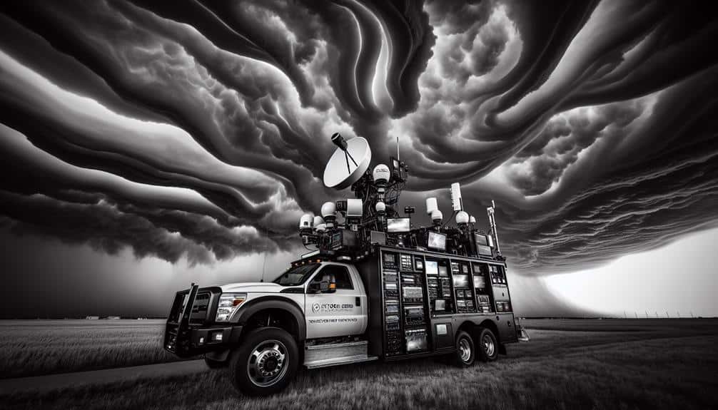
Doppler Radar Systems
Doppler radar systems provide meteorologists with real-time data on storm velocity and precipitation intensity, enabling more accurate weather predictions. These systems operate by emitting radio waves that bounce back from precipitation particles, allowing us to measure the speed and direction of storms. By analyzing these returned signals, we gain precise insights into storm dynamics, which is critical for effective storm tracking.
Radar accuracy is paramount in this field. Enhanced radar resolution helps us detect small-scale features within storms, such as mesocyclones and tornadoes, that might otherwise go unnoticed. The higher the radar accuracy, the better we can predict severe weather events, thereby providing communities with the information they need to make informed decisions and maintain their freedom.
Moreover, Doppler radar systems excel at storm tracking. They allow us to monitor storm development and movement continuously, offering a dynamic picture of weather patterns. This capability is particularly beneficial during severe weather outbreaks, as it provides the timeliness and precision required to issue warnings and advisories.
Satellite Imaging Technology
While Doppler radar systems provide valuable ground-level insights, satellite imaging technology offers a thorough, top-down perspective on storm systems, enhancing our ability to monitor and predict weather patterns globally.
Satellite imaging technology excels in capturing expansive atmospheric data, offering unparalleled views that ground-based systems can't achieve. By integrating high-resolution images from various satellite sensors, we can meticulously analyze cloud formations, temperature variations, and moisture levels.
The process of image interpretation allows us to extract crucial information from satellite images. We identify storm development, track cloud motion, and monitor precipitation patterns with high precision. This capability significantly aids in storm tracking, enabling us to predict storm paths and intensities more accurately.
For instance, geostationary satellites provide continuous monitoring, offering real-time updates that are vital during severe weather events. Moreover, polar-orbiting satellites contribute to comprehensive global coverage, ensuring no region remains unmonitored.
This extensive data collection empowers us to produce detailed storm models and forecasts. By leveraging these advanced imaging technologies, we can enhance our predictive accuracy and provide timely warnings, ultimately safeguarding communities and promoting our collective freedom to prepare and respond effectively.
Weather Prediction Models
Let's explore the critical components of weather prediction models that enhance our storm forecasting accuracy.
We'll examine how numerical weather predictions, ensemble forecasting techniques, and data assimilation methods contribute to more reliable predictions.
Numerical Weather Predictions
Numerical weather predictions, driven by sophisticated mathematical models, form the backbone of modern storm forecasting by simulating atmospheric conditions with high precision. These models leverage vast amounts of observational data, including temperature, humidity, pressure, and wind speed, to generate forecasts. By incorporating data from satellites, weather stations, and ocean buoys, we enhance forecast accuracy and provide more reliable storm predictions.
In our quest for precision, data analysis plays an important role. We use complex algorithms to assimilate observational data and refine our initial conditions, which are essential for accurate predictions. The process involves solving the fundamental equations of fluid dynamics and thermodynamics on a global scale. This not only improves short-term forecasts but also extends the reliability of long-term storm predictions.
Furthermore, high-resolution models allow us to capture small-scale atmospheric phenomena, such as convection and turbulence, which are crucial for predicting severe weather events. As we continue to refine these models and integrate more data, our ability to anticipate and prepare for storms improves significantly. This empowers us to make informed decisions, enhancing our resilience and freedom in the face of natural disasters.
Ensemble Forecasting Techniques
In our pursuit of more dependable storm forecasts, we employ ensemble forecasting techniques, which involve running multiple simulations to account for uncertainties in initial conditions and model parameters. By leveraging this approach, we can better capture the range of possible outcomes and enhance our predictive accuracy. Ensemble forecasting allows us to generate probabilistic forecasts, which are pivotal in a world increasingly affected by climate change.
Each simulation within an ensemble forecast may slightly vary, reflecting different assumptions about the atmosphere's current state and how it might evolve. This variation helps us quantify the uncertainty in our predictions and assess potential storm impacts more thoroughly. For instance, while a single deterministic forecast might indicate a specific storm path, ensemble forecasts can reveal a range of possible trajectories, thereby offering a more nuanced picture of potential risks.
Moreover, ensemble forecasting is invaluable for policy makers and emergency responders, providing them with crucial information to make informed decisions. As climate change continues to alter weather patterns, the significance of accurate storm predictions can't be overstated. By embracing ensemble forecasting, we empower ourselves with the tools to navigate these uncertainties and guarantee better preparedness for future storm events.
Data Assimilation Methods
Harnessing data assimilation methods, we integrate real-time observational data into weather prediction models to refine our storm forecasts. By combining data from various sources, such as satellite imagery, ground-based radar, and remote sensing technologies, we enhance the accuracy of our models. This integration allows us to capture the dynamic state of the atmosphere more precisely, leading to more reliable storm predictions.
We employ advanced machine learning techniques to process and analyze this vast amount of data. These algorithms can identify patterns and correlations within the data that might be overlooked by traditional methods. By doing so, we improve the initial conditions of our weather models, which is essential for accurate storm forecasting. Machine learning provides a sophisticated approach to handling the complexity and variability of atmospheric data.
Additionally, data assimilation bridges the gap between observational data and model predictions. By continuously updating our models with the latest observations, we guarantee they remain relevant and precise. This iterative process allows us to predict storm behavior with greater confidence, giving individuals and communities the freedom to make informed decisions.
Ultimately, our analytical approach to data assimilation empowers us to provide timely and accurate storm forecasts, enhancing safety and preparedness.
Storm Chasing Software
Let's examine how storm chasing software enhances our predictions through real-time data integration and advanced predictive modeling algorithms. These tools allow us to analyze vast amounts of data swiftly, leading to more accurate forecasts.
Mobile compatibility features, in addition, ensure that storm chasers can access critical updates on the go, improving safety and responsiveness.
Real-time Data Integration
Our ability to forecast storms with precision relies on the seamless integration of real-time information through advanced storm chasing software. By utilizing cutting-edge data visualization tools and real-time data analysis, we can convert raw weather observations into actionable insights. These tools enable us to monitor atmospheric conditions as they develop, offering a dynamic perspective of weather patterns that's vital for accurate storm prediction.
Through the utilization of machine learning algorithms, we incorporate vast amounts of weather data from diverse sources, including satellite imagery, radar readings, and ground-based sensors. This integration of weather data enables us to identify patterns and anomalies that may otherwise be overlooked. Machine learning enhances our forecasting capabilities by constantly learning from new data, refining its models, and improving its accuracy over time.
Real-time data integration empowers us with a level of situational awareness that's crucial for prompt decision-making. The ability to adapt quickly to changing conditions not only improves our storm prediction accuracy but also supports proactive measures in risk management and safety protocols.
Essentially, the fusion of machine learning and real-time data integration signifies a significant shift in how we comprehend and respond to severe weather phenomena.
Predictive Modeling Algorithms
Predictive modeling algorithms in storm chasing software provide us with data-driven insights that enhance our ability to forecast severe weather events with high precision. These advanced tools leverage machine learning techniques and pattern recognition algorithms to analyze vast amounts of meteorological data. By employing statistical modeling, we can identify patterns and trends that aren't immediately evident.
Our analytical approach involves:
- Machine Learning Techniques: We utilize these to train models on historical weather data, enhancing the accuracy of our forecasts over time.
- Pattern Recognition Algorithms: These algorithms enable us to detect early indicators of storm formation, giving us a crucial time advantage.
- Data Analysis: By examining real-time and historical data, we can create a thorough picture of the atmospheric conditions, enriching our predictive capabilities.
- Statistical Modeling: This allows us to quantify the likelihood of storm events, providing a statistical foundation for our predictions.
These data-driven methodologies empower us to make informed decisions, allowing us to act swiftly and effectively. Our freedom to move and respond efficiently to severe weather hinges on the reliability and accuracy of these predictive tools. Embracing these technologies guarantees we stay a step ahead, safeguarding lives and property.
Mobile Compatibility Features
Integrating mobile compatibility features into storm chasing software guarantees that meteorologists and storm chasers can access real-time data and predictive models on-the-go, enhancing their responsiveness and decision-making capabilities. Our focus on mobile functionality allows us to utilize advanced user interface design that ensures data is presented clearly and intuitively, even on smaller screens. This is critical when every second counts in predicting and reacting to severe weather conditions.
Real-time notifications are a cornerstone of mobile compatibility, enabling us to receive immediate updates on storm developments. These notifications can be tailored using location-based alerts, which use GPS tracking to provide precise, localized information. This ensures that we're always aware of the latest changes in our specific area, allowing for more accurate and timely interventions.
The integration of GPS tracking also offers significant benefits for coordination and safety. It allows us to share our exact locations with team members, enhancing collaboration and positioning everyone effectively to gather data and stay safe.
Mobile Weather Apps

Mobile weather apps frequently provide real-time data and predictive models that enhance our ability to forecast storms with greater precision. These tools are essential in our quest for timely and reliable storm predictions. By integrating advanced user interface design and accuracy monitoring, we can access vital weather information swiftly.
Push notifications and severe weather alerts keep us informed of imminent threats, empowering us to make proactive decisions. The analytical approach of these apps guarantees that we receive data-driven updates, reducing the risk of misinformation.
Consider the following advantages:
- Immediate Updates: Real-time data streams keep us ahead of rapidly changing weather conditions.
- User-Centric Design: Intuitive interfaces make complex meteorological data accessible to all, enhancing our understanding and response efforts.
- Precision Tracking: Accuracy monitoring provides us with the confidence to trust the app's predictions, necessary during severe weather events.
- Timely Alerts: Push notifications for severe weather alerts ensure we're never caught off guard, giving us the freedom to act swiftly and safely.
High-Resolution Weather Maps
In recent years, high-resolution weather maps have revolutionized our ability to visualize and analyze storm patterns with unparalleled detail. These maps employ advanced algorithms and satellite data to provide precise meteorological information, allowing us to track storms minute by minute.
By leveraging high-resolution imagery, we can discern intricate weather patterns that were previously undetectable with lower-resolution tools.
We've seen that these maps effectively capture micro-scale phenomena such as localized thunderstorms and tornadoes. This level of detail empowers meteorologists to make more accurate short-term forecasts, improving public safety and preparedness.
Additionally, high-resolution weather maps play an essential role in long-term climate trend analysis. They enable us to observe changes in storm frequency, intensity, and trajectory over time, offering insights into how climate change is impacting weather patterns globally.
The integration of high-resolution weather maps with machine learning models further enhances their predictive capabilities. By analyzing vast amounts of historical data, these models can identify subtle patterns and predict future storm activity with increasing accuracy.
As we continue to refine these technologies, we're moving closer to a future where storm predictions aren't only precise but also timely, giving us the freedom to make well-informed decisions.
Atmospheric Monitoring Sensors
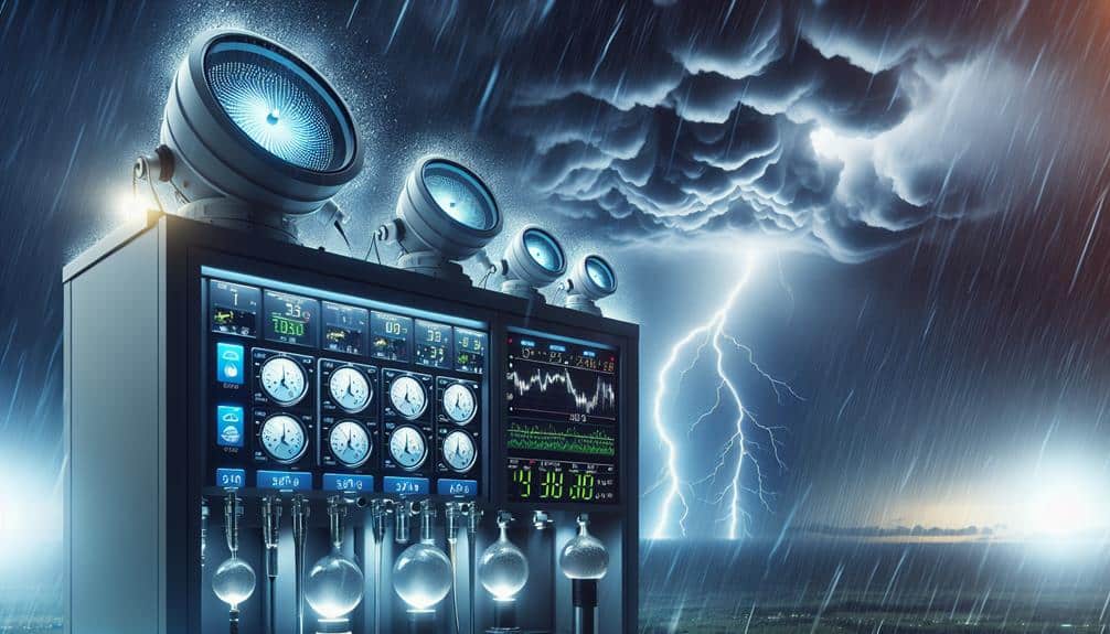
Building on the advancements of high-resolution weather maps, atmospheric monitoring sensors provide the granular data necessary to enhance our understanding of storm dynamics. These sensors, with their impressive sensor accuracy and extensive monitoring range, offer crucial insights into the atmospheric conditions that precede and accompany storms.
Strategic sensor placement is vital. By positioning sensors in diverse and high-impact areas, we can capture a thorough dataset. This placement guarantees we're not missing significant atmospheric variations that could influence storm development.
Data integration follows, where the real-time readings from these sensors are fed into sophisticated models. This integration allows us to refine our predictions and respond more effectively to emerging storm threats.
To highlight the impact, consider the following benefits of atmospheric monitoring sensors:
- Precise Data Collection: High sensor accuracy guarantees we're capturing minute atmospheric changes, essential for predicting storm intensity.
- Wide Monitoring Range: Broad coverage allows us to monitor extensive areas, providing a clearer picture of evolving weather systems.
- Timely Alerts: Immediate data integration translates to faster, more reliable storm warnings.
- Enhanced Safety: By improving storm predictions, we empower communities to take timely action, safeguarding lives and property.
Frequently Asked Questions
How Do Hurricanes Form and Gain Strength?
We analyze hurricane formation through warm ocean water and atmospheric conditions. Hurricanes gain intensity as they draw energy from warm waters, with wind speeds increasing due to pressure differences. This empowers us to predict storm behavior accurately.
Can Storm Predictions Help in Agricultural Planning?
Yes, storm predictions can enhance agricultural planning by optimizing crop yield and monitoring weather patterns. We can adapt planting schedules, manage resources efficiently, and mitigate risks, ensuring our farming decisions are data-driven and resilient.
What Are the Safety Measures During a Severe Storm?
During severe storms, we should prioritize safety by identifying emergency shelters and determining evacuation routes. Data shows timely evacuations greatly reduce fatalities. Analyzing storm patterns helps us make informed decisions, ensuring our freedom and security.
How Can Communities Prepare for Potential Flooding?
Think Noah's Ark: we should enhance flood prevention by building levees and dams, and establish robust emergency response plans. Data-driven analysis of flood zones can guide evacuation routes, ensuring our freedom and safety during potential flooding scenarios.
What Is the Role of Climate Change in Storm Intensity?
We see climate change impact directly correlating with increased storm intensity. Data shows rising temperatures and altered weather patterns amplify storm strength, leading to more powerful and frequent storms, threatening our freedom to live safely and securely.