Traversing Gulf of Mexico hurricanes demands that we leverage exact forecasting models and robust data collection techniques. With sea surface temperatures exceeding 26.5°C fueling storms, our advanced radar and satellite tools become indispensable. We need to prioritize resilient infrastructure and reduce greenhouse gas emissions to mitigate long-term effects. Essential gear like high-impact helmets and waterproof communication devices safeguard our teams, while safety protocols ensure readiness. Collaborating with meteorological agencies enhances our predictive capabilities and storm response. Detailed understanding of storm energy distribution also supports proactive mitigation strategies. For a thorough approach, let's explore further technical aspects and methodologies.
Key Points
- Utilize advanced forecasting models to anticipate hurricane paths and intensities.
- Invest in resilient infrastructure to minimize hurricane damage in vulnerable areas.
- Equip with durable protective gear and advanced tracking tools for safe and effective storm-chasing.
- Collaborate with meteorological agencies to access real-time data and enhance predictive accuracy.
Understanding Gulf Hurricanes
Gulf hurricanes, fueled by the warm waters of the Gulf of Mexico, form rapidly and often intensify quickly, posing significant risks to coastal regions. These storms originate from tropical disturbances that encounter the Gulf's high sea surface temperatures, which exceed 26.5°C. When these conditions coincide with favorable atmospheric dynamics, such as low vertical wind shear and abundant moisture, cyclogenesis occurs, leading to the formation of powerful hurricanes.
We've observed that climate change exacerbates these phenomena. Warmer ocean temperatures and altered atmospheric patterns increase both the frequency and intensity of hurricanes. Data from the National Oceanic and Atmospheric Administration (NOAA) indicates a marked uptick in Category 4 and 5 storms over the past few decades. These intense hurricanes bring devastating impacts: storm surges, heavy rainfall, and high winds that cause extensive damage to infrastructure and ecosystems.
Mitigation strategies are essential to minimize these impacts. By implementing advanced forecasting models and investing in resilient infrastructure, we can better prepare for these powerful storms. Additionally, reducing greenhouse gas emissions may mitigate the long-term effects of climate change, potentially decreasing hurricane intensity.
Our proactive approach to understanding and addressing these elements can protect vulnerable coastal communities and preserve our freedom to live safely in these regions.
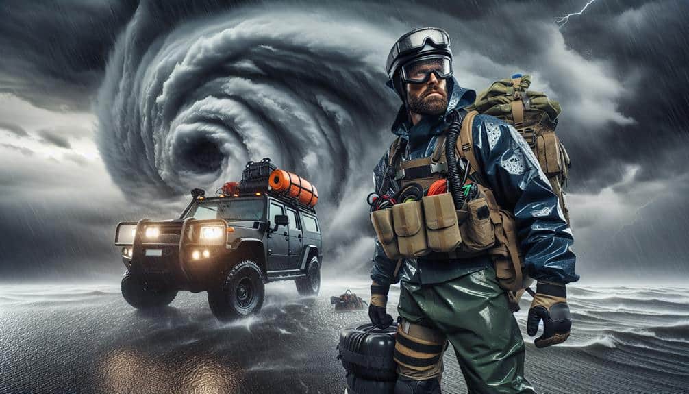
Essential Equipment for Storm Chasing
As we prepare to face the unpredictable conditions of Gulf hurricanes, we must prioritize durable protective gear that withstands extreme weather.
We'll also need advanced tracking tools, including satellite phones and GPS systems, to monitor storm progress and guarantee safety.
Utilizing this equipment effectively can greatly enhance our storm-chasing capabilities and data accuracy.
Durable Protective Gear
When storm chasing in the Gulf of Mexico, having durable protective gear, such as high-impact helmets and reinforced jackets, is necessary for guaranteeing safety amidst extreme weather conditions. We need to prioritize equipment that can withstand the harshest elements.
High-impact helmets provide crucial head protection against flying debris. Reinforced jackets, often made of materials like Kevlar, shield us from wind-driven projectiles and severe rain.
Let's also focus on our feet. Sturdy boots with non-slip soles are essential for maintaining footing on slippery, uneven surfaces. These boots should be waterproof to keep our feet dry and insulated against the cold, preventing hypothermia.
Our gear isn't limited to personal protection. Waterproof cameras are indispensable for documenting storm data without risking equipment failure due to moisture. To guarantee continuous communication, we rely on rugged communication devices, capable of withstanding storm conditions and maintaining connectivity with our team.
In the event of prolonged exposure, emergency shelters are crucial. Lightweight, portable, yet robust, these shelters shield us from the elements, offering a safe space to regroup and plan our next steps. By prioritizing durable protective gear, we maximize our safety and data collection efficiency.
Advanced Tracking Tools
Equipping ourselves with advanced tracking tools is vital for accurately predicting hurricane paths and securing our safety during storm-chasing missions in the Gulf of Mexico. The precision of satellite imagery and radar technology enables us to monitor storm development in real-time, providing essential data for making informed decisions.
Satellite imagery offers a detailed view of weather systems from space, capturing high-resolution images that reveal the structure and movement of hurricanes. This technology allows us to track storms over vast oceanic expanses, observe atmospheric conditions, and detect changes in storm intensity and trajectory.
Radar technology, on the other hand, is essential for close-range observation. Doppler radar systems measure the velocity of precipitation particles, helping us determine wind speeds and identify tornadoes within hurricanes. By analyzing radar data, we can assess the storm's current location, predict its path, and estimate landfall impact with greater precision.
Together, these tools provide a multi-faceted perspective on hurricanes, enhancing our ability to anticipate potential hazards and adjust our strategies accordingly.
Safety Protocols for Researchers

Researchers must adhere to strict safety protocols to reduce risks during hurricane season in the Gulf of Mexico. Our first priority is establishing strong emergency procedures. We need to guarantee that every team member knows the evacuation routes, safe zones, and action plans for various scenarios.
Detailed contingency plans are non-negotiable; they guide us on where to go and what to do when a hurricane is imminent.
Effective communication methods are essential for our safety. We utilize satellite phones, VHF radios, and encrypted messaging apps to maintain constant contact with each other and with base operations. These tools allow us to receive real-time updates on weather conditions and coordinate our movements accordingly.
It's vital that our communication devices are regularly tested and that backup systems are in place.
Our safety protocols also include mandatory training sessions on the use of personal protective equipment (PPE), such as life vests and helmets, which are vital during high-risk operations. We conduct regular drills to make sure that everyone is proficient in these emergency procedures.
Data Collection Techniques
As we prioritize safety, our data collection techniques must also be robust and precise to guarantee the integrity of our research during Gulf of Mexico hurricanes. Leveraging advanced technology, we employ remote sensing and aerial surveys to gather exhaustive data.
Remote sensing, utilizing satellites and radar, provides us with high-resolution imagery and real-time data, essential for monitoring hurricane development and progression. This method allows us to collect data on sea surface temperatures, wind speeds, and atmospheric conditions without direct exposure to hazardous environments.
Aerial surveys complement remote sensing by offering detailed, localized observations. Equipped with sophisticated instruments, aircraft can capture high-definition photographs and thermal imagery, enabling precise measurements of storm surge, coastal erosion, and infrastructure damage. These surveys also help validate satellite data, ensuring accuracy and reliability in our findings.
Analyzing Storm Patterns

Understanding storm patterns in the Gulf of Mexico requires analyzing vast datasets to identify trends, anomalies, and predictive indicators. We focus on rainfall distribution and wind speed trends to decode the complexities of these tropical systems. By leveraging satellite imagery, historical storm data, and advanced modeling software, we can pinpoint areas prone to heavy rainfall and fluctuating wind velocities.
First, we segment the data by temporal and spatial factors. Analyzing rainfall distribution involves mapping precipitation events during various phases of a storm. This helps us understand how moisture is transported and where it's likely to intensify flooding. High-resolution models allow us to visualize rainfall patterns, facilitating better preparedness and response strategies.
Next, we assess wind speed trends. By examining historical wind data, we can identify shifts in storm intensity. Wind speed trends provide critical insights into the energy distribution within a hurricane. This assists in forecasting the potential damage and necessary mitigation measures.
Our data-driven approach empowers us to make informed decisions, offering a clearer picture of the storm's behavior. Through precise analysis, we gain the freedom to anticipate and adapt to the dynamic environment of the Gulf of Mexico.
Collaborating With Meteorological Agencies
Collaborating with meteorological organizations enhances our ability to collect real-time data, validate predictive models, and implement effective storm response strategies. By working closely with these organizations, we can access high-definition satellite imagery, Doppler radar data, and advanced atmospheric models. This partnership greatly enhances our forecast accuracy, allowing us to predict the trajectory and intensity of hurricanes with greater precision.
We depend on agencies like the National Hurricane Center (NHC) and NOAA to provide us with timely updates and detailed data sets. Their advanced modeling techniques enable us to cross-verify our predictions, ensuring that our models are both strong and dependable. Accurate forecasts are crucial for guiding emergency response teams and local authorities, enabling them to make well-informed decisions that can save lives and property.
Furthermore, our collaboration with these meteorological organizations facilitates the dissemination of crucial information to the public. By integrating their data into our communication channels, we can provide real-time updates and actionable advice to those in the hurricane's path. This guarantees that communities have the flexibility to prepare adequately, making informed choices about evacuations and other safety measures. Our joint efforts ultimately lead to a more resilient and better-prepared populace.
Frequently Asked Questions
How Do Hurricanes in the Gulf of Mexico Impact Local Marine Life?
When hurricanes hit the Gulf of Mexico, they wreak havoc on the marine ecosystem, but marine life adapts through various strategies. Our conservation efforts focus on maintaining marine biodiversity to guarantee ecological balance and resilience.
What Are the Long-Term Environmental Effects of Gulf Hurricanes?
We're examining the long-term environmental effects of Gulf hurricanes. Ecosystem recovery and biodiversity impact are significant, often prolonged. Coastal erosion leads to habitat loss, dramatically altering marine environments and affecting local communities' resilience and freedom.
How Can Communities Better Prepare for Gulf Hurricanes?
To improve community resilience and emergency response, we should focus on infrastructure preparation and robust evacuation plans. Data-driven strategies and precise terminology in our planning will empower communities and guarantee freedom through effective hurricane preparedness.
What Role Does Climate Change Play in the Frequency of Gulf Hurricanes?
In addressing the Current Question, we recognize that climate change impacts the frequency and intensity of Gulf hurricanes. Data indicates rising sea temperatures and atmospheric changes contribute to more severe storms, necessitating robust preparation and adaptive strategies.
How Do Gulf Hurricanes Affect Oil and Gas Operations?
Gulf hurricanes greatly disrupt oil and gas operations, causing economic impacts and extensive infrastructure damage. We need to assess storm patterns, bolster resilience measures, and mitigate risks to guarantee operational continuity and safeguard our economic freedom.