When maneuvering the dangers of chasing supercell storms, we need to prioritize safety through thorough preparation and real-time data analysis. We rely on tools like high-definition radar and GPS to track unpredictable storm paths and maintain situational awareness. Utilizing protective gear, reliable communication, and established emergency procedures helps mitigate risks like high winds, large hail, and tornadoes. Thorough risk assessments and understanding storm behavior are essential to avoid exacerbating emergency situations and guarantee we're not obstructing first responders or local residents. For a deeper understanding of effective strategies and ethical considerations, let's proceed to more inclusive insights.
Key Points
- Conduct thorough risk assessments using real-time weather data and radar for informed decision-making.
- Maintain reliable communication with team members and authorities to ensure timely updates and coordinated actions.
- Wear protective gear and equip vehicles with technology to track and document storm behavior safely.
- Follow legal and ethical guidelines to avoid trespassing and interfering with emergency services.
Understanding Supercell Storms
Supercell storms, the most severe type of thunderstorm, are characterized by a deep, persistently rotating updraft known as a mesocyclone. To truly understand these powerful systems, we need to explore their storm structure and formation process.
The storm structure of a supercell is complex, typically comprising a towering anvil-shaped cloud, a central updraft region, and a flanking line of cumulus clouds.
The formation process begins with the presence of strong wind shear, which is the change in wind speed and direction with height. This wind shear tilts the updraft, allowing it to rotate and sustain itself over time. Moisture and instability in the atmosphere provide the necessary fuel, while a lifting mechanism, such as a cold front or dry line, initiates the upward motion.
Data indicates supercells can reach heights of over 60,000 feet and produce intense weather phenomena, including large hail, damaging winds, and tornadoes. By analyzing Doppler radar data and atmospheric soundings, we can better predict the formation and behavior of these storms.
Understanding the intricate details of supercell storm structure and formation empowers us to navigate the risks and embrace the freedom of storm chasing with greater confidence and safety.
Essential Safety Precautions
To safeguard our safety while chasing supercell storms, we must meticulously follow a set of key safety precautions grounded in the latest meteorological data and best practices.
First, thorough risk assessment is important. We need to analyze weather models and real-time radar data to identify potential hazards accurately. Understanding the storm's trajectory helps minimize exposure to severe weather conditions.
Effective communication is another cornerstone of safety. We should establish reliable communication channels among our team members and local authorities. Utilizing radio systems and mobile apps ensures we stay informed and can quickly relay essential information.
Emergency procedures and preparedness are non-negotiable. We must have a well-defined plan that includes evacuation routes and safe shelters. Regularly conducting drills helps reinforce these procedures, making them second nature during an actual emergency.
Additionally, maintaining a heightened situational awareness is critical. Continuous monitoring of weather updates and visual cues from the storm allows us to make real-time decisions.
Required Gear and Equipment
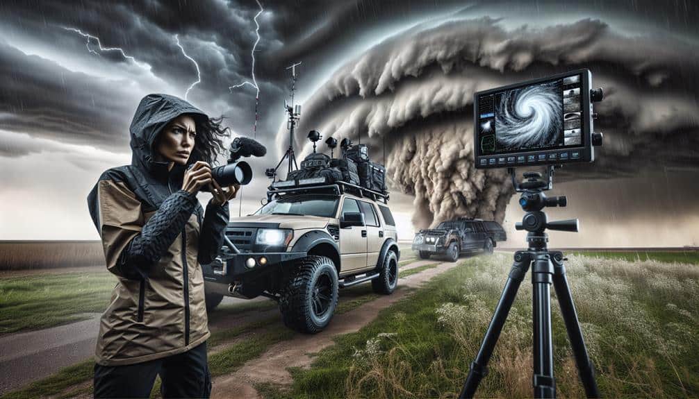
With safety precautions meticulously outlined, we now need to equip ourselves with the right gear and equipment to effectively chase and study supercell storms. First, protective clothing is non-negotiable. We must wear durable, waterproof gear capable of withstanding high winds and debris. A sturdy helmet and protective eyewear are essential to shield us from flying particles.
Advanced technology plays a pivotal role in storm chasing. High-resolution radar systems and GPS units allow us to track storm movements with precision. We should also equip our vehicles with dash cameras and anemometers to measure wind speeds and document storm behavior in real-time.
Communication devices are critical for maintaining contact with our team and emergency services. Two-way radios and satellite phones guarantee we stay connected, even in areas with poor cellular coverage. Additionally, reliable internet access helps us receive real-time weather updates and alerts.
Emergency supplies can't be overlooked. We need first aid kits, non-perishable food, water, and portable power banks. These items guarantee that we're prepared for any situation, keeping our primary focus on the storm itself.
Risks of Storm Chasing
When we chase supercell storms, we face extreme weather hazards like high winds, large hail, and flash floods.
The unpredictable paths of these storms add another layer of risk, as rapid changes can catch us off guard.
Data from the National Weather Service shows that storm chasers frequently encounter dangerous conditions, emphasizing the need for constant vigilance.
Extreme Weather Hazards
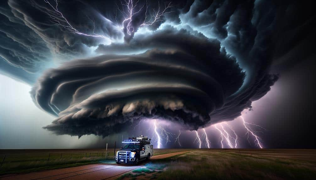
Storm chasers face a myriad of extreme weather hazards, including violent winds, large hail, and unpredictable tornado paths, making the endeavor inherently risky. Every storm we pursue not only brings the thrill of adventure but also exposes us to significant dangers.
Lightning strikes are a constant threat, turning our vehicles into potential conductors. Flash floods can suddenly transform dry terrain into perilous waterways, trapping us in our tracks. Hail damage is another critical concern, as hailstones can reach the size of baseballs, smashing windshields and denting metal. Tornadoes, with their unpredictable nature and immense power, present a formidable challenge.
The following hazards illustrate the risks we face:
- Blinding rain: Reducing visibility and increasing the chance of accidents.
- Large hailstones: Damaging vehicles and equipment, posing physical danger.
- Intense lightning: Risking electrocution and equipment failure.
- Sudden flash floods: Stranding vehicles and threatening our safety.
Unpredictable Storm Paths
Traversing the unpredictable paths of supercell storms requires constant vigilance and real-time data analysis, as even the most advanced forecasting models can struggle to predict a storm's exact trajectory. We need to stay on top of storm behavior, tracking every shift and change. This demands a robust understanding of meteorological data, such as Doppler radar and satellite imagery, to anticipate sudden deviations in the storm's path.
Our planning must be meticulous; we can't afford to overlook any detail. Emergency response readiness is essential, not only for our safety but also for the communities potentially in the storm's path. We must always have an evacuation plan, alternative routes, and communication lines open to share real-time updates.
Despite our best efforts, the inherent unpredictability of supercells can put us in unexpected situations. Rapid intensification or sudden changes in direction can catch even seasoned storm chasers off guard. It's crucial that we balance our pursuit of freedom and adventure with a respect for the sheer power and unpredictability of nature.
Rewards and Thrills
Experiencing the raw power of a supercell storm firsthand offers unparalleled insights into atmospheric dynamics and extreme weather behavior. The adrenaline rush is undeniable as we position ourselves strategically to capture the perfect shot for storm photography. Each chase brings us closer to understanding these meteorological marvels, all while adhering to stringent safety protocols.
The storm chasing community is a tight-knit group, united by our shared passion and commitment to safety. Our data and observations contribute significantly to scientific research and early warning systems. The thrill comes not only from the chase itself but from being part of something larger.
Here's what we see and feel during a chase:
- Darkening skies that signal the storm's approach, filling us with anticipation.
- Rotating cloud formations that reveal the storm's immense power.
- Brilliant lightning strikes illuminating the sky, each one a photographic opportunity.
- Roaring winds that heighten our senses, making us acutely aware of nature's force.
Legal and Ethical Considerations
While the thrill of storm chasing fuels our passion, we must also navigate the intricate landscape of legal regulations and ethical responsibilities. Operating within these frameworks is essential to guarantee not only our safety but also the safety of others who share the road and the environment with us.
Liability concerns are paramount. We need to understand that our actions could have significant legal ramifications. For example, trespassing on private property to get a better view isn't just disrespectful—it's illegal. The potential legal costs and repercussions can be severe, including fines and even imprisonment. We must weigh our desire for freedom against these consequences.
Ethical dilemmas also come into play. We've moral obligations to avoid exacerbating emergency situations. Blocking roadways, interfering with first responders, or creating panic among local residents are actions that contradict the ethical code we should uphold. Our presence should never escalate the danger or hinder the efforts of emergency services.
Frequently Asked Questions
How Do Supercell Storms Affect Local Wildlife?
Supercell storms greatly impact ecosystems by disrupting animal behavior. We observe shifts in migration patterns, altered feeding habits, and increased mortality rates. Data indicates these changes can destabilize local wildlife populations, highlighting the storms' profound ecological influence.
Are There Any Famous Supercell Storms in History?
We've seen famous supercell storms like the Tri-State Tornado of 1925, whose historical impact devastated communities across three states. Such notable supercell events highlight the severe impact on communities and underscore the need for preparedness.
What Meteorological Tools Predict the Formation of Supercells?
Isn't it fascinating how Doppler radar and satellite imagery allow us to predict supercell formation? We analyze atmospheric conditions and use storm prediction models, providing us with data-driven insights to forecast these powerful weather phenomena accurately.
How Do Storm Chasers Communicate With Each Other During a Chase?
We use radios, GPS, and mobile apps to stay connected. Emergency protocols guarantee we can alert each other quickly, while safety precautions keep everyone informed about potential hazards, maximizing our freedom to chase safely and effectively.
What Role Do Supercell Storms Play in Climate Change Research?
Imagine a tempestuous dance of nature's fury. We study supercell storms to uncover their climate change impact, deriving data-driven research findings that reveal atmospheric patterns, helping us understand and mitigate future climate-related challenges.