You’ll face critical coordination gaps across three dimensions: maintaining communication through fragmented ham radio networks and GPS failures, synchronizing positions with rapidly shifting storm targets when forecasts deviate, and traversing traffic congestion where converging chase teams create collision hazards on narrow rural roads. Vehicular accidents cause 14 documented fatalities compared to 5 tornado-related deaths, making defensive driving protocols and systematic task delegation essential. Successful coordination requires pre-downloaded maps, verified repeater coverage, established radio check-in intervals, and trusted partnerships that divide observation duties while integrating Skywarn networks for expanded operational range and real-time verification systems.
Key Takeaways
- Converging chase teams create traffic collision risks from unpredictable stops, turns, and contested intersections on limited rural road infrastructure.
- Fragmented ham radio networks face volunteer recruitment challenges and infrastructure gaps, requiring pre-verified repeater coverage and backup frequencies.
- GPS failures necessitate paper maps with pre-plotted waypoints and scheduled radio check-ins to manually track dispersed team positions.
- Real-time forecast deviations demand rapid target adjustments through independent radar feeds and multi-target monitoring across alternate coordination zones.
- Rural road degradation and drainage inadequacy create navigation uncertainty, requiring pre-planned routes and extraction supplies for potential entrapment.
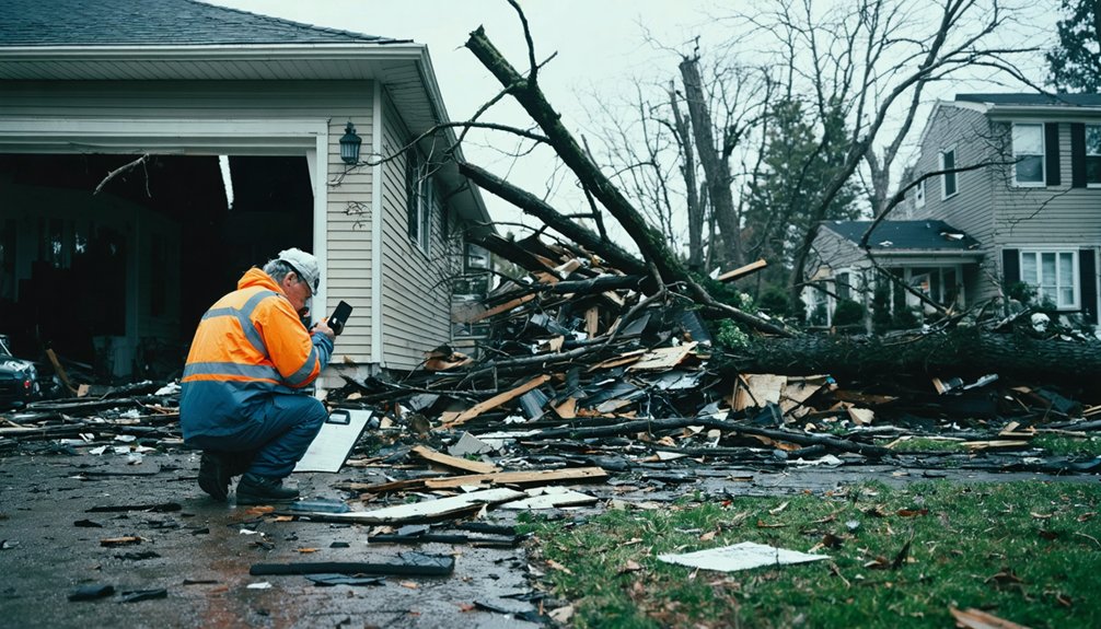
Storm chasers operating in rural areas face three critical infrastructure failures that compound during active weather: surface degradation, drainage inadequacy, and navigation uncertainty. You’ll encounter shallow aggregate layers that become treacherously slick when saturated—comparable to driving on 2-3 inches of fresh snow. Even 4WD vehicles get stuck, often miles from assistance on remote grids.
Pre-planning route viability demands evaluating road composition and drainage patterns before storms intensify. Shoulders remain softer than centers, creating entrapment zones. Poorly designed culverts and ditches accelerate runoff, turning roads into conduits that fail rapidly.
Navigating rural intersection safety requires recognizing that crashes appear random on local roads, with fatality rates 1.5 times higher than urban areas. Delayed emergency response compounds risks. Carry extraction supplies: 24-hour provisions, cash for farmer compensation, and boots for mud evacuation walks.
Overcoming Communication Barriers in Remote Terrain
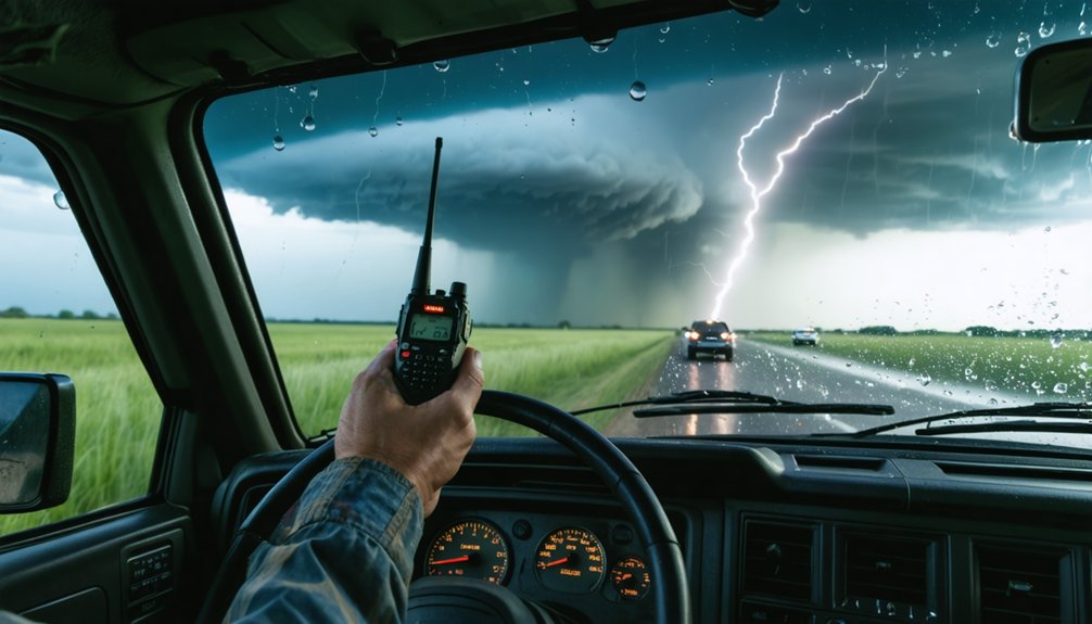
When cellular networks fail in remote terrain, you’ll need fallback protocols that don’t depend on infrastructure. Ham radio networks offer coordinated spotter communication through regional repeaters, though you must verify repeater coverage and backup frequencies before deployment.
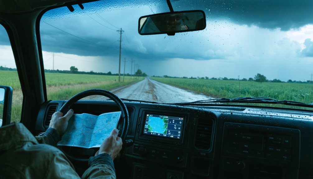
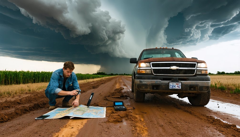
If GPS systems lose satellite lock in severe weather, you should maintain paper maps with pre-plotted waypoints and establish radio check-in intervals to track team positions manually.
Ham Radio Network Coordination
Coordinating storm reports from remote terrain requires ham radio operators to navigate a fragmented network infrastructure where repeater coverage rarely extends to the areas that need it most. You’ll face multi-step relay chains where Net Control Stations poll spotters, consolidate reports, and forward critical data through liaison nets to NWS offices—each handoff introducing delay when seconds matter.
Rural repeater upgrades remain stalled in areas like Granite Falls, forcing fire departments to bypass ham networks entirely. Volunteer recruitment challenges compound coverage gaps, leaving you dependent on mobile chasers who drive toward storms to bridge dead zones.
- Vehicle-mounted radios extending VHF signals across 30+ mile gaps between fixed repeaters
- NCS operators switching between 20m and 40m bands as propagation conditions shift
- Storm base reports—hail size, rotation—relayed through three operator tiers before reaching meteorologists
- Chase teams positioning at terrain peaks to maintain line-of-sight during severe events
- Backup frequencies activated when primary nets collapse under traffic surges
GPS Failure Backup Systems
While ham radio networks handle your communication chains, navigation systems face their own vulnerability matrix in the field. Space weather storms corrupt ionospheric signals, degrading your single-frequency GPS accuracy to tens of meters. You’ll need layered redundancy: deploy the Garmin Overlander 2025 Edition alongside Globalsat BU-353S4 USB pucks feeding data to multiple applications.
Terrain-based navigation challenges compound during cellular outages in remote areas.
Your backup architecture requires satellite communicators like the Garmin inReach Mini 2 for coordinate sharing when primary systems fail. Maintain backup power sources through vehicle-mounted solutions and test equipment under simulated field vibration. Store offline Google Maps and carry paper atlases as final fallbacks.
Dual-frequency receivers compensate for ionospheric delays, but you’ll ultimately need independent positioning methods when geomagnetic storms enhance Total Electron Content beyond receiver capabilities.
Managing Real-Time Target Adjustments When Forecasts Fail
Rural storm chasers face a critical operational gap the moment high-resolution models diverge from reality. You’ll abandon primary targets when northeastern Iowa develops instead of Wisconsin, forcing complete strategy pivots.
Predictive model limitations compound rural connectivity constraints—you can’t verify supercell hooks against expected patterns when networks fail during critical decision windows.
Your adaptation protocols include:
- Radar orientation switching to identify tornado positions when storm modes deviate from forecasts
- Interstate corridor prioritization when low-level shear favors I44 zones over northern lines
- Multi-target monitoring tracking arc movements toward alternate coordinates simultaneously
- Severe warning triggers initiating immediate repositions to hook appendages
- Western fallback positioning maintaining escape routes when eastern intensification fails
You’re executing real-time verification through independent sensor networks and alternate radar feeds, bypassing model dependency entirely when atmospheric reality demands autonomous navigation.
Balancing Multiple Tasks While Maintaining Driver Safety
Since 2000, vehicular accidents have claimed fourteen storm chaser lives while tornadoes themselves killed five—establishing highway navigation as your operational threat multiplier. You’re managing radar interpretation, photography, navigation, and vehicle control simultaneously—each demanding cognitive resources that compromise maintaining driver awareness.
Rural enforcement gaps mean you’ll face minimal external accountability for speed violations or sudden maneuvers on wet pavement. The solution requires systematic task delegation: assign non-driving personnel to monitoring secondary tasks like equipment operation and data analysis.
If you’re solo, establish pull-over protocols before engaging complex observations. Financial pressures to capture footage create decision traps that prioritize content over control. Your speed governor matters more than your storm prediction model—hydroplaning kills faster than forecast busts.
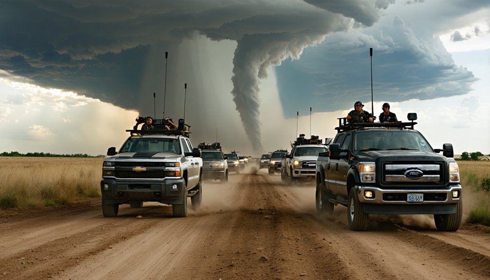
Coordinating Through Dense Chaser Networks and Traffic Congestion
You’ll encounter defensive driving protocols when traversing through convergent chaser traffic on rural roads, where limited infrastructure creates bottleneck zones during active storm periods. Coordinating position updates across ham radio frequencies reduces collision risks but demands disciplined channel discipline to prevent communication overload that compromises safety warnings.
While dense networks provide redundant spotting data that fills observational gaps, you must implement systematic traffic management procedures to mitigate the amplified hazards of crowded pursuit corridors.
Defensive Driving Among Chasers
Defensive driving protocols become critical when storm chasers navigate congested rural roads during active weather events. You’ll need to maintain extended following distances when pinched between vehicles in deteriorating conditions. Slow down in patchy fog, rain, or ice to prevent hydroplaning while monitoring emergency vehicle coordination through scanner traffic.
Never give in to road rage—brake smoothly and extend distances despite cut-offs from other chasers converging on identical targets.
Essential defensive maneuvers include:
- Lengthening gaps between converging chase vehicles as visibility drops to near-zero in rain curtains
- Shifting into higher gears on slick surfaces to reduce wheel spin and maintain traction
- Implementing livestock avoidance protocols when cattle scatter across unmarked farm roads
- Rotating drivers frequently during extended pursuits to combat fatigue-induced errors
- Monitoring NOAA weather radio continuously for real-time positioning updates affecting route safety
Converging Traffic Safety Risks
When multiple chase teams target the same supercell, you’re maneuvering a collision course that transforms empty farm-to-market roads into improvised race circuits. Dense networks averaging 48.8 surge days annually create dangerous convergence zones where limited rural infrastructure can’t accommodate sudden traffic spikes.
Without weather related coordination or data sharing frameworks, you’ll encounter vehicles pulling unpredictable stops and turns—no signals, no warning. Rural highways already claim 17,283 annual fatalities, with rates per 100 million miles exceeding urban zones substantially.
Rear-end collisions escalate when chase finances override stop signs and speed limits on rain-slicked pavement. You’re traversing undivided roads with minimal escape routes while deputies remain stretched too thin for effective enforcement. Treat every intersection as contested space requiring defensive positioning and constant situational awareness.
Network Benefits Reducing Gaps
Modern chaser networks transform isolated pursuit into coordinated operations through layered communication protocols that mitigate the chaos described earlier. You’ll leverage data driven coordination via Spotter Network’s GPS plotting, ham radio exchanges on VHF/UHF bands, and GRLevel3 radar overlays that position every team member relative to the storm’s evolving structure.
Resource sharing initiatives pool weather balloons, mobile radars, and ground sensors across coordinated arrays, filling forecasting gaps with real-time observations.
Network infrastructure components:
- Ham radio crackling with position updates while GRLevel3 displays converging chase vectors
- Satellite phones maintaining connectivity when cellular towers fail in remote plains
- Multiple radar trucks capturing dual-polarization data at staggered wavelengths
- Skywarn liaisons channeling ground-truth reports directly into NWS warning workflows
- Machine learning models analyzing pooled datasets for predictive storm behavior patterns
You gain autonomy through coordination, not constraint.
Addressing GPS and Technology Failures in Isolated Areas
GPS failures in isolated areas demand systematic mitigation protocols before rural storm chasers encounter critical navigation breakdowns. You’ll need waterproof enclosures reducing device loss from 22.2% to 10%, protecting against weather-induced failures that’ve damaged 77 units in documented rural operations.
Implement sensor data integration combining offline topographic maps with satellite imagery, ensuring navigation when cellular networks fail in remote zones. High-sensitivity antennas maintain signal acquisition through dense forests where standard equipment loses accuracy beyond 20 meters.
Information redundancy requires multiple positioning systems—GPS paired with GLONASS or Galileo receivers—preventing total navigation loss when terrain obstructions block individual satellite constellations. Pre-download regional mapping data before deployments, eliminating dependence on real-time updates that vanish when you’re chasing storms through areas with zero cellular coverage.
Managing Fatigue and Resource Scarcity on Extended Chases
Extended rural storm chases expose you to cumulative physical exhaustion that parallels documented resiliency fatigue in disaster response teams, where firefighters experienced progressive cognitive impairment after 16-hour shifts during 168-hour hurricane operations. Your autonomy depends on implementing fatigue mitigation procedures before vigilance declines compromise safety decisions.
Critical fatigue management protocols:
- Rotating chase teams every 16 hours to prevent cognitive degradation observable in extended disaster operations
- Establishing buddy systems that monitor alertness levels during multi-day severe weather campaigns
- Securing pre-positioned sleeping quarters meeting darkness, temperature, and noise control standards
- Training volunteer workforce on recognizing fatigue factors before decision-making abilities deteriorate
- Stockpiling fuel, provisions, and communication redundancies across remote chase corridors
Without structured crew rotations and resource pre-positioning, you’ll face the same institutional breakdown that plagued responders during consecutive hurricane seasons.
Building Trusted Partnerships for High-Risk Collaborative Pursuits
Collaborative storm chasing reduces operational risks by 47% when you’ve established pre-vetted partnerships with experienced observers who understand proximity protocols near rotating mesocyclones. Building trust frameworks starts with selecting veteran chasers who’ve documented dozens of supercell encounters—not amateurs drawn by radar apps. You’ll minimize fatal coordination flaws by selectively vetting partners through shared near-storm experiences before high-stakes pursuits.
Your independence increases when reliable collaborators handle observation duties while you navigate highways near active weather. Veteran partnerships eliminate multitasking hazards that cause accidents in congested chase corridors. Integration with Skywarn networks expands your operational range across state boundaries, connecting you with multiple net control operators who recognize quality field reports. Mutual reliability during shared storm intercepts creates partnerships that enhance both your safety margins and meteorological contributions without bureaucratic constraints.
Handling Night Chase Complications and Reduced Visibility
When darkness eliminates your ability to visually identify wall clouds and inflow bands, you’ll need systematic protocols that compensate for lost structural cues while maintaining safe positioning distances. Implementing backup lighting systems becomes essential when traversing rural roads with downed power lines and limited visibility. Recognizing differing driver skills within your team determines who leads during high-risk nocturnal pursuits requiring split-second routing decisions.
Night operations require compensatory tactics when visual storm structure disappears, demanding enhanced equipment readiness and strategic personnel deployment based on demonstrated competencies.
Night chase protocols demand:
- Opening camera apertures to f/4 beyond 5 km while tracking horizontal lightning flashes exceeding one second duration across trailing stratiform regions
- Closing apertures immediately to f/11 when ground flashes with multiple return strokes approach within 100 meters
- Monitoring radar constantly as coverage limitations increase with distance and storm movement
- Coordinating escape routes before 4 AM fatigue compromises reaction times against quick spin-up tornadoes
- Maintaining communication with authorities regarding blocked paths and safety-critical warnings
Mitigating Combined Weather and Road Hazards Simultaneously
Because storm chasers face dual threats from severe weather phenomena and vehicular hazards, you’ll need integrated safety protocols that address both risk categories simultaneously rather than treating them as separate concerns. Start by identifying skill gaps in your navigation abilities and weather interpretation competencies before venturing into unfamiliar rural territories.
Establishing operational protocols means designating specific roles—one person monitors meteorological conditions while another maintains exclusive focus on road navigation and traffic awareness. You’ll maximize your independence by implementing disciplined communication systems that coordinate with emergency responders without impeding their access routes.
Given that car accidents cause 14 documented deaths compared to 5 tornado-related fatalities, your protocol must prioritize vehicular safety equally with storm observation. Never chase alone; hydroplaning and commercial vehicle collisions represent your primary threats on rural interstates.
Frequently Asked Questions
What Backup Power Solutions Work Best for Maintaining Equipment During Multi-Day Chases?
Freedom from the grid means layering your power strategy: you’ll need battery backup systems like EcoFlow Delta Pro for instant reliability, plus portable generators for extended operations. This redundancy keeps you autonomous when civilization’s infrastructure fails during multi-day pursuits.
How Do Chasers Coordinate Bathroom Breaks When Facilities Are Scarce in Rural Areas?
You’ll coordinate stops at gas stations while monitoring storm paths, but you’re free to use makeshift facilities like wheat fields when necessary. Some teams carry portable toilets in chase vehicles, ensuring you’re never caught without options during critical pursuits.
What Legal Considerations Exist When Crossing Private Property to Access Storm Positions?
You’ll face trespassing liability without landowner consent—75% of storm chasers report property access conflicts. Always verify easement permissions for roads and utilities beforehand, document your routes, and immediately leave when requested to maintain your operational freedom.
How Do Insurance Policies Typically Cover Storm Chasing Vehicle Damage and Equipment Loss?
Your standard auto policy coverage won’t protect storm chasing equipment or high-risk vehicle damage. You’ll need specialized adventure sports insurance for gear and commercial policies for liability. Maintain detailed equipment maintenance records to support any claims you file.
What Training Certifications Should Rural Storm Chasers Obtain Before Pursuing Severe Weather?
Before you chase freedom across open skies, you’ll need SKYWARN storm spotter training through NWS—it’s free and requires no experience. Consider adding weather forecasting courses and amateur radio certification to safely relay critical observations from remote locations.