We've distilled 10 crucial data-driven pointers to improve our storm chasing efficiency. Let's monitor live radar and track changes in atmospheric pressure. Scrutinizing storm patterns, using satellite imagery, and interpreting weather models will enhance our precision. Inspecting rainfall data and evaluating wind speeds helps us stay safe. By examining historical storm data, we can compare and forecast future occurrences more accurately. Utilizing state-of-the-art mobile apps keeps data accessible on the go. Lastly, collaborating with experts guarantees we're informed of the latest advancements and insights. For a deeper comprehension and advanced techniques, let's delve further.
Key Points
- Continuously monitor real-time radar data and satellite imagery for accurate storm tracking and prediction.
- Use anemometers to measure wind speeds and rain gauges for precise rainfall data collections.
- Analyze historical storm data to identify key indicators and refine predictive models.
- Collaborate with meteorologists and experienced storm chasers for enhanced safety and prediction accuracy.
Monitor Real-Time Radar
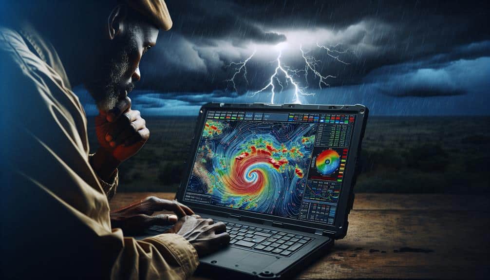
To effectively track and predict storm patterns, we must monitor real-time radar data continuously. Our ability to anticipate storm development hinges on precise radar interpretation. By integrating storm prediction models with advanced data visualization techniques, we can enhance situational awareness and make informed decisions in the field.
When monitoring radar, we focus on key indicators such as reflectivity, velocity, and dual-polarization data. Reflectivity helps us identify the intensity of precipitation, while velocity data provides insights into wind patterns and potential rotation. Dual-polarization radar adds a layer of detail by differentiating between types of precipitation, such as hail and rain. This thorough radar interpretation allows us to pinpoint severe weather conditions accurately.
For effective storm interception, real-time updates are essential. By leveraging high-resolution radar data, we can track storm cells minute-by-minute, adjusting our course to stay within safe distances while still capturing critical data. Data visualization tools, such as animated radar maps and 3D storm models, enable us to visualize storm structures and movement, aiding in rapid decision-making.
In essence, continuous monitoring of real-time radar data empowers us to predict storm patterns accurately, interpret intricate radar signals, and intercept storms safely and efficiently.
Analyze Storm Patterns
By carefully examining storm patterns, we can identify trends and anomalies that inform our forecasting models and enhance our predictive accuracy. The increased granularity in storm data allows us to examine extreme weather trends and discern the effects of climate change on storm frequency and intensity. Through climate change analysis, we can better understand how shifts in global temperatures influence storm genesis and progression.
To perform an effective storm severity assessment, we must scrutinize historical data alongside current storm patterns. This dual approach enables us to detect deviations from established norms, pinpointing potential areas of concern. By continuously refining our models, we can improve forecast accuracy, providing more reliable information for decision-making during storm events.
Our analysis isn't confined to one dataset; we integrate multiple sources, including meteorological records, sensor data, and crowd-sourced reports. This all-encompassing approach guarantees we capture the multifaceted nature of storms, allowing us to create a more complete picture of their behavior.
Ultimately, our goal is to provide actionable insights that empower us to navigate and respond to severe weather events with greater precision. Through diligent storm pattern analysis, we can anticipate and mitigate the impacts of increasingly extreme weather, fostering a safer and more informed storm-chasing community.
Utilize Satellite Imagery
When we utilize satellite imagery, we gain access to real-time weather updates that are vital for storm chasing.
By analyzing cloud patterns, we can better predict storm development and intensity.
Additionally, tracking storm movement helps us make informed decisions about positioning and safety.
Real-time Weather Updates
Why depend only on ground-based observations when satellite imagery provides us with precise, real-time weather updates essential for storm chasing? Satellite imagery offers unmatched accuracy and timeliness, enabling us to track storm development minute-by-minute. This level of detail is vital for effective storm chaser communication and adherence to emergency protocols.
The reliability concerns associated with ground-based systems—such as limited coverage and delayed data—are greatly alleviated by satellite technology. Satellites provide a thorough view of weather systems, capturing data that might be overlooked by localized instruments. This ensures that the weather data we rely on is both accurate and current, allowing us to make informed decisions quickly.
Furthermore, the integration of real-time satellite data into our storm chasing strategies enhances our ability to predict storm paths and intensities with greater precision. This predictive capability not only improves our safety but also maximizes the efficiency of our chase missions.
Cloud Pattern Analysis
Leveraging satellite imagery, we can perform detailed cloud pattern analysis to gain vital insights into storm dynamics and development. By examining cloud formation, we can identify the early stages of storm development and predict potential intensification. High-resolution satellite images reveal cloud structures, such as cumulonimbus formations, which are often precursors to severe weather events. Understanding these patterns allows us to enhance our weather prediction capabilities.
In our climate analysis, satellite data provides an all-encompassing view of atmospheric conditions over vast areas. We can observe changes in cloud cover, track moisture levels, and identify temperature variations that influence storm behavior. This data is essential for anticipating shifts in weather systems and making informed decisions during storm-chasing activities.
Satellite imagery also enables us to monitor cloud formation in real-time, offering immediate feedback on evolving weather patterns. By analyzing the movement and development of cloud systems, we can better understand the mechanisms driving storm formation. This analytical approach empowers us to predict storm paths and potential impacts with greater accuracy.
Storm Movement Tracking
Building on our cloud pattern analysis, we can utilize satellite imagery to meticulously track storm movement and predict its trajectory with greater precision. Satellite imagery offers a bird's-eye view, enabling us to monitor the development and movement of storm systems in real time.
By integrating this storm tracking technology into our toolkit, we enhance our storm prediction techniques, allowing for timely and accurate forecasts.
Our primary focus is to identify key indicators such as cloud density, wind patterns, and temperature variations. These metrics help us delineate storm boundaries and anticipate shifts in trajectory.
Employing high-resolution satellite data, we can pinpoint the storm's current location and predict its path with minimal error margins. This precision is essential for devising effective storm chaser tactics and ensuring storm chaser safety.
Interpret Weather Models
When interpreting weather models, we must first understand the key parameters and outputs they provide, such as temperature, pressure, and wind patterns. These elements are vital for evaluating weather model accuracy and guiding our data interpretation efforts.
Accurate models help us predict storm behavior, enabling us to make informed decisions on when and where to chase.
To enhance forecast reliability, we should regularly monitor model updates. Weather models, like the Global Forecast System (GFS) or the European Centre for Medium-Range Weather Forecasts (ECMWF), are frequently updated with the latest observational data. These updates refine the predictions, reducing uncertainties. By staying current with these updates, we can adapt our strategies swiftly, ensuring we're always a step ahead.
We need to evaluate multiple models to cross-check the predictions. Comparing outputs from various models helps us identify consistencies and discrepancies, increasing our confidence in the forecast. It's crucial to remember that no single model is infallible; combining insights from different models provides a more detailed picture.
Given the dynamic nature of weather, real-time data interpretation is essential. By leveraging high-resolution models and the latest updates, we can optimize our storm-chasing endeavors, balancing excitement with safety.
Track Atmospheric Pressure
Understanding weather models is just the start; to refine our storm-chasing strategies, we must meticulously track atmospheric pressure patterns. By analyzing pressure trends, we can better forecast the development and movement of storm systems.
Pressure measurements taken at various locations and altitudes provide us with critical data points, allowing us to detect subtle shifts in atmospheric conditions. We rely on barometers and advanced pressure sensors to gather accurate pressure measurements. These instruments help us observe changes in the atmospheric pressure, which are often precursors to severe weather events.
For instance, a rapid drop in pressure can indicate the approach of a low-pressure system, typically associated with storms and heavy precipitation. Our analysis of this data extends beyond mere observation. We utilize sophisticated software to model pressure trends, enabling us to predict the likely path and intensity of storms.
Assess Wind Speeds
To accurately assess wind speeds, we must rely on precise anemometer usage and understand critical wind speed thresholds. Proper calibration and placement of the anemometer are essential for reliable data.
Let's explore the best methods for deploying this tool and the key thresholds that indicate varying storm intensities.
Anemometer Usage Tips
Accurately gauging wind speeds in storm conditions requires precise calibration and proper use of an anemometer. To guarantee wind speed accuracy, we must prioritize regular anemometer maintenance. Checking for debris, making sure the bearings are free-moving, and performing periodic calibrations are essential steps. These actions help us avoid false readings, which can be crucial during high-stakes storm chasing.
Anemometer placement is another vital factor in achieving reliable data. We need to position the device at an ideal height, typically around 10 meters above ground level, to minimize ground interference. Placing it away from obstructions such as buildings or trees ensures the wind flow remains uninterrupted, providing more precise readings.
For effective data collection techniques, let's make sure we record wind speeds at consistent intervals. This method provides a thorough understanding of the wind patterns within the storm. We should also use digital anemometers with data logging capabilities to easily track and analyze trends over time.
Wind Speed Thresholds
As we guarantee our anemometers are properly maintained and positioned, it's important to assess wind speeds accurately by understanding and using specific wind speed thresholds. Knowing these thresholds is vital for both wind speed safety and forecast accuracy.
First, let's categorize wind speeds. Light winds range from 1 to 15 mph, moderate winds from 15 to 30 mph, and strong winds start at 30 mph and above. These categories help us make real-time decisions, ensuring our safety and the integrity of our data.
For instance, if wind speeds exceed 40 mph, it's often advisable to retreat to a safer location as the risk to equipment and personnel increases substantially.
Moreover, understanding these thresholds enhances our forecast accuracy. By analyzing wind speed data against these categories, we can predict storm intensification and potential track changes with greater precision. This not only aids our immediate field operations but also contributes to broader meteorological models.
Evaluate Rainfall Data

When evaluating rainfall data, we must first verify the accuracy and reliability of our data sources. By ensuring our rain gauges are calibrated and strategically placed, we can trust the measurements we gather. Rain gauge accuracy directly affects our ability to conduct precise rainfall distribution analysis, which is essential for understanding the spatial variability of precipitation during a storm. This, in turn, informs our storm water impact assessment and helps us predict areas most at risk of flooding.
Next, we should systematically analyze the collected data. Using advanced statistical tools, we can identify patterns and anomalies in rainfall intensity and duration. This analytical approach enables us to perform thorough flood risk evaluations, highlighting regions that may experience significant storm water runoff. Accurate rainfall data is crucial for developing predictive models that can guide our decision-making processes during storm chasing operations.
Additionally, we should integrate data from multiple sources, such as radar estimates and satellite imagery, to cross-verify our findings. By cross-referencing various datasets, we enhance the robustness of our analysis and minimize the risk of relying on flawed data. This thorough methodology empowers us to make informed decisions, ensuring we stay ahead of the storm and prioritize safety.
Study Historical Storms
When we study historical storms, we can analyze storm patterns to understand their frequency and behavior.
By identifying key indicators such as pressure changes and wind speeds, we gain insights into storm development.
Comparing storm data across different events allows us to refine our predictive models and improve our storm-chasing strategies.
Analyze Storm Patterns
To effectively predict storm behavior, we need to meticulously analyze historical storm data and identify recurring patterns. This process involves storm intensity analysis and data correlations, essential for understanding how storms evolve and behave. By examining past storms, we can pinpoint trends and make more informed predictions.
Firstly, we should:
- Examine storm intensity levels: By analyzing the strength of past storms, we can identify the conditions that lead to severe weather events. This helps us recognize potential threats more accurately.
- Identify data correlations: Looking at relationships between different data points, such as temperature, humidity, and wind speed, allows us to understand how these factors interact to form storms.
- Assess climate change impact: Climate change is altering weather patterns globally. By performing trend analysis on historical data, we can see how warming temperatures and shifting weather systems influence storm formation and intensity.
- Develop predictive models: Using our findings, we can create models that forecast future storm behavior, giving us a valuable tool for storm chasing.
Identify Key Indicators
Moving from pattern analysis, we must now identify key indicators by examining historical storms to refine our predictive capabilities.
Historical data is invaluable for pinpointing specific factors that influence storm intensity and behavior. By scrutinizing past storms, we can discern patterns in barometric pressure, temperature gradients, and humidity levels that often precede high-intensity events.
Our primary focus should be on variables that consistently correlate with storm intensity. For instance, a sudden drop in atmospheric pressure or substantial increases in sea surface temperatures can serve as early warning signs of an impending severe storm. By isolating these indicators, we improve our risk assessment methodologies, enabling more precise predictions for storm chasers.
We should also consider the geographical and temporal aspects of historical storms. Certain regions and times of year are more prone to severe weather, and understanding these tendencies can greatly enhance our preparedness.
Examining the aftermath of historical storms provides insights into the potential impact, helping us gauge the severity and risks associated with future storms.
Compare Storm Data
Let's explore historical storm data to identify patterns that will enhance our predictive models and improve our storm-chasing strategies. By delving into past storm events, we can leverage storm comparison techniques and data analysis methods to gain insights into future storm behavior.
First, we need to gather detailed storm data, including parameters such as wind speed, pressure, and precipitation levels. This data forms the backbone of our weather pattern evaluation and helps us identify recurring trends.
Using sophisticated data interpretation strategies, we can:
- Identify Common Precursors: Pinpoint the conditions that typically precede severe storms, such as temperature gradients or humidity levels.
- Analyze Storm Trajectories: Study the paths that previous storms have taken to predict future movements with greater accuracy.
- Evaluate Storm Intensity Changes: Understand how and why certain storms escalate or diminish in intensity to refine our response strategies.
- Correlate Environmental Factors: Examine the impact of geographical features like mountains or water bodies on storm development and progression.
Leverage Mobile Apps

Utilizing mobile applications, we can access real-time weather information and advanced radar visuals, which greatly enhances our storm-chasing capabilities. These tools allow us to monitor storm behavior meticulously, providing insights into storm development, movement, and intensity. Applications like RadarScope and Storm Shield offer high-resolution radar details, enabling us to track supercells and tornadoes with pinpoint accuracy. This accuracy is vital for making informed decisions in dynamic weather situations.
Beyond tracking storm behavior, mobile apps also play a crucial role in ensuring safety measures. Applications such as Weather Underground and NOAA Weather Radar provide real-time alerts for severe weather warnings. By staying updated, we can adjust our paths to avoid risky areas and reduce risk. Additionally, features like GPS tracking and location sharing are essential for maintaining communication and coordination within our team.
Moreover, using mobile applications, we can integrate multiple data sources, including satellite visuals, wind patterns, and storm reports, creating a thorough picture of the weather scenario. This multi-faceted approach maximizes our efficiency and effectiveness in the field.
Essentially, leveraging mobile apps not only enriches our storm-chasing experience but also emphasizes our dedication to safety and precision.
Collaborate With Experts
Collaborating with meteorologists and experienced storm chasers offers invaluable insights and enhances our understanding of intricate weather patterns. Expert collaboration is crucial for precise storm prediction and efficient weather forecasting. By pooling our knowledge and resources, we can make more informed decisions and increase our chances of safely capturing the perfect storm.
Engaging with experts allows us to:
- Access Advanced Data: Working closely with meteorologists grants us access to sophisticated models and state-of-the-art technology, providing us with a clearer picture of storm development.
- Gain Practical Experience: Seasoned storm chasers offer firsthand knowledge that textbooks can't provide. Their insights help us anticipate storm behavior and enhance our field strategies.
- Improve Safety Protocols: Learning from those who've navigated numerous storms ensures we adopt best practices, reducing risks and enhancing our safety measures.
- Broaden Our Network: Building relationships with experts creates a support system, fostering collaboration and ongoing learning in weather forecasting.
Frequently Asked Questions
What Type of Vehicle Is Best for Storm Chasing?
We believe the best storm chasing vehicle is an SUV with significant vehicle modifications. Enhanced durability, advanced chasing tactics, and off-road capabilities guarantee we can navigate harsh weather conditions while maintaining the freedom to pursue storms.
How Do I Ensure My Safety During a Storm Chase?
Ironically, chasing storms isn't about running blindly into danger. We maintain safety by rigorously adhering to safety protocols, ensuring reliable emergency communication, and prioritizing weather tracking for situational awareness. Freedom thrives with informed, calculated risks.
What Essential Gear Should I Bring for Storm Chasing?
For storm chasing, we need essential gear like emergency supplies, communication devices, weather monitoring tools, and GPS tracking. These items guarantee we're prepared, stay connected, and accurately track storms, enhancing our safety and effectiveness.
How Do I Get Started in Storm Chasing as a Beginner?
Did you know 70% of tornadoes occur in the U.S.? To get started in storm chasing, we should master storm chasing techniques and weather forecasting. Let's embrace the thrill and freedom of tracking nature's most powerful events.
What Are the Legal Considerations for Storm Chasers?
When storm chasing, we must consider insurance requirements and liability concerns. We should guarantee our policies cover potential damages and injuries. Understanding local laws helps us avoid legal issues while maintaining the freedom to chase storms.