Contrary to popular belief, you won’t encounter guaranteed tornado sightings in Tornado Alley, as only a fraction of storm systems produce visible funnels. The region’s boundaries have shifted eastward since 1979, with western events decreasing 25% while eastern occurrences rose 12%. You’ll face greater danger from vehicular accidents than the storms themselves, and tornado season extends year-round rather than concentrating in spring. The following sections reveal how geographic redistribution and evolving atmospheric patterns have fundamentally transformed traditional storm chasing assumptions.
Key Takeaways
- Tornado Alley’s geographic boundaries have shifted eastward, with western events decreasing 25% while eastern occurrences rose 12% since 1986.
- Tornadoes occur year-round, not just spring; southern regions peak in early spring while northern states experience June-July maximums.
- Nearly one-fourth of significant tornadoes happened outside the traditional Great Plains corridor, challenging the region’s exclusive reputation.
- Vehicular accidents represent the most significant threat to storm chasers’ safety, not the tornadoes themselves.
- Dixie Alley now experiences tornado frequency matching or exceeding the Great Plains, making it equally dangerous for chasing.
Tornado Sightings in Tornado Alley Are Not Guaranteed Despite Popular Belief
Tornado Alley’s reputation as a guaranteed storm chasing destination doesn’t align with meteorological data. You’ll find stochastic occurrence patterns throughout the region, with traditional states experiencing 30% fewer strong tornadoes since 1990.
Oklahoma averages 69 annual tornadoes, yet Ohio exceeded this in 2024—demonstrating high seasonal variability that defies predictable patterns. The strong tornado centroid has shifted 110 miles eastward over three decades, while Dixie Alley doubled its EF2+ frequency. Even during peak months, forecasting limitations prevent trip-specific guarantees.
In 2024’s mid-year count, over half of 1,194 tornadoes occurred outside traditional boundaries. You’re statistically better positioned pursuing storms in southeastern states, where Oklahoma now ranks ninth per 10,000 square miles while Florida leads at 12.3.
The Geographic Boundaries of Tornado Alley Are Far From Fixed
You might assume Tornado Alley occupies fixed geographic boundaries, but research from 1921–1995 demonstrates that nearly one-fourth of significant tornadoes occurred outside the traditional Great Plains corridor.
Recent meteorological data indicates the primary tornado activity zone has shifted eastward, with increased frequency now documented across the northern Great Plains into the Canadian Prairies and throughout the southeastern United States in what meteorologists designate as “Dixie Alley.”
This geographic redistribution, first identified by Allen Pearson in 1971, reflects measurable changes in atmospheric patterns that directly impact where you’ll encounter the highest probability of tornado intercepts.
Traditional Boundaries Are Shifting
Since 1952, when researchers first applied the term “Tornado Alley” to a project spanning Texas, Louisiana, Oklahoma, Kansas, South Dakota, and Iowa, the geographic boundaries have remained unofficial and continuously debated.
You’re now facing evolving risk factors as research confirms an eastward migration pattern. Comparing 1951–1985 against 1986–2020 data, tornadogenesis peaks shifted from northern Texas, Oklahoma, and Kansas toward Mississippi, Louisiana, and Alabama. Western events decreased 25% while eastern occurrences rose 12%.
This migration creates increased forecasting challenges since traditional Great Plains farmland offered low-density targets, but modern corridors impact Nashville’s 2 million and Atlanta’s 6.3 million metro populations. You’ll encounter stronger, longer-path tornadoes measured in path-miles, fundamentally altering risk calculations beyond simple geographic repositioning.
Dixie Alley Emerges South
Everything meteorologists thought they knew about America’s most dangerous tornado zone demands revision. Dixie Alley—stretching from Louisiana through the Carolinas—now experiences tornado frequency matching or exceeding the Great Plains, with research documenting an eastward shift during 1979–2017.
You’re facing a fundamentally different threat profile here:
- Nocturnal tornado risk peaks during late fall and winter when you can’t see what’s approaching
- Population vulnerability intensifies with Nashville’s 2 million and Atlanta’s 6.3 million residents in direct paths
- QLCS formations provide minimal warning time compared to classic supercells
- Dense forests and rolling terrain eliminate visual escape routes
- Homes lack basements due to soil conditions, removing your primary shelter option
The Southeast’s meteorological reality contradicts traditional storm chasing assumptions about when, where, and how tornadoes strike.
Northern Extensions Into Canada
While meteorologists track tornadoes migrating eastward across the southern United States, another geographic expansion unfolds northward beyond the 49th parallel. Canada’s Tornado Alley encompasses Alberta, Saskatchewan, Manitoba, Ontario, and Quebec, averaging 80 tornadoes annually.
You’ll find the same meteorological mechanisms at work: Gulf moisture penetrates northward through low-pressure troughs east of the Rockies, while Ontario’s activity gets enhanced by cool air masses from Lakes Huron, Erie, and Ontario.
The Northern Tornadoes Project’s enhanced weather monitoring since 2017 reveals an eastern shift matching US trends. Ontario and Quebec now experience increased activity while Prairie occurrences decline. This eastward migration demands updated mitigation strategies, particularly where population density amplifies tornado impacts. You can’t rely on historical boundaries when atmospheric dynamics continuously reshape risk zones.
Tornado Season Extends Well Beyond the Traditional Spring Months
Although most people associate tornadoes exclusively with spring, these violent phenomena occur throughout the calendar year across the United States, with distinct regional and seasonal patterns that extend far beyond the traditional March-through-June window. Understanding fall tornado seasonality and winter tornado frequency empowers you to make informed decisions year-round.
Tornadoes strike year-round across America, not just in spring—knowing seasonal patterns helps you stay prepared every month.
Regional Peak Timing Variations:
- Southern Plains peak May through early June, while Gulf Coast regions maximize during early spring
- Northern states (Minnesota, Iowa, Dakotas) experience June-July peaks, not spring months
- Dixie Alley demonstrates significant November secondary peaks alongside April-May primary activity
- November-December represents a distinct severe weather season across Southern states due to Gulf moisture and jet stream positioning
- Winter tornadoes penetrate northward into Ohio Valley despite reduced warm air availability
May averages 294 annual tornadoes nationally—highest frequency recorded.
Successful Storm Interception Requires Years of Experience and Strategy
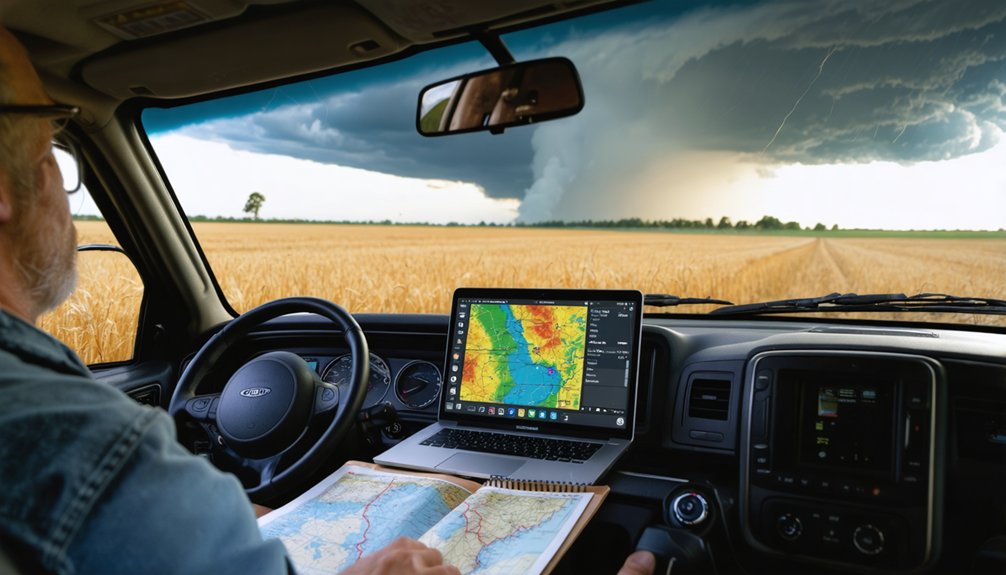
The belief that successful storm chasing demands decades of field experience oversimplifies a multifaceted discipline where strategic planning, meteorological expertise, and technological proficiency often outweigh raw time accumulation. You’ll encounter field expertise challenges that demand quality chase days rather than quantity—active evaluation of meteorological conditions proves more valuable than passive years spent chasing.
Strategic positioning techniques integrate formal training in radar interpretation, real-time mobile technology, and pre-dawn atmospheric analysis to identify prime intercept locations. Your forecasting accuracy depends on continuous learning of emerging models, Doppler radar proficiency, and flexible route correction during active operations.
While historical baseline data shows experienced chasers maintain advantages, modern technology democratizes access—competent interpretation of satellite imagery and weather tracking software accelerates skill development considerably.
Dixie Alley Has Emerged as a High-Frequency Tornado Region
You might assume tornado activity remains concentrated in the traditional Great Plains corridor, but data from 1979-2017 reveals robust positive trends across Missouri, Illinois, Indiana, Tennessee, and Kentucky.
Dixie Alley’s tornado frequency has more than doubled since 1990, with significant upward trajectories documented throughout portions of the Midwest, Northeast, and Southeast. This geographical shift contrasts sharply with decreased activity observed in the traditional Tornado Alley of the Great Plains.
Mid-South Tornado Frequency Trends
The transformation is striking in specific metrics:
- Mississippi now ranks 5th nationally with 9.2 tornadoes per 10,000 square miles annually
- Tornado frequency more than doubled in Dixie Alley since 1990
- Eastern Arkansas and Memphis area show highest concentration increases
- EF2+ tornado density escalated dramatically over the past 30 years
- STP values confirm environmental trends supporting rainfall enhanced tornadoes
This eastward migration intersects with urban sprawl impacts, creating unprecedented vulnerability.
You’ll find Kentucky, Tennessee, and Missouri experiencing positive trends in both tornado reports and favorable atmospheric environments.
Southeast Violent Outbreak Patterns
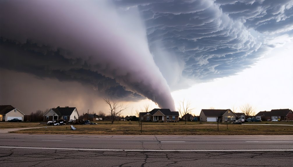
Since 1979, tornado activity across the United States has undergone a dramatic geographic redistribution, with Dixie Alley—the region encompassing the lower Mississippi Valley and upper Tennessee Valley—emerging as the nation’s most significant tornado threat zone. You’ll find tornado frequency has more than doubled since 1990 across Mississippi, Alabama, Arkansas, Missouri, Illinois, Indiana, Tennessee, and Kentucky.
This eastward shift creates unprecedented danger due to increased population density compared to traditional Great Plains corridors. Extreme storm characteristics define this region: tornadoes strike chiefly at night, often during cold seasons, with rain-wrapped funnels that resist visual detection. Fast-moving systems reduce your reaction time while storms stall and produce multiple thunderstorm rounds over days.
Since 1993, Alabama and Tennessee have recorded more annual tornado fatalities than Kansas and Oklahoma combined.
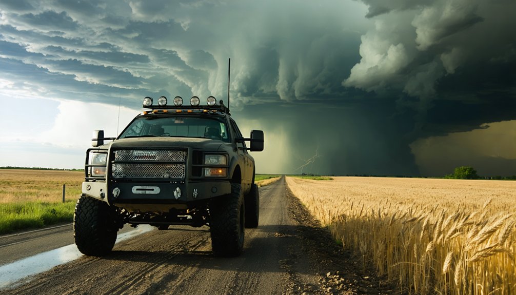
Traffic Hazards Pose Greater Risks Than the Storms Themselves
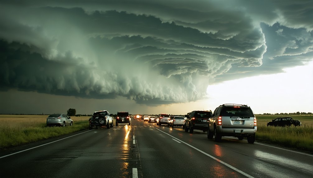
While tornadoes dominate public perception of storm-chasing dangers, vehicular accidents actually represent the most significant threat to chasers’ safety. Your driving skill challenges intensify when wet roads, limited visibility, and congested chase routes converge simultaneously. Dangerous storm chasing behaviors multiply when multiple teams operate in confined areas with unpredictable movements.
The greatest danger in storm chasing isn’t the tornado itself—it’s the drive to intercept it.
Critical Traffic Risk Factors:
- Other chasers create erratic driving patterns around active storm systems
- Southeastern road networks feature curves and limited escape routes versus Plains grid systems
- Dense vegetation and hilly terrain restrict visibility for safe vehicle positioning
- Populated areas introduce civilian traffic unfamiliar with severe weather protocols
- End-of-day fatigue compounds poor visibility conditions
You’ll face compromised escape routes when residential zones restrict directional options, particularly when storms shift unexpectedly in terrain lacking the navigational freedom of traditional Tornado Alley.
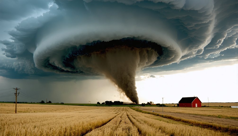
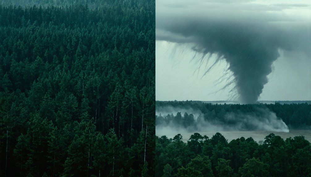
Photogenic Tornado Encounters Remain Extremely Rare Events
Beyond traversing hazardous road conditions, storm chasers confront another sobering reality: actually witnessing a photogenic tornado requires exceptional patience and favorable odds. Despite 1,000+ annual U.S. tornadoes, most measure just 250 feet wide with 112 mph winds before dissipating within one mile.
Tour planning constraints compound these challenges—workshops explicitly emphasize supercell thunderstorms over tornado photography, calling photogenic encounters “icing on the cake.” Even during peak seasonal factors like May’s 298-tornado average, you’ll face long drives targeting probability zones.
Sample itineraries show first tornado sightings on Day 5, with forecasters prioritizing highest-likelihood storm locations. The 1999 Bridge Creek tornado’s record 302 mph winds and May 2003’s 543 tornadoes represent statistical outliers, not typical experiences in your pursuit of nature’s most elusive phenomena.
Southeast Tornadoes Produce Higher Casualty Rates Than Tornado Alley
Critical risk amplifiers include:
- Intensity: Half of deadly southeastern tornadoes reach EF-4 or EF-5 strength, causing 89.5% of deaths
- Speed: Rapid forward velocities exceeding 50 mph limit warning response time
- Duration: Average track lengths of 66 miles cross multiple jurisdictions
- Construction: Substandard building codes compared to Tornado Alley regions
- Geography: Dense forests obscure visual tornado detection
Louisiana, Arkansas, Kentucky, and Florida rank among the top ten per-capita casualty states.
Frequently Asked Questions
What Equipment Do Professional Storm Chasers Typically Carry in Their Vehicles?
You’ll need specialized weather instruments like anemometers and barometers, plus portable power sources including inverters and lithium batteries. Essential gear includes DSLR cameras, communication devices, GPS units, vehicle recovery tools, and extensive safety equipment for extended field operations.
How Do Meteorologists Predict Which Storms Will Produce Tornadoes Versus Hail?
You’ll find meteorologists analyze convective available potential energy paired with storm intensity indicators like vertical wind shear and helicity. High CAPE with weak shear favors hail, while strong low-level rotation signals tornado potential in supercells.
Can Tornadoes Occur at Night and How Does This Affect Chasing?
Yes, tornadoes occur at night—33.8% of U.S. fatalities happened nocturnally since 1880. Nighttime tornado characteristics include reduced visibility that complicates your detection efforts. You’ll face doubled fatality risks and limited escape routes, making nocturnal chasing exceptionally dangerous.
What Training or Certifications Should Beginning Storm Chasers Obtain Before Starting?
Like Dorothy learning Kansas’s skies before Oz, you’ll need SKYWARN™ spotter certification, weather awareness training, first aid credentials, and local climatology knowledge. Master radar interpretation, atmospheric dynamics, and forecasting models before you’re field-ready.
How Do Storm Chasers Coordinate With Emergency Management During Active Outbreaks?
You’ll coordinate through established communication channels like Spotter Network and emergency radio frequencies, following coordination protocols that enable real-time data sharing with NWS and local agencies. Your observations supplement radar detection, providing ground-truth verification during active tornado events.