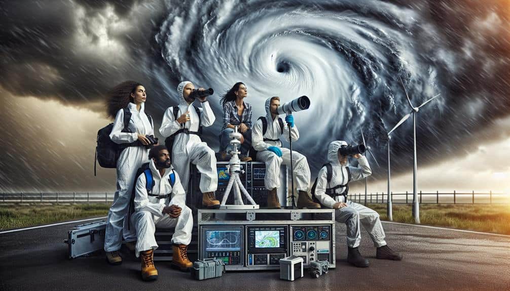
We gather and analyze hurricane data using advanced methods like drone surveillance, Doppler radar, and satellite imagery to capture detailed storm metrics. Our storm chasers play a vital role, gathering real-time data on wind speeds, pressure, and humidity, which enhances predictive models and forecasts. We examine historical data and real-time observations to identify storm patterns and trends. Our analysis of ocean buoys, aircraft reconnaissance data, and weather balloons further refines our understanding. This thorough approach not only enhances predictive accuracy but also informs safety and emergency procedures. Exploring more will unveil deeper insights into our methodologies and findings.
Key Points
- Satellite imagery and ocean buoy data provide high-resolution insights into hurricane formation and behavior.
- Storm chasers collect real-time atmospheric data, enhancing predictive models and forecasts.
- Drones and Doppler radar track wind speeds, pressure, humidity, and precipitation intensity.
- Historical data and predictive models help identify trends and anomalies in hurricane patterns.
The Role of Storm Chasers
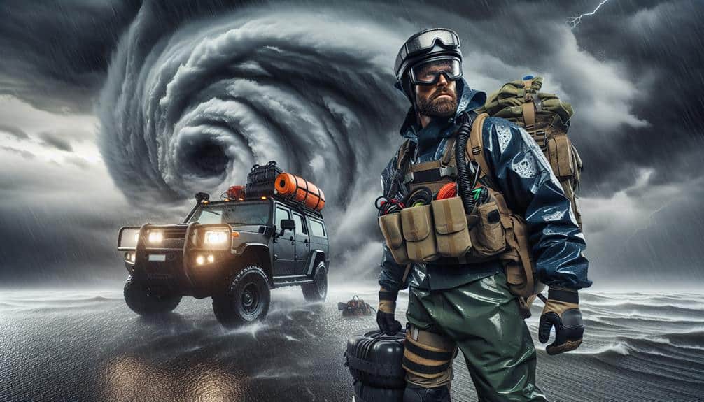
Storm chasers play a vital role in gathering real-time data that enhances our comprehension of hurricane dynamics and enhances predictive models. By venturing into the heart of these storms, we collect necessary information such as wind speeds, barometric pressure, and humidity levels. This data is essential for improving our hurricane models, which in turn allows us to issue more precise forecasts and warnings.
Public awareness is notably heightened through our efforts. When we share our findings with meteorological agencies and the general public, we empower communities to make informed decisions about evacuation and preparedness. The data we collect not only informs scientific models but also acts as a catalyst for media coverage, expanding the dissemination of important information.
Media outlets depend on our real-time updates and visuals to convey the urgency and seriousness of approaching hurricanes.
Our work doesn't just stop at data collection; it's also about translating that data into actionable insights. We work hard to ensure that the public understands the risks they face and the steps they can take to reduce those risks. By doing so, we contribute to a more resilient society, equipped with the knowledge to confront these natural disasters directly.
Equipment for Hurricane Tracking
To effectively gather the vital data that enhances our understanding of hurricanes, we rely on specialized equipment designed for accurate and reliable measurements. Drone surveillance allows us to capture real-time visual data from altitudes and angles inaccessible to traditional aircraft. These drones are equipped with sensors that measure wind speeds, pressure, and humidity, providing a detailed view of the hurricane's structure.
Radar technology is another essential tool. Doppler radar, in particular, helps us track precipitation intensity and storm motion. By emitting radio waves and analyzing the returning signals, we can determine the velocity and direction of hurricane winds. This data is critical for predicting the storm's path and potential impact areas.
Weather balloons, launched into the storm's environment, carry instruments known as radiosondes. These devices collect data on atmospheric pressure, temperature, and humidity at various altitudes. With GPS tracking, we can accurately determine their position, ensuring precise data collection even within the chaotic environment of a hurricane.
Together, these technologies form a robust framework for hurricane tracking. By leveraging drone surveillance, radar technology, weather balloons, and GPS tracking, we can better predict hurricane behavior, ultimately empowering us to make informed decisions and enhance our preparedness.
Data Collection Methods
Let's analyze our primary data collection methods: satellite imagery analysis, ocean buoy measurements, and aircraft reconnaissance data.
Each method provides critical insights; satellite imagery offers extensive spatial coverage, ocean buoys deliver real-time sea surface data, and aircraft reconnaissance captures in-situ atmospheric conditions.
Satellite Imagery Analysis
Satellite imagery analysis provides us with high-resolution data critical for tracking the development and movement of hurricanes. By utilizing remote sensing technologies, we can capture detailed images of storm systems from space, enabling us to monitor their evolution in real-time.
These images, collected through geostationary and polar-orbiting satellites, offer invaluable insights into hurricane intensity, structure, and trajectory.
We employ advanced algorithms to process and interpret this data, which enhances our weather forecasting capabilities. The thermal infrared imagery, for instance, allows us to measure cloud-top temperatures, revealing key information about storm strength.
Visible spectrum imaging, on the other hand, provides clarity on the eye formation and cloud patterns, essential for predicting potential landfall locations.
Ocean Buoy Measurements
Ocean buoy measurements play an important role in gathering up-to-the-minute data on sea surface temperatures, wave heights, and atmospheric pressure, all of which are crucial for understanding hurricane dynamics. By deploying a network of buoys across the ocean, we collect comprehensive datasets that inform predictive models and enhance our ability to anticipate hurricane behavior.
These buoys meticulously record wave dynamics, providing insights into the energy transfer between the sea surface and the atmosphere. When we analyze these measurements, we can correlate changes in wave height with wind speed, a critical factor in evaluating a hurricane's strength. Additionally, measuring ocean currents helps us understand how warm water is distributed, which directly influences a storm's intensity and trajectory.
Atmospheric pressure readings from buoys offer valuable information about the pressure gradients driving hurricane formation and development. Lower pressure readings often signify the presence of a developing storm system. By continuously monitoring these variables, we can refine our predictive models, making them more precise and dependable.
In essence, ocean buoy measurements are essential for real-time data collection. They empower us to decode the intricate interactions between sea and sky, enhancing our understanding and forecasting of hurricane dynamics.
Aircraft Reconnaissance Data
By utilizing specialized aircraft equipped with advanced instruments, we collect essential in-situ data on wind speed, pressure, temperature, and humidity within and around hurricanes. These aircraft, often referred to as 'hurricane hunters,' fly specific flight patterns designed to maximize data collection efficiency. They penetrate the eyewall multiple times, providing us with real-time data vital for weather analysis.
Our data interpretation of these measurements yields invaluable meteorological insights. For instance, we can pinpoint the precise location of the storm's center and estimate its intensity more accurately than satellite observations alone. The high-resolution data on wind speed and direction helps us understand the storm's structure, while pressure readings offer clues about potential changes in intensity.
Temperature and humidity profiles collected at various altitudes allow us to analyze the thermodynamic environment of the hurricane. This extensive dataset supports better weather models, enhancing our predictive capabilities.
Analyzing Storm Patterns
To analyze storm patterns effectively, we scrutinize a combination of historical data, predictive models, and real-time meteorological observations. By examining storm intensity and wind speed metrics, we can identify trends and anomalies in hurricane behavior. Historical data provides a rich repository of past storm characteristics, allowing us to compare current events with previous ones.
Predictive models, leveraging sophisticated algorithms, offer projections based on varying atmospheric conditions. When we look at real-time meteorological observations, we capture critical parameters such as barometric pressure, sea surface temperatures, and wind speed. These data points feed into our predictive models, continually refining their accuracy.
Storm intensity, often measured by the Saffir-Simpson Hurricane Wind Scale, is a key metric that helps us gauge the potential impact and necessary preparations. Our approach is inherently data-driven, relying on a vast network of satellites, buoys, and radar systems. This network enables us to track the formation, progression, and potential landfall of hurricanes with increasing precision.
Safety Protocols for Researchers
As researchers, we must prioritize essential safety equipment, establish robust emergency response plans, and conduct thorough fieldwork risk assessments.
Our data collection efforts hinge on these protocols to mitigate hazards and guarantee operational integrity.
Essential Safety Equipment
A robust hurricane research operation demands that we equip ourselves with specialized safety gear, including wind-resistant clothing, GPS trackers, and emergency communication devices. Protective gear is essential, offering resistance to extreme wind speeds and debris impact. Wind-resistant clothing not only shields us from the elements but also enhances our mobility, allowing us to gather crucial data without compromising our safety.
In addition to protective gear, emergency supplies are a vital component of our toolkit. These supplies include first aid kits, water purification tablets, and non-perishable food items. Such provisions ensure that we can sustain ourselves if we become isolated during field research. Our GPS trackers are indispensable for maintaining real-time location data, which is crucial for both our research accuracy and personal safety.
Effective communication plans are non-negotiable. We utilize emergency communication devices to maintain constant contact with our base and fellow researchers. These devices are equipped with redundancy features to ensure reliability even in the harshest conditions.
Concurrently, well-documented evacuation procedures provide a clear, actionable pathway for leaving hazardous areas swiftly and safely. Together, these elements form a comprehensive safety framework, enabling us to conduct research effectively while preserving our freedom and well-being.
Emergency Response Plans
Our emergency response plans, meticulously crafted and rigorously tested, ensure we can promptly and effectively address any unforeseen hazards during hurricane research operations. By implementing precise evacuation procedures, we guarantee swift and safe removal from high-risk zones. Our communication protocols are designed to maintain continuous, real-time updates between field teams and command centers, leveraging satellite and radio technologies.
Shelter management is a cornerstone of our strategy. We identify and secure facilities capable of withstanding extreme weather, optimizing them for both short-term and extended stays. This involves proactive resource allocation, stocking shelters with necessary supplies such as food, water, medical kits, and backup power systems. Detailed inventories and automated tracking systems help us manage these resources efficiently.
Data-driven analyses inform every aspect of our emergency response. We utilize historical data and predictive models to forecast likely scenarios, allowing us to preemptively deploy resources and personnel. This proactive approach minimizes disruptions and enhances our operational resilience.
Our commitment to thorough planning and dynamic response mechanisms empowers us to conduct essential hurricane research while safeguarding our team's well-being and maintaining their autonomy and freedom to explore.
Fieldwork Risk Assessment
Effective fieldwork risk assessment guarantees researchers adhere to strict safety protocols, minimizing hazards and safeguarding lives during hurricane studies. When we venture into the field, it's vital to meticulously analyze weather patterns and environmental factors. This thorough hazard assessment enables us to predict potential dangers and implement effective safety measures.
Our data analysis begins with real-time weather monitoring, utilizing satellite imagery and meteorological data to track storm developments. By understanding the trajectory and intensity of hurricanes, we can determine the safest times and locations for data collection. This proactive approach helps us to avoid high-risk zones and maintains that our presence in the field doesn't compromise our safety.
We also conduct in-depth environmental assessments, examining factors such as terrain stability, flood risks, and wind speeds. This information guides our decisions on where to set up equipment and how to navigate the field safely. By continually updating our risk assessments based on the latest data, we maintain a dynamic safety protocol that adapts to changing conditions.
Our commitment to thorough fieldwork risk assessment not only protects our team but also ensures the integrity of our research. By prioritizing safety, we can focus on advancing our understanding of hurricanes, while enjoying the freedom to explore and analyze these potent natural phenomena.
Contributions to Meteorology
Through decades of research and technological advancements, we've greatly enhanced our ability to predict and understand the complex dynamics of hurricanes. Our meteorological models now integrate vast datasets, providing insights into historical impacts and current climate change trends. By analyzing patterns from past hurricanes, we can better predict future storm behaviors and potential threats. This predictive capability empowers communities to make informed decisions, ultimately safeguarding lives and property.
Satellite technology, Doppler radar, and computer modeling have revolutionized our approach. These tools allow us to track storm formation, intensity, and trajectory with remarkable precision. For example, the integration of historical impact data with real-time observations has refined our understanding of hurricane development stages. Additionally, by incorporating climate change trends into these models, we've identified shifts in hurricane frequency and intensity, directly linking them to global warming.
Our collective efforts in meteorology have led to more accurate forecasting, giving people the freedom to prepare and respond effectively. As we continue to refine our models and expand our datasets, we aim to further mitigate the risks posed by these formidable natural phenomena.
Frequently Asked Questions
How Do Hurricanes Impact Marine Ecosystems?
A rising tide lifts all boats; hurricanes drastically disrupt marine life but also test ecosystem resilience. Data shows mixed impacts: some species thrive post-storm, while others suffer, highlighting nature's balance and our quest for freedom through understanding.
What Are the Economic Costs of Hurricane Damage?
We analyze the economic costs of hurricane damage by evaluating infrastructure damage and insurance claims. These costs can escalate into billions, affecting public and private sectors, and highlighting vulnerabilities in our preparedness and response strategies.
How Are Hurricane Names Chosen?
We select hurricane names using established naming conventions that reflect meteorological significance. These names consider cultural influences and gender diversity. Our analytical approach guarantees the chosen names are memorable, culturally inclusive, and alternately male and female.
What Are the Psychological Effects of Hurricanes on Survivors?
Studies show 30% of hurricane survivors experience PTSD. We must focus on mental health to support resilience building. By understanding psychological impacts, we can develop effective strategies for recovery and empower individuals to regain their freedom.
How Can Communities Prepare for Hurricane Season?
We can enhance our community's readiness by focusing on emergency planning and clearly marking evacuation routes. Data indicates that well-prepared communities experience fewer casualties and quicker recovery times, ensuring our freedom and safety during hurricane season.