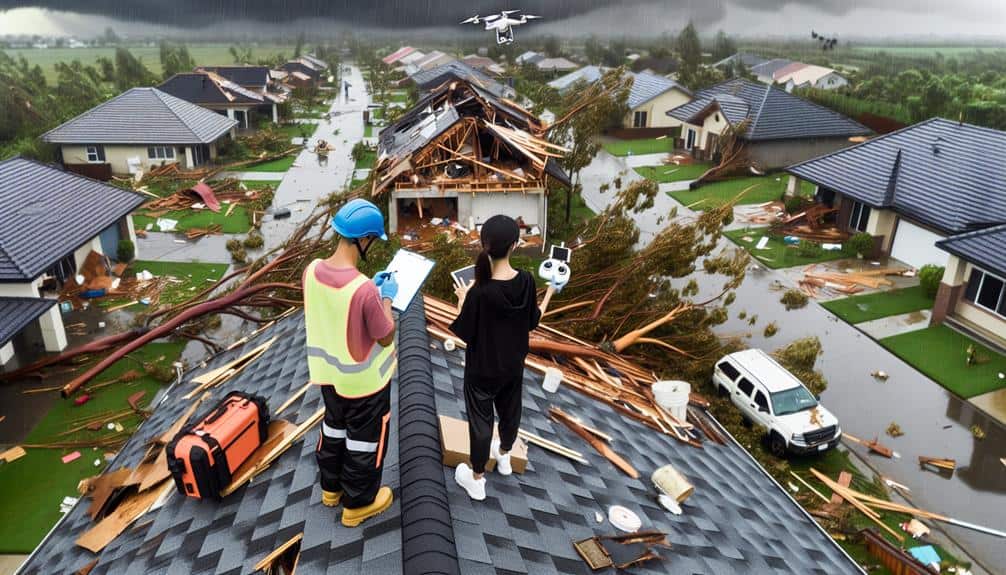
We use several methods to document storm damage thoroughly. Our team captures high-quality photos and videos, including drone footage, to provide detailed visual evidence from all angles. We conduct aerial surveys for rapid assessment and map the damage using GPS technology. Written reports systematically detail the extent and nature of the damage, integrating precise measurements and visual aids. Remote sensing helps us access difficult terrain, and social media provides real-time updates and geotagged images. These techniques guarantee we collect detailed data for thorough analysis and informed decision-making. Let's explore how each method contributes to achieving these goals.
Key Points
- High-quality photographs capture detailed and overall storm damage.
- Video documentation with time-stamped footage shows damage progression.
- Aerial drone surveys provide high-resolution imagery for rapid damage assessment.
- Written reports detail damage extent with exact measurements and visual aids.
Photographic Evidence
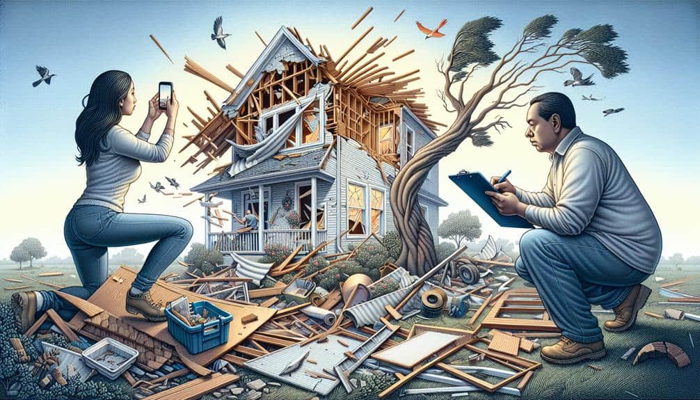
Capturing high-quality photographic evidence is necessary for accurately documenting storm damage. It allows us to record the extent and specifics of the damage in a manner that's both clear and thorough. To achieve this, we need a structured approach that includes both detailed close-ups and wide shots.
First, let's discuss detailed close-ups. These images capture the fine details of damage, such as cracks in walls, broken windows, and water stains. Close-ups provide an intimate look at the small yet significant impacts that might be overlooked in broader views. They're essential for insurance claims and repair estimates, offering an indisputable record of specific damages.
On the other hand, wide shots give us the big picture. These images encompass entire areas, displaying the overall extent of the storm's impact. By capturing wide shots, we can show the relationship between damaged elements, such as how a fallen tree may have impacted a fence and a roof simultaneously. Wide shots also help in visualizing the landscape context, providing a sense of scale that's crucial for thorough assessment.
Video Documentation
Let's start by discussing the necessary equipment for recording storm damage and identifying key angles to capture.
We'll also examine the importance of time-stamping footage to ensure accurate documentation.
Proper use of video can provide a detailed view that complements photographic evidence.
Equipment for Recording
High-quality cameras and drones are essential tools for effectively documenting storm damage through video. Using advanced drone technology, we can achieve detailed damage assessment from angles and heights that would be challenging or unsafe to capture otherwise. Drones equipped with 4K cameras enable us to obtain detailed footage, pinpointing specific areas of damage and providing a clear visual record.
Drones offer unparalleled flexibility and can cover large expanses of affected areas quickly. We can program them to follow specific flight paths, ensuring consistent and repeatable documentation. This not only saves time but also allows us to focus on analyzing the collected data rather than the process of gathering it.
High-resolution handheld cameras complement drone footage by providing ground-level perspectives. These cameras, often equipped with image stabilization and high zoom capabilities, allow us to capture close-up details of structural damage, water intrusion, and other critical elements.
Together, drones and handheld cameras provide a comprehensive view of storm damage, combining aerial and ground-level insights.
Incorporating both types of equipment guarantees that our damage assessments are thorough and precise, empowering us to make informed decisions and take swift action in recovery efforts. This combination of technology maximizes our ability to document and respond to storm damage effectively.
Key Angles to Capture
To make sure thorough video documentation of storm damage, we must strategically capture key angles that highlight both the extent and specifics of the destruction. First, we should focus on wide shots that show the overall impact on the property and its surroundings, allowing us to correlate damage with recent weather patterns. This can be particularly valuable when filing insurance claims, as it provides a detailed view of the affected area.
Next, capturing close-up shots of specific damage points is essential. We should zoom in on areas where structural integrity appears compromised, such as cracks in foundations, roof damage, or broken windows. These detailed views not only illustrate the severity but also help in evaluating necessary safety measures for repair.
Additionally, we need to document interior damage, emphasizing areas where water intrusion, mold, or structural weakness is evident. By recording from multiple angles, we can provide a more thorough picture, aiding insurance adjusters in understanding the full scope of the damage.
Lastly, it's important to include angles that show the relationship between damaged areas and unaffected parts. This contrast can underscore the selective nature of the damage, reinforcing the connection to specific weather patterns and supporting our insurance claims.
Time-stamping Footage
Time-stamping video footage is essential for establishing a clear timeline of the storm's impact and the subsequent damage. By adding precise time stamps, we can accurately chronicle the sequence of events, which is vital for thorough data analysis. This chronological precision allows us to correlate specific damages with distinct phases of the storm, providing a clear narrative that aids both in understanding the storm's progression and in developing effective response strategies.
From a legal perspective, time-stamped footage holds significant weight. It serves as irrefutable evidence that can be used in insurance claims, legal disputes, and compliance with regulatory requirements. Accurate documentation minimizes ambiguities, ensuring that the evidence presented is both reliable and admissible in court. This level of detail is indispensable when addressing the legal implications associated with storm damage, helping to protect our interests and uphold our rights.
Moreover, integrating time-stamping technology into our video documentation processes enhances the overall reliability and credibility of the collected data. It empowers us with the freedom to present unassailable proof and facilitates more rigorous data analysis, ultimately leading to better-informed decisions and actions in the aftermath of a storm.
Aerial Drone Surveys
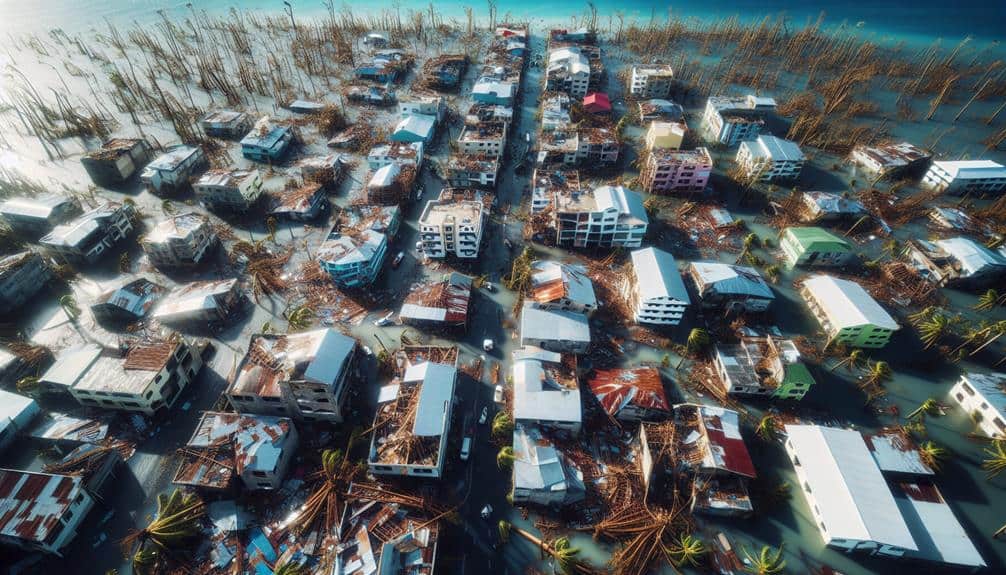
With aerial drone surveys, we can capture high-resolution imagery, allowing for a rapid damage assessment.
This method is particularly effective in accessing difficult terrain where ground-based inspections are impractical.
High-Resolution Imagery Capture
High-resolution imagery captured through aerial drone surveys provides an unmatched level of detail essential for accurately documenting storm damage. When we deploy drones equipped with advanced cameras, we can obtain precise, up-close views of affected areas that satellite imaging and traditional methods simply can't match. This approach allows us to swiftly analyze intricate weather patterns and their impacts, offering real-time data vital for effective damage assessment.
Our process involves meticulous image analysis, identifying even the smallest signs of degradation or structural compromise. By capturing high-resolution photographs and videos, we create a detailed visual record that aids in pinpointing the exact locations and extents of damage. These detailed visuals are essential for insurance claims, repair planning, and resource allocation.
Moreover, aerial drone surveys enable us to cover large areas quickly and safely, reducing the need for ground-based inspections that can be time-consuming and hazardous. The flexibility and autonomy provided by drone technology empower us to operate in diverse environments, from urban landscapes to remote regions, ensuring no area is left unchecked. This method not only accelerates our response time but also enhances the accuracy and reliability of our storm damage documentation efforts.
Rapid Damage Assessment
Harnessing the intricate visuals acquired from high-definition imagery, we can promptly kickstart swift damage evaluations through aerial drone surveys. Drones equipped with cutting-edge cameras offer us a bird's-eye perspective, allowing for immediate data collection over expansive areas. This capability is invaluable when analyzing storm damage, as it enables us to gather thorough visual data without delay.
By utilizing drones, we carry out an extremely detailed analysis of affected zones. We can identify the extent and severity of damage to infrastructure, vegetation, and properties within minutes. This swift evaluation process not only saves time but also guarantees safety by reducing the need for ground-based inspections in potentially hazardous conditions.
Furthermore, the accuracy of drone surveys enhances our data collection precision. High-definition footage and imagery captured by these drones can be processed using specialized software to generate detailed orthomosaic maps and 3D models. These tools assist in the precise cataloging of damage, facilitating well-informed decision-making for disaster response and recovery efforts.
Difficult Terrain Access
Aerial drone surveys enable us to efficiently access and document storm damage in terrains that are challenging or unsafe for ground crews. Utilizing remote sensing technologies, drones provide a thorough overview of affected areas, capturing high-resolution images and videos. This enables us to assess the extent of damage without exposing personnel to potential hazards.
Deploying drones in difficult terrain helps to mitigate the communication challenges often encountered in such environments. With real-time data transmission capabilities, drones guarantee that we receive accurate information promptly. This immediacy allows for quicker decision-making and more efficient allocation of resources for recovery efforts.
Moreover, drones equipped with advanced sensors can detect structural weaknesses, soil displacement, and other subtle indicators of storm impact that might be missed by ground surveys. By leveraging these remote sensing technologies, we gain a more precise understanding of the damage, which is essential for developing targeted repair strategies.
Written Reports
We should start our written reports by systematically detailing the extent and nature of the storm damage observed. This initial damage assessment is essential for creating a thorough and accurate document. Our reports should be meticulous, focusing on specifics that can later support insurance claims.
To make sure our reports are detailed and precise, we can follow these steps:
- Identify and quantify damage: Clearly describe the damage to structures, trees, and other property. Use exact measurements and terms.
- Document immediate impacts: Note any urgent issues such as safety hazards or disruptions to essential services. This helps prioritize repairs and emergency responses.
- Include visual aids: Attach photographs, diagrams, or sketches to complement written descriptions. Visual evidence is essential for validation.
GPS Mapping
Integrating GPS mapping into our documentation process allows us to pinpoint the exact locations of storm damage with unparalleled accuracy. By leveraging this technology, we can systematically capture geospatial data during our field observations, making sure that every detail is meticulously recorded.
When we conduct field observations, we use handheld GPS devices or mobile apps to log coordinates of damaged areas. This data is then uploaded to a central database, enabling thorough data analysis. By mapping these coordinates, we can visualize the distribution and intensity of the storm's impact, providing a clear picture of the affected regions.
Our data analysis process involves overlaying GPS data with other geographical information systems (GIS) layers such as topography, land use, and infrastructure. This integration allows us to identify patterns and correlations, helping us to make informed decisions regarding resource allocation and recovery efforts.
Moreover, GPS mapping facilitates collaboration with other agencies and stakeholders. By sharing precise geospatial data, we make sure that all parties have a unified understanding of the situation, which is vital for coordinated disaster response.
Essentially, GPS mapping empowers us with the freedom to act swiftly and effectively, minimizing the storm's aftermath and accelerating recovery.
Social Media Updates
By utilizing the power of social media updates, we can swiftly gather up-to-the-minute information from affected communities, enhancing our ability to document storm damage with immediacy and accuracy. Platforms like Twitter, Facebook, and Instagram offer us unparalleled access to firsthand accounts and visual evidence, which are invaluable for damage assessment.
Community engagement on social media provides several advantages:
- Up-to-the-Minute Updates: Users post photos, videos, and status updates that offer an immediate look at the damage, often before official reports are available.
- Geotagging: Many posts include location data, enabling us to map out affected areas precisely and efficiently.
- Collectively Sourced Information: We can leverage the collective input of thousands of individuals, providing a broader and more detailed picture of the storm's impact.
Using these real-time updates helps us stay ahead in our documentation processes. It allows us to validate information quickly, ensuring that our assessments are both current and thorough.
Furthermore, community engagement fosters a collaborative environment where individuals feel empowered to contribute, further enhancing the accuracy and depth of our storm damage records.
Frequently Asked Questions
How Can Property Owners Prepare for Potential Storm Damage Documentation?
Imagine a homeowner successfully filing a claim due to meticulous preparation. We should conduct regular property inspections, take photo evidence, maintain an inventory checklist, and make video recordings to guarantee thorough and accurate storm damage documentation.
What Role Do Insurance Companies Play in Storm Damage Documentation?
Insurance companies play a pivotal role in storm damage documentation. They process insurance claims and involve adjusters to accurately assess damages. This secures fair compensation and helps property owners regain their freedom from financial burdens.
Are There Specific Apps Recommended for Documenting Storm Damage?
Yes, there are specific apps recommended for documenting storm damage. We recommend using apps like Encircle and EagleView for their data accuracy and robust image storage capabilities, ensuring precise and reliable documentation for insurance claims.
How Soon Should Damage Be Documented After a Storm?
We should document damage immediately after a storm to guarantee timeliness and accuracy. Proper documentation is essential for claims and repairs. Delays can lead to discrepancies, making it harder to assess the true extent of the damage.
What Are the Legal Implications of Inaccurate Storm Damage Documentation?
Inaccurate documentation can lead to severe legal consequences. We risk insurance denial, liability issues, and potential lawsuits. Accurate, timely records protect our interests and guarantee fair claims processing, maintaining our financial freedom and peace of mind.