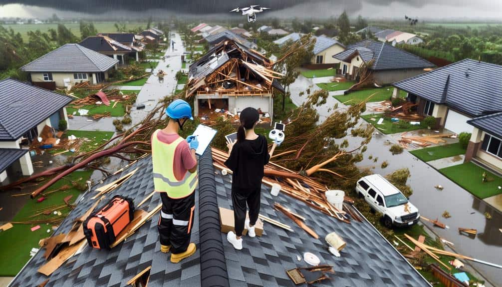
Capturing detailed tornado damage starts with prioritizing our safety by checking for hazards and wearing protective gear. We use high-resolution cameras and drones for clear, thorough documentation. Targeting key structures like hospitals and schools helps us assess the impact on important infrastructure. Recording from multiple angles—ground-level, aerial, and side views—ensures we collect extensive data. Finally, comparing before and after shots illustrates the extent of the damage and supports effective analysis. Explore these methods further to enhance your documentation and analysis of tornado impacts.
Key Points
- Prioritize personal safety and ensure the environment is secure before starting documentation.
- Use high-resolution cameras and drones to capture detailed images and aerial views.
- Focus on key structures like hospitals and schools to assess the impact on essential infrastructure.
- Document damage from multiple angles, including ground-level, overhead, and side views for comprehensive analysis.
Prioritize Safety First
Our primary concern must always be prioritizing personal safety before attempting to document tornado damage. We can't stress enough the significance of adhering to safety precautions and emergency response protocols.
The first step is to verify that the immediate environment is secure. This involves checking for downed power lines, gas leaks, and unstable structures. If any hazards are present, it's essential to wait for emergency responders to clear the area.
We should also equip ourselves with essential safety gear. Hard hats, sturdy boots, gloves, and high-visibility vests greatly reduce the risk of injury. Carrying a first-aid kit and having a reliable means of communication, like a fully charged mobile phone or a two-way radio, is necessary for staying connected and calling for help if needed.
In addition, a clear emergency response plan is important. This plan should include predefined meeting points, a method for accounting for all team members, and a strategy for rapid evacuation if conditions deteriorate.
Use High-Resolution Cameras
Once safety measures are in place, we should focus on utilizing high-detail cameras to capture detailed images of tornado damage. High-detail cameras provide the clarity and detail needed for thorough documentation and analysis, essential for understanding the extent and nature of the damage.
Using drones equipped with high-detail cameras, we can survey large areas quickly and safely. Drones allow us to access areas that may be too dangerous or inaccessible on foot. This aerial perspective guarantees extensive coverage, enhancing our ability to assess the damage accurately.
By capturing high-detail images, we can enhance analysis through detailed visual records. These records are invaluable for both immediate assessment and long-term research. They help identify patterns in damage, which can inform future building codes and disaster preparedness strategies.
- Witness the raw power of nature: High-detail images reveal the true extent of destruction, evoking a profound respect for the forces at play.
- Empower communities: Detailed documentation aids in securing necessary aid and resources for affected areas.
- Preserve history: Capturing these moments ensures future generations understand the impact of these events.
- Support scientific research: High-quality images contribute to valuable data for disaster studies.
Focus on Key Structures
Prioritize documenting key structures to ensure a thorough understanding of the tornado's impact on essential infrastructure. When evaluating tornado damage, our main focus should be on buildings and other structures necessary for community functioning, such as hospitals, schools, bridges, and power facilities. These key structures provide valuable insights into the storm's intensity and the resilience of our infrastructure.
We must evaluate the structural integrity of these buildings meticulously. This involves noting any visible damage to foundations, supports, and load-bearing components. By doing so, we can identify which materials and designs perform best under severe conditions, guiding future construction standards.
Aerial footage plays a vital role in our documentation efforts. Using drones or helicopters, we can capture detailed views of affected areas, allowing us to observe patterns of destruction and pinpoint the most severely damaged structures. This bird's-eye perspective is essential for understanding the broader impact on the community and prioritizing recovery efforts.
Document From Multiple Angles
To gain a thorough understanding of tornado damage, we must document the impacted areas from multiple viewpoints. By capturing various perspectives, we make certain that our data collection is extensive and accurate. Different angles reveal the degree of structural damage and help us grasp the tornado's impact under varying lighting conditions.
Utilizing aerial footage and video documentation allows us to capture a macro view of the damage, providing valuable context that ground-level photos alone can't offer. Drones are particularly effective for this purpose, enabling us to gather wide-ranging visual data efficiently.
When documenting:
- Ground-level shots: Capture detailed close-ups of specific damage.
- Overhead views: Use drones for broad, thorough coverage.
- Side angles: Show depth and layering of damage, essential for structural analysis.
- Time-lapse videos: Record the progression of damage over time.
These angles collectively form a robust dataset.
Our approach must be precise and methodical to ensure flexibility in our analysis and the subsequent steps in the recovery process. By leveraging multiple angles, we gain a clearer, more detailed picture of the tornado's destruction, aiding in effective documentation and analysis.
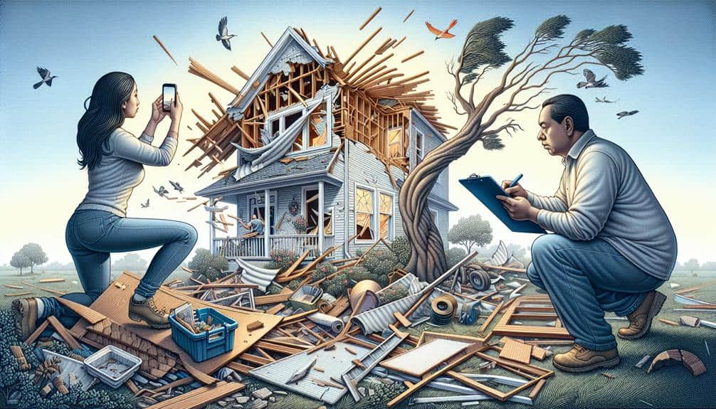
Capture Before and After Shots

How can we effectively illustrate the extent of tornado damage?
One effective method is capturing before and after shots. By comparing images taken prior to and following a tornado, we can clearly demonstrate the dramatic changes wrought by the storm. To maximize the impact of these shots, we need to take into account several factors.
First, let's think about lighting effects. Capturing images under similar lighting conditions ensures consistency. Early morning or late afternoon light can highlight textures and shadows, making the damage more apparent. Adjusting our camera settings to match these conditions in both sets of photos will create a more compelling visual narrative.
Next, incorporating drone footage offers a unique perspective. Drones allow us to capture wide-area shots that ground-level photography simply can't achieve. We should document the same locations from the same angles before and after the tornado, providing an overarching view of the destruction.
Frequently Asked Questions
How Do I Protect My Camera Gear During Extreme Weather Conditions?
Imagine the storm hitting hard. We've got to weatherproof our equipment and have an emergency backup plan. Using rain covers, sealing bags, and portable shelters guarantees our gear stays safe. Let's protect our freedom to capture.
What Legal Permissions Are Needed to Document Tornado Damage on Private Property?
To document tornado damage on private property, we must obtain permission from property owners, respecting property rights and addressing liability concerns. Without explicit consent, our actions could violate rights and expose us to legal risks.
How Can I Ensure the Accuracy of the GPS Coordinates for Each Photo?
To maintain precision in GPS coordinates for photo documentation accuracy, we should use high-quality GPS-enabled cameras with extreme weather protection. Verifying coordinates with mapping software increases reliability, guaranteeing our data remains precise and dependable.
Are There Specific Apps Recommended for Organizing and Tagging Tornado Damage Photos?
We recommend using apps with robust image recognition and data analysis features. They should support cloud storage for easy access and offer digital cataloguing capabilities to streamline organizing and tagging tornado damage photos efficiently and accurately.
What Are the Best Practices for Sharing Tornado Damage Photos With Insurance Companies?
In the aftermath, we'll guarantee data privacy by using secure sharing platforms. For image analysis, let's provide high-resolution photos with detailed captions. Always validate receipt with our insurance agents to maintain transparency and expedite claims.