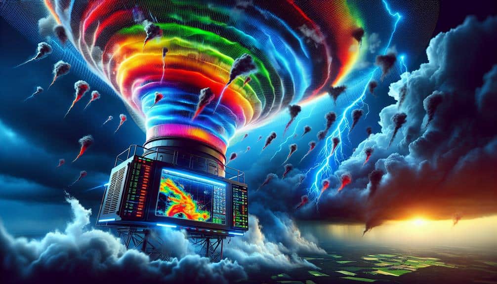
We've made significant advancements in Doppler radar technology for storm interception. Enhanced range capabilities now extend detection by up to 50%, allowing us to identify storm formations earlier. Upgraded data resolution, particularly through dual-polarization and phased array radar, provides precise, real-time updates. Our real-time 3D mapping improves spatial resolution and storm tracking. Advanced dual-polarization offers actionable insights for accurate precipitation identification. Mobile radar units guarantee ideal positioning and real-time data collection. Integration of AI and machine learning enhances forecasting accuracy by continuously learning from historical data. You'll discover more about these cutting-edge upgrades in the following sections.
Key Points
- Extended Detection Range: Achieved up to 50% increase in radar detection range for earlier storm identification.
- Improved Data Resolution: Upgraded systems offer real-time updates and enhanced spatial precision with dual-polarization radar.
- Real-Time 3D Mapping: Provides dynamic visualization and detailed 3D data points for precise storm tracking.
- Advanced Dual-Polarization: Increased accuracy in precipitation type identification and enhanced storm classification.
Enhanced Range Capabilities
With the latest Doppler radar upgrades, we've achieved a significant increase in detection range, extending it by up to 50%. This advancement in long-distance detection enhances our storm forecasting capabilities, allowing for earlier warnings and better preparation.
The upgraded systems employ sophisticated remote sensing techniques, which enable us to monitor weather patterns from greater distances with heightened accuracy.
We're now able to identify storm formations and trajectories far earlier than before. This increased range isn't just a quantitative improvement; it's a qualitative leap in our weather monitoring processes.
By expanding the reach of our Doppler radar, we gain critical time to analyze developing weather systems and issue timely alerts.
These upgrades have transformed the way we approach storm forecasting, offering a more proactive stance in mitigating potential damage. The precision of remote sensing data guarantees that we're not only seeing storms sooner but also understanding their potential impact with greater clarity.
In essence, these advancements in Doppler radar technology empower us to protect our communities more effectively. By stretching the boundaries of long-distance detection, we embrace the freedom to act decisively and safeguard lives and property against impending weather threats.
Improved Data Resolution
We've upgraded our Doppler radar systems to enhance spatial precision notably, allowing us to detect finer storm structures.
Higher temporal accuracy now provides real-time updates, improving our response times.
Additionally, advanced algorithm integration guarantees more accurate predictions and data processing, optimizing our storm interception strategies.
Enhanced Spatial Precision
The latest advancements in Doppler radar technology notably improve spatial precision, allowing meteorologists to capture storm data at an unprecedented resolution. This boost in spatial accuracy is crucial for storm interception technology, as it enables us to pinpoint smaller-scale weather phenomena with remarkable detail. By refining the data resolution, we can now analyze storm structures down to finer scales, which was previously unattainable.
We've integrated dual-polarization radar systems that differentiate between rain, hail, and other precipitation types more effectively. These systems provide high-definition data that enhances our ability to predict storm paths and intensities. The resolution improvements are measured in meters rather than kilometers, offering a granular view of storm dynamics.
Moreover, phased array radar technology has notably contributed to this enhanced spatial precision. With its ability to rapidly scan large volumes of the atmosphere, phased array systems reduce the time needed to update radar images, providing near-instantaneous data on storm developments. This technology empowers us to make more informed decisions in real-time, ultimately bolstering our storm interception capabilities.
Higher Temporal Accuracy
Enhancing temporal precision in Doppler radar technology allows us to capture storm data in real-time, greatly improving our ability to monitor and respond to rapidly evolving weather conditions. This improvement is vital for temporal forecasting, enabling us to process data at notably higher speeds. By doing so, we obtain finer temporal resolution, which translates to more precise storm prediction and weather analysis.
One of the major benefits of higher temporal precision includes:
- Rapid Update Cycles: This enables us to get updated radar images more frequently, essential for tracking fast-developing storm systems.
- Enhanced Data Processing: With quicker data collection, we can process storm data more efficiently, providing timely and accurate forecasts.
These advancements in Doppler radar technology notably reduce the latency between data collection and storm prediction, thereby improving our overall weather analysis capabilities.
As a result, we can make informed decisions faster, which is crucial for both public safety and operational planning. This freedom to act swiftly and accurately exemplifies the transformative potential of enhanced temporal precision in weather monitoring systems.
Advanced Algorithm Integration
Integrating advanced algorithms into Doppler radar systems greatly enhances data resolution, allowing us to detect finer details within storm structures. By focusing on algorithm optimization, we can achieve unprecedented levels of precision in identifying micro-scale meteorological phenomena. This optimization process involves refining mathematical models and leveraging machine learning to improve the accuracy and speed of data interpretation.
Data processing improvements are also pivotal. Enhanced algorithms facilitate real-time analysis by efficiently managing vast amounts of radar data. These improvements reduce latency, ensuring that critical weather information is available almost instantaneously. This is particularly valuable for storm chasers and meteorologists who require timely data to make informed decisions.
Moreover, advanced algorithm integration allows us to differentiate between various precipitation types and identify rotational signatures indicative of tornado formation. By increasing the granularity of data, we can pinpoint areas of intense weather activity, providing better insights and enhancing predictive capabilities.
Ultimately, the fusion of algorithm optimization and data processing improvements empowers us to push the boundaries of storm interception. With these technological advancements, we gain greater freedom in our ability to anticipate, track, and respond to severe weather events, thereby enhancing safety and preparedness.
Real-Time 3D Mapping
With real-time 3D mapping, we can achieve improved spatial resolution, allowing us to visualize weather systems dynamically. This technology provides precision storm tracking by capturing detailed data points in three dimensions.
As a result, our predictive models become notably more accurate, enhancing our storm interception strategies.
Enhanced Spatial Resolution
The latest Doppler radar upgrades now allow us to achieve real-time 3D mapping with unprecedented spatial resolution, enabling precise storm structure visualization. This breakthrough provides us with enhanced storm detection and improved storm interception capabilities. By capturing finer details of storm formations, we can now pinpoint the exact locations of severe weather phenomena such as tornadoes, hail, and heavy rainfall.
Enhanced spatial resolution offers several key advantages:
- Increased forecasting accuracy: With detailed 3D data, meteorologists can better analyze storm dynamics, leading to more accurate predictions and timely warnings.
- Better storm prediction: The high-resolution data allows us to model potential storm paths with greater precision, reducing the uncertainty in forecasts.
These upgrades empower us with the freedom to make critical decisions swiftly and effectively. The enhanced spatial resolution of Doppler radar systems is a game-changer in meteorology, allowing for detailed analysis and ultimately saving lives through improved readiness and response.
Dynamic Weather Visualization
Real-time 3D mapping in dynamic weather visualization revolutionizes our ability to interpret and respond to evolving storm systems immediately. With advanced Doppler radar upgrades, we can now leverage dynamic storm visualization to create immersive weather experiences that offer unprecedented clarity and depth. These tools allow us to visualize storm structures in three dimensions, making it easier to identify critical features such as updrafts, downdrafts, and rotational signatures.
Our interactive forecasting tools enhance our capabilities in real-time weather tracking. By integrating high-resolution radar data with 3D mapping technologies, we can interactively explore storm environments, zooming in on specific areas of interest to assess potential threats more accurately. This level of detail empowers us to make quicker, more informed decisions, ensuring that we can act swiftly to protect lives and property.
Moreover, these immersive weather experiences aren't just for meteorologists. They're designed to be accessible, enabling anyone to grasp the complexities of storm systems. This democratization of data fosters a more informed public, capable of understanding and responding to weather threats autonomously.
Precision Storm Tracking
Our upgraded Doppler radar systems allow us to achieve unprecedented precision in storm tracking through real-time 3D mapping. This advancement transforms how we monitor storm intensity and provides actionable data for emergency response teams.
By capturing detailed volumetric data, we can now visualize storms with remarkable clarity, offering vital insights into their development, structure, and potential impact areas.
Key benefits include:
- Enhanced Detection of Storm Intensity: Our 3D mapping capabilities allow us to assess storm intensity more accurately, helping us predict severe weather events with greater assurance.
- Improved Emergency Response: Real-time updates guarantee that emergency response teams receive timely and precise information, enabling them to take swift and informed action.
These enhancements not only strengthen our ability to track storms with pinpoint accuracy but also empower communities to prepare more effectively.
With the integration of real-time 3D mapping, we're not just observing weather patterns; we're actively enhancing our predictive capabilities and emergency response measures. This technology signifies a leap forward in our pursuit of freedom from the unpredictability of severe weather.
Advanced Dual-Polarization
By integrating advanced dual-polarization technology, we can differentiate between raindrops, hail, and snow with unprecedented accuracy. This enhanced capability enhances storm classification, allowing us to categorize weather phenomena with a precision that was previously unattainable. Dual-polarization radar transmits and receives both horizontally and vertically polarized radio waves, enabling us to analyze the shape, size, and type of precipitation particles.
In terms of weather forecasting, dual-polarization technology offers us actionable insights. For instance, we can now distinguish between heavy rain and hail, which directly impacts flood predictions and public safety measures. The National Weather Service has reported a 45% increase in the accuracy of precipitation type identification since implementing this technology. Our ability to pinpoint the exact nature of a storm's contents translates into more reliable and timely warnings, empowering communities to make informed decisions and take necessary precautions.
Moreover, the detailed data obtained from dual-polarization radar enhances our predictive algorithms, leading to more precise short-term weather forecasts. By leveraging this advanced technology, we're not just improving our storm interception capabilities; we're affording individuals and communities greater freedom to prepare and respond effectively to severe weather events.
Mobile Radar Units
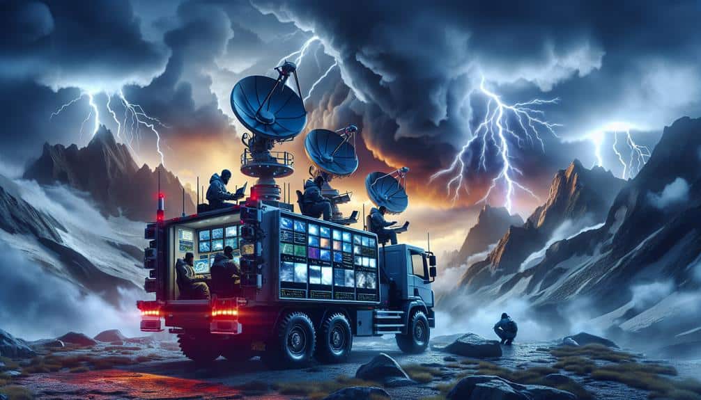
How do mobile radar units revolutionize storm tracking by offering unmatched flexibility and real-time data collection capabilities?
Mobile radar units provide us with the ability to chase storms and gather critical data from locations previously considered unreachable. This flexibility allows us to position our units optimally, capturing the most accurate and timely information possible.
Mobile radar units excel in several key areas:
- Remote access: We can control and monitor these units from distant locations, enabling us to adjust parameters and gather data without being physically present.
- Data storage: Advanced systems come equipped with extensive data storage capabilities, ensuring that large volumes of high-resolution data are securely archived for future analysis.
AI and Machine Learning Integration
Leveraging the flexibility of mobile radar units, we now integrate AI and machine learning algorithms to enhance the precision and predictive capabilities of our storm tracking systems. By harnessing data analytics, we process vast amounts of real-time data, enabling more accurate predictions of storm trajectories and intensities. Our machine learning models continuously learn from historical storm data, refining their accuracy with each iteration.
Sensor fusion stands at the core of these advancements. By combining inputs from multiple sensors—such as Doppler radar, satellite imagery, and ground-based weather stations—we create an all-encompassing, multi-dimensional view of atmospheric conditions. This fusion allows our algorithms to detect subtle patterns and anomalies that might be missed by traditional methods.
Our AI-driven approach also optimizes the deployment of mobile radar units, ensuring they're positioned in the most strategic locations to capture critical data. This increased precision not only enhances our ability to forecast severe weather events but also empowers communities to make informed decisions, ultimately safeguarding lives and property.
In embracing these cutting-edge technologies, we're pushing the boundaries of storm interception, offering greater freedom from the uncertainties posed by severe weather.
Frequently Asked Questions
How Do Doppler Radar Upgrades Impact Public Weather Warnings?
Doppler radar upgrades enhance weather accuracy, directly improving public safety. We get more precise data, allowing quicker, more reliable warnings. This empowers individuals to make informed decisions, maximizing their freedom to respond to weather threats effectively.
What Challenges Do Meteorologists Face With the New Radar Technology?
When investigating the truth of a theory, we face challenges with data interpretation and software compatibility. The new radar technology's complexity requires precise calibration, and ensuring seamless integration with existing systems is critical for accurate forecasting and public safety.
Are There Any Environmental Concerns With the Latest Radar Upgrades?
We're evaluating the environmental impact of new radar tech. While data accuracy has improved greatly, we've got to make sure it doesn't harm ecosystems. Balancing technological advancement with environmental preservation is essential for responsible meteorological practices.
How Do the Costs of Upgraded Radar Systems Compare to Older Models?
When we analyze the cost comparison between upgraded radar systems and older models, we find that technology advancements have increased initial expenses. However, long-term savings from improved accuracy and efficiency justify the higher upfront costs.
What Training Is Required for Meteorologists to Use the New Radar Features?
We need thorough training, including radar software certification and hands-on experience. Meteorologists undergo in-depth simulations to master the new features. This guarantees precise storm interception, empowering us to deliver accurate forecasts and enhance public safety.


