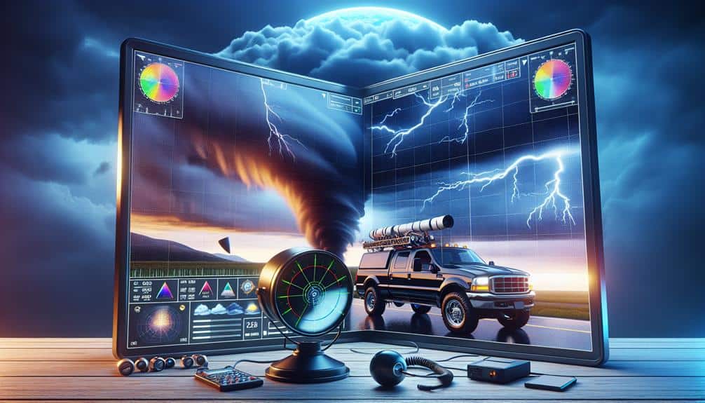
As storm chasers, we rely on advanced Doppler radar tools like RadarScope and GRLevel3 for high-resolution, real-time weather data and customizable settings. Weather Underground offers detailed visualization using live radar feeds, while StormTrack's advanced storm patterns enhance monitoring accuracy. MyRadar leverages cutting-edge algorithms for high-definition radar imaging, and AllisonHouse provides granular insights with seamless integration. WeatherBug's tools deliver hyper-local data and immediate alerts. Each tool enhances situational awareness, reliability, and safety through innovative features and real-time updates, enabling precise storm tracking and improved decision-making. Stay tuned for an in-depth exploration of these indispensable tools.
Key Points
- RadarScope offers high-resolution radar with real-time GPS tracking and a user-friendly interface, ideal for storm chasers.
- GRLevel3 provides detailed radar analysis and customizable displays for enhanced situational awareness during storm chasing.
- Weather Underground uses an extensive network of personal weather stations for accurate, real-time data and precise storm tracking.
- StormTrack features high-resolution radar data and safety alerts to balance thrill and safety in storm chasing.
RadarScope
RadarScope is a high-resolution radar app that provides storm chasers with detailed, real-time weather data. When we're out in the field, having access to advanced radar technology is essential for effective storm tracking. RadarScope leverages NEXRAD Level 3 data to deliver high-definition radar imagery, enabling us to visualize precipitation intensity, storm structure, and potential rotation with precision. This app is indispensable for anyone looking to maintain situational awareness in volatile weather conditions.
One of the key advantages of RadarScope is its ability to display reflectivity, velocity, and dual-polarization data. Reflectivity data helps us identify the intensity and type of precipitation, while velocity data reveals wind patterns within a storm, vital for detecting tornadoes. Dual-polarization radar further enhances our storm tracking capabilities by differentiating between rain, hail, and debris.
We also benefit from RadarScope's integration with GPS, allowing real-time location tracking relative to storm systems. This feature is especially useful for determining safe navigation routes and optimizing our positioning for data collection. The app's user-friendly interface and customizable settings let's tailor the radar displays to our specific needs, ensuring we've the most relevant information at our fingertips.
GRLevel3
Let's explore GRLevel3, a tool that provides real-time weather data essential for storm chasers. It offers detailed radar analysis, allowing us to interpret meteorological events with precision.
Additionally, the customizable display options enable us to tailor the interface to our specific needs, enhancing our situational awareness.
Real-Time Weather Data
Utilizing GRLevel3, we gain access to real-time weather data that enhances our ability to make informed decisions during storm chasing. This tool provides us with live updates, important for effective storm tracking. As we monitor extreme weather conditions, the immediacy of the data allows us to anticipate sudden changes in storm patterns. This is particularly useful for implementing safety precautions, ensuring that we remain out of harm's way while collecting valuable data.
The real-time data stream from GRLevel3 includes high-resolution radar imagery, which is instrumental in identifying severe weather formations like tornadoes, hail, and heavy rainfall. By analyzing this data, we can predict storm trajectories and potential impact zones with a higher degree of accuracy. This level of precision is vital for both operational efficiency and personal safety.
Moreover, GRLevel3's capability to overlay multiple data sources enhances our situational awareness. Integrated features such as velocity scans and reflectivity measurements provide a detailed view of the storm system. This empowers us to make rapid, data-driven decisions in the field, maximizing our freedom to chase storms effectively while minimizing risks.
In essence, GRLevel3's real-time weather data is a cornerstone of modern storm chasing, merging technology and safety seamlessly.
Detailed Radar Analysis
With GRLevel3, we explore the intricate details of radar data, allowing us to dissect storm structures with unparalleled accuracy. This tool equips us with high-resolution reflectivity, velocity, and dual-polarization data essential for storm tracking and severe weather analysis. By examining these parameters, we can identify key features such as mesocyclones, hook echoes, and debris signatures, which are critical for predicting tornado formation.
Our focus on precipitation analysis benefits greatly from GRLevel3's advanced capabilities. We can evaluate rain rates, hail size, and the potential for flash flooding with precision. This level of detail is invaluable for making real-time decisions and issuing timely warnings.
The software's ability to display various radar products simultaneously enhances our situational awareness, enabling us to interpret complex weather scenarios effectively.
In addition to storm prediction, GRLevel3 enhances our ability to monitor storm evolution. We can track the lifecycle of a storm cell, from its inception through to its dissipation, providing us with actionable insights. This granular level of analysis empowers us to anticipate changes in storm intensity and trajectory, optimizing our storm chasing strategies and ensuring we stay ahead of severe weather threats.
Customizable Display Options
GRLevel3 offers a variety of customizable display options that allow us to tailor the radar data presentation to meet our specific storm chasing needs. The software's flexibility in weather tracking is unmatched, enabling us to adjust parameters such as reflectivity, velocity, and precipitation types. This granularity guarantees we can focus on critical data points, optimizing our decision-making process during severe weather events.
Map customization is another key feature of GRLevel3. We can modify base maps to include or exclude various geographical elements, such as roads, cities, and topography. This allows us to create a clean, focused display that highlights the most relevant data for our current tracking objectives. Additionally, the ability to overlay multiple data sets, such as storm tracks and warning polygons, provides a detailed view of the evolving situation.
We also have the option to customize color tables, enabling us to distinguish between different intensity levels more effectively. This is particularly useful when interpreting complex radar signatures in real-time. By adjusting these visual parameters, we can enhance our situational awareness and make more informed decisions, improving our operational efficiency and safety.
Weather Underground
Let's examine Weather Underground's capabilities for storm chasers.
We appreciate its real-time data accuracy, supported by an extensive network of personal weather stations.
The platform's radar map features and customizable alerts system enhance our ability to track and respond to severe weather conditions efficiently.
Real-time Data Accuracy
Leveraging Weather Underground's up-to-date data accuracy, we can make informed decisions during storm chases based on the most current atmospheric conditions. This platform excels in providing high-detail data visualization, which is pivotal for precise storm tracking. The integration of live radar feeds with predictive models allows us to anticipate storm movements and developments efficiently.
Weather Underground's accuracy in weather prediction is strengthened by its extensive network of personal weather stations, offering hyper-local data that enhances our situational awareness. This level of detail is essential for emergency response planning, ensuring we can navigate safely and provide timely alerts to affected communities.
Utilizing real-time data, we gain a thorough understanding of storm dynamics, enabling us to adjust our strategies on the fly. The platform's ability to assimilate vast amounts of meteorological data and present it in an accessible format ensures we remain ahead of rapidly changing weather patterns.
In storm tracking, the precision offered by Weather Underground's tools can't be overstressed. It allows us to pinpoint storm locations accurately and monitor their progression, minimizing risks and maximizing our operational effectiveness. Ultimately, real-time data accuracy empowers us to chase storms with confidence, prioritizing both safety and success.
Radar Map Features
Weather Underground's radar map features deliver detailed visualizations that are essential for interpreting storm trajectories and intensities effectively. Utilizing advanced Doppler radar technology, we gain an enhanced tracking efficiency that's pivotal when we're in the field.
The radar map offers several layers, allowing us to customize our view based on what data we need at any given moment. The ability to toggle between different radar map layers means we can focus on specific weather phenomena, such as precipitation, wind speeds, or storm cell structures. This level of customization puts us in control, letting us make real-time decisions that are essential for accurate storm tracking.
Here are three key benefits of Weather Underground's radar map features:
- Enhanced Visualization: The radar map layers provide multi-dimensional views of storm systems, making it easier to anticipate changes in weather patterns.
- Customization Options: We can adjust the radar map to display only the data relevant to our current tracking needs, optimizing our operational efficiency.
- High Tracking Efficiency: The Doppler radar technology offers precise, up-to-the-minute data, enabling us to make informed decisions quickly.
Customizable Alerts System
Building on the radar map's advanced features, Weather Underground's customizable alerts system ensures we stay informed about vital weather changes in real-time. The platform's alert customization options are extensive, allowing us to tailor notifications to our specific needs. We can set parameters for various weather events, from severe thunderstorms to tornado warnings, ensuring that we only receive the most relevant information.
The user interface design of Weather Underground excels in simplicity and efficiency. It's intuitive, making it easy for us to navigate and adjust our notification settings. With just a few clicks, we can modify alert thresholds, set geographic boundaries, and choose the type of alerts we want to receive, whether via email, SMS, or push notifications.
Map integration plays an important role in this system. By overlaying alerts directly onto the radar map, we can visualize potential threats in the context of our current location and planned routes. This functionality provides a detailed view of weather conditions, enabling us to make informed decisions quickly.
Essentially, the customizable alerts system by Weather Underground enhances our situational awareness, allowing us the freedom to chase storms with confidence and precision.
StormTrack
StormTrack offers storm chasers real-time data visualization, allowing us to accurately monitor and predict storm paths. By leveraging advanced storm patterns and tracking techniques, we gain a thorough understanding of storm behavior, enabling us to make well-informed decisions. The platform integrates high-resolution radar data, facilitating precise storm tracking and timely updates. This capability is essential for anticipating shifts in storm intensity and direction.
Safety precautions and emergency protocols are vital when chasing storms. StormTrack equips us with the necessary tools to guarantee we're always a step ahead. The system provides alerts for severe weather conditions, helping us to maintain a safe distance from dangerous storm cells. Additionally, its robust mapping features allow us to plot escape routes and identify safe zones in real-time.
Here are the key features that make StormTrack indispensable:
- Data Integration: Seamlessly combines radar, satellite, and ground reports for a complete view.
- Predictive Analytics: Utilizes machine learning to forecast storm trajectories with high precision.
- Safety Alerts: Issues real-time warnings for hazardous weather conditions and suggests emergency procedures.
Utilizing StormTrack, we achieve a balance between thrill and safety, empowering us to chase storms with confidence and accuracy.
MyRadar
In addition to StormTrack, we utilize MyRadar's capabilities to further enhance our storm tracking toolkit with its advanced radar imaging and real-time weather updates. MyRadar stands out due to its radar technology advancements, offering unparalleled storm tracking accuracy. By integrating high-definition radar data with cutting-edge algorithms, MyRadar ensures we receive the most precise and timely information about severe weather conditions. This level of accuracy is essential for making informed decisions and optimizing our storm chasing strategies.
One of MyRadar's standout features is its user-friendly interface. The platform allows us to easily toggle between various radar layers and customize our view based on specific needs. This flexibility is important when on the move, as it minimizes distractions and maximizes focus on critical weather data. Additionally, MyRadar provides real-time storm updates, ensuring we're always aware of the latest developments.
The app's ability to push notifications for severe weather alerts further enhances our situational awareness, allowing us to adapt our plans dynamically. By leveraging MyRadar's sophisticated radar technology and intuitive interface, we can achieve greater freedom and precision in our storm chasing endeavors, ultimately leading to safer and more successful outcomes.
AllisonHouse
AllisonHouse delivers an extensive suite of customizable weather data services that empower us with granular insights and real-time radar information essential for advanced storm chasing. Leveraging cutting-edge weather tracking technology, AllisonHouse provides high-resolution radar data that helps us interpret severe weather conditions more accurately. This enhanced radar data interpretation supports our need for precision and speed, vital for making informed decisions in volatile storm environments.
One of the standout features of AllisonHouse is its ability to integrate seamlessly with various radar applications, offering a tailored user experience. Here are the top three benefits of using AllisonHouse:
- Comprehensive Data Access: We gain access to a broad spectrum of weather data, including real-time lightning strikes, local storm reports, and high-definition radar imagery.
- Customization Options: The platform allows us to customize the data feed according to our specific storm chasing needs, ensuring we receive only the most relevant information.
- Reliability and Speed: AllisonHouse's robust infrastructure ensures fast and reliable data delivery, minimizing delays that could compromise our severe weather safety.
For those of us who thrive on the freedom to chase the storm, AllisonHouse's powerful suite of tools and services offers unparalleled support, making it an essential resource for our storm chasing endeavors.
WeatherBug
WeatherBug offers another valuable tool in our storm chasing arsenal, providing real-time alerts and hyper-local weather data that enhance our situational awareness and decision-making capabilities. Leveraging WeatherBug's advanced storm tracking features, we can pinpoint severe weather patterns with remarkable accuracy. Its real-time data integration from over 10,000 professional-grade weather stations guarantees we receive precise and timely information.
WeatherBug excels in delivering immediate weather alerts, essential for anticipating rapid changes in storm conditions. The app's Spark Lightning Alerts give us an edge by providing real-time updates on lightning activity within a specified radius, enabling us to avoid potential hazards. Additionally, its exclusive Dangerous Thunderstorm Alerts (DTAs) equip us with advanced warnings about approaching severe storms, allowing better preparation and response.
The hyper-local weather data provided by WeatherBug, including minute-by-minute forecasts and live radar maps, ensures we remain well-informed and agile. This localized information is crucial for making split-second decisions during storm tracking operations. Furthermore, WeatherBug's user-friendly interface and customization options allow us to tailor our data feed to specific needs, optimizing our storm chasing efficiency.
Frequently Asked Questions
How Does Doppler Radar Work in Detecting Storm Movements?
We analyze storm movements using Doppler technology by measuring changes in frequency of returned signals. This data analysis helps us track weather patterns accurately, making Doppler radar essential in meteorological applications for predicting severe weather events.
What Are the Key Features to Look for in a Doppler Radar Tool?
Just as ancient mariners relied on the stars, we depend on key features like high resolution, real-time data, and range accuracy in Doppler radar tools. These enhance storm detection and optimize Doppler radar workings for precise forecasts.
Can Doppler Radar Predict the Severity of a Storm?
We rely on Doppler radar to predict storm intensity by analyzing wind speed and precipitation patterns. This enhances forecast accuracy, but Doppler radar can't always determine the exact severity, emphasizing the need for thorough data analysis.
Are There Any Free Doppler Radar Tools Available for Storm Chasers?
There are free options and alternative tools for storm chasers. Budget-friendly options include online resources like RadarScope and Weather Underground, which provide reliable data without high costs, ensuring we can chase storms without breaking the bank.
How Accurate Are Doppler Radar Tools in Real-Time Storm Tracking?
When we chase the tempest's wrath, Doppler radar's real-time storm tracking accuracy is our guiding star. Despite Doppler radar limitations, its precision in predicting storm paths provides essential data that enhances our pursuit of freedom and safety.


