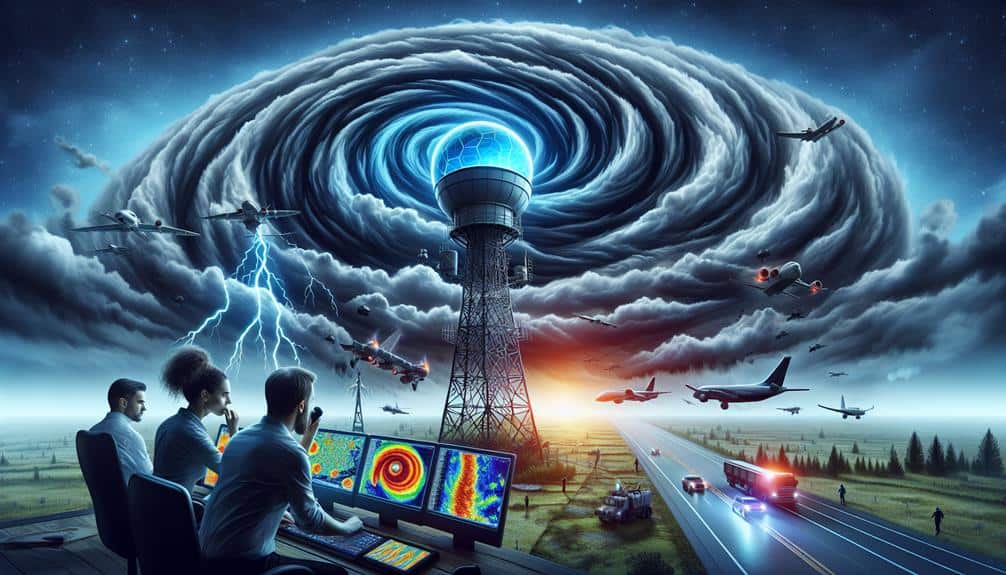
We utilize Doppler radar technology to greatly improve storm chasing by accurately pinpointing weather phenomena and predicting severe events. By interpreting radar data, we recognize important patterns like hook echoes, inflow notches, and bow echoes, which are indicative of tornadoes and hurricanes. Key metrics such as velocity and reflectivity give us a thorough understanding of storm dynamics, enabling us to anticipate shifts in storm intensity and wind behavior. Integrating high-resolution radar data with predictive modeling and advanced algorithms enhances our ability to track and forecast storms effectively. By understanding these technologies, we can discover more about storm chasing strategies.
Key Points
- Doppler radar identifies tornado formations, enabling timely action during storm chasing.
- Real-time radar data integration enhances severe weather prediction and tracking accuracy.
- Velocity and reflectivity data combined provide vital insights into storm intensity and dynamics.
- Recognizing radar patterns like hook echoes helps pinpoint severe weather events.
Understanding Doppler Radar
Doppler radar, a pivotal tool in meteorology, measures the velocity and movement of precipitation to provide necessary data for storm analysis. By leveraging advanced radar technology, we can pinpoint the location and intensity of weather phenomena with remarkable accuracy. This capability is essential for storm prediction, enabling us to anticipate severe weather events and take necessary precautions.
Radar systems emit pulses of microwave radiation, which bounce off precipitation particles. The returning signal, or echo, is then analyzed to determine the velocity and direction of movement. This real-time weather tracking allows us to create detailed maps of storm structure and progression. Consequently, we can identify potential tornado formations, track hurricanes, and monitor heavy rainfall, all of which are crucial for public safety and emergency planning.
In our quest for freedom from the unpredictable forces of nature, Doppler radar provides a powerful means to stay ahead of the storm. The continual advancements in radar technology have enhanced our ability to predict and respond to severe weather, making storm chasing not just an act of adventure but a scientific endeavor grounded in precision and preparedness. This underscores the indispensable role of Doppler radar in contemporary meteorology.
Radar Data Interpretation
To harness the full potential of Doppler radar, we must adeptly interpret the radar data to discern patterns and anomalies indicative of severe weather events. By meticulously analyzing radar scans, we can identify essential features such as hook echoes, inflow notches, and bow echoes, which are critical markers of tornado genesis and other severe phenomena.
Understanding the intricacies of storm tracking requires us to recognize how weather patterns evolve over time. By comparing successive radar images, we can pinpoint the movement, intensity, and potential development of storms. This temporal analysis allows us to predict the trajectory and behavior of severe weather systems, providing us with a tactical advantage in storm chasing.
Moreover, interpreting radar data involves distinguishing between different types of precipitation and their spatial distribution. This knowledge helps us to assess the severity and type of storm we're dealing with, whether it be supercells or squall lines. The ability to read radar reflectivity patterns and differentiate between rain, hail, and snow assures we can make informed decisions about our pursuit strategies.
In essence, proficient radar data interpretation empowers us with the foresight to navigate the complexities of storm chasing, guaranteeing both our safety and the success of our mission.
Velocity and Reflectivity
Understanding the principles of velocity and reflectivity is important for accurately evaluating storm dynamics and potential hazards. When we analyze Doppler radar data, we evaluate velocity to determine wind direction and wind speed within the storm. This helps us to gauge storm movement and identify potential areas of rotation, which are critical for predicting tornado formation. Velocity data provides information on the wind's behavior, allowing us to anticipate shifts in storm intensity.
Reflectivity, on the other hand, measures the amount of transmitted radar signal that bounces back from precipitation particles. Higher reflectivity values typically indicate heavier rainfall rates or hail, which are essential for understanding the storm's potential impact on the ground. By analyzing reflectivity, we can also infer the structure and composition of the storm, contributing to our understanding of its severity.
Combining velocity and reflectivity data, we gain a thorough picture of the storm's internal dynamics. This integrated approach enables us to make informed decisions about storm chasing strategies, ensuring both our safety and the accuracy of our observations.
Identifying Storm Signatures
When identifying storm signatures, we must analyze velocity patterns that indicate wind rotation and potential tornado formation.
Reflectivity data helps us determine precipitation intensity and type, providing critical insights into storm structure.
Velocity Patterns in Storms
Analyzing velocity patterns in storms using Doppler radar allows us to identify distinct signatures that indicate severe weather conditions. By observing wind patterns, we can discern vital elements of storm behavior. Doppler analysis provides us with radial velocity data, which illustrates the motion of particles toward or away from the radar. This information is essential for storm tracking, enabling us to pinpoint areas of rotation that might develop into tornadoes.
When examining velocity data, we look for specific features such as mesocyclones and rear-flank downdrafts. A mesocyclone, identified by a cyclonic rotation within a storm, signals a potential tornado formation. Conversely, a rear-flank downdraft can indicate the presence of strong winds capable of causing significant damage. These velocity patterns are critical for early warning systems, enhancing our ability to forecast and respond to adverse weather events.
Moreover, Doppler radar enables us to monitor the evolution of these storm signatures in real-time. Continuous storm tracking and Doppler analysis allow us to adapt our strategies swiftly, ensuring both safety and efficiency. By leveraging this technology, we enhance our understanding and predictive capabilities, offering greater freedom in maneuvering and responding to severe weather.
Reflectivity Indicating Precipitation
Reflectivity data from Doppler radar allows us to identify precipitation intensity and distribution, providing essential insights into storm signatures. By analyzing these data points, we can decipher various storm characteristics, such as the type and severity of precipitation. This capability is pivotal for storm chasers who need precise information to navigate and analyze weather systems effectively.
When interpreting reflectivity data, we're looking for specific indicators:
- High reflectivity values: These suggest intense precipitation, often indicating heavy rain, hail, or even snow.
- Patterns of gradient reflectivity: Sharp changes in reflectivity values can show boundaries of storm cells and help us predict storm movement.
Doppler Radar Anomalies
We often encounter Doppler radar anomalies that provide key insights into identifying specific storm signatures, such as hook echoes and bounded weak echo regions (BWERs), which can indicate the presence of severe weather events like tornadoes. These anomalies are critical for accurate storm tracking and effective weather prediction.
Hook echoes signify rotating air masses, often a precursor to tornado formation, while BWERs point to strong updrafts in supercell thunderstorms.
When analyzing radar data, we must be vigilant about radar interference, which can obscure true storm features. Such interference can manifest as false echoes or clutter, necessitating careful anomaly detection. By distinguishing between genuine storm signatures and noise, we enhance our weather prediction accuracy and improve our ability to issue timely warnings.
Leveraging advanced algorithms, we can automate the identification of these anomalies, streamlining the storm tracking process. For instance, machine learning models trained on historical radar data can discern patterns indicative of severe weather. This proactive approach empowers us to chase storms more effectively, ensuring we capture critical data while staying safe.
Ultimately, understanding and interpreting Doppler radar anomalies enable us to access the freedom to explore and predict nature's most formidable phenomena.
Enhancing Accuracy
To enhance accuracy, we leverage high-resolution Doppler radar data to pinpoint storm structures and predict their evolutions with greater precision. By integrating advanced storm prediction models and rigorous data analysis, we improve our weather tracking and forecasting techniques, enabling us to anticipate severe weather events more effectively. This method allows us to minimize uncertainties and maximize the reliability of our forecasts.
Key aspects of our approach include:
- Real-time Data Integration: We combine real-time Doppler radar data with satellite imagery and ground-based observations to create a thorough, multi-dimensional view of storm systems.
- Algorithmic Enhancements: Utilizing machine learning algorithms, we analyze vast datasets to identify patterns and anomalies that traditional methods might overlook, thereby refining our storm prediction capabilities.
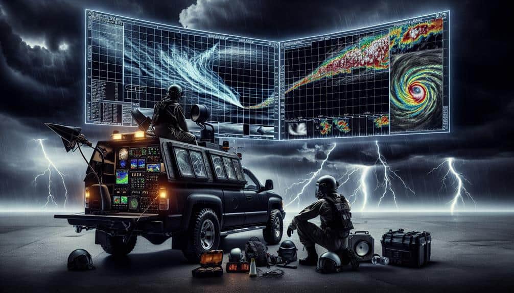
Mobile Radar Systems
When we use mobile radar systems, we can collect real-time data that greatly enhances our tracking accuracy.
By continuously updating our positional information, we make sure that our storm-chasing operations are both precise and responsive.
This dynamic approach allows us to make informed decisions based on the latest meteorological data.
Real-time Data Collection
Mobile radar systems are essential tools for collecting real-time data during storm chasing, enabling precise tracking and analysis of severe weather phenomena. By deploying these systems, we can capture high-resolution data necessary for storm tracking and data analysis. This real-time information is critical for enhancing weather forecasting and bolstering emergency response efforts, ultimately safeguarding lives and property.
To fully appreciate the capabilities of mobile radar systems, consider the following key features:
- High Mobility: Allows us to position ourselves strategically relative to the storm, ensuring the most accurate data collection.
- Advanced Data Processing: Enables immediate data analysis, facilitating real-time decision-making and adjustments to our storm chasing strategy.
Our ability to collect and analyze this real-time data translates directly into improved storm tracking, allowing meteorologists to issue timely warnings and coordinate more effective emergency responses. The freedom to move our radar systems to where they're needed most means we're always on the front lines, ready to capture the essential data that keeps everyone safer.
Enhanced Tracking Accuracy
Deploying mobile radar systems greatly enhances our ability to track and analyze storm dynamics with unparalleled accuracy. By leveraging advanced radar technology, we can pinpoint storm features and movements in real-time, greatly improving our forecasting techniques and storm prediction capabilities. This precision allows us to make informed decisions and devise effective storm chasing strategies, ensuring both safety and the collection of high-quality data.
Our mobile radar units are equipped with sophisticated Doppler radar technology, providing fine-scale observations of storm structure. These systems offer high temporal and spatial resolution, capturing rapid changes in storm intensity and direction. By integrating this data with existing weather models, we achieve a more thorough understanding of storm evolution and behavior.
Moreover, the mobility of these systems enables us to position ourselves strategically relative to the storm. This strategic placement is vital for intercepting storms at their most critical phases, maximizing our data collection efforts while minimizing risk. The enhanced tracking accuracy afforded by mobile radar systems directly translates into better storm prediction, more effective forecasting techniques, and ultimately, a deeper insight into the mechanics of severe weather phenomena.
Essentially, mobile radar systems empower us to chase storms with greater precision and freedom.
Safety Considerations
Safety considerations are paramount in storm chasing, requiring us to meticulously analyze Doppler radar data to predict storm paths and potential hazards. To guarantee our safety, we must establish detailed emergency protocols and thorough equipment preparation. By understanding the intricacies of storm movements, we can effectively deploy our resources and minimize exposure to life-threatening conditions.
Key safety measures include:
- Emergency protocols: We need clear, actionable plans for evacuation and first aid. All team members should be familiar with these protocols to guarantee swift response during emergencies.
- Equipment preparation: Ensuring all gear, including communication devices and weather monitoring tools, is in top working condition is essential. Redundant systems provide backups in case of equipment failure.
Analyzing Doppler radar data aids in precise risk assessment, allowing us to adapt our strategies in real time. This data-driven approach, coupled with strong communication strategies, ensures our pursuit of freedom in storm chasing is both exciting and safe.
Frequently Asked Questions
How Does Doppler Radar Differ From Traditional Weather Radar?
Doppler radar provides superior Doppler accuracy and storm tracking compared to traditional radar. Doppler technology enhances weather prediction by measuring velocity changes, providing critical data for real-time analysis and improved forecasts, thereby ensuring our freedom from unexpected weather events.
Can Doppler Radar Detect Tornadoes in Real-Time?
We grasp the urgency. Yes, Doppler radar can detect tornado formation in real-time by measuring wind velocity changes. This real-time detection provides essential data, enhancing our ability to stay informed and make timely decisions for safety.
What Are the Limitations of Using Doppler Radar for Storm Chasing?
The limitations of using Doppler radar for storm chasing include compromised storm tracking accuracy due to radar beam attenuation and range, and inherent safety limits that may risk our safety during close-range encounters with severe weather systems.
How Do Weather Apps Use Doppler Radar Data for Forecasting?
Weather app accuracy improves when we use Doppler radar technology. It provides real-time data on precipitation, wind speed, and storm movement, enabling precise forecasts. This empowers us to make informed, timely decisions and enjoy greater freedom.
What Training Is Required to Interpret Doppler Radar Data Effectively?
Interpreting Doppler radar data is like reading a complex novel; we need extensive meteorology training. Mastering radar interpretation, storm tracking, and radar analysis techniques guarantees we can navigate the data storm with precision and autonomy.


