We rely on Doppler radar because it lets us measure storm velocities and directions by analyzing frequency shifts, giving us real-time data on mesocyclones and wind speeds. This technology allows accurate tracking and prediction of storm paths, helping us detect tornadoes, hailstorms, and severe thunderstorms through precise phase shift measurements. Dual-polarization radar further distinguishes precipitation types, enhancing prediction accuracy. We can analyze wind velocity vectors and storm morphology in real time, which aids in making informed decisions and supporting emergency responses. Discover how these elements work together to fortify our storm-chasing strategies and safety measures.
Key Points
- Real-Time Tracking: Doppler radar provides real-time tracking of storm movements, enabling storm chasers to follow and anticipate changes accurately.
- Severe Weather Identification: It identifies severe weather conditions like tornadoes and hailstorms early, ensuring timely alerts and safety measures.
- Enhanced Prediction: The radar's high-resolution data improves the accuracy of predicting storm behavior, aiding in better decision-making.
- Wind Velocity Measurement: It measures wind speeds and directions, crucial for detecting potential tornado formations and other hazardous weather patterns.
Understanding Doppler Radar
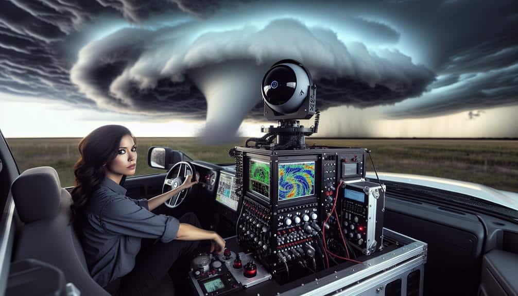
Doppler radar, an important tool in meteorology, enables us to measure the velocity and direction of storm systems by analyzing the frequency shift of returned radar signals. This technology, fundamental to our storm chaser tools, relies on the Doppler effect—a change in frequency or wavelength of a wave in relation to an observer moving relative to the wave source. By emitting pulses of radio waves and receiving them back after they bounce off precipitation particles, Doppler radar calculates the radial velocity of those particles.
Our use of Doppler radar technology provides real-time data, vital for understanding the dynamics within storm systems. It allows us to detect rotating updrafts, known as mesocyclones, which are precursors to tornado formation. The precision of Doppler radar helps us determine wind speeds and identify areas of intense rainfall or hail, thereby enhancing our situational awareness.
In addition to its velocity-measuring capabilities, Doppler radar's dual-polarization feature can differentiate between types of precipitation, such as rain, snow, and sleet. This dual-polarization capability adds another layer of information, enabling us to make more informed decisions during storm chasing.
As we embrace this technology, we gain the freedom to navigate and study storm systems with greater accuracy and safety.
Tracking Storm Movement
By leveraging the high-resolution data from Doppler radar, we can accurately track the movement of storm systems and predict their future paths. This capability is essential for storm chasers as it allows us to analyze the velocity and direction of storm patterns in real-time.
The Doppler radar measures the phase shift of returning radar waves, enabling us to determine the velocity of precipitation particles within the storm system. By compiling these data points, we can map the storm's trajectory and anticipate its progression with remarkable precision.
Weather forecasters rely on Doppler radar to decipher complex storm patterns and issue timely warnings. The radar's ability to differentiate between various types of precipitation—rain, snow, hail—and their respective velocities adds a layer of depth to our predictive models. This information is crucial for making informed decisions about when and where a storm may intensify or dissipate.
Additionally, the radar's continuous data stream allows us to monitor changes in the storm's structure and speed, which are often indicators of potential shifts in its path. By integrating this data with other meteorological tools, we can refine our forecasts, ensuring that we stay ahead of the storm's movements.
Identifying Severe Weather
Utilizing high-resolution data, we can identify severe weather phenomena such as tornadoes, hailstorms, and intense thunderstorms with remarkable accuracy. Doppler radar is indispensable in detecting these severe conditions by analyzing storm patterns, velocity data, and reflectivity gradients.
We're able to discern the rotational signatures indicative of tornado genesis, the distinct reflectivity spikes that signal hail formation, and the intense updrafts characteristic of severe thunderstorms.
In our storm-chasing endeavors, pinpointing these hazardous weather phenomena is essential for issuing timely weather alerts. Doppler radar's capability to differentiate between various precipitation types and their intensities allows us to anticipate and respond to potential threats more effectively.
By examining the velocity couplets and hook echoes within storm patterns, we can identify the presence of mesocyclones, which are often precursors to tornadoes.
Furthermore, correlating radar data with ground observations enhances our situational awareness, ensuring that weather alerts are both accurate and actionable. This proactive approach empowers us to navigate the unpredictable nature of severe weather with greater confidence.
Enhancing Prediction Accuracy
To enhance prediction accuracy, we must focus on real-time data collection and improved storm tracking capabilities.
By leveraging Doppler radar technology, we can obtain high-resolution velocity data, enabling precise identification of storm dynamics.
This real-time information allows us to refine our predictive models, resulting in more accurate and timely forecasts.
Real-time Data Collection
Real-time data collection via Doppler radar significantly enhances our ability to predict storm behavior with increased accuracy and timeliness. By integrating cutting-edge technology and leveraging recent research advancements, we can interpret intricate data sets and conduct detailed storm analysis, providing us with a clearer understanding of storm dynamics.
Utilizing Doppler radar, we can gather high-resolution data on the following critical parameters:
- Wind Velocity: By measuring the speed of particles within a storm, we can determine wind speeds and identify potential tornado formations.
- Rainfall Intensity: Real-time data on precipitation rates enables us to forecast flooding risks and make timely decisions for public safety.
- Storm Structure: Detailed imaging of storm layers helps in comprehending the storm's lifecycle, from formation to dissipation.
- Movement Patterns: Tracking the direction and speed of storm systems allows us to predict their paths with greater precision.
The freedom to analyze this data in real-time empowers us to make quick, informed decisions, enhancing our predictive capabilities. Our analytical precision, supported by scientific terminology and advanced data interpretation, guarantees that we're not just observing storms but actively decoding their behavior, thereby safeguarding lives and property more effectively.
Improved Storm Tracking
Building on the real-time data collection capabilities of Doppler radar, we enhance our storm tracking accuracy by meticulously analyzing wind velocity vectors, precipitation patterns, and storm morphology. By scrutinizing these variables, we obtain a granular understanding of storm patterns, enabling us to predict the storm's path with greater precision.
Our analysis begins with wind velocity vectors, which reveal the movement and intensity of wind within the storm. This data is pivotal for identifying rotational signatures that could indicate the development of tornadoes.
Next, we examine precipitation patterns to assess the distribution and intensity of rainfall or hail. This helps us predict potential flooding and other hazards associated with severe weather.
Furthermore, understanding storm morphology—the structure and evolution of storm cells—provides insights into the lifecycle of a storm. By combining these elements, we refine our weather forecasting models, allowing us to provide timely and accurate warnings to the public.
Ultimately, Doppler radar empowers us with the freedom to navigate and respond to severe weather phenomena with unparalleled accuracy. Enhanced storm tracking not only improves our safety but also bolsters our ability to inform communities, thereby minimizing the impact of these natural events.
Improving Safety Measures
Enhancing safety measures for storm chasers involves integrating advanced Doppler radar systems to provide more precise and timely weather data. By doing so, we can greatly strengthen our safety precautions and develop robust emergency protocols.
To secure our well-being and effectiveness in the field, we must focus on the following areas:
- Risk Assessment: Utilizing Doppler radar, we can evaluate atmospheric conditions with great precision, allowing us to make informed decisions about when and where to chase storms.
- Communication Strategies: Real-time data streamed from Doppler radar empowers us to communicate more effectively with our team members, ensuring everyone is aware of imminent threats.
- Safety Precautions: Enhanced radar capabilities enable us to implement advanced safety measures by predicting more precisely the path and intensity of severe weather events.
- Emergency Protocols: With access to up-to-the-minute radar data, we can establish and execute emergency protocols swiftly, minimizing the risk of harm.
Real-Time Data Analysis
With real-time data analysis, we can harness Doppler radar to obtain immediate weather updates, allowing for rapid response to developing storm conditions. This capability greatly enhances our prediction accuracy, providing invaluable insights into storm trajectories and intensities.
Immediate Weather Updates
Real-time data analysis from Doppler radar systems allows storm chasers to make immediate, informed decisions about rapidly changing weather conditions. This is vital for our storm chaser safety and effective weather monitoring.
By providing accurate data, Doppler radar enables us to optimize our rapid response to evolving storms. The precise, timely information guarantees that we can quickly adapt our strategies and minimize risks.
To better illustrate, consider the following points:
- Velocity Measurements: Doppler radar calculates the speed and direction of wind within a storm, helping us identify potential tornado formations before they touch down.
- Precipitation Intensity: Real-time updates on rainfall rates and hail sizes allow us to assess the severity of a storm's impact and choose safer routes.
- Storm Structure: Detailed radar images reveal the internal structure of storms, which is critical for understanding their development and potential hazards.
- Lightning Activity: Monitoring lightning frequency and distribution helps us forecast the storm's energy and potential for intensification.
Enhanced Prediction Accuracy
By leveraging Doppler radar's high-resolution data, we can greatly enhance our prediction models and improve the accuracy of storm forecasts. This advanced technology enables us to capture real-time data on storm intensity, which is essential for understanding and forecasting storm behavior. The precision of Doppler radar allows us to analyze wind velocity patterns and precipitation rates, offering a detailed view of evolving weather systems.
Through this real-time data analysis, we can significantly improve prediction reliability. For storm chasers, this means we can make informed decisions quickly, reducing risks and optimizing our strategies. High-resolution Doppler radar data helps us discern subtle changes in storm intensity, enabling more precise and timely forecasts. This is crucial for anticipating severe weather events and issuing early warnings.
Forecast precision is another key benefit. The ability to track storm behavior with such detail allows us to predict not just where a storm will go, but how it will evolve. This level of detail supports better planning and resource allocation, enhancing our overall readiness. By integrating Doppler radar into our toolkit, we guarantee that our storm chasing efforts are based on the most reliable and accurate data available.
Supporting Emergency Responses
By leveraging the advanced capabilities of Doppler radar, we can significantly enhance the accuracy and timeliness of emergency response efforts during severe weather events. The incorporation of Doppler radar in emergency preparedness and disaster response strategies is crucial for effective weather monitoring and crisis management.
- Early Warning: Doppler radar enables us to identify severe weather patterns well in advance, providing emergency services with more time to mobilize and implement disaster response plans.
- Up-to-the-minute Updates: Continuous weather monitoring via Doppler radar offers real-time data, allowing us to adapt crisis management strategies dynamically as storm conditions change.
- Precise Geolocation: The technology provides high-resolution imaging, accurately pinpointing the specific areas most vulnerable. This geospatial accuracy ensures that resources are allocated where they're most needed, reducing potential damage and loss.
- Dissemination of Alerts: Doppler radar data can be quickly shared with the public and emergency services through various communication channels. This swift dissemination helps guarantee that individuals and communities are well-informed and can take necessary precautions.
Frequently Asked Questions
How Does Doppler Radar Technology Differ From Traditional Weather Radar?
Doppler radar technology offers enhanced accuracy over traditional weather radar. It provides storm chasers with precise storm forecasting benefits by detecting velocity and movement within weather systems, allowing for more effective and safer tracking.
What Are the Limitations of Doppler Radar in Storm Tracking?
Doppler radar accuracy can be limited by factors like range, resolution, and signal attenuation, posing storm chaser challenges. We must interpret data carefully, recognizing these constraints while tracking severe weather for timely, effective warnings.
How Do Storm Chasers Interpret Doppler Radar Data in the Field?
"Knowledge is power." We interpret Doppler radar data using field techniques like velocity patterns and reflectivity signatures to track storm movement and intensity. Our analytical precision helps us predict potential dangers and strategize real-time responses effectively.
What Advancements Are Being Made in Doppler Radar Technology for Storm Chasing?
We're seeing radar enhancements like dual-polarization and phased-array systems, which greatly enhance storm detection. These advancements offer greater accuracy in tracking storm structures, allowing us to make critical decisions faster and with more precision.
How Can the Public Access Doppler Radar Information During Severe Weather Events?
When storms loom like dark shadows, we can tap into public access online tools and mobile apps. Emergency alerts deliver Doppler radar data straight to our devices, ensuring we stay informed and free to make safe decisions.


