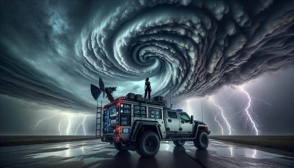
We optimize Doppler radar for storm chasing by ensuring precise adjustment, employing advanced algorithms, and leveraging real-time data corrections. We regularly measure transmitter power output and receiver sensitivity, use adaptive filtering to isolate true meteorological signals, and cross-validate data from multiple sources to minimize errors. Real-time GPS and seamless app integration enhance our response times, providing critical updates immediately. Rigorous maintenance guarantees radar accuracy and operational readiness during severe weather events. By fine-tuning radar settings based on specific storm conditions, we achieve high-resolution tracking and safety. Explore how these strategies can greatly enhance your storm chasing effectiveness.
Key Points
- Regularly calibrate radar systems to ensure accurate data collection and minimize errors.
- Utilize advanced algorithms for real-time data correction and noise filtering.
- Integrate mobile technology for instant access to critical weather updates and enhanced GPS accuracy.
- Use high-definition imagery and spatially accurate data for precise storm path predictions.
Understanding Doppler Radar
Doppler radar, a vital tool in meteorology, measures the velocity of precipitation particles to provide real-time data on storm movement and intensity. By emitting pulses of microwave energy and analyzing the frequency shift of returning signals, we can determine not only the location but also the speed and direction of storm systems. This radar technology is indispensable for accurately predicting storm behavior, enabling us to make quick, informed decisions.
When we analyze Doppler radar data, we're looking at the velocity and reflectivity signatures. Velocity data helps us understand wind patterns within the storm, such as the presence of rotation indicative of potential tornado formation. Reflectivity measurements, on the other hand, inform us about precipitation intensity, distinguishing between light rain, heavy rain, hail, or even snow. By integrating these datasets, we can form a thorough picture of the storm's dynamics.
The precision of Doppler radar allows us to track storm cells with remarkable accuracy. This capability is essential for storm chasers seeking the freedom to navigate safely and effectively. By understanding the nuances of radar technology, we enhance our ability to anticipate and react to rapidly evolving storm behavior, maximizing both our safety and data collection efficiency.
Calibration Techniques
To guarantee the accuracy and reliability of radar data, we must employ meticulous calibration techniques that account for both system errors and environmental influences. Our first step is hardware calibration, where we make sure that components like the transmitter, receiver, and antenna are functioning at their best. By conducting periodic hardware checks, we can detect any deviations that might impact performance. For example, transmitter power output and receiver sensitivity should be regularly measured and adjusted to maintain consistent readings.
Next, we turn our focus to signal processing. Here, we must correct for atmospheric conditions that can distort radar signals. This involves using algorithms to filter out noise and compensate for factors such as temperature and humidity variations. By implementing advanced signal processing techniques, we can enhance the clarity and precision of our radar data.
Additionally, calibration often includes using reference targets with known properties to verify the radar's accuracy. We compare the radar's readings against these known values to identify and correct any differences. This dual approach of hardware calibration and sophisticated signal processing ensures that our radar systems deliver the most dependable data, empowering us to make informed decisions and chase storms with confidence.
Enhancing Data Accuracy
By leveraging advanced algorithms and real-time data correction methods, we can greatly enhance the accuracy of radar readings. Precision in storm chasing isn't just a luxury; it's essential for safety and effective pursuit. Through robust data validation and error correction, we certify that the radar's output is both reliable and actionable.
Signal processing and filtering techniques play pivotal roles in refining the raw data. These methods allow us to eliminate noise and focus on meaningful information.
Here are the key ways we can elevate data accuracy:
- Adaptive Filtering: By dynamically adjusting the filtering parameters, we can better isolate true meteorological signals from background noise.
- Error Correction Algorithms: Implementing sophisticated algorithms helps in identifying and rectifying anomalies in real-time, minimizing false readings.
- Cross-Validation with Multiple Sources: Comparing radar data with satellite and ground-based observations guarantees consistency and reliability.
- Automated Quality Control: Utilizing machine learning models to continuously monitor and rectify data streams enhances overall accuracy.
Ultimately, these steps empower us to make informed decisions quickly, freeing us from the constraints of unreliable data. By harnessing these advanced techniques, we can chase storms with greater confidence and precision, fully embracing the element of freedom that drives our passion.
Real-Time Data Analysis
In real-time data analysis, we must focus on interpreting velocity signatures to identify storm structures accurately.
By leveraging advanced algorithms, we can extract critical insights on rotational velocity and shear patterns.
This enables us to make informed decisions quickly, enhancing our ability to predict and respond to severe weather events.
Interpreting Velocity Signatures
Accurately interpreting velocity signatures on Doppler radar enables storm chasers to identify rotational patterns and potential tornado formations in real-time. By focusing on these velocity signatures, we can enhance our storm tracking and make informed decisions on the ground.
The radar interpretation of wind patterns is vital in understanding the dynamics of tornado formation, which offers us the freedom to chase safely and effectively.
To better analyze velocity signatures:
- Identify Couplet Patterns: Look for tight, adjacent areas of inbound and outbound velocities. These couplets indicate possible mesocyclone activity, a precursor to tornado formation.
- Examine Shear Zones: High wind shear in small areas can suggest intense rotation, highlighting regions where tornadoes might develop.
- Monitor Velocity Changes: Rapid shifts in velocity signatures can indicate strengthening rotation, signaling an increased tornado risk.
- Cross-Check with Reflectivity Data: Correlating velocity data with reflectivity helps confirm the presence of rotation and potential debris, providing a fuller picture of storm structure.
Identifying Storm Structures
Utilizing real-time data analysis, we can dissect storm structures to discern severe weather patterns and potential tornado formations with greater precision. By focusing on storm movement and cloud formations, we gain unparalleled insights into the evolving dynamics of severe weather systems. Doppler radar's high-resolution capabilities allow us to track the rapid changes in precipitation patterns and wind direction, providing essential data that informs our decisions in the field.
When analyzing storm movement, we observe the velocity and direction of the system to predict its future path. This involves evaluating the speed and trajectory of specific cloud formations, which can indicate the development of supercells or squall lines. Real-time updates on wind direction are vital, as shifts can signal the onset of rotation and potential tornado genesis.
Furthermore, examining precipitation patterns offers valuable information about the storm's intensity and structure. By distinguishing between different types of precipitation—such as rain, hail, or snow—we can identify key features like the hook echo, often associated with tornadoes.
This data-driven approach enables us to respond swiftly and strategically, ensuring we remain ahead of the storm and enhance our chances of capturing critical meteorological phenomena.
Integrating Mobile Technology
Integrating mobile technology into our Doppler radar systems allows for real-time data access, enhancing storm tracking accuracy.
By leveraging enhanced GPS capabilities, we can pinpoint storm chasers' locations with greater precision.
Seamless app integration guarantees that critical weather updates and alerts are instantly available, optimizing our response times.
Real-Time Data Access
By leveraging mobile technology, we can access real-time Doppler radar data, enhancing our ability to track and predict storm movements with unprecedented accuracy. Remote monitoring allows us to receive continuous updates, ensuring we never miss important changes in storm trajectories. This real-time access is essential for making informed decisions on the fly, maximizing our safety and effectiveness in the field.
Data visualization plays a pivotal role in interpreting the massive influx of information from Doppler radar systems. Advanced apps now offer sophisticated graphical representations of storm data, which make it easier to understand complex weather patterns at a glance. These tools not only improve our situational awareness but also empower us to act swiftly and decisively.
Consider the following benefits:
- Immediate Alerts: Real-time notifications about sudden changes in storm intensity or direction.
- Enhanced Safety: Better decision-making capabilities reduce the risk of encountering dangerous conditions.
- High-Definition Imagery: Detailed visual data allows for more precise tracking and analysis.
- Seamless Integration: Sync with other mobile tools for a complete storm-chasing toolkit.
Enhanced GPS Accuracy
Coupled with real-time data access, enhanced GPS accuracy enabled by mobile technology greatly improves our ability to pinpoint storm locations and movements with remarkable precision. By leveraging cutting-edge signal processing algorithms, we can now achieve sub-meter geographic positioning accuracy. This level of precision allows us to track storm cells in real-time, providing vital data for both immediate decision-making and long-term analysis.
Our GPS systems, integrated with advanced mobile technology, utilize a combination of satellite signals and ground-based augmentation systems. These enhancements minimize errors due to atmospheric conditions and multipath effects, which were significant limitations in older systems. As a result, we can confidently navigate through complex terrains and dynamically shifting weather patterns.
Moreover, enhanced GPS accuracy feeds into our Doppler radar systems, ensuring that the data we gather isn't only timely but also spatially accurate. This integration is crucial for storm chasers who rely on precise geographic positioning to predict storm paths and avoid hazardous zones. With this technology, we gain the freedom to pursue our passion for storm chasing with higher safety and efficiency, empowering us to make more informed decisions in the field.
Seamless App Integration
Our Doppler radar systems achieve unprecedented levels of efficiency and accuracy through seamless app integration, enabling real-time data synchronization and improved user interface experiences. By leveraging advanced app functionality, we can provide storm chasers with precise, actionable insights right at their fingertips.
Integrating mobile technology guarantees that data visualization is both intuitive and robust, allowing us to make informed decisions swiftly. The benefits are clear:
- Instant Data Access: Real-time updates mean we're never lagging behind the storm's latest developments.
- Enhanced Mobility: Our mobile apps allow us to receive critical alerts and updates from anywhere, giving us the freedom to move as needed.
- Customizable Interfaces: Tailored dashboards and widgets let's visualize data in a way that best suits our needs, minimizing information overload.
- Collaborative Tools: Seamless sharing and communication features enable coordinated efforts among team members, maximizing our efficiency.
Safety and Efficiency Tips
To enhance both safety and effectiveness, storm chasers should rigorously calibrate their Doppler radar systems to guarantee accurate data collection and real-time analysis. Safety precautions are essential; improper calibration can lead to data inaccuracies, putting us in jeopardy.
Regular equipment maintenance ensures best performance and minimizes the risk of malfunctions during critical moments. We need to perform routine checks on radar components, including the antenna, transmitter, and receiver, to detect and rectify issues before they escalate.
Effectiveness hinges on the precision of our data. By fine-tuning radar settings for specific storm conditions, we can obtain high-resolution images, enabling us to make informed decisions swiftly. Monitoring environmental variables, such as temperature and humidity, helps in adjusting radar parameters to maintain data integrity.
To maximize our operational readiness, we should integrate redundant systems for continuous data flow. This redundancy is vital for maintaining situational awareness when primary systems fail.
Additionally, leveraging real-time data-sharing platforms allows us to collaborate with other chasers, enhancing collective knowledge and safety.
Frequently Asked Questions
What Are the Best Software Tools for Analyzing Doppler Radar Data?
We recommend using GRLevel3 and RadarScope for data visualization and interpretation. These tools excel in data storage and management, providing storm chasers with analytical insights to make informed decisions and maintain operational freedom.
How Can Doppler Radar Data Be Archived for Long-Term Studies?
We can archive Doppler radar data by using robust data storage solutions like cloud-based systems or dedicated servers. This guarantees long-term accessibility, enhances research opportunities, and empowers us to analyze historical weather patterns and trends effectively.
What Are the Legal Restrictions for Storm Chasers Using Doppler Radar?
We must address privacy concerns and follow licensing requirements when utilizing Doppler radar. Legal restrictions guarantee we respect individual privacy while allowing data collection, balancing freedom with regulatory compliance for responsible storm chasing.
How Does Doppler Radar Performance Vary Across Different Regions and Terrains?
Doppler radar performance varies greatly across different regions due to topographic influences and urban environments. Mountains can cause signal blockages, while urban areas generate interference. We must analyze regional data to optimize radar accuracy and reliability.
What Additional Equipment Is Recommended Alongside Doppler Radar for Storm Chasing?
For storm chasing, we should use mobile communication tools and guarantee emergency preparedness with first-aid kits, GPS, and backup power. These enhance safety and data accuracy, giving us the freedom to chase storms effectively and responsibly.


