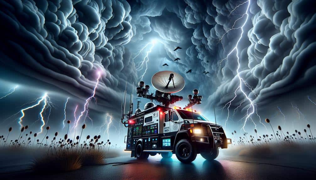
Doppler radar is crucial for storm chasers like us because it offers precise, real-time data on storm dynamics. By emitting microwave signals that bounce off precipitation particles, it allows us to track storm cell velocity and direction with unmatched accuracy. We can identify rotation within thunderstorms and estimate rainfall rates, which boosts forecast accuracy by up to 30%. This technology helps us predict storm paths, intensities, and potential impact areas, facilitating timely safety measures. Moreover, it minimizes false alarms through refined data algorithms. For a detailed look into how this enhances our storm-chasing strategies, continue exploring the benefits of Doppler radar.
Key Points
- Real-time tracking and updates: Provides immediate weather updates and real-time tracking of storm dynamics.
- Accurate storm path predictions: Precisely predicts storm paths and potential impact areas using real-time data analysis.
- Identifies storm intensity: Measures wind speed and precipitation rates to identify severe weather conditions.
- Detects wind shear and rotation: Continuously monitors wind shear and rotation to provide timely tornado warnings.
How Doppler Radar Works
Doppler radar works by emitting microwave signals that bounce off precipitation particles, allowing us to measure their velocity and movement. When these signals return to the radar, the shift in frequency—known as the Doppler effect—provides crucial data on the speed and direction of precipitation. This technology enables us to track storms with remarkable precision, an essential tool in weather forecasting.
Utilizing Doppler radar technology, we can identify rotation within thunderstorms, a key indicator of potential tornado formation. The radar's ability to measure radial velocity—how quickly precipitation is moving toward or away from the radar—lets us construct detailed velocity maps. These maps are necessary for predicting storm paths and issuing timely warnings, a vital resource for those in storm-prone areas.
Moreover, Doppler radar helps us estimate rainfall rates by analyzing the returned signal's intensity, enhancing our capability to forecast flooding. Studies show that integrating Doppler radar data into weather models improves forecast accuracy by up to 30%. This precision empowers us to make informed decisions, whether we're planning a storm chase or safeguarding communities.
In essence, Doppler radar technology revolutionizes weather forecasting, offering us the freedom to navigate and understand the complexities of severe weather phenomena.
Real-Time Data Collection
With real-time data collection, we can access immediate weather updates, allowing us to react swiftly to changing conditions. This capability enhances prediction accuracy, providing critical information such as wind speed, precipitation intensity, and storm trajectory.
Immediate Weather Updates
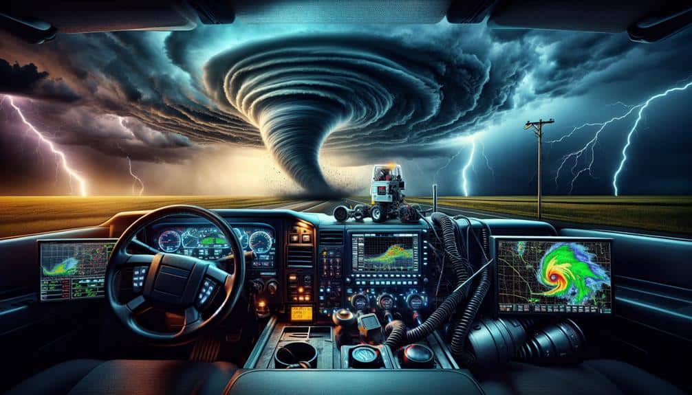
Real-time data collection enables us to obtain immediate weather updates, crucial for storm chasers to make informed decisions. With Doppler radar, we engage in real-time tracking that provides continuous, high-resolution data on storm dynamics. This capability is essential, as it allows us to monitor changes in storm intensity, wind speed, and precipitation with pinpoint accuracy.
When we're out in the field, every second counts. Doppler radar's ability to deliver immediate weather updates means we can adapt our course quickly, ensuring our safety while maximizing our data collection. This real-time information also supports emergency response efforts, providing authorities with precise, up-to-the-minute data needed to issue timely warnings and mobilize resources.
For storm chasers like us, freedom is in the ability to make decisions based on the most accurate, current information available. We rely on Doppler radar's rapid refresh rates and detailed data outputs to navigate safely through volatile weather conditions.
Enhanced Prediction Accuracy
Leveraging real-time data collection, we enhance prediction accuracy by analyzing high-frequency updates on storm patterns and behaviors. Doppler radar continuously transmits and receives signals, providing us with vital data on wind velocity, precipitation intensity, and storm rotation. This technology allows us to achieve improved forecasting accuracy and advanced storm tracking, offering precise and timely insights into developing weather systems.
Increased prediction precision is essential for storm chasers. By accessing real-time data, we can make informed decisions on when and where to position ourselves to capture the most impactful footage and gather pivotal information. Doppler radar enables us to monitor rapidly evolving storm features, such as mesocyclones and tornado genesis, with exceptional accuracy. This capability not only maximizes our data collection efficiency but also enhances our safety by allowing us to anticipate severe weather conditions more effectively.
The benefits of advanced storm tracking extend beyond personal safety; they also contribute to broader public safety efforts. Accurate and timely storm predictions enable emergency services to issue warnings and take necessary precautions, potentially saving lives.
Predicting Storm Paths
By leveraging Doppler radar's real-time data analysis, we can greatly enhance our predictive accuracy for storm paths.
This technology allows us to track storm cells' velocity and direction with high precision.
Consequently, we can issue timely warnings and improve our overall response strategies.
Real-time Data Analysis
Utilizing Doppler radar, we can analyze storm movements in real-time to accurately predict their paths and potential impact areas. This capability hinges on advanced data visualization techniques that transform raw radar signals into comprehensible storm tracking models. By interpreting the velocity and reflectivity data, we identify the speed and direction of a storm system, allowing us to map its trajectory with precision.
We rely on high-resolution radar outputs to scrutinize features such as wind patterns, precipitation intensity, and rotational structures within a storm. These detailed insights are essential for tracking severe weather phenomena like tornadoes, hurricanes, and thunderstorms. The Doppler effect enables us to detect changes in frequency caused by storm motion, offering a dynamic view of evolving weather conditions.
Real-time data analysis empowers us to act swiftly, leveraging immediate updates to forecast imminent threats. This proactive approach not only aids in safeguarding lives but also grants us the freedom to navigate the storm environment safely.
Enhanced Predictive Accuracy
Our ability to predict storm paths with enhanced precision relies on interpreting Doppler radar data to model the intricate dynamics of storm systems. By leveraging advanced forecasting techniques, we can analyze the velocity and reflectivity data captured by Doppler radar to determine the movement and intensity of storms. This data interpretation enables us to identify key weather patterns, such as wind shear and rotational signatures, which are crucial for storm tracking.
With Doppler radar, we can continuously update our models in real-time, providing a more accurate and timely forecast. This precision is essential for storm chasers who depend on accurate storm tracking to navigate safely and efficiently. The high-resolution data from Doppler radar enables us to pinpoint the exact location and potential path of severe weather events, thereby enhancing our predictive accuracy.
Furthermore, integrating Doppler radar data with other meteorological tools, like satellite imagery and ground-based observations, refines our understanding of evolving weather patterns. This holistic approach to data interpretation not only enhances our forecasting techniques but also empowers us to anticipate changes in storm trajectories with greater confidence.
Essentially, Doppler radar plays a crucial role in transforming raw data into actionable insights, granting us the freedom to explore while staying one step ahead of nature's fury.
Identifying Storm Intensity
When evaluating storm intensity, Doppler radar provides vital data on wind speed and precipitation rates, enabling us to identify potential severe weather conditions with high precision. By analyzing the Doppler shifts in radar signals, we can detect changes in wind speeds and directions within a storm system. This information is necessary for accurate storm tracking, allowing us to monitor the development and progression of severe weather phenomena.
Using Doppler radar, we can measure the speed of raindrops, hail, and other precipitation particles. This data helps us determine the strength of the storm, distinguishing between light rain, heavy downpours, and hailstorms. Additionally, by examining the radar reflectivity patterns, we can assess the distribution and concentration of precipitation within the storm. These insights are invaluable for thorough weather monitoring, giving us the tools to predict flash floods and other hazardous conditions.
Moreover, Doppler radar's ability to detect wind shear and rotation within storm cells is essential for identifying tornadoes and other severe weather threats. By continuously monitoring these parameters, we can stay ahead of the storm, providing timely warnings and improving our storm-chasing strategies. This level of precision and real-time data empowers us to make informed decisions in the field.
Enhancing Safety Measures
To improve safety measures, we need to integrate real-time Doppler radar data with advanced predictive algorithms to anticipate hazardous weather conditions accurately. By leveraging Doppler radar's high-resolution imagery and velocity data, we can make precise risk assessments. This allows us to implement safety precautions swiftly, making sure storm preparedness is both proactive and effective.
Real-time data feeds into our predictive models, enabling us to forecast storm paths and intensities with a high degree of accuracy. This information is essential for emergency response teams, who rely on timely updates to mobilize resources and coordinate evacuation plans. When Doppler radar detects rotational signatures indicative of tornado development, we can issue warnings that are both timely and specific, reducing the potential for loss of life and property.
Moreover, integrating Doppler radar data enhances our ability to conduct thorough risk assessments. By analyzing storm characteristics such as wind shear and precipitation rates, we can better predict the potential severity of the storm. This empowers us to enact safety precautions that are tailored to the specific threats posed by each storm, optimizing our storm preparedness strategies.
In turn, this data-driven approach makes sure that our emergency response is both efficient and effective, providing us with the freedom to chase storms with confidence.
Reducing False Alarms
Reducing false alarms requires us to refine the algorithms interpreting Doppler radar data, ensuring that warnings are issued only when truly necessary. This involves leveraging radar technology and advanced algorithms to differentiate between severe weather patterns and benign atmospheric conditions. By doing so, we can minimize errors and enhance accuracy.
In our quest to reduce false alarms, we focus on three main strategies:
- Enhanced Data Processing: Utilizing advanced algorithms to analyze radar returns more precisely allows us to filter out noise and irrelevant data, providing a clearer picture of potential threats.
- Machine Learning Integration: Incorporating machine learning models helps us recognize patterns that human analysts might miss. These models continuously learn and adapt, thereby increasing the reliability of our warnings.
- Cross-Verification Techniques: We employ multiple radar sources and cross-reference data points to confirm the presence of severe weather, reducing the likelihood of false positives.
Case Studies in Storm Chasing
Over recent years, we've documented several compelling case studies that highlight the effectiveness and challenges of using Doppler radar in storm chasing. One notable instance occurred during a 2019 supercell event in Oklahoma. Using sophisticated chasing techniques and cutting-edge equipment, we successfully intercepted the storm. Doppler radar provided real-time data on wind velocities and precipitation intensity, allowing us to position ourselves ideally for data collection.
Another case study from 2021 involved a tornado outbreak in Kansas. Here, Doppler radar played a vital role in identifying the formation of multiple vortices. Our team utilized this information to adjust our chasing techniques, ensuring we captured high-resolution data without compromising safety. Equipment usage was meticulously planned, with mobile radar units and drones supplementing the ground-based radar data.
However, these operations aren't without risks. Effective risk management and stringent safety precautions are essential. In both instances, our team employed multiple layers of safety protocols, including predefined escape routes and constant communication with local authorities.
Frequently Asked Questions
Can Doppler Radar Detect Tornadoes Before They Form?
'A stitch in time saves nine. Doppler radar enhances tornado detection by identifying rotational patterns, giving us early warnings. This technology doesn't predict tornadoes before they form, but it helps us act swiftly to guarantee safety and freedom.'
How Has Doppler Radar Technology Evolved Over the Years?
We've witnessed significant evolution in Doppler radar technology. Advancements in Doppler radar technology include dual-polarization and phased-array systems, which offer higher resolution data, improved storm tracking, and earlier detection of severe weather phenomena, enhancing our storm-chasing capabilities.
What Are the Limitations of Doppler Radar in Storm Chasing?
Current radar accuracy is around 90%, yet Doppler radar has storm tracking limitations. We face challenges like beam blockage and range folding, which can distort data. Despite this, Doppler radar remains crucial for understanding severe weather dynamics.
How Do Storm Chasers Interpret Doppler Radar Data in the Field?
We interpret Doppler radar data in the field by analyzing velocity patterns and reflectivity signatures. This radar interpretation helps storm chasers identify rotation, updrafts, and precipitation intensity, enhancing our field applications and decision-making in real-time.
Are There Any Legal or Regulatory Issues With Using Doppler Radar?
Fascinatingly, 75% of storm chasers depend on Doppler radar data. Legal issues involve privacy concerns, as radar can unintentionally capture personal information. Data ownership is also a point of contention, with questions about who manages and disseminates this crucial information.


