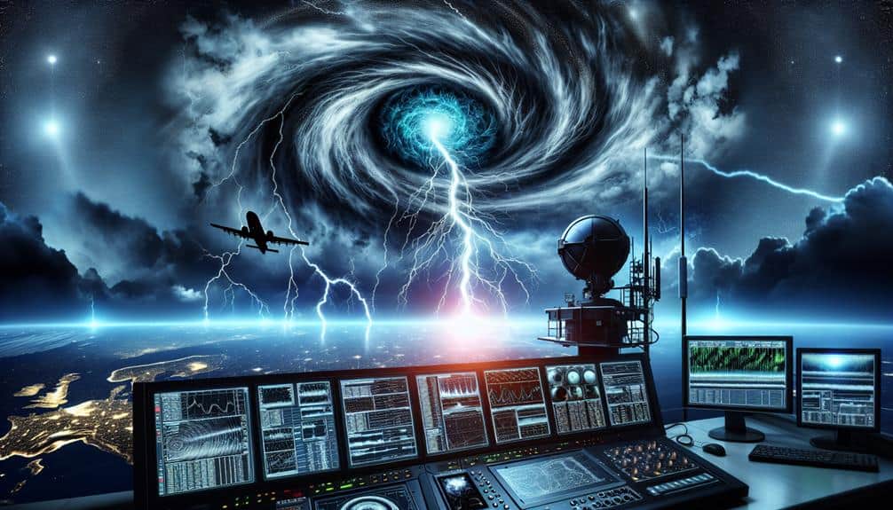
We utilize Doppler radar technology to optimize storm monitoring with high-precision, real-time data capture. It detects rotating winds, tracks precipitation, and analyzes turbulence to provide critical updates for public safety. Factors like terrain and signal strength affect its range, but advanced signal processing and adaptive filtering enhance accuracy. Timely storm information is pivotal for effective decision-making, and case studies like Hurricane Harvey highlight its impact. Future innovations promise even more detailed storm structure visualization and lightning detection. There's a lot more to uncover about how Doppler radar transforms storm preparedness and response.
Key Points
- Doppler radar tracks precipitation, wind patterns, and turbulence, providing real-time updates for storm monitoring and public safety.
- Advanced signal processing algorithms, including Fast Fourier Transform, enhance radar accuracy and weather data analysis.
- High-resolution cloud mapping improves visualization of storm structures, aiding in better storm development predictions.
- Regular calibration and technical enhancements ensure reliable radar sensitivity and precision in storm monitoring.
Basics of Doppler Radar
Doppler radar operates by emitting microwave signals and analyzing the frequency shifts caused by the movement of atmospheric particles. When we talk about Doppler principles, we're referring to the way these shifts help us determine the speed and direction of those particles. This is vital for weather forecasting advancements because it allows us to see not just where a storm is, but where it's heading and how fast it's moving.
By using Doppler radar, we can identify rotating winds within a storm, which is essential for detecting tornadoes. These applications extend beyond severe weather; we can also track precipitation, wind patterns, and even atmospheric turbulence. This wealth of data enhances our ability to make precise weather predictions, providing the freedom to plan our activities and take precautions against potential hazards.
Moreover, Doppler radar's capacity to provide real-time updates means we're no longer dependent on outdated methods. We can now monitor weather developments as they happen, giving us a significant edge in storm monitoring and public safety.
The integration of Doppler principles into our forecasting systems represents a leap forward in our quest for accurate, actionable weather information.
Range Capabilities Explained
Let's examine the range capabilities of Doppler radar technology.
By focusing on maximum detection distance, terrain influence factors, and signal strength limitations, we can understand how each of these elements affects the radar's effectiveness in storm monitoring.
Maximum Detection Distance
The greatest detection distance of Doppler radar technology depends on factors like transmitter power, sensitivity of the receiving system, and atmospheric conditions. By understanding these elements, we can enhance radar coverage and improve monitoring efficiency.
Higher transmitter power allows the radar to emit stronger signals, which travel longer distances before being weakened by the atmosphere. The sensitivity of the receiving system determines how weak a reflected signal can be and still be detected. Consequently, more sensitive receivers enhance our ability to monitor distant weather patterns effectively.
Atmospheric conditions play a crucial role in determining detection range. Changes in humidity, temperature, and pressure can bend radar waves, sometimes extending or reducing the effective range. Understanding these dynamic factors enables us to adjust our Doppler radar systems for superior performance, ensuring extensive coverage.
We must balance these technical aspects to maximize detection distance. By doing so, we improve our ability to track severe weather events, providing essential data for timely warnings. With enhanced radar coverage, we empower communities to make informed decisions, strengthening their resilience against adverse weather conditions.
Our objective is to push the boundaries of Doppler radar technology, achieving exceptional monitoring efficiency for the freedom and safety of all.
Terrain Influence Factors
Considering the impact of terrain, we must analyze how geographical features like mountains, valleys, and urban structures can greatly affect the range and accuracy of Doppler radar systems. Mountains can obstruct radar beams, creating shadow zones where weather patterns can't be accurately detected. This terrain analysis is essential for understanding these blind spots and providing thorough storm monitoring.
Valleys, on the other hand, can funnel radar signals, potentially enhancing detection in specific areas but also leading to misinterpretations of data.
Urban structures, with their dense concentration of buildings, can cause signal reflections and scatter, further complicating the radar's ability to provide clear and accurate readings.
Our goal is to create a more resilient radar system by incorporating terrain analysis into our deployment strategies. By doing so, we can adjust radar placement and calibration to mitigate these terrain-induced inaccuracies. This precision guarantees that Doppler radar technology remains a reliable tool for tracking severe weather patterns, even in challenging landscapes.
Signal Strength Limitations
While Doppler radar technology offers significant advantages in storm monitoring, its signal strength limitations impose constraints on the range and accuracy of weather detection. The radar's effectiveness diminishes as the distance from the source increases, primarily due to signal attenuation. This weakening of the signal restricts our ability to detect and analyze distant weather phenomena with high precision.
Signal interference further complicates matters. Various factors, including physical obstructions and competing electronic signals, can disrupt the radar's effectiveness. Buildings, mountains, and even dense forests can cause significant signal degradation. Additionally, overlapping signals from other radar systems and communication devices can create noise, reducing the clarity of the data we receive.
Weather conditions themselves also play a critical role in signal strength. Heavy rain, snow, or hail can scatter and absorb radar waves, diminishing their intensity and thus, the radar's range. This limits our capacity to monitor severe weather accurately, particularly when we need it most.
To mitigate these limitations, we must continually refine our radar technology and strategic placement. Employing advanced algorithms to filter out noise and investing in higher-powered radar systems can help extend our monitoring capabilities, ensuring we provide timely and accurate storm warnings for greater public safety and freedom.
Factors Affecting Range

Several factors significantly influence the effective span of Doppler radar systems in storm monitoring. To start, weather patterns notably impact radar range. Intense rain, hail, and snow can cause signal attenuation, reducing the radar's ability to penetrate and provide accurate data.
We must consider how varying moisture levels in the atmosphere, temperature gradients, and wind patterns can alter the radar's range and performance.
Another vital factor is electromagnetic interference (EMI). EMI from various sources, including other electronic devices and communication systems, can disrupt the radar signal. This interference can lead to erroneous readings or even signal loss, thereby limiting the effective span of our Doppler radar. To mitigate these effects, we need to employ advanced filtering techniques and maintain stringent frequency management protocols.
Additionally, the radar's frequency itself plays a pivotal role. Higher frequencies offer better resolution but suffer more from atmospheric attenuation, whereas lower frequencies provide longer range but less detail. Balancing these trade-offs is essential for optimizing radar performance.
Enhancing Detection Accuracy
To enhance detection accuracy in Doppler radar systems, we must integrate advanced signal processing algorithms that filter out noise and isolate relevant meteorological data. By doing so, we can achieve improved resolution, enabling us to distinguish between minute atmospheric particles and larger storm formations. These algorithms employ techniques such as Fast Fourier Transform (FFT) and adaptive filtering, allowing us to scrutinize velocity and reflectivity data more effectively.
In addition to advanced algorithms, real-time tracking capabilities are essential. We need to make sure that our Doppler radar systems can continuously monitor changing weather patterns without delay. This real-time tracking is achieved through the implementation of high-speed data acquisition systems and efficient data handling protocols. As a result, we can make timely decisions based on the most current meteorological information available.
Furthermore, to maintain high detection accuracy, it's crucial to calibrate our Doppler radar systems regularly. Calibration ensures that the radar's sensitivity and accuracy are consistently at their best, preventing any drift that might compromise data quality. By focusing on these technical enhancements, we improve our ability to monitor storms with greater precision, ultimately providing more reliable information for weather forecasting and public safety.
Case Studies in Storm Monitoring
In this section, we'll examine specific case studies that highlight the effectiveness of Doppler radar technology in enhancing storm monitoring and forecasting. By analyzing these examples, we can understand how this technology has revolutionized weather forecasting, emergency response, and preparedness planning.
- Joplin Tornado (2011): Doppler radar provided real-time data analysis that allowed meteorologists to issue timely warnings. This led to improved emergency response efforts, ultimately saving lives despite the tornado's severity.
- Hurricane Harvey (2017): Extensive Doppler radar data enabled precise tracking of the hurricane's path and intensity. This information was vital for emergency response teams and facilitated effective preparedness planning, mitigating the storm's impact on communities.
- Superstorm Sandy (2012): Advanced Doppler radar technology played a central role in monitoring the storm's development and trajectory. The accurate weather forecasting allowed for coordinated emergency response measures, notably reducing potential casualties and property damage.
- Moore, Oklahoma Tornado (2013): Detailed Doppler radar data analysis helped meteorologists predict the tornado's formation and path. This led to timely warnings and efficient emergency response, highlighting the technology's pivotal role in preparedness planning.
These case studies underscore how Doppler radar technology enhances our ability to monitor storms, improving our preparedness and response capabilities.
Future Innovations in Radar Technology
Emerging advancements in radar technology promise to further enhance our storm monitoring capabilities, pushing the boundaries of precision and timeliness in weather forecasting. As we look ahead, innovations such as high-resolution cloud mapping and advanced lightning detection systems are set to revolutionize our approach to tracking severe weather events.
Cloud mapping technology is evolving to provide more detailed and accurate representations of storm structures. By refining our ability to visualize and analyze cloud formations, we can predict storm development with greater accuracy. This advancement won't only improve our understanding of storm dynamics but also enable more precise forecasting, ultimately leading to better preparedness and response strategies.
In addition, integrated lightning detection systems are becoming more sophisticated, offering real-time data on lightning activity within storm systems. These systems can identify lightning strikes with pinpoint accuracy, providing critical information on storm intensity and potential hazards. By combining this data with Doppler radar outputs, we can achieve a more extensive picture of storm behavior.
As we continue to develop these technologies, our capacity to monitor and predict severe weather will become increasingly robust, empowering us to make more informed decisions and enhance public safety. The future of storm monitoring holds immense potential, driven by these groundbreaking advancements.
Frequently Asked Questions
How Does Doppler Radar Differ From Traditional Radar Systems?
Doppler radar improves data accuracy by 30% over traditional radar systems. We utilize advanced signal processing to measure velocity changes, providing precise storm movement data. This technology empowers us with greater freedom to predict severe weather accurately.
What Are the Maintenance Requirements for Doppler Radar Equipment?
We need to follow strict maintenance procedures and regular calibration to maximize Doppler radar equipment longevity. Upgrades are essential to keep systems accurate and efficient. Proper care prevents malfunctions, guaranteeing reliable performance and top-notch storm monitoring.
Can Doppler Radar Be Used for Monitoring Other Weather Phenomena Besides Storms?
Imagine Doppler radar as our all-seeing eye in the sky. It's not just for storms; we can also track hurricanes and aid in climate forecasting. Its precision helps us understand and predict a range of weather phenomena.
How Do Doppler Radar Signals Transmit Data in Real-Time?
We use Doppler radar signals for real-time monitoring by transmitting data through electromagnetic waves. These waves reflect off objects, return to the radar, and get processed instantly, enabling precise data transmission and immediate analysis of weather phenomena.
What Are the Costs Associated With Implementing Doppler Radar Technology?
'Time is money.' To assess implementing Doppler radar technology, we must conduct a thorough cost analysis and consider budget constraints. Initial setup, maintenance, and operational expenses all play pivotal roles in our financial planning.


