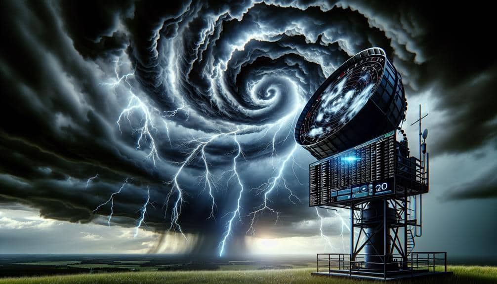
We need high-definition Doppler radar for storm observation because it provides detailed data that helps us accurately predict and detect severe weather events. This radar captures finer details within storm systems, identifying tornadoes, hailstorms, and microbursts early on. It precisely tracks storm velocity and movement, improving our ability to forecast and respond to changes. Enhanced resolution means we can pinpoint hazardous events and their intensity, integrating data with predictive algorithms for best accuracy. As a result, our emergency protocols become more effective and timely. Understanding these advantages will reveal the critical role of high-definition radar in weather safety.
Key Points
- Detects finer details within storm systems for more precise predictions.
- Captures smaller-scale storm features that are critical for accurate forecasting.
- Enhances detection of storm structures, improving response times for emergency protocols.
- Measures velocity changes to predict storm evolution accurately.
Understanding Doppler Radar
Doppler radar operates by emitting microwave signals that bounce off precipitation particles, allowing us to measure their speed and movement relative to the radar. This radar technology leverages the Doppler effect to provide real-time data on weather patterns and atmospheric conditions. By analyzing the frequency shift of the returned signals, we can determine the rate and direction of moving precipitation, such as raindrops or snowflakes.
Our data analysis capabilities are greatly enhanced by Doppler radar, enabling us to track storm systems with precision. For instance, when a storm is approaching, the radar detects changes in the signal's frequency caused by the motion of precipitation particles. This information allows us to predict the storm's path and intensity.
Importance of High Resolution
To maximize the accuracy of storm tracking and prediction, we must focus on the importance of high-definition Doppler radar data.
High-definition data enables us to detect finer details within storm systems, which is critical for improving safety and data accuracy. By capturing smaller-scale features, we can make more precise predictions and respond more effectively to potential threats.
High-definition Doppler radar provides several key benefits:
- Enhanced Detection of Storm Features: We can identify specific storm structures, such as tornadoes or microbursts, allowing for more timely and accurate warnings.
- Increased Data Granularity: With finer resolution, we obtain more detailed velocity and reflectivity data, leading to better forecasts and situational awareness.
These capabilities are essential for meteorologists and emergency responders. High-definition Doppler radar data doesn't just offer incremental improvements; it drastically enhances our understanding and management of severe weather events.
Tracking Storm Movements
By leveraging high-definition radar data, we can precisely track storm movements, allowing us to monitor speed, direction, and potential changes in real-time. This capability greatly enhances our storm prediction models, providing more accurate and timely forecasts.
High-resolution Doppler radar gives us detailed insights into weather patterns, enabling us to observe minute changes in storm behavior that might otherwise go unnoticed.
For instance, Doppler radar's ability to measure velocity along the radar beam helps us determine the speed and direction of storm cells. By analyzing this data, we can predict how a storm will evolve, including its potential to intensify or diminish. Real-time monitoring offers us the freedom to make quick, informed decisions, such as issuing warnings or adjusting emergency response plans.
Moreover, high-definition radar allows us to detect smaller-scale features within storms, such as mesocyclones or updrafts, which are critical for understanding storm dynamics. By tracking these elements, we can identify shifts in weather patterns that could indicate the development of more severe weather. The precision gained from high-resolution radar is essential for improving storm prediction accuracy and ensuring public safety.
Identifying Severe Weather
Leveraging high-definition radar data, we can identify severe weather phenomena such as tornadoes, hailstorms, and microbursts with remarkable accuracy. By analyzing fine-scale weather patterns, we're able to pinpoint the exact location and intensity of these hazardous events. This capability is essential for issuing timely severe alerts, which can save lives and mitigate property damage.
High-definition Doppler radar provides several advantages:
- Detection of Tornadic Signatures: By examining rotational velocity patterns, we can identify the formation of tornadoes well before they touch down.
- Hailstorm Identification: Reflectivity data helps us detect hail cores within thunderstorms, allowing us to issue targeted warnings.
The precision of high-resolution radar data allows us to discern detailed weather patterns that are often missed by lower-definition systems. This granularity guarantees that our severe alerts aren't only timely but also highly accurate, empowering individuals to take necessary precautions.
Enhancing Forecast Accuracy
Enhancing forecast accuracy hinges on our ability to integrate high-resolution Doppler radar data with advanced predictive algorithms. By leveraging cutting-edge technological advancements, we can significantly enhance forecast precision.
High-resolution radar provides granular data on storm structure, allowing us to detect minute changes in wind patterns and precipitation intensity. These detailed observations feed directly into sophisticated data analysis techniques, enabling more accurate storm prediction.
Our predictive models are only as good as the data we input. High-resolution Doppler radar improves the spatial and temporal granularity of our observations, which is critical for refining these models. Enhanced data resolution allows us to pinpoint the initiation and development of severe weather systems with unparalleled accuracy. This capability remarkably boosts our storm prediction efforts, reducing uncertainty and enhancing public safety.
Integrating Doppler radar data into our forecasting frameworks allows us to employ advanced algorithms like machine learning and ensemble forecasting. These methods analyze vast datasets to identify patterns and predict future weather scenarios.
As technological advancements continue to evolve, the precision of our forecasts will only get better. With better data and more powerful analytical tools, we gain the freedom to make informed decisions, ultimately safeguarding lives and property.
Benefits for Storm Chasers
With Doppler radar's high resolution, we can greatly enhance safety measures for storm chasers by providing precise data on storm intensity and path.
Accurate storm tracking allows us to predict movements with increased accuracy, reducing the risk of unexpected encounters.
These advancements enable more informed decision-making, ensuring both safety and successful observation.
Enhanced Safety Measures
Doppler radar's high resolution greatly enhances our safety by providing real-time, detailed storm data, allowing storm chasers to make informed, split-second decisions. With improved technology, we've gained the ability to capture high-definition images of storm structures. This level of detail enables us to implement critical safety measures effectively.
- Rapid Identification of Storm Features: High-resolution data allows us to quickly spot dangerous storm features such as mesocyclones and tornadoes, enhancing our situational awareness.
- Precise Hazard Mapping: We can map hazards with pinpoint accuracy, determining the exact locations of heavy rainfall, hail, and wind shear, which helps in steering clear of high-risk zones.
These advancements aren't just about gathering data; they're essential for our safety. Real-time updates mean we can adjust our paths instantaneously, reducing the risk of getting caught in life-threatening situations.
Safety measures, supported by high-resolution Doppler radar, empower us to chase storms more efficiently and securely. We embrace this freedom, knowing that technology is our ally in navigating nature's most unpredictable phenomena.
Accurate Storm Tracking
Leveraging high-resolution Doppler radar, we can track storm movements with unparalleled accuracy, allowing us to anticipate their paths and make precise navigational decisions. This advanced technology is a game-changer for storm chasers, enhancing our ability to predict storms with pinpoint precision. By integrating real-time data interpretation, we can decode complex weather patterns and fine-tune our storm prediction models.
High-resolution Doppler radar gives us granular details about a storm's structure, velocity, and intensity. This data-rich environment empowers us to conduct thorough weather analysis, identifying potential threats and opportunities for closer observation. The ability to discern minute changes in storm behavior is vital, enabling us to stay ahead of rapidly evolving weather conditions.
Moreover, high-resolution radar contributes to more accurate data interpretation, minimizing the risks associated with storm chasing. By understanding the storm's dynamics in real-time, we can adjust our positions to maintain a safe yet effective distance. This precision not only enhances our safety but also maximizes our ability to capture critical data and imagery.
In essence, the integration of advanced technology in storm tracking liberates us from guesswork, offering a clear, data-driven pathway to successful and safe storm chasing endeavors.
Frequently Asked Questions
How Does Doppler Radar Technology Work?
We analyze Doppler radar mechanics by emitting radar signals and measuring their return time. Radar signal processing interprets these signals, detecting motion and precipitation intensity, giving us essential data for storm tracking and early warnings.
What Advancements Have Been Made in Doppler Radar Technology Recently?
We've seen a quantum leap in radar resolution with recent advancements in Doppler technology. These upgrades allow us to pinpoint storm details with surgical precision, giving us the freedom to make more accurate and timely weather predictions.
How Does Doppler Radar Differ From Traditional Radar?
Doppler radar differs from traditional radar by measuring velocity, enhancing radar accuracy. It detects motion within weather systems, improving weather prediction. This capability gives us the freedom to make informed decisions based on precise, real-time data.
What Are the Limitations of Current Doppler Radar Systems?
We're discussing current Doppler radar limitations. Its resolution affects radar accuracy, often leading to gaps in data. This impacts weather prediction, making it harder to forecast small-scale phenomena like tornadoes or microbursts accurately and in real-time.
Are There Any Alternative Methods to Doppler Radar for Storm Observation?
Just as ancient mariners relied on the stars, we turn to remote sensing and satellite imagery for storm observation. These alternatives complement Doppler radar, providing high-resolution data and broader coverage, enhancing our ability to monitor weather systems.


