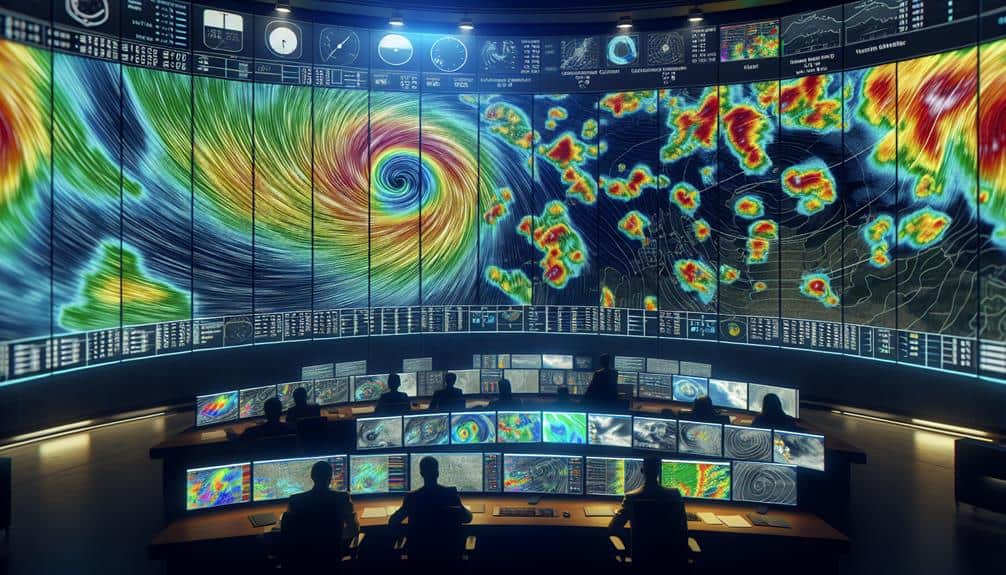
We can greatly enhance storm identification using Doppler radar by improving spatial resolution and reducing signal clutter. Techniques like dual-polarization radar help us differentiate precipitation types and pinpoint storm structures with high precision. Advanced signal filtering and machine learning algorithms minimize non-meteorological interference, guaranteeing accurate data. Additionally, analyzing storm velocity patterns and using real-time data integration boosts our prediction capabilities. Regular radar system calibration and ongoing training for meteorologists guarantee precise data interpretation. These combined efforts lead to better storm tracking and timely warnings. For a deeper understanding of these strategies, let's explore further.
Key Points
- Utilize dual-polarization radar for detailed precipitation and storm structure analysis.
- Implement advanced signal filtering techniques to reduce clutter and noise.
- Enhance spatial resolution to pinpoint storm locations and track storm evolution accurately.
- Analyze radial velocity patterns to identify rotation areas and potential tornado formations.
Understanding Doppler Radar Basics
To fully grasp the advantages of Doppler radar in storm identification, we must first break down its fundamental principles and operational mechanics. At its core, Doppler radar technology relies on the Doppler effect, which measures changes in frequency or wavelength relative to a moving object. When we emit radar waves, they interact with atmospheric particles and return to the radar system, allowing us to analyze the shifts in frequency.
Signal processing is vital. By interpreting these returned signals, we can determine the velocity and direction of storm movements. This ability to detect motion makes Doppler radar indispensable for weather forecasting and storm tracking. It enables us to predict the path and intensity of storms more accurately than traditional radar systems.
In practical terms, Doppler radar offers real-time data, essential for timely decision-making in weather forecasting. By continuously analyzing the velocity patterns of precipitation, we can identify potential severe weather conditions such as tornadoes, thunderstorms, and hurricanes.
This technology not only enhances our understanding of storm dynamics but also empowers us to issue more precise warnings, ensuring public safety and freedom from weather-related disruptions.
Enhancing Radar Resolution
To enhance radar resolution, we need to focus on increasing spatial accuracy and reducing signal clutter. By improving the spatial resolution, we can pinpoint storm locations with greater precision, thereby improving forecasting accuracy.
Additionally, implementing advanced signal processing techniques will help minimize clutter, ensuring that we obtain clearer and more reliable data.
Increasing Spatial Accuracy
Improving radar resolution hinges on refining the spatial precision of Doppler radar systems. This enhancement allows us to pinpoint storm structures with unparalleled accuracy. By enhancing spatial resolution, we can conduct precise analysis on storm tracking. This enables us to interpret intricate details of meteorological phenomena. Advanced radar systems with higher spatial precision provide detailed data that are essential for accurate storm identification and prediction.
When we discuss data interpretation, the clarity of the spatial precision becomes vital. High-resolution radar data enables us to differentiate between different storm cells, identify rotation within supercells, and track storm evolution with greater accuracy. This means our ability to predict severe weather events improves, offering communities the freedom to prepare more effectively.
To increase spatial accuracy, we can leverage techniques such as dual-polarization radar, which provides more detailed information about precipitation types and storm structure. Additionally, improving the radar's range resolution allows us to capture smaller-scale features within storms.
Reducing Signal Clutter
Reducing signal clutter in Doppler radar systems is pivotal for enhancing radar resolution and improving our ability to accurately identify and track storms. We need to employ advanced signal filtering techniques to differentiate between actual storm data and irrelevant noise. By implementing clutter reduction algorithms, we can effectively minimize the interference caused by ground objects, birds, and other non-meteorological targets, thereby refining our radar readings.
One approach is beam steering, which allows us to direct the radar beam selectively to isolate specific targets. This method enhances the precision of our measurements by focusing on areas of interest while disregarding extraneous elements. Moreover, integrating adaptive filtering techniques helps dynamically adjust to varying environmental conditions, making our radar systems more robust and reliable.
Data-driven strategies, such as leveraging machine learning algorithms, can further optimize signal filtering and clutter reduction. By training these algorithms on vast datasets, we can improve their ability to distinguish between genuine meteorological phenomena and clutter. This way, our Doppler radar systems become more adept at providing clear, actionable data for storm identification and tracking.
Analyzing Storm Velocity Data
When we analyze storm velocity data, we focus on interpreting velocity patterns to identify storm structures and behaviors.
By applying advanced techniques, we can accurately track wind speed changes and distinguish between various storm intensities.
This data-driven approach allows us to improve our predictive models and enhance storm identification accuracy.
Velocity Data Interpretation Techniques
Accurate interpretation of storm velocity data from Doppler radar is vital for identifying and predicting severe weather events. To achieve this, we must leverage advanced velocity data visualization techniques.
By visualizing velocity data, we can more clearly discern the motion of storm systems, distinguishing between areas of rotation and convergent or divergent wind patterns. This clarity is essential for effective storm tracking techniques and timely warnings.
We start by analyzing the radial velocity patterns to identify inbound and outbound wind speeds relative to the radar. This helps us pinpoint rotation areas, which are often precursors to tornado formation. Utilizing dual-polarization radar data enhances our ability to differentiate between precipitation types, further refining our storm analyses.
Moreover, employing algorithms for velocity data smoothing and noise reduction ensures more precise readings. We can then overlay velocity data with reflectivity data to provide a comprehensive view of storm dynamics. By doing so, we improve our capability to track storm evolution and anticipate its impact.
Through these data-driven techniques, we empower ourselves to make informed decisions, ultimately enhancing public safety and enabling individuals to exercise their freedom with accurate, timely information about severe weather threats.
Identifying Storm Patterns
Building on our understanding of velocity data interpretation, let's focus on identifying specific storm patterns by meticulously analyzing storm velocity data. By examining the velocity signatures captured by Doppler radar, we can pinpoint weather patterns indicative of severe storms.
One critical aspect is tracking rotational velocity, which helps us identify mesocyclones or potential tornado formations. These rotational signatures appear as couplets of inbound and outbound velocities, providing clear evidence of cyclonic activity.
We also need to carefully analyze the broader weather patterns, such as supercell structures, which are typically characterized by a well-defined hook echo in the radar reflectivity data. By overlaying velocity data, we can confirm the presence of strong updrafts and downdrafts, which are essential for storm prediction and understanding storm dynamics.
Moreover, examining velocity data allows us to detect squall lines and bow echoes, which are associated with damaging straight-line winds. Recognizing these patterns early enhances our ability to issue timely warnings and mitigate the impact on affected areas.
Analyzing Wind Speed Changes
By meticulously examining shifts in wind speed within storm velocity data, we can uncover pivotal insights into the intensity and development of severe weather systems. Our approach hinges on precise wind pattern analysis and data interpretation, allowing us to predict storm behavior with greater accuracy. Through the use of advanced Doppler radar algorithms, we can detect speed variations that signify changes in storm dynamics, such as intensification or dissipation phases.
First, we need to interpret the raw data gathered by Doppler radar. This involves identifying regions of strong wind shear, which typically indicate severe conditions like tornadoes or downbursts. The algorithms help us filter out noise and focus on meaningful data points, enhancing our speed detection capabilities. By analyzing these shifts, we can pinpoint areas where the storm is gaining strength or weakening, providing valuable lead time for warnings.
Additionally, continuous monitoring and updating our data interpretation models are pivotal. As we refine our Doppler radar algorithms, we enhance our ability to predict sudden changes in storm velocity. This ongoing process is essential for maintaining the freedom to make informed decisions, whether we're in meteorology or emergency management, safeguarding lives and property effectively.
Utilizing Dual-Polarization Radar
Dual-polarization radar greatly enhances our ability to discern different types of precipitation within a storm system. By transmitting and receiving both horizontal and vertical pulses, we gain a more detailed picture of the storm's structure. This advanced radar technology offers significant advantages in polarimetric applications and storm classification.
Here's how dual-polarization radar improves our storm identification capabilities:
- Enhanced Precipitation Differentiation: With polarimetric data, we can distinguish between rain, snow, sleet, and hail. This helps us predict potential impacts more accurately.
- Improved Storm Structure Analysis: Dual-polarization radar allows us to analyze the internal structure of storm clouds, identifying features like updrafts and downdrafts, which can indicate storm severity.
- Better Tornado Detection: We can more effectively identify debris signatures, which are pivotal for confirming tornadoes, thereby improving timely warnings.
- Reduced False Alarms: By precisely categorizing precipitation types, we can reduce false alarms related to severe weather alerts, ensuring the public only takes action when necessary.
Using dual-polarization radar, we can leverage detailed data to improve our storm classification methods. This empowers us to make informed decisions, enhancing our freedom to anticipate and respond to severe weather events effectively.
Integrating Real-Time Data
Incorporating real-time data allows us to continuously update and refine our storm identification models, enhancing both accuracy and timeliness in our weather predictions. By integrating data from multiple sources, such as satellite observations, ground-based sensors, and Doppler radar, we can create a more detailed and dynamic picture of storm development. This data integration is critical for improving predictive modeling, enabling us to anticipate storm paths and intensities with greater precision.
We leverage machine learning algorithms to analyze these vast datasets in real-time, identifying patterns and anomalies that may indicate severe weather. These algorithms improve over time, learning from historical data and real-time inputs to refine their predictions. This approach not only optimizes our weather forecasting capabilities but also provides us with the flexibility to adapt to rapidly changing conditions.
Through the seamless integration of real-time data and advanced predictive modeling, we enhance our ability to issue timely warnings and take proactive measures. This empowers individuals and communities, giving them the freedom to make informed decisions and take appropriate actions to protect themselves and their property.
Calibrating Radar Systems
Calibrating radar systems ensures that our Doppler radar data remains accurate and reliable for storm identification and analysis. This process is vital for improving radar accuracy and guaranteeing that the data we collect is both precise and actionable.
To achieve this, we need to employ effective radar calibration techniques and continually optimize radar performance by adjusting radar settings. Here's how we can do it:
- Regular Calibration Checks: Conducting frequent calibration checks helps us identify and correct any deviations in radar performance. This includes verifying the alignment of the radar's transmitter and receiver components.
- Use of Calibration Targets: We can use known calibration targets, such as corner reflectors, to assess and adjust the radar's readings. These targets provide a standard reference that helps in fine-tuning the radar's sensitivity and accuracy.
- Software Calibration Tools: Leveraging advanced software tools allows us to simulate various environmental conditions and adjust radar settings accordingly. This makes sure that the radar can handle diverse weather scenarios effectively.
- Field Tests and Validation: Performing field tests under real-world conditions helps validate the radar's performance post-calibration. This hands-on approach is crucial for confirming that our adjustments lead to improved radar accuracy.
Training for Accurate Interpretation
Once our radar systems are properly calibrated, the next step is training meteorologists to accurately interpret the Doppler radar data. Mastery of interpretation techniques is essential for effective storm tracking and timely warnings. We need to focus on understanding the various radar signatures associated with different types of weather phenomena. By doing so, we can better identify and predict severe weather events such as tornadoes, hailstorms, and heavy rainfall.
Training programs should incorporate real-world examples and historical data to provide a thorough understanding of radar imagery. We must analyze past case studies to recognize patterns and anomalies. This hands-on approach guarantees that meteorologists aren't just theoretically prepared but practically adept at storm tracking.
Utilizing advanced software tools that simulate radar data can also improve our training. These tools allow us to manipulate variables and observe outcomes, giving meteorologists a sandbox environment to hone their interpretation techniques.
Furthermore, continuous education is essential. We should regularly update our training modules to include the latest advancements in radar technology and meteorological science. By doing so, we ensure that our interpretation skills remain sharp and our storm tracking capabilities are at their peak, granting us the freedom to make informed decisions swiftly and accurately.
Frequently Asked Questions
We can enhance public engagement by using advanced data visualization techniques. By presenting Doppler radar data in an intuitive, interactive format, we empower individuals with the freedom to understand and respond to storm threats more effectively.
What Are the Common Limitations of Doppler Radar in Storm Identification?
Think of Doppler radar as a magnifying glass: it offers clarity but has its limitations. Improved algorithms and enhanced accuracy are essential, yet terrain interference, range limits, and resolution issues still hinder perfect storm identification.
How Do Weather Apps Utilize Doppler Radar Data for Forecasts?
We analyze how weather apps use Doppler radar integration to enhance weather app accuracy. By processing real-time radar data, these apps provide precise forecasts, empowering users with timely, reliable information for making informed decisions about their activities.
What Are the Costs Associated With Upgrading Doppler Radar Systems?
Upgrading Doppler radar systems is no small feat; it requires significant cost considerations. We need to analyze funding sources like federal grants and private investments to guarantee we can enhance storm identification capabilities without breaking the bank.
How Can Doppler Radar Technology Be Maintained to Ensure Longevity?
We can guarantee Doppler radar technology's longevity through proactive maintenance strategies like regular calibration, software updates, and hardware inspections. These strategies assure longevity and best performance, providing reliable data essential for weather prediction and storm tracking.


