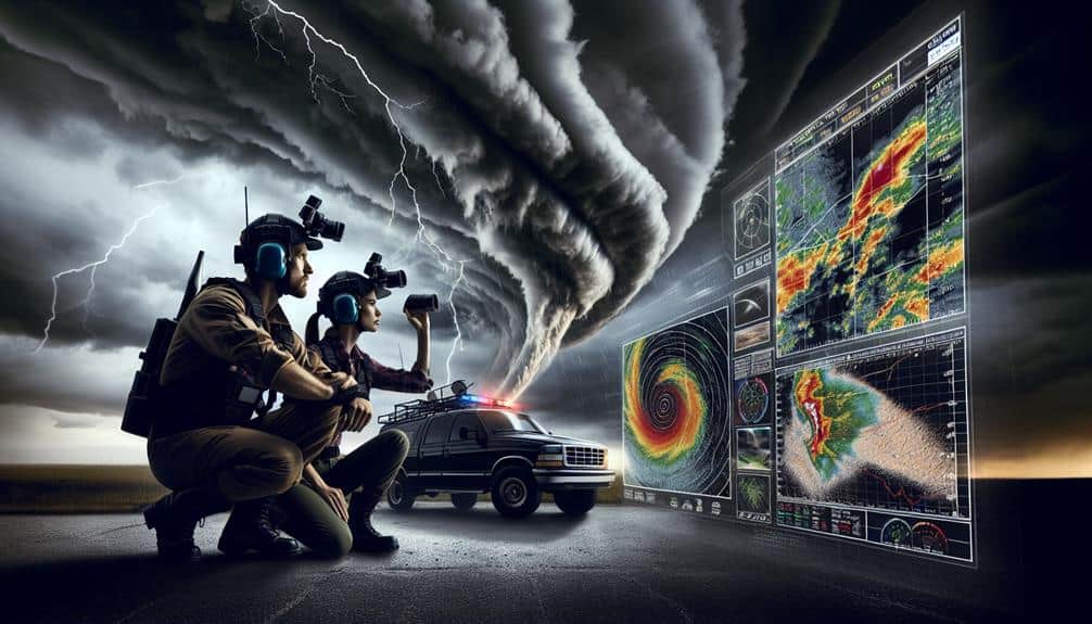
In storm chasing, we rely on Doppler radar to measure storm velocity and location in real-time. Selecting compact, rugged, and high-resolution radar systems enhances mobility and accuracy. Proper setup and calibration are essential for stability and clear data. We interpret velocity patterns, reflectivity values, and storm structures to identify severe weather indicators like mesocyclones, hook echoes, and bow echoes. Wind speed analysis and wind shear detection are crucial for predicting tornadoes. Safety gear, emergency supplies, and robust communication plans are non-negotiable for field safety. Leveraging mobile radar apps ensures access to real-time data wherever we are. Explore further to optimize your storm-chasing toolkit.
Key Points
- Regularly calibrate and maintain radar equipment to ensure accurate data during storm chasing.
- Use mobile radar apps for real-time updates and customizable alerts.
- Analyze velocity patterns and reflectivity values to identify severe weather features.
- Detect wind shear and rotational patterns early to predict tornado formation.
Understanding Doppler Radar Basics
To grasp how storm chasers use Doppler radar, we must first understand the fundamental principles of how this technology measures the velocity and location of precipitation. At its core, radar technology sends out a pulse of radio waves into the atmosphere. When these waves encounter precipitation, they bounce back to the radar system, providing data on the distance and intensity of the precipitation.
By analyzing the frequency shift of the returning waves—known as the Doppler effect—we can determine the speed and direction of the moving precipitation particles.
This information is essential for understanding weather patterns. The data from Doppler radar allows us to visualize the structure of storm systems in real-time, identifying areas of heavy rainfall, hail, or potential tornado formation. By interpreting these radar signals, we can predict the development and movement of severe weather, giving us the freedom to make informed decisions about when and where to chase storms safely.
Moreover, Doppler radar enhances our ability to track small-scale features within storms, such as rotation patterns that could indicate the genesis of a tornado. Understanding these basics empowers us to harness radar technology effectively, optimizing our storm-chasing strategies.
Choosing the Right Equipment
Having grasped the basics of Doppler radar, we must now focus on selecting the appropriate gear to maximize our storm-chasing efforts. The first step involves understanding the crucial importance of radar systems tailored for mobile use. We need compact, rugged, and highly sensitive radar units capable of real-time data acquisition. Portable Doppler radar systems should offer high resolution and rapid scanning capabilities to track storm developments accurately.
Radar maintenance and calibration are equally essential. Regular calibration ensures our radar's accuracy, reducing the risk of data errors during a chase. Maintenance routines, including software updates and hardware checks, are necessary for the longevity and reliability of our equipment.
Considering equipment upgrades and advancements is also key. Technological progress in radar systems has introduced features like dual-polarization, which enhances precipitation and wind analysis to a great extent. Investing in these advancements can provide us with a competitive edge, offering more detailed and accurate storm data.
Setting Up Your Radar System
Setting up our radar system requires careful planning and precision to achieve peak performance during storm chases.
First, we need to guarantee proper radar installation. This involves securely mounting the radar on our vehicle or base station, considering factors such as balance, stability, and unobstructed line of sight. We must also calibrate our radar to eliminate any errors in data collection, making sure that the unit is aligned and functioning at its best capacity.
Next, we focus on the radar's maintenance. Regular checks are essential to keep our system in top condition. We inspect connections, clean the equipment to prevent debris interference, and update software to make sure compatibility with the latest weather data analysis techniques.
A well-maintained radar system is less likely to fail during critical moments, hence providing us the freedom to focus on the chase.
Interpreting Radar Data
Interpreting radar data requires us to meticulously analyze velocity patterns, reflectivity values, and storm structure to accurately predict severe weather events. We begin by examining radar data visualization to identify key features such as hook echoes, which can indicate potential tornado development.
Reflectivity values help us estimate precipitation intensity and type, essential for storm prediction.
Velocity patterns are vital for Doppler radar analysis. By comparing inbound and outbound velocities, we can detect rotation within a storm, a hallmark of severe weather detection. We must also scrutinize storm structure, including updraft and downdraft regions, to assess storm severity and potential hazards.
In this process, we need to be precise and analytical. Misinterpreting radar data can lead to incorrect forecasts, putting lives at risk. Utilizing advanced radar data visualization tools allows us to see the bigger picture, enabling more accurate storm prediction.
By combining all these elements, we enhance our ability to detect and respond to severe weather conditions promptly.
We must stay vigilant and continually refine our Doppler radar analysis techniques. The freedom to chase storms comes with the responsibility to maintain accuracy and provide timely, reliable information for severe weather detection.
Identifying Storm Patterns
Building on our understanding of radar data interpretation, we now focus on identifying storm patterns that signal potential severe weather developments. Recognizing these patterns is essential for accurate weather prediction and effective storm tracking.
One key pattern to identify is a mesocyclone, which appears as a rotating, cyclonic updraft within a thunderstorm. It often precedes the development of tornadoes. We should be vigilant for hook echoes on radar, indicative of these mesocyclones.
Another significant pattern is the bow echo, which signals strong straight-line winds. On radar, a bow echo manifests as a curved line of intense reflectivity, suggesting the presence of damaging winds.
Squall lines, which are elongated bands of thunderstorms, also demand attention. These can produce widespread severe weather, including heavy rain, hail, and tornadoes. Embedded supercells within these lines are particularly dangerous and need careful monitoring.
Lastly, watch for velocity couplets, which indicate areas of wind shear. These couplets can signal the early formation of tornadoes. By mastering the identification of these storm patterns, we enhance our storm tracking capabilities and improve our weather prediction accuracy, ensuring we stay one step ahead of nature's fury.
Tracking Storm Movement
To track storm movement, we analyze velocity patterns using Doppler radar to determine wind speeds and directions. This allows us to identify rotation signatures that indicate potential tornado formation.
Analyzing Velocity Patterns
By analyzing velocity patterns on Doppler radar, we can accurately track storm movement and predict its trajectory. This capability is vital for storm prediction and ensuring our safety while chasing storms.
The radar's velocity data, represented by different colors, indicates wind direction and speed. By examining these patterns, we can discern the storm's path and intensity.
Wind analysis is essential for understanding storm dynamics. When we see green shades, they signify winds moving towards the radar, while red shades indicate winds moving away. This differentiation helps us calculate the storm's rotation and movement. By interpreting these colors, we can pinpoint areas of strong winds, potential updrafts, and downdrafts.
Additionally, analyzing velocity patterns allows us to identify convergence zones where winds from different directions collide. These zones often indicate the formation of severe weather phenomena. By tracking these patterns over time, we can predict the storm's development and anticipate its potential impact.
Understanding and interpreting Doppler radar velocity patterns empowers us to make informed decisions on the ground. This knowledge not only enhances our storm chasing experience but also provides essential data for broader meteorological studies.
Let's leverage this technology to chase safely and effectively.
Identifying Rotation Signatures
We can identify rotation signatures on Doppler radar by examining the juxtaposition of inbound and outbound velocity patterns. When we see contrasting colors, often red and green, closely paired on the velocity scan, it signals storm cell rotation. This rotation identification is essential for understanding potential tornado formation.
To effectively track storm movement, we need to focus on the mesocyclone within the storm cell. The mesocyclone is a rotating updraft that can lead to tornado formation if conditions favor. Doppler radar helps us pinpoint these rotations by measuring the velocity of precipitation particles moving towards or away from the radar.
We must make sure that the velocity couplet—where inbound and outbound velocities are adjacent—is tight and well-defined. A broad or diffuse couplet might indicate weaker rotation, which is less likely to produce a tornado.
Consistent monitoring is key, as storm cell rotation can evolve rapidly, and timely rotation identification can mean the difference between successful storm chasing and encountering dangerous conditions.
Analyzing Wind Speeds
When we analyze wind speeds, we focus on interpreting velocity data to understand storm dynamics.
We'll identify rotational patterns that signal potential tornado formation and assess wind shear to predict storm intensity.
This precise analysis helps us make informed decisions for tracking and safety.
Velocity Data Interpretation
Interpreting velocity data from Doppler radar involves analyzing wind speed patterns to predict storm behavior accurately. We need to understand how radar beam angles impact our readings. As the radar scans the atmosphere, different beam angles can provide varied insights into wind speeds at multiple altitudes.
With technology advancements, we've seen significant improvements in the granularity and accuracy of these readings, allowing us to make more precise predictions.
However, it's important to remember Doppler radar limitations. For instance, beam spreading and attenuation can affect the accuracy of wind speed data. Additionally, radar's capability to detect storm intensity diminishes with distance, making it harder to assess far-off weather systems thoroughly. Despite these limitations, interpreting velocity data is still one of the most effective ways to gauge storm dynamics.
We must also consider the relationship between wind speeds and storm intensity. Faster winds often indicate a more severe storm. By scrutinizing areas of high velocity, we can identify potential threats and make timely decisions.
Through careful analysis of Doppler radar data, we empower ourselves to understand and respond to the ever-changing nature of severe weather.
Identifying Rotational Patterns
Identifying rotational patterns in wind speeds is vital for detecting the early formation of tornadoes and other severe weather phenomena. When we analyze Doppler radar data, we focus on rotational tracking techniques to pinpoint areas where wind speeds indicate cyclonic activity. By scrutinizing changes in wind direction and velocity, we can identify mesocyclones—precursors to tornadoes.
Rotational tracking techniques involve examining radar velocity data for inbound and outbound wind patterns. These patterns reveal the presence of rotation and help us with storm movement analysis. As we track these rotational signatures, we also look for tight gradients in wind speed, which suggest rapid changes in atmospheric conditions.
Effective tornado formation prediction relies on our ability to detect these rotational patterns early. By monitoring the development of rotation within a storm, we can anticipate potential tornado genesis. Wind shear detection plays a pivotal role here; detecting significant wind shear helps us understand the storm's potential to develop into a tornado.
Our goal is to use these techniques to stay one step ahead, providing timely warnings and ensuring safety. Accurate identification of rotational patterns enhances our predictive capabilities, making our storm chasing efforts more precise and effective.
Wind Shear Analysis
Our examination of rotational patterns naturally leads us to explore wind shear, a critical factor in understanding storm dynamics and tornado formation. Wind shear detection is essential for evaluating storm intensity and predicting severe weather events.
By using Doppler radar, we can measure variations in wind speed and direction at different altitudes, which helps us identify hazardous conditions.
However, we must be aware of the Doppler radar limitations and accuracy concerns. These factors can impact our ability to precisely interpret data, particularly in complex storm environments. To maximize our effectiveness, we should focus on the following key points:
- Vertical Wind Profiles: Analyze the changes in wind speed and direction at various altitudes to assess the potential for severe weather.
- Velocity Couplets: Look for tight areas of contrasting velocities, which can indicate strong rotational shear and potential tornado formation.
- Environmental Conditions: Consider external atmospheric factors like temperature and humidity, which can influence wind shear and storm intensity.
- Radar Calibration: Regularly calibrate and maintain the radar system to minimize errors and enhance data accuracy.
Predicting Tornado Formation
By leveraging Doppler radar technology, we can more accurately predict the formation of tornadoes through real-time analysis of atmospheric conditions. This involves closely monitoring radar signatures such as hook echoes and velocity couplets. These indicators help us identify the rotational characteristics within supercell thunderstorms, vital for predicting tornado formation. By understanding the intricate dance of atmospheric conditions, we can discern patterns that precede a tornado outbreak, providing valuable lead time for communities in the path.
Climate change introduces additional complexity to our forecasts. As global temperatures rise, the frequency and intensity of severe weather events, including tornado outbreaks, are affected. We must adapt our predictive models to account for these evolving climatic variables. Enhanced radar algorithms that integrate data on temperature, humidity, and wind shear become crucial tools in our arsenal.
The precision of Doppler radar allows us to analyze the micro-scale interactions within storm cells, enabling a more nuanced understanding of how tornadoes form. This technology empowers us with the freedom to make informed decisions, enhancing our ability to anticipate and track these formidable natural phenomena. In doing so, we can better serve both the scientific community and the public.
Safety Precautions in the Field
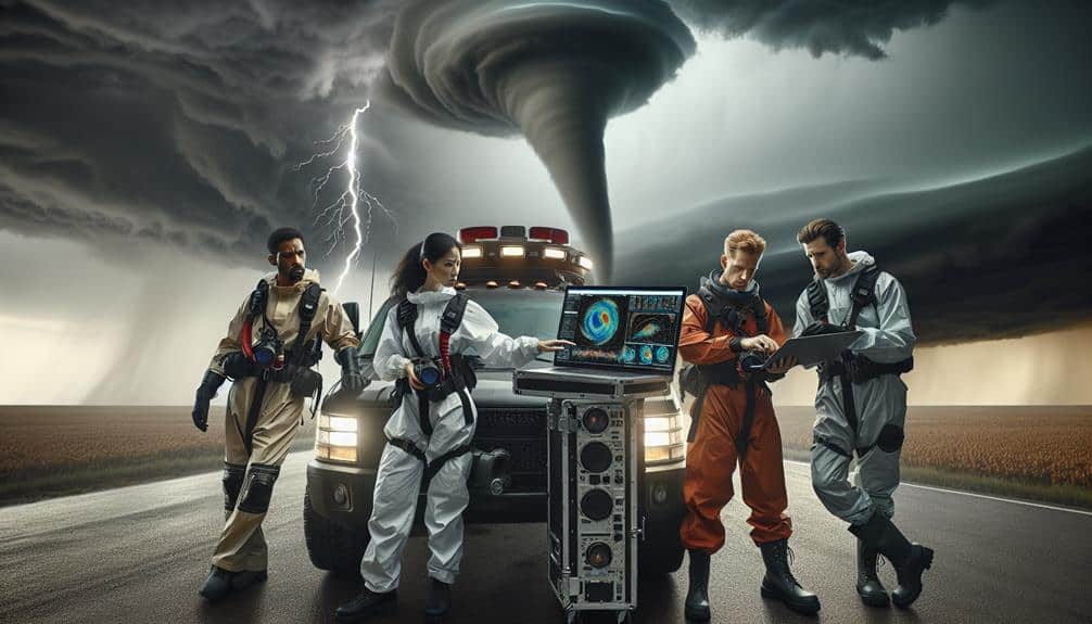
When we're out in the field, our safety hinges on weather-resistant gear essentials and robust emergency communication plans. We must guarantee our equipment can withstand extreme conditions and that our team maintains constant contact.
Prioritizing these measures allows us to operate effectively while minimizing risks.
Weather-Resistant Gear Essentials
Appropriate weather-resistant gear is necessary for storm chasers to guarantee both safety and operational effectiveness in the field. We must make sure that our equipment isn't only reliable but also well-maintained to withstand the severe conditions we encounter. Thorough gear maintenance is vital; it minimizes the risk of equipment failure when we're in the thick of a storm.
Additionally, identifying and knowing the locations of storm shelters can provide an important line of defense when the weather turns particularly dangerous. We also need to focus on emergency supplies and vehicle prep. Our vehicles are our lifelines, and having them well-prepped increases our chances of staying safe and mobile. Stocking up on emergency supplies ensures we're prepared for any situation, from getting stranded to sustaining minor injuries.
Here are four essential items for storm chasers:
- Weather-resistant clothing: High-quality, waterproof, and windproof gear to keep us dry and warm.
- First aid kit: Thorough medical supplies for treating injuries in the field.
- Durable footwear: Strong, weatherproof boots to navigate rough and wet terrain.
- Vehicle emergency kit: Tools and spare parts to handle breakdowns and keep our vehicle running smoothly.
Emergency Communication Plans
Effective emergency communication plans are essential for ensuring the safety and coordination of our team while storm chasing. First, we need to establish robust communication protocols. Each team member should know the exact sequence of actions to take in an emergency response situation. This includes designated check-in times, predefined emergency codes, and backup communication methods like satellite phones.
Next, integrating public alerts into our system is vital. Monitoring local emergency broadcasts and receiving timely updates from the National Weather Service allows us to stay ahead of rapidly changing conditions. We can then relay this information through our communication channels, ensuring everyone on our team is informed and prepared.
We also must engage in community outreach efforts. Before heading into a storm-prone area, we should notify local authorities of our presence and plans. This not only enhances our safety but also helps in coordinating potential rescue or evacuation efforts if needed.
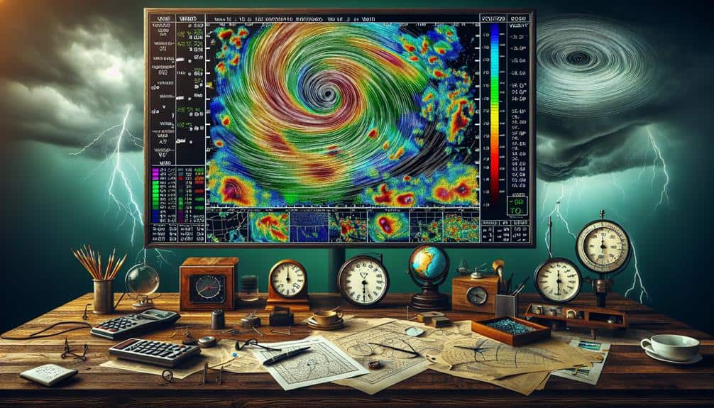
Leveraging Mobile Radar Apps
Leveraging mobile radar apps allows storm chasers to access real-time data and make informed decisions swiftly. In our pursuit of freedom and precision, these apps are essential tools. They provide the flexibility to adapt to rapidly changing weather conditions, and the storm chaser community has consistently highlighted their significance through various radar app reviews.
When selecting a mobile radar app, it's important to take into account the following:
- Real-Time Updates: Make sure the app provides continuous live data. Delays can jeopardize our ability to respond effectively.
- Customization Options: Look for features that allow us to set alerts for specific weather phenomena. Customizable settings can help us focus on what truly matters.
- User Interface: A clutter-free, intuitive interface is crucial. We need to interpret data quickly without unnecessary distractions.
- Compatibility and Accessibility: The app should be compatible with multiple devices and accessible even in areas with limited connectivity.
Frequently Asked Questions
How Do I Join a Storm Chasing Community or Network?
Did you know 75% of storm chasers belong to a community? Joining a community enhances our storm chasing experience through shared knowledge and networking opportunities. Check online forums and local clubs to connect with fellow storm chasers.
Can Doppler Radar Be Used for Studying Hurricanes?
Yes, we can use Doppler technology for hurricane tracking and scientific research. It precisely measures storm intensity, wind patterns, and movement, providing valuable data to enhance our understanding and forecasting of hurricanes.
What Are the Legal Considerations for Storm Chasing Activities?
When we chase storms, we navigate a landscape fraught with liability concerns and legal implications. We must follow safety protocols and meet insurance requirements to guarantee our freedom to explore while mitigating potential risks.
Are There Any Certifications Required for Storm Chasers?
We need certifications and training in storm chasing for safety and credibility. While not legally required, these enhance our skills and connect us with the community. Networking through these programs guarantees we're up-to-date on best practices.
How Can I Fund My Storm Chasing Expeditions?
How can we fund our storm chasing expeditions? We can explore diverse funding sources such as sponsorships, crowdfunding platforms, and grants. By strategically leveraging these options, we'll secure the financial freedom to pursue our passion.


