To analyze wind patterns effectively during storm chasing, we leverage our understanding of fluid dynamics and atmospheric pressure gradients. We rely on well-maintained, calibrated equipment for accurate data. By interpreting weather models, cross-referencing wind speed and pressure changes, and monitoring real-time updates via Doppler radar, we can predict severe weather with precision. Analyzing wind shear and convergence zones helps us identify tornado potentials. Collaboration with meteorologists and field experts enhances our analytical accuracy. Each step ensures we're equipped to safely and accurately forecast storm behavior, providing the insights needed for a successful chase. Discover these essential details further ahead.
Key Points
- Regularly calibrate and field-test equipment to ensure accurate and reliable wind data during storm chasing.
- Cross-reference multiple weather models to identify consistent wind speed, direction, and pressure changes for better predictions.
- Utilize Doppler radar to monitor real-time wind direction changes and detect storm rotation.
- Analyze wind shear by examining variations in wind speed and direction at different altitudes to predict storm intensity.
Understand Wind Dynamics
To understand wind dynamics, we must first examine the fundamental principles of fluid motion and atmospheric pressure gradients. Wind dynamics involve the study of how air moves in response to differences in atmospheric pressure. These pressure differences create gradients that drive the flow of air, forming the basis of storm formation and intensity.
In storm chasing, performing a thorough wind shear analysis is essential. Wind shear refers to the change in wind speed and direction with altitude. Strong vertical wind shear is a key factor in the development of severe thunderstorms and tornadoes. By analyzing wind shear, we can predict the potential for storm formation and assess the likely intensity of the storm.
Moreover, understanding the relationship between wind dynamics and storm intensity helps us anticipate the behavior of a storm. For instance, a high wind shear environment often leads to more organized and intense storm systems, while low wind shear might result in less severe weather.
Data from weather balloons, Doppler radar, and satellite imagery provide valuable insights into these dynamics.
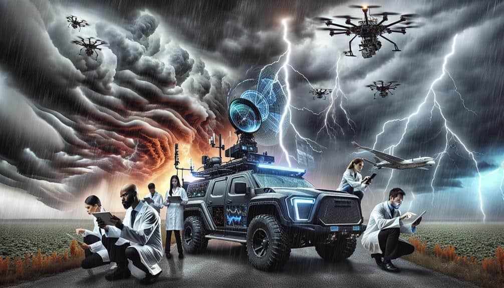
Use Reliable Equipment
Accurate storm chasing relies heavily on using dependable equipment that provides precise data on wind patterns and atmospheric conditions. To safeguard our data's validity, we must prioritize both equipment maintenance and staying abreast of technology advancements. Reliable tools not only guarantee wind data accuracy but also enhance our overall wind safety.
By conducting regular equipment maintenance, we can prevent malfunctions during critical moments. This involves calibrating anemometers, inspecting barometers, and ensuring data loggers are fully operational. With technology continuously evolving, adopting the latest devices that offer enhanced sensitivity and precision is essential.
To help us navigate the complexities of storm chasing, consider these essential tips:
- Regular Calibration: Adjust your instruments frequently to maintain wind data accuracy.
- Battery Management: Keep spare batteries and power sources to avoid sudden equipment failure.
- Software Updates: Regularly update the software on all your devices to benefit from the latest technology advancements.
- Field Testing: Perform field tests before chasing to verify that all equipment is functioning correctly.
Study Weather Models
When we study weather models, we need to interpret model data accurately to understand storm dynamics.
By identifying key patterns in wind speed, direction, and pressure changes, we can predict storm behavior with greater precision.
This approach allows us to enhance our storm chasing strategies and guarantee safety.
Interpreting Model Data
Weather models, such as the ECMWF and GFS, provide essential data sets that we must analyze meticulously to predict wind patterns during storm chasing. By interpreting these models, we can make accurate wind speed calculations and assess model accuracy, which are pivotal for storm prediction. We need to pay close attention to wind direction changes, as they offer significant insights into the storm's potential path and intensity.
We should always cross-reference multiple models to confirm data consistency. It's crucial to look at the temporal resolution of the models, ensuring that the data granularity matches our requirements for precision. We'll also need to consider the initialization times of these models because any delay can impact the accuracy of our wind speed calculations and storm prediction.
- Cross-reference multiple models: Ensures data consistency and reliability.
- Temporal resolution analysis: Matches data granularity with our precision needs.
- Model initialization times: Affects accuracy of wind speed calculations.
- Wind direction analysis: Critical for understanding storm paths.
Identifying Key Patterns
By scrutinizing wind shear and convergence zones within the models, we can identify critical patterns that influence storm development. Wind direction analysis is pivotal in storm prediction, as it helps us detect areas where air masses with differing velocities and directions intersect. This intersection often forms the initial stages of storm formation. Examining these wind patterns in conjunction with atmospheric pressure trends allows us to pinpoint areas with potential severe weather activity.
Tracking wind shear—changes in wind speed and direction with altitude—is essential. Significant wind shear indicates a higher likelihood of storm intensification, particularly in supercell formation. Convergence zones, where surface winds collide and force air upwards, serve as breeding grounds for cyclonic activity. By analyzing these zones, we can better predict storm paths and potential severity.
We must also consider atmospheric pressure trends. Low-pressure systems are typically associated with storm formation due to their role in uplifting air and creating unstable atmospheric conditions. By correlating wind shear patterns and pressure trends, we gain a thorough understanding of storm dynamics. This integrated approach enhances our ability to forecast storms, empowering us to make informed, timely decisions in storm chasing.
Monitor Real-Time Data
To effectively monitor real-time data, we must utilize advanced weather radar tools, track wind speed fluctuations, and observe pressure systems.
By doing so, we can make precise predictions about storm behavior and potential paths.
This approach guarantees our analysis is both accurate and timely.
Utilize Weather Radar Tools
Leveraging advanced weather radar tools allows us to monitor real-time data, providing essential insights into wind patterns during storm chasing. By utilizing radar technology, we enhance our wind direction analysis and refine our storm chasing techniques. Understanding wind pattern identification is critical for predicting storm behavior and maintaining safety.
When we tap into these tools, we gain access to detailed, real-time information that empowers us to make informed decisions. Radar technology allows us to visualize wind direction and movement, helping us anticipate changes in storm dynamics.
Here are some key benefits of using weather radar tools:
- Real-time Updates: Continuous data streams keep us informed of sudden changes in wind direction and storm intensity.
- Enhanced Safety: Accurate wind pattern identification helps us avoid hazardous areas and make safer navigational choices.
- Predictive Power: Advanced radar technology improves our ability to forecast storm paths and potential wind shifts.
- Data Integration: Combining radar data with other meteorological information creates a thorough view of storm systems.
Incorporating these tools into our toolkit not only enhances our storm chasing techniques but also guarantees we stay ahead of the storm, maximizing both our effectiveness and safety.
Track Wind Speed Changes
Monitoring real-time wind speed changes enables us to detect rapid shifts that could signal the development of severe weather conditions. By tracking these fluctuations, we gain valuable insight into wind direction analysis, which is essential for accurate storm prediction.
Utilizing high-resolution anemometers and Doppler radar, we can observe minute-by-minute changes in wind speed and direction. This data allows us to correlate wind speed increases with potential storm intensity, providing a clear picture of evolving weather patterns.
When wind speeds suddenly spike, it often indicates the presence of strong updrafts or downdrafts, which are key components in the formation of severe thunderstorms and tornadoes. By integrating wind speed correlation with other meteorological data, we enhance our predictive models, leading to better-informed decision-making during storm chasing.
Real-time monitoring also empowers us to adapt quickly. If wind direction analysis shows a sudden shift, it may suggest a rapidly developing storm system. This information is crucial for adjusting our routes and positioning ourselves safely, maximizing our ability to capture significant weather events while minimizing risk.
Essentially, our capacity to track wind speed changes in real-time is a cornerstone of effective storm chasing, providing both safety and precision.
Observe Pressure Systems
By analyzing real-time data on pressure systems, we can identify the formation and movement of high and low-pressure areas that greatly influence storm development. Monitoring these systems allows us to anticipate changes in wind direction and wind intensity, important for effective storm chasing.
Pressure gradients between high and low-pressure areas drive wind movement. When we scrutinize these gradients, we gain insights into how rapidly winds might change and where they're headed. Utilizing isobars—lines representing equal pressure on a map—helps us visualize these gradients. Tight isobar spacing indicates strong pressure gradients and thus higher wind intensity, which is essential in predicting storm paths.
To make this process more effective, let's focus on these key actions:
- Monitor synoptic-scale weather charts to track broad pressure systems.
- Use mesoscale analysis tools for detailed, localized pressure information.
- Compare real-time data with historical patterns to identify anomalies.
- Employ advanced software to overlay isobars on satellite images for better visualization.
Identify Wind Shear
To identify wind shear, we analyze the variation in wind speed and direction over short distances in the atmosphere. This is essential in storm chasing, as abrupt changes in wind direction and speed can indicate the presence of severe weather phenomena. We monitor these variations at different altitudes, focusing on how quickly and significantly the wind changes.
Using anemometers and weather balloons, we collect data on wind direction and speed at various altitudes. By comparing these values, we can calculate the shear impact, which helps us understand the potential for storm development. For instance, a notable increase in wind speed coupled with a sharp change in direction within a small vertical distance often indicates strong wind shear, a key ingredient for tornado formation.
We also look at historical data to identify patterns that may suggest future shear conditions. By doing so, we can predict areas where wind shear might be particularly intense, allowing us to plan our storm chasing routes more effectively. This method of analyzing wind shear helps us make informed decisions, ensuring we maximize our chances of witnessing extreme weather while minimizing risk.
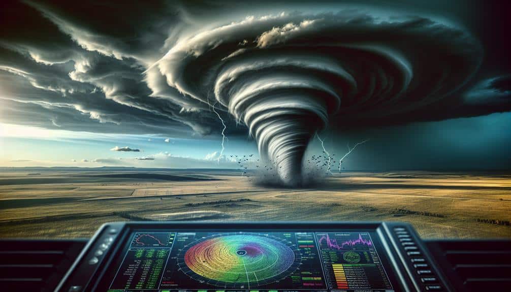
Analyze Doppler Radar
Doppler radar's unique ability to measure the velocity of precipitation particles allows us to detect rotation within thunderstorms, which is important for identifying potential tornadoes. By interpreting these radar readings, we can perform precise wind direction analysis and enhance our storm prediction capabilities.
The radar's data helps us in storm tracking, providing real-time insights into the storm's movement and intensity.
Here are some key points to keep in mind when analyzing Doppler radar:
- Velocity Signatures: Look for areas of inbound and outbound velocities close together, indicating possible rotation.
- Reflectivity Patterns: High reflectivity can show strong updrafts or precipitation cores, essential for storm prediction.
- Divergence and Convergence: Analyze areas of wind convergence and divergence to identify strong storm cells.
- Storm Relative Motion (SRM): Use SRM to subtract the storm's movement, making it easier to spot rotation.
Collaborate With Experts

Consistently working together with meteorologists, engineers, and atmospheric scientists allows us to leverage diverse expertise for more accurate storm predictions. By pooling expert insights, we can dissect complex wind patterns and enhance our data analysis techniques. This multidisciplinary approach provides us with a thorough understanding of storm dynamics, ensuring that our predictions are based on robust, scientifically validated information.
Professional collaboration is vital for accessing real-time data and advanced analytical tools. Meteorologists offer crucial insights into atmospheric conditions, while engineers contribute with sophisticated modeling techniques and instrumentation. Atmospheric scientists bring a deep understanding of weather systems, enabling us to interpret the data more effectively. Together, we can identify subtle wind pattern shifts that might otherwise go unnoticed.
Utilizing a collaborative network also enhances our capability to respond swiftly to evolving storm conditions. By maintaining open communication channels, we can share data instantaneously and refine our storm predictions on the fly. This agility not only improves our chances of accurately predicting storm paths but also empowers us to make informed decisions that prioritize safety and freedom.
Essentially, professional collaboration and data analysis are indispensable in our quest for precision in storm chasing.
Frequently Asked Questions
How Do I Stay Safe While Chasing Storms?
Staying safe while chasing storms is like finding your way through a maze: we need to prioritize safety precautions and have an emergency plan. Conducting risk assessments and maintaining communication strategies are essential for our freedom and survival in unpredictable conditions.
What Should I Pack for a Storm Chasing Trip?
For a storm chasing trip, we should pack necessary gear like GPS units, weather radios, and high-resolution cameras. Emergency supplies, including first aid kits, extra batteries, and non-perishable food, are important to guarantee our safety and preparedness.
How Do I Find Local Storm Chasing Groups?
Finding local storm chasing groups? Let's join online forums and attend local meetups. We should connect with meteorologists and reach out to local universities. These methods provide precise data and help us enjoy the freedom of storm chasing.
What Are the Best Apps for Storm Chasers?
For the best storm tracking apps, we prefer Windy and RadarScope for their precise weather radar apps and wind tracker apps. They offer advanced forecasting tools, ensuring we stay ahead of the storm while chasing our freedom.
How Can I Improve My Photography Skills During Storm Chasing?
To improve our photography skills during storm chasing, we can master lighting techniques and composition, optimize camera settings, and utilize advanced editing software. By doing so, we capture dramatic scenes, highlight details, and create powerful, breathtaking images.