We depend on data-driven analysis for storm chaser safety by integrating real-time weather monitoring via Doppler radar and satellite data, enabling high-resolution storm tracking. Advanced predictive models using machine learning analyze vast meteorological datasets to forecast storm trajectories and intensities, refining our strategies continuously. Real-time risk assessment techniques pinpoint high-risk areas by evaluating environmental hazards dynamically. Utilizing tools like GPS tracking and meteorological software guarantees precise decision-making and situational awareness. These methods collectively minimize risks while maximizing operational freedom, allowing for informed movements and strategic planning. To uncover further nuances of our safety protocols, stay engaged.
Key Points
- Provides real-time updates on storm locations, enabling immediate adjustments to avoid high-risk areas.
- Enhances predictive accuracy by analyzing vast datasets, forecasting storm trajectories and intensities.
- Identifies specific meteorological threats and potential hazards through detailed data analysis.
- Facilitates dynamic risk assessments, offering current and accurate information for informed decision-making.
Real-Time Weather Monitoring
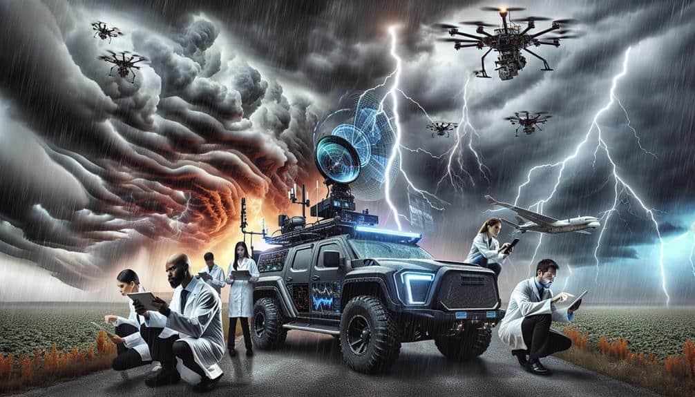
Leveraging real-time weather monitoring, we utilize advanced radar systems and satellite data to track storm developments with pinpoint accuracy. By integrating Doppler radar, geostationary satellites, and ground-based sensors, we achieve high-resolution storm data that supports our mission for safety and precision.
Our geographic tracking capabilities enable us to pinpoint storm locations and trajectories, which is essential for emergency response coordination. When a supercell forms, we can immediately identify its rotation and potential for tornado formation. This data-centric approach means we're always ahead, making sure our movements are calculated and safe.
Real-time data allows us to monitor key meteorological variables such as wind velocity, precipitation rates, and atmospheric pressure changes. These parameters are necessary for understanding storm intensity and potential hazards. By continuously updating our geographic tracking systems, we can adjust our routes on the fly, avoiding high-risk areas and optimizing our chase strategy.
Our emergency response protocols are also heavily reliant on this technology. Quick dissemination of accurate weather data ensures that local authorities and first responders are informed promptly. This coordination is essential for minimizing risks and maximizing our operational freedom, allowing us to chase storms without compromising safety.
Predicting Storm Patterns
To predict storm patterns, we employ machine learning algorithms that analyze vast datasets of historical weather conditions and current atmospheric variables. These algorithms identify intricate patterns and correlations that are imperceptible through traditional methods. By leveraging large-scale data analysis, we enhance our predictive accuracy, which is essential for storm chaser safety.
Machine learning models, such as neural networks and decision trees, process terabytes of meteorological data. They assess variables like humidity, temperature gradients, and wind speed to forecast storm trajectories and intensities. These models continuously learn from new data, refining their predictions and adapting to evolving weather dynamics.
Data visualization plays a pivotal role in interpreting these complex models. We generate high-resolution, interactive maps and graphs that depict storm paths, potential impact zones, and probabilistic outcomes. This visual representation transforms raw data into actionable insights, empowering us to make informed decisions on the field.
Risk Assessment Techniques
Building on our predictive capabilities, we employ advanced risk assessment techniques to evaluate the potential dangers storm chasers might face in the field. Our primary focus lies in hazard identification, where data interpretation plays a pivotal role. By analyzing meteorological data, we can pinpoint high-risk areas and timeframes, enabling us to implement effective safety measures.
We also utilize robust mitigation strategies to minimize risks. This involves real-time monitoring of environmental conditions and dynamically updating our risk models based on the latest data. Our approach guarantees that storm chasers have the most current and accurate information to make informed decisions.
To aid our audience in understanding the essential components of our risk assessment techniques, we've identified key factors:
- Hazard Identification: Pinpointing specific meteorological threats using thorough data analysis.
- Safety Measures: Establishing guidelines and protocols to protect storm chasers in various scenarios.
- Data Interpretation: Leveraging real-time weather data to predict and assess risks.
- Mitigation Strategies: Developing plans to reduce exposure and potential harm.
Tools and Technology
In the field of storm chasing, our arsenal of tools and technology includes high-resolution radar systems, GPS tracking, and advanced meteorological software. These resources are essential for real-time data acquisition and predictive modeling, allowing us to navigate the volatile environment safely.
High-resolution radar technology provides detailed information on storm intensity and structure, enabling us to identify potential tornado formations and hail cores with precision. By integrating GPS tracking, we can monitor our exact location relative to the storm, ensuring we remain within safe distances.
Satellite imaging offers a macro perspective, capturing the broader meteorological patterns that influence storm development. This data, when synthesized with radar technology, enhances our situational awareness and decision-making capabilities.
Advanced meteorological software further processes these inputs, generating predictive models that forecast storm trajectories and potential impact zones. These models are essential for adjusting our course dynamically and avoiding hazardous areas.
Case Studies and Insights

By leveraging these advanced tools and technology, we've gathered critical data that provides deep insights into storm chaser safety through multiple case studies. These case studies highlight how data-driven analysis can notably enhance our safety protocols and emergency response strategies.
One illuminating case study involved a group of storm chasers who faced an unexpected tornado. Using real-time meteorological data and predictive analytics, they adjusted their route, avoiding the storm's most perilous zones. This data-driven decision-making underscored the importance of immediate, actionable insights.
Here are some compelling insights from our case studies:
- Predictive Analytics: These tools helped us foresee hazardous conditions, allowing for timely route adjustments.
- Real-time Data Integration: Combining various data streams enhanced situational awareness and response times.
- Enhanced Communication Channels: Effective data sharing facilitated coordinated emergency response efforts.
- Machine Learning Models: These models identified patterns in storm behavior, improving our safety protocols.
These case studies illustrate that integrating data into our safety protocols isn't just beneficial—it's essential. By adopting these data-centric approaches, we've not only improved our emergency response but also empowered our team to chase storms with greater confidence and freedom.
Frequently Asked Questions
How Do Storm Chasers Typically Communicate During a Chase?
When storm clouds gather like an orchestra tuning up, we use communication methods like radios, satellite phones, and GPS. Emergency protocols guarantee we're synced, relaying precise data to stay safe and free to chase another day.
What Training Do Storm Chasers Undergo for Safety?
We undergo rigorous training on safety protocols through realistic simulations. Emergency procedures and equipment training are essential components. This guarantees we're prepared for any situations, allowing us to chase storms effectively while maximizing our safety and freedom.
Are There Specific Regions Where Storm Chasing Is Most Common?
A picture is worth a thousand words. We often chase storms in geographic hotspots like Tornado Alley, where weather patterns show high frequency. These regions offer the most thrilling experiences, combining freedom with data-centric precision.
How Do Storm Chasers Fund Their Expeditions?
We often fund our storm-chasing expeditions through sponsorship opportunities and crowdfunding. These methods help cover equipment costs and travel expenses, ensuring we can pursue our passion for storm chasing without financial constraints limiting our freedom.
What Personal Protective Gear Do Storm Chasers Use?
Like modern-day explorers, we use safety equipment like helmets and reinforced vehicles. Effective gear maintenance and leveraging technology advancements are essential for our safety. These tools enhance our protection while allowing us the freedom to chase storms.