We enhance storm chasing by leveraging advanced data analysis techniques that integrate real-time data from satellites, radar systems, and IoT sensors. Predictive analytics, powered by machine learning algorithms, boost accurate storm trajectory forecasts through pattern recognition and anomaly detection. High-resolution satellite imagery and meticulous radar data interpretation sharpen our ability to monitor precipitation and wind velocities. Real-time visualizations and statistical models enable instant strategic adjustments, improving community risk awareness. By integrating these sophisticated tools, we achieve precise storm tracking and situational awareness, preparing us for unpredictable weather conditions. Discover how these techniques revolutionize storm chasing and risk mitigation.
Key Points
- Real-time data from satellites and IoT sensors enhance storm tracking accuracy and decision-making.
- Predictive analytics using machine learning models provide accurate storm trajectory forecasts.
- Integration of satellite imagery allows for real-time monitoring of storm development and movement.
- Machine learning algorithms improve predictive modeling and detect atypical weather patterns.
Leveraging Real-Time Data
By harnessing real-time data from satellites, radar systems, and IoT sensors, we can enhance the accuracy and responsiveness of storm tracking. This approach allows us to capture and analyze vast amounts of data instantaneously, transforming how we monitor storm development and movement.
Real-time tracking enables us to receive updates on atmospheric conditions, wind speeds, and precipitation levels without delay. By integrating these data streams, we can generate precise, up-to-the-minute visualizations that empower us to make informed decisions quickly.
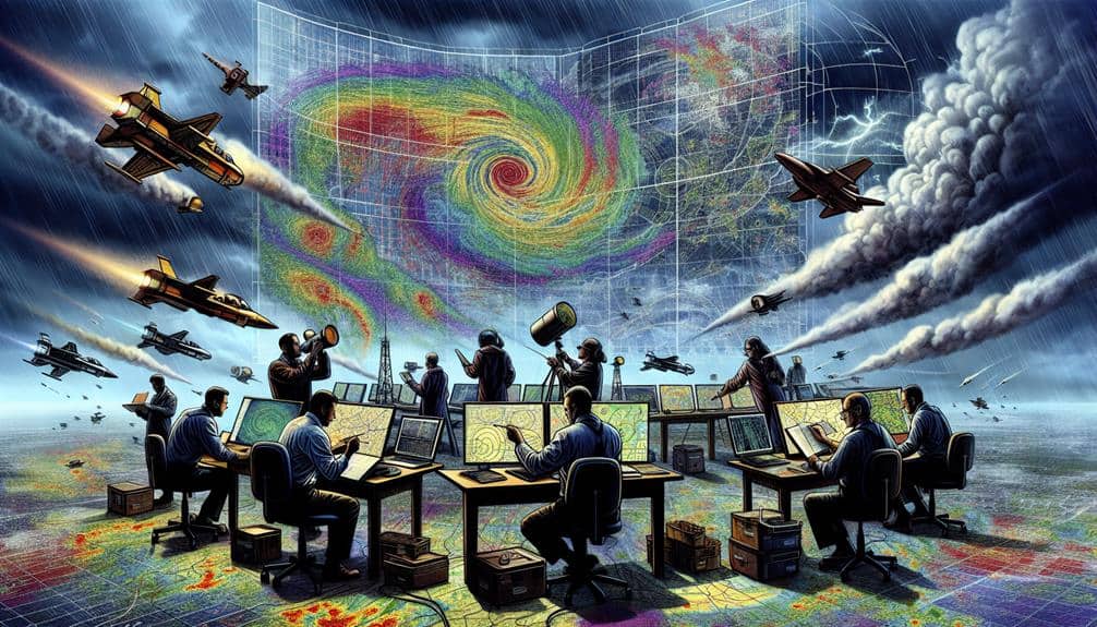
Data visualization plays a critical role in storm chasing. By converting raw data into interactive maps and graphs, we can identify storm patterns and potential paths with unprecedented clarity. For instance, radar echoes can be visualized to show the intensity and velocity of precipitation, while satellite imagery provides a broader view of cloud formations and storm systems.
IoT sensors on the ground can relay hyper-local data, such as temperature changes and humidity levels, which are essential for predicting storm behavior. Our ability to visualize and interpret this data in real-time not only enhances our situational awareness but also increases our operational flexibility, granting us the freedom to adapt to rapidly changing conditions.
Predictive Analytics in Storm Chasing
How can we utilize predictive analytics to forecast storm trajectories more accurately and mitigate potential risks?
By leveraging sophisticated algorithms and machine learning models, we can analyze vast datasets to identify weather patterns and enhance tracking accuracy. These predictive models ingest historical data, atmospheric conditions, and real-time inputs to generate more reliable storm predictions.
We employ statistical techniques such as regression analysis and clustering to discern patterns in weather data. This allows us to pinpoint likely storm paths and intensities with greater precision. Integrating data visualization tools further enhances our ability to interpret complex datasets, making storm prediction more accessible and actionable.
Predictive analytics enables us to forecast storm trajectories by evaluating multiple variables simultaneously, including temperature gradients, humidity levels, and wind speeds. This multi-faceted approach reduces the margin of error in our predictions, providing a clearer picture of potential storm developments.
Additionally, we can simulate various scenarios to understand potential outcomes, helping us develop better risk mitigation strategies. By improving tracking accuracy, we're not only advancing our storm chasing capabilities but also empowering communities to make informed decisions, ensuring safety and freedom in the face of natural disasters.
Integrating Satellite Imagery
Integrating satellite imagery into our storm chasing toolkit allows us to capture and analyze real-time data on storm development and movement with unmatched accuracy. By leveraging satellite tracking, we can monitor atmospheric conditions and detect emerging weather patterns that may indicate severe storms. High-resolution satellite images provide us with essential insights into cloud formation, temperature variations, and moisture levels, enabling us to make more informed decisions on when and where to chase.
Using satellite data, we can track the evolution of weather systems from their early stages to full-blown storms. This capability enhances our predictive accuracy and operational efficiency. For example, satellite imagery allows us to observe the structure of supercells and assess their potential to produce tornadoes or hail. By integrating this data with ground-based observations, we can develop a thorough understanding of storm dynamics.
Moreover, satellite tracking facilitates real-time updates, which are vital during rapidly evolving weather scenarios. Access to near-instantaneous data means we can adjust our strategies on the fly, ensuring we remain in ideal positions to observe and document storm behavior.
As a result, satellite imagery is an indispensable asset in our pursuit of storm chasing precision and safety.
Utilizing Machine Learning Algorithms
By leveraging machine learning algorithms, we can enhance predictive modeling accuracy through sophisticated pattern recognition and data assimilation. Real-time data processing enables us to make timely decisions, improving our storm tracking capabilities.
Additionally, anomaly detection techniques help us identify atypical weather patterns, allowing for more precise forecasting and risk assessment.
Predictive Modeling Accuracy
Machine learning algorithms significantly enhance the accuracy of predictive modeling in storm chasing by analyzing vast datasets and identifying patterns that traditional methods might overlook. By leveraging these algorithms, we can achieve higher data accuracy, which is essential for making informed decisions.
We utilize techniques like cross-validation and bootstrap methods to guarantee robust model validation. These methods enable us to test our models against different subsets of data, thereby improving their reliability.
Our models incorporate a variety of parameters such as atmospheric pressure, humidity, wind speed, and temperature. The machine learning algorithms analyze these parameters in real-time, providing predictions with unparalleled precision.
We also use feature engineering to optimize the input variables, which further refines the model's predictive capabilities.
Data accuracy is paramount in storm chasing because even minor errors can lead to significant consequences. By integrating high-resolution datasets from satellite imagery, radar systems, and historical storm data, our predictive models become more dependable.
With accurate models, we obtain the freedom to make more calculated decisions, reducing risks and increasing the chances of successful storm tracking. This approach ensures that our storm chasing efforts aren't only exciting but also grounded in scientific rigor.
Real-time Data Processing
We deploy advanced machine learning algorithms to process real-time data streams, enabling immediate analysis and response during storm chasing operations. By leveraging real-time monitoring, we can ingest vast amounts of meteorological data from sensors, satellites, and radar systems. This continuous flow of data is crucial for accurate, up-to-the-minute assessments of evolving storm conditions.
Our machine learning models are trained to identify important patterns and anomalies within this data, facilitating rapid decision-making. The integration of these algorithms guarantees that we can dynamically adjust our chase strategies, optimizing safety and efficiency.
Additionally, we employ sophisticated data visualization techniques to present this information in a clear, actionable format. Interactive dashboards and heat maps allow us to pinpoint areas of interest and potential hazards in real-time.
The combination of real-time monitoring and data visualization empowers us to act swiftly and decisively, giving us the freedom to chase storms with unparalleled precision. By translating complex datasets into intuitive visual outputs, we enhance situational awareness and operational agility.
As a result, our storm chasing efforts aren't only more effective but also significantly safer, enabling us to capture important data while minimizing risk.
Anomaly Detection Techniques
Leveraging machine learning algorithms, we focus on anomaly detection techniques to identify irregular patterns within meteorological data that signal potential storm developments. By utilizing statistical analysis and pattern recognition, we can sift through massive datasets to pinpoint deviations from normal weather conditions. These deviations often precede severe weather events, providing us with actionable insights earlier than traditional methods.
In our approach, we employ supervised and unsupervised learning models to train our anomaly detection systems. Supervised learning enables us to classify known storm patterns, while unsupervised learning helps uncover new, previously unidentified anomalies. By integrating multiple data sources—such as satellite imagery, Doppler radar readings, and ground-based sensor data—we enhance the accuracy and reliability of our predictions.
We also implement real-time statistical analysis to continuously monitor atmospheric variables like temperature, humidity, and wind speed. When our models detect anomalies, they trigger alerts, giving storm chasers lead time to prepare and respond. This proactive strategy not only improves safety but also maximizes the efficiency of storm chasing missions.
Ultimately, our adoption of machine learning for anomaly detection empowers us to make data-driven decisions with a high degree of precision, offering a pathway to greater freedom and flexibility in storm tracking and response.
Interpreting Radar Data
Often, the key to understanding storm dynamics lies in meticulously analyzing radar data to identify precipitation patterns, wind velocities, and potential rotation. We leverage radar analysis for storm tracking, enabling us to anticipate storm evolution with precision.
By interpreting Doppler radar returns, we can discern the intensity and type of precipitation. Reflectivity values indicate the size and density of hydrometeors, while velocity data reveals wind patterns within the storm.
Accurate data interpretation is pivotal for identifying mesocyclones and supercell structures. High-resolution radar imagery allows us to track weather patterns in real-time, offering insights into the storm's lifecycle.
We look for hook echoes and bounded weak echo regions (BWERs), which signal possible tornadic activity. Additionally, dual-polarization radar provides data on precipitation shape and phase, enhancing our understanding of storm composition.
Our radar analysis techniques extend beyond conventional methods. By integrating machine learning algorithms, we can refine data interpretation, reducing false positives and enhancing detection accuracy. These advancements empower us to make informed decisions, increasing our freedom and flexibility in storm chasing.
As we refine our radar analysis methods, we improve our ability to predict and react to severe weather phenomena effectively.
Enhancing Decision-Making Processes
To enhance our decision-making processes, we leverage predictive modeling techniques, integrate real-time data, and employ advanced risk assessment tools.
These methodologies allow us to anticipate storm behavior more accurately and respond promptly to changing conditions.
Predictive Modeling Techniques
Utilizing predictive modeling techniques, we can greatly enhance our decision-making processes during storm chasing by analyzing vast datasets with precision. By leveraging advanced weather forecasting models, we can predict storm paths with greater accuracy, allowing us to position ourselves optimally for data collection and safety. These models integrate a multitude of variables, including atmospheric pressure, humidity, and wind patterns, to generate actionable insights.
To further refine our strategies, we employ data visualization tools that transform complex datasets into comprehensible, real-time graphics. Visual representations of storm trajectories and intensity levels enable us to make swift, informed decisions. For instance, heat maps and vector fields can illustrate potential areas of severe weather, guiding our movements and ensuring we remain at a safe distance while still gathering essential data.
Moreover, machine learning algorithms enhance our predictive capabilities by continuously learning from new data inputs. They adapt to evolving weather conditions, improving forecast accuracy over time. This adaptability is optimal for maintaining our operational freedom and ensuring we can chase storms without unnecessary restrictions.
Real-Time Data Integration
Building on the predictive power of our modeling techniques, real-time data integration enables us to dynamically adjust our storm chasing strategies based on the latest meteorological information. By leveraging sensor fusion and data visualization, we can synthesize data from multiple sources to achieve a thorough understanding of evolving storm conditions.
- Sensor Fusion: We combine data from radar, satellite imagery, ground-based sensors, and mobile weather stations. This fusion enhances the accuracy of our situational awareness, providing a multi-dimensional view of storm activity.
- Data Visualization: Utilizing advanced data visualization tools, we can interpret complex datasets quickly. Real-time graphical representations, such as heat maps and animated storm tracks, allow us to make informed decisions swiftly.
- Dynamic Updates: With continuous data streaming, our systems update in real-time, enabling us to pivot our strategies instantly. This responsiveness is essential for safely maneuvering through volatile storm environments.
- Collaborative Platforms: By incorporating cloud-based platforms, we facilitate seamless communication and data sharing among team members, ensuring everyone has access to the most current information.
Integrating these advanced techniques, we elevate our decision-making processes, allowing for more precise and timely interventions. This approach not only enhances our storm chasing efficacy but also maximizes our operational freedom, giving us the flexibility to adapt to nature's unpredictability.
Risk Assessment Tools
Leveraging advanced risk assessment tools, we can quantify and prioritize the potential hazards we may encounter during storm chasing missions. By integrating real-time geographic mapping with sophisticated weather forecasting models, we gain an extensive understanding of the storm's trajectory, intensity, and potential impact zones. These tools allow us to visualize probable danger areas, thereby enabling us to make informed decisions quickly and effectively.
Our risk assessment framework employs algorithms that analyze historical storm data, current atmospheric conditions, and predictive weather patterns. This data-driven approach enables us to calculate probabilities of severe weather phenomena such as tornadoes, hail, and flash floods. By doing so, we can allocate resources more efficiently, ensuring our teams are in the safest possible locations while maximizing observational opportunities.
Moreover, geographic mapping provides us with essential information about terrain, road networks, and proximity to urban areas, which is vital for planning evacuation routes and emergency responses. The integration of these tools not only enhances our decision-making processes but also empowers us to chase storms with a higher degree of safety and precision.
Ultimately, these advancements grant us the freedom to pursue our passion while minimizing risks.
Frequently Asked Questions
What Qualifications Are Needed to Become a Storm Chaser?
Did you know 75% of storm chasers have a background in meteorology? We need solid meteorology knowledge and extensive field experience to predict and follow severe weather patterns accurately, ensuring safety and successful data collection.
How Do Storm Chasers Stay Safe During Severe Weather Conditions?
We prioritize emergency preparedness, utilizing storm shelters when necessary. Our communication strategies and risk assessment protocols guarantee we stay informed and make data-driven decisions, maximizing our safety while experiencing the freedom of storm chasing.
What Equipment Is Essential for Storm Chasing?
For storm chasing, we depend on essential gear like cameras and sensors. Vehicle preparation includes strengthening safety features. Advanced technology aids data collection, while robust communication systems guarantee real-time updates. Freedom comes with well-prepared, precise execution.
Can Storm Chasing Help in Climate Change Research?
Imagine us standing under a turbulent sky, instruments in hand. Yes, storm chasing can aid in climate change research, as we gather critical data on extreme weather patterns, enabling precise data correlation and understanding climate change impact.
How Can the Public Contribute to Storm Data Collection?
We can empower citizen scientists to contribute by gathering real-time storm observations. Using crowd-sourced data from mobile apps and weather networks, we'll improve the accuracy of storm models, providing valuable insights for research and public safety.