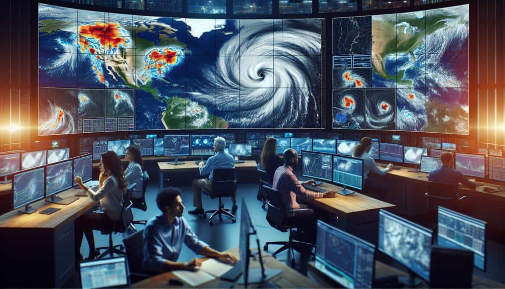
We improve storm tracking accuracy by leveraging historical weather data, which enables us to analyze patterns and trends critical for forecasting. By integrating machine learning models, we use supervised learning to enhance anomaly detection and predictive power. Additionally, real-time satellite and Doppler radar data provide high-resolution visual information and precise velocity measurements. Advanced predictive analytics techniques, such as regression analysis and neural networks, empower us to model storm behavior more accurately. Finally, real-time data processing from meteorological sensors guarantees that our tracking models are continuously updated. To comprehend the full scope of these techniques, explore the deeper insights offered.
Key Points
- Historical weather data analysis identifies storm patterns and trends for accurate tracking.
- Machine learning models predict storm behavior using supervised learning on extensive datasets.
- Satellite data integration provides real-time, high-resolution imagery for precise storm modeling.
- Real-time image processing automates weather pattern detection, reducing human error.
Utilizing Historical Weather Data
By leveraging historical weather data, we can enhance the accuracy of storm tracking models through thorough pattern analysis and trend identification. Historical data provides a detailed archive of past storm behaviors, offering invaluable insights into their formation, trajectory, and intensity. By incorporating this data, we can discern recurring patterns that indicate potential changes in storm development due to climate change impact.
Our analysis must be data-driven and precise. We examine variables such as temperature anomalies, sea surface temperatures, and atmospheric pressure levels. Over time, these factors reveal significant trends that inform our models. For instance, we can correlate rising sea temperatures with increased storm intensity, a direct manifestation of climate change impact.
Additionally, historical data is essential for disaster preparedness. By understanding past storm patterns, we can predict future events more accurately and develop more effective evacuation plans and resource allocation strategies. This helps communities enhance their resilience and preparedness for future storms.
Machine Learning Models
Leveraging historical weather data, we enhance our storm tracking accuracy further by integrating advanced machine learning models that identify and predict complex patterns. By utilizing supervised learning, we train our models on vast datasets, enabling them to recognize storm characteristics and evolution more accurately. This approach not only improves forecasting but also allows us to detect anomalies in weather patterns that traditional methods might overlook.
Our machine learning models work by:
- Data Preprocessing: Cleaning and normalizing historical weather data to verify quality inputs for the models.
- Feature Selection: Identifying the most relevant variables that influence storm behavior, such as wind speed, pressure, and humidity.
- Model Training: Using supervised learning algorithms to educate on labeled datasets, enhancing their predictive power.
- Anomaly Detection: Implementing techniques to identify unusual weather events that could indicate the onset of severe storms.
Satellite Data Integration
Incorporating satellite data allows us to process real-time images and enhance data fusion for more accurate storm tracking.
We integrate multispectral and infrared imagery to improve temporal resolution and spatial accuracy.
This integration provides a detailed dataset, enabling precise modeling and prediction of storm behavior.
Real-time Image Processing
Real-time image processing of satellite data enables us to enhance storm tracking accuracy by providing timely, high-resolution visual information. By leveraging advanced image recognition algorithms, we can identify and analyze weather patterns more effectively. This process allows us to stay ahead of storm developments, providing critical information for timely and well-informed decision-making.
Incorporating satellite data into our storm tracking systems involves several key steps:
- Image Acquisition: We utilize high-resolution satellite imagery to capture real-time data of atmospheric conditions. This continuous feed guarantees we have the most current information available.
- Image Recognition Algorithms: These algorithms automatically detect and categorize different weather patterns, such as cloud formations and storm systems. By automating this process, we reduce human error and increase efficiency.
- Data Analysis: We process the recognized patterns to predict storm trajectories and intensities. This analysis is guided by historical data and current atmospheric conditions, ensuring precise forecasts.
- Visualization: The processed data is then transformed into visual maps and charts, making it simpler for meteorologists and policymakers to comprehend and act upon the information.
Enhanced Data Fusion
Enhanced data fusion techniques allow us to integrate diverse satellite datasets, providing a more thorough understanding of storm dynamics. By combining data from multiple sensors, we can generate a cohesive picture that enhances the accuracy of storm tracking.
Sensor fusion involves merging information from various satellite instruments, such as microwave radiometers, infrared sensors, and visible light cameras. Each sensor type offers unique insights into storm structures, precipitation patterns, and temperature profiles.
With advanced data integration, we align and synchronize these disparate data sources into a unified framework. This process corrects for temporal and spatial discrepancies, enabling more precise tracking of storm movement and intensity.
For example, integrating microwave data with infrared imagery allows us to penetrate cloud cover and gain insights into the storm's internal structure, which visible sensors alone can't provide.
Doppler Radar Analysis
Let's focus on Doppler radar analysis to enhance our storm tracking accuracy.
We'll examine velocity measurement methods to quantify wind speeds and directions, and we'll identify precipitation patterns to predict storm development.
Velocity Measurement Methods
To accurately measure storm velocity, we rely on Doppler radar analysis, which leverages the Doppler effect to determine the speed and direction of moving precipitation particles. This analysis is important for understanding storm dynamics and enhancing our wind speed, direction analysis capabilities. By examining the frequency shift in radar waves reflected off precipitation, we can infer the velocity and trajectory of storm components.
Doppler radar provides us with detailed velocity data, enabling us to make precise storm path forecasting. Here's how we utilize Doppler radar for velocity measurement:
- Frequency Shift Detection: We measure the change in frequency of radar waves as they bounce off precipitation particles moving towards or away from the radar. This shift directly relates to particle velocity.
- Velocity Ambiguity Resolution: We implement algorithms to resolve uncertainties in velocity data, ensuring accurate wind speed and direction analysis.
- Dual-Polarization Radar: By using dual-polarization radar, we get more inclusive data on precipitation particle shape and orientation, improving overall velocity measurements.
- Real-Time Data Integration: We continuously integrate real-time Doppler radar data with other meteorological data sources, enhancing our storm path forecasting models.
Precipitation Pattern Identification
By analyzing Doppler radar data, we can identify distinct precipitation patterns, such as rain bands and hail cores, which are crucial for enhancing storm tracking accuracy. This advanced radar technology measures the velocity and intensity of precipitation, providing us with precise, real-time data. In storm prediction, recognizing these patterns allows us to forecast the storm's path and intensity more effectively.
When Doppler radar detects rain bands, we can track the storm's movement and predict its potential impact on specific locations. Hail cores, identified by higher reflectivity values, indicate areas of severe weather, enabling us to issue timely warnings. This data-driven approach enhances our weather forecasting capabilities, giving people the information they need to make informed decisions and stay safe.
Incorporating Doppler radar analysis into our storm prediction toolkit empowers us to dissect complex weather systems. By continuously refining our methodologies, we increase our ability to predict storm behavior with greater accuracy. This freedom to understand and anticipate weather patterns guarantees that we can better prepare for and mitigate the impacts of severe storms, safeguarding lives and property.
With these tools, we're not just tracking storms; we're mastering their patterns.
Predictive Analytics Techniques
Predictive analytics techniques often leverage machine learning algorithms and statistical models to enhance the accuracy of storm tracking forecasts. By utilizing these advanced methods, we can significantly enhance weather pattern prediction and predictive modeling. This approach allows us to anticipate storm behavior more precisely and make data forecasting more reliable.
To achieve these goals, we often employ a combination of the following techniques:
- Regression Analysis: This method helps us understand the relationships between various atmospheric variables, leading to more precise predictions of storm paths and intensities.
- Neural Networks: By mimicking the human brain, neural networks can process vast amounts of meteorological data, identifying intricate patterns that traditional methods might miss.
- Ensemble Models: Combining multiple predictive models reduces the risk of errors from any single model, providing a more robust forecast.
- Time Series Analysis: This technique allows us to analyze historical weather data to identify trends and seasonal variations, improving our ability to predict future storm behavior.
Real-Time Data Processing
In real-time data processing, we harness high-frequency data streams from various meteorological sensors to update and refine storm tracking models instantaneously. By optimizing our sensor network, we make certain that data acquisition is both thorough and precise. This involves strategically placing sensors to maximize coverage and minimize data redundancy.
Our approach to data visualization techniques is equally critical. Real-time visualizations enable us to interpret complex data swiftly, facilitating quicker decision-making. Effective data visualization transforms raw data into actionable insights, enabling us to predict storm paths more accurately.
Algorithm performance evaluation is another cornerstone of our real-time data processing. We continuously assess and enhance our algorithms to make sure they operate at peak efficiency. By rigorously testing these algorithms against historical and real-time data, we can identify and rectify any discrepancies, thereby improving overall tracking accuracy.
Data quality assessment is indispensable for reliable storm tracking. We employ various methods to verify and validate the incoming data, making sure that only high-quality data is fed into our models. Poor-quality data can lead to erroneous predictions, so maintaining data integrity is a top priority.
Together, these techniques form a robust framework for real-time storm tracking, empowering us to provide timely and accurate forecasts.
Frequently Asked Questions
What Are the Key Challenges in Storm Tracking?
Key challenges in storm tracking include data collection difficulties and predictive modeling limitations. We need precise, real-time data and advanced algorithms to forecast paths accurately. Overcoming these obstacles guarantees better preparedness and greater freedom from storm-related disruptions.
How Do Meteorologists Verify the Accuracy of Storm Predictions?
We verify storm predictions by using data validation processes, integrating machine learning models, and analyzing satellite imagery and radar data. These methods guarantee our forecasts are precise, empowering individuals to make informed decisions freely and confidently.
What Role Do Human Analysts Play in Storm Tracking?
Human analysts scrutinize data models to investigate their accuracy. Our human input is essential in identifying anomalies and ensuring precision. We enhance accuracy verification, leveraging our expertise to complement automated systems, ensuring reliable storm tracking.
How Is Storm Tracking Technology Evolving?
We're witnessing rapid evolution in storm tracking technology due to satellite advancements and radar innovations. These improvements provide precise, real-time data, empowering us to predict storm paths accurately and safeguard communities, enhancing our freedom to plan and prepare.
What Are the Limitations of Current Storm Tracking Techniques?
Sailing through the stormy waters of data limitations and forecast uncertainties, we often find our predictions fall short. These constraints hinder our ability to provide precise storm tracking, impacting the freedom to make informed safety decisions.

