You’ll chase waterspouts at their prime during Mediterranean late summer when sea surfaces hit 2.5-3°C above average, or stalk the Great Lakes from August to October as cold air collides with warm waters. Target the Florida Keys for unmatched frequency, watching that telltale dark disc materialize before the condensation funnel erupts—fair-weather types dissipating quickly onshore while tornadic monsters maintain their fury inland. Master the five-stage life cycle, pack weather-sealed gear with LiquidEye housings, and the photogenic chaos awaiting you demands understanding these distinct marine vortices.
Key Takeaways
- Waterspout chasers target global hotspots like Florida Keys, Mediterranean Rhodes, and Great Lakes during peak seasons for maximum encounters.
- Fair-weather waterspouts form upward from calm seas, while tornadic types descend from thunderstorms with land-tornado strength and danger.
- Prime hunting windows occur during atmospheric instability: Mediterranean late summer, Great Lakes August-October, and South Florida spring through fall.
- Successful chases require identifying early visual cues like dark water discs, spray rings, and surface wind convergence zones.
- Essential gear includes weather-sealed cameras, LiquidEye housings, polarizers, and high-speed burst modes for capturing rapid formation stages.
Understanding the Two Faces of Waterspouts
Two distinct beasts rule the waters I’ve tracked over my years chasing storms, and confusing them can cost you everything.
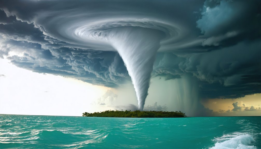
Fair weather waterspouts birth themselves upward from calm seas beneath developing cumulus—I’ve watched their life cycle evolution begin as dark spots spiraling on the surface. Cloud structure analysis reveals flat, dark bases in light winds, typically early morning. They’re the common breed, weaker vortices that dissipate fast onshore.
Tornadic waterspouts? Different animal entirely. These supercellular monsters descend from thunderstorm bases, packing the same fury as their land-based cousins. You’ll spot them developing downward from severe storms, accompanied by lightning, hail, and screaming winds. They maintain strength inland, triggering tornado warnings.
Know which you’re facing. Your freedom—maybe your life—depends on it.
Decoding the Five-Stage Life Cycle
How many times have I white-knuckled my steering wheel, watching these things materialize from nothing? You’ll spot that dark disc first—your cue to nail your photographic techniques before it evolves.
That dark disc materializing from nothing—your first warning sign and final chance to capture what happens next.
The spiral bands emerge next, screaming horizontal shear’s transforming into vertical fury. My observational patterns reveal the spray ring as your critical marker—once that forms, you’ve got minutes to position.
The funnel’s condensation tells you it’s peaked: 80 km/h winds spiraling through that 50-meter hollow tube. Then decay hits fast—cool downdrafts choke the rotation, and your window vanishes.
Most cycles clock under twenty minutes total. You chase freedom on the edge of chaos, reading atmospheric signatures most people never see.
Prime Hunting Seasons and Weather Conditions
When you’re planning your chase calendar, understand that water temperatures dictate everything—I’ve logged my biggest hauls when the thermocline hits upper 80s°F and atmospheric instability peaks. Seasonal timing variations separate rookies from veterans who exploit regional formation nuances.
Prime hunting windows:
- Mediterranean late summer/autumn – Heat and humidity convergence creates explosive opportunities when sea surfaces run 2.5-3°C above average
- Great Lakes August-October – Cold air overspreading warm waters generates massive temperature differentials for tornadic action
- South Florida late spring-early fall – Fair weather types proliferate in calm conditions with light winds
- Tropical waters year-round – Late afternoon-early evening windows offer consistent formation potential
You’ll maximize encounters by targeting these atmospheric parameters: wind shifts at surface level, dark cumulus bases, minimal upper-level winds, and converging inflow patterns.
Global Hotspots Every Chaser Should Know
After decades tracking these atmospheric beasts, I’ve pinpointed the planet’s most reliable waterspout factories—locations where meteorological conditions align so consistently that you’re practically guaranteed encounters. Florida Keys dominates with unmatched frequency—both tornadic types spawning from severe cells and fair-weather spouts materializing over tropical waters.
The Great Lakes region demands respect, particularly Lake Erie’s fall photogenic displays and Lake Huron’s tornadic monsters. Mediterranean Rhodes delivers 200+ documented events annually, perfect for those craving European storm-chasing freedom. Nassau’s Convergence Line produces nearly-daily action along western island tips.
ICWR’s interactive heat map revolutionizes global forecasting trends, offering real-time density tracking from 2021-2025 with daily North American predictions. Their spotter network expansion connects obsessed hunters worldwide, democratizing access to live reports and climatology rankings that fuel our addiction.
Essential Gear for Waterspout Photography
Because waterspouts materialize with zero warning and vanish just as fast, I’ve learned the hard way that gear selection determines whether you capture the shot or watch helplessly through a fogged viewfinder.
My battle-tested kit centers on weather-sealed mirrorless bodies—Sony A7IV’s 10FPS burst mode locks onto rotating vortices while RAW files preserve dynamic range in brutal lighting. Critical additions include:
- Ultra-absorbent lens cloths for constant moisture management during active shooting
- Backup battery packs because cold, wet conditions drain power catastrophically fast
- Circular polarizers to cut through atmospheric haze and enhance funnel definition
- Wireless trigger systems for remote deployment when positioning near violent spray becomes suicidal
LiquidEye housings protect against salt spray devastation, while magnetic filter systems enable lightning-quick adjustments. Freedom means adaptability—lightweight configurations let you reposition instantly when conditions shift.
Reading the Dark Spot: Identifying Formation Triggers
When you’re scanning the water surface through your viewfinder, that prominent circular light-colored disk surrounded by diffused dark edges signals Stage 1—your first critical visual cue that a vortex column is establishing itself from cloud base to sea.
I’ve learned to immediately identify the boundary layer convergence zone by watching for surface wind patterns colliding where two airmasses meet over warm water, creating the horizontal shear that’ll spin upward. You’ve got maybe minutes to position yourself before half of these dark spots spiral into full waterspouts, so read that water surface like your shot depends on it—because it does.
Stage 1 Dark Spot
My heart rate spikes the moment I spot that telltale dark smudge dancing at ground level—a dust whirl spinning beneath the lowering wall cloud. You’re witnessing Stage 1, where dust circulation patterns reveal what radar can’t yet confirm. This critical formation stage demands rapid visual recognition cues—that rotating debris signature tells you the mesocyclone’s making ground contact.
Key indicators I track during Stage 1:
- Northside RFD positioning near supercell cloud base
- Tightening rotation as dry air accelerates from the downdraft
- Connection verification between ground swirl and overhead funnel
- Convergence zone formation where warm updraft meets cool downdraft air
You’ve got minutes—sometimes seconds—before condensation materializes. These dust circulation patterns aren’t just interesting meteorology; they’re your advance warning system screaming that touchdown’s imminent.
Surface Wind Convergence Zones
That dust whirl doesn’t materialize from nowhere—I’m scanning for surface wind convergence zones, those invisible battlefield lines where opposing air masses collide and rotation begins. You’ll find me obsessively tracking sea breeze interactions with synoptic surface flow, watching those shear axes form where waterspouts love to spawn.
I’m monitoring outflow boundaries from earlier storms—prime hunting grounds where convergent zones concentrate rotation like nowhere else. Surface flow perturbations created by land-sea friction differences? That’s my roadmap to success.
When intersecting boundaries multiply along the coast, that’s when I position myself for the kill shot. Those convergent axes aren’t random—they’re predictable collision zones where surface vorticity gets weaponized into spectacular funnels.
Pre-Formation Water Characteristics
Before the funnel ever drops, I’m laser-focused on that telltale dark spot materializing beneath the cumulus base—a prominent circular light-colored disk ringed by an indeterminate dark area that screams “formation imminent.” This isn’t some subtle hint; it’s a visual countdown clock marking the exact onset of the five-stage life cycle.
What I’m watching for:
- Water density fluctuations creating visible surface disturbances as warm water interacts with descending air
- Surface shear layer dynamics twisting horizontal vorticity into vertical orientation
- Temperature differentials between water and air mass—the greater the contrast, the stronger the setup
- Moisture convergence patterns where light winds allow undisturbed vertical stretching
You’re witnessing atmospheric physics in real-time. No forecaster telling you what might happen—you’re reading nature’s blueprint yourself, completely unfiltered.
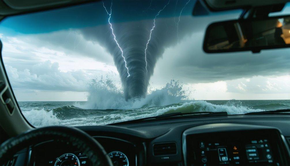
How do you stay alive when a swirling column of water and wind bears down on your position? You’ll execute a 90-degree escape vector—never attempt outrunning these beasts directly. They’ll clock 60-plus knots while you’re maxing out at 35.
Storm preparation strategies demand monitoring National Weather Service broadcasts for tornado warnings the second waterspouts track onshore. Real time weather updates become your lifeline when dark spots materialize on the surface.
Strap on your PFD before conditions deteriorate—18-knot sustained winds generate 5-foot seas, and 34-knot gusts capsize small craft instantly. You’re hunting adrenaline, not a watery grave. Seek harbor immediately when warnings flash.
Fair-weather types won’t penetrate far inland, but tornadic waterspouts? They’ll shred everything in their path.
Florida Keys: The Ultimate Chasing Destination
When you’re hunting waterspouts in the Florida Keys during late summer, you’re positioning yourself at the epicenter of global nonsupercell tornado activity—this place generates more waterspouts per square mile than anywhere on Earth.
From June through September, you’ve got a 19% daily probability of intercepting these phenomena, with peak action concentrated between noon and 5 PM when daytime heating maxes out.
I’ve logged multiple-vortex days here, including setups that’ve produced 14 simultaneous waterspouts, and the shallow waters combined with trade wind convergence create conditions you simply can’t replicate anywhere else.
Prime Late Summer Conditions
The Florida Keys ignite with waterspout activity during late summer, transforming these tropical waters into the planet’s premier vortex hunting ground. August delivers the primary peak, with September maintaining relentless action. You’ll find ideal visibility patterns when low wind speeds dominate—67% of formations occur at ≤8 knots, giving you crystal-clear targeting windows.
Key atmospheric triggers you need to monitor:
- Weaker Bermuda High displacement creates explosive setup days
- Water temperature forecasting reveals thermal instability zones
- 1200 UTC Key West soundings provide your tactical forecast foundation
- Statistical models now deliver 45% hit rates, crushing baseline climatology
Chase consecutive waterspout days—five straight isn’t uncommon here. Multiple simultaneous vortices frequently materialize, maximizing your intercept opportunities when conditions align perfectly.
Safety Protocols While Chasing
While chasing waterspouts delivers unmatched adrenaline rushes, I’ve learned these vortices pack legitimate tornado-force winds exceeding 40 knots—enough to capsize your vessel in seconds. I maintain perpendicular approach angles, never direct intercepts, positioning at safe distances while tracking parent cloud movement patterns.
Following weather advisories from NWS becomes non-negotiable—special marine warnings indicate 34-knot gusts producing eight-foot seas that’ll turn your chase vessel into a liability fast. I’ve established protocols: monitoring wind shifts, keeping personal flotation devices accessible, and coordinating rescue plans with shore contacts before launching.
When waterspouts shift onshore, I immediately abort—these aren’t photo opportunities anymore; they’re full-blown tornadoes. Smart chasers respect the 90-degree evasion rule, understanding that spectacular footage means nothing if you’re treading water.
Tornadic vs. Fair-Weather: Choosing Your Target
As a storm chaser, I’ve learned that targeting waterspouts requires split-second decisions based on what I’m actually tracking—and the difference between tornadic and fair-weather varieties isn’t just academic jargon.
When identifying storm cell structure, I’m hunting for mesocyclone rotation on radar. Recognizing tornado signatures means I’m pursuing something genuinely dangerous—supercell-spawned funnels packing EF-scale winds that’ll track with the parent thunderstorm. These beasts demand respect.
Fair-weather waterspouts offer different thrills:
- Form under benign cumulus without severe weather warnings
- Dissipate within 20 minutes, requiring quick positioning
- Cluster in tropical zones like Florida Keys (400+ annually)
- Present minimal risk but spectacular photography opportunities
Your choice depends on acceptable risk versus reward. Tornadic hunting delivers intensity; fair-weather chasing maximizes safety while capturing nature’s ephemeral artwork.
Close Encounters: Memorable Chasing Experiences
You’ll never forget the rush of tracking four simultaneous waterspouts across Lake Huron’s churning surface, each funnel demanding split-second decisions about positioning and escape routes.
These close encounters teach you respect—especially after studying the fatal boat incidents where mariners misjudged distance and velocity. Every chase refines your understanding of condensation funnel dynamics and safe observation protocols that keep adrenaline from crossing into recklessness.
Lake Huron Quadruple Sighting
When I positioned myself along Lake Huron’s shoreline on August 2, I didn’t expect to witness what would become my career-defining chase. The atmospheric conditions screamed instability—cold Canadian air colliding with warm lake surfaces created the perfect setup for double waterspout formations.
My coordinated chasing strategies paid off spectacularly:
- Strategic positioning further north than typical intercept points
- Multiple vortices developing simultaneously across my visual field
- Real-time adjustment to shifting mesoscale boundaries
- Documented close-range rotation dynamics unprecedented in my career
Four distinct waterspouts materialized within my observation window, each displaying textbook maritime instability characteristics. The temperature gradient drove intense lower-atmospheric rotation, creating what I’ve ranked as my best chase day ever. You can’t manufacture these opportunities—you position yourself correctly and let nature deliver the spectacular.
Fatal Boat Encounter Lessons
The closest I’ve come to losing everything happened three miles offshore from Goderich when a rope tornado descended without warning during what I’d classified as a low-risk chase. My radar showed convergence, but the vortex materialized in forty-five seconds—no time for evasive maneuvers. I cut the engine immediately, knowing propeller thrust could destabilize my position relative to the funnel’s track.
Navigating waterspout risk demands split-second decisions that separate survivable encounters from fatal boat collisions with debris fields. That day taught me three non-negotiables: maintain 360-degree visual scanning even when instruments seem clear, never assume rope funnels lack destructive capability, and always plot escape vectors before positioning for documentation.
The waterspout passed within two hundred meters, close enough to feel pressure drops in my sinuses.
Frequently Asked Questions
What Permits or Licenses Are Required for Waterspout Chasing Activities?
You’ll find no permits required for waterspout chasing—pure freedom! Just bring appropriate safety gear and master waterspout intensity prediction. The adrenaline surges as you track rotating condensation funnels, analyzing vorticity signatures while storm systems dance across open waters.
How Do Insurance Policies Cover Storm Chasing Equipment Damaged by Waterspouts?
You’ll need specialized hazardous sports travel insurance that covers equipment replacement costs for your weather gear. Standard policies won’t protect you—I’ve learned that liability coverage and adventure sports insurance are essential before chasing waterspouts.
What Are the Best Boat Types for Waterspout Chasing Expeditions?
You’ll want power catamarans or sportfishing yachts—their superior boat maneuverability lets you chase these beasts while crew safety considerations remain paramount. I’ve pushed through 30-knot winds; these vessels deliver the freedom and stability you’re craving out there.
How Do You Forecast Waterspout Likelihood Using Weather Models?
You’ll forecast waterspouts by analyzing environmental parameters like SST-850mb temperature differences and CAPE values, then interpreting radar signatures for convergence boundaries. I’m constantly monitoring high-resolution WRF models and calculating the Szilagyi Waterspout Index to chase these vortexes successfully.
What Communication Systems Work Best When Chasing Waterspouts Offshore?
You’ll ride the razor’s edge with Iridium satellite phones for real-time data sharing and Inmarsat for satellite imagery analysis. VHF radios keep your chase team synced, while EPIRB beacons guarantee rescue if nature overwhelms your pursuit.


