You’ll need thorough pre-chase protocols integrating meteorological analysis, route reconnaissance, and communication redundancies before deployment. Configure your vehicle with tested mechanical systems, backup power supplies, and dashboard-mounted radar applications while positioning yourself southeast of the target—approximately 45 degrees from the updraft. You must maintain multiple escape routes, monitor CG flash rates, and recognize rain-wrapped tornadoes through environmental cues. Implement redundant communication systems including HAM radios and satellite phones with standardized check-in protocols. The sections below detail specific equipment configurations, hazard recognition techniques, and emergency response procedures that’ll enhance your operational safety margins.
Key Takeaways
- Complete pre-chase planning including meteorological analysis, route reconnaissance, offline mapping systems, and identification of multiple escape routes before departure.
- Verify vehicle mechanical systems, battery, defroster, and backup power supplies while carrying replacement windshield materials and emergency equipment.
- Position southeast of tornado track at 45 degrees from updraft, avoiding northern approaches and maintaining awareness of road network limitations.
- Monitor lightning activity and hail cores, establish shelter protocols, and maintain escape routes from precipitation areas with hydroplaning risks.
- Implement redundant communication systems including HAM radios and satellite phones with standardized check-in protocols and real-time GPS coordinate sharing.
Pre-Chase Planning and Preparation Protocols
Before deploying into the field, you must establish exhaustive pre-chase protocols that integrate meteorological analysis, route reconnaissance, and communication redundancies.
Your daily forecast briefings should identify supercell potential and mesocyclone signatures, enabling precise target destination identification before storm initiation.
Secure detailed road networks and alternative routes within your target area, ensuring you won’t become trapped by outflow-dominant systems or deteriorating infrastructure.
Configure your Garmin Overlander with offline mapping capabilities and maintain paper atlases as failsafe navigation.
Install backup power supply options—portable battery banks and vehicle inverters—to sustain your radar systems, two-way radios, and meteorological instruments throughout extended operations.
Fuel your vehicle completely and carry reserve capacity.
Lock in your jumping-off point coordinates before departing, allowing rapid response when convective development begins.
Vehicle and Equipment Setup Requirements
When deploying into severe convective environments, your chase vehicle functions as a mobile command center requiring systematic mechanical validation and equipment integration. Verify brakes, suspension, and tire tread depth prevent hydroplaning on moisture-laden surfaces.
Test battery, defroster, and supplemental cooling systems before chase season initiates. Install sunroof guards using four-magnet configurations with metal grating spaced adequately from roof panels. Avoid convertibles entirely—fixed hardtop construction provides essential hail protection.
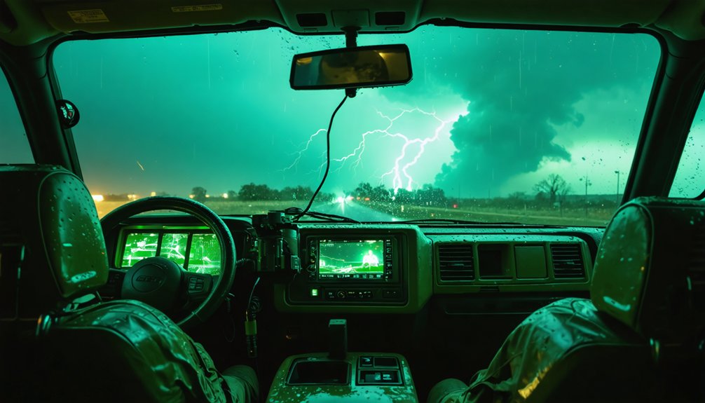
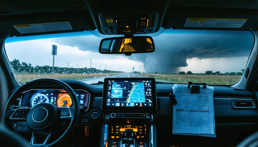
Position dashboard camera mounts to maintain unobstructed sightlines while accessing radar applications through swivel-capable displays complying with visibility regulations. Activate parking lights when shoulder-positioned; maintain headlight operation during precipitation events. Carry replacement windshield materials and backup bulbs as accessory component specifications.
Your vehicle autonomy depends on preemptive maintenance protocols and strategic equipment placement optimizing both operational capability and structural resilience against atmospheric hazards.
Strategic positioning represents the differential between successful storm documentation and life-threatening entraplement scenarios. You’ll need to arrive at your target location one hour before initiation, allowing critical data reanalysis time.
Strategic positioning separates successful storm chasers from those who become trapped—arrive early and always maintain your escape routes.
Approach exclusively from west, south, or east angles—never cross tornadic storms from the north. Position southeast of the tornado track, approximately 45 degrees starboard of the updraft for ideal visual access while maintaining escape viability.
Specialized topographic mapping identifies single-bridge crossings and road network limitations before departure. Establish multiple predetermined escape routes leading away from storm movement direction. Fuel tank capacity monitoring prevents operational failures during repositioning maneuvers. Study cell coverage maps for your carrier’s strength in target areas.
Leave observation spots several minutes early on high-risk days to avoid mega-chaser convergence on limited rural roads, maintaining navigational freedom throughout your operation.
Hazard Awareness and Risk Mitigation
You must recognize that lightning strikes carry a 10% minimum mortality rate with 75% of survivors experiencing permanent effects, making proper avoidance protocols essential despite only one documented chaser injury.
Hail and extreme winds represent credible vehicle and personnel threats during close-range storm intercepts, requiring real-time assessment of mesocyclone structure and precipitation core dynamics.
Your ability to identify tornado formation signatures, hook echoes, wall clouds, and rear-flank downdraft interactions directly correlates with maintaining safe positioning relative to the most dangerous storm features.
Lightning Strike Avoidance Tactics
- Monitor CG flash rates through NLDN real-time data to identify strike-dense sectors before positioning
- Establish shelter identification protocols within 30-second access points when anvil crawlers increase
- Avoid water-related positioning during electrical activity—fishing and watercraft scenarios account for 54% of fatalities
- Track negative leader propagation patterns during temperature changes at seasonal boundaries
Your vehicle provides substantial protection as a Faraday cage, but direct strikes to outlying structures demand 10-minute post-flash standoff distances before resuming external operations.
Hail and Wind Dangers
While lightning poses acute electrocution risks, hail and wind dynamics present equally lethal hazards that demand proactive positioning strategies throughout active chase operations.
You’ll encounter hail formation producing projectiles from pea-size to grapefruit dimensions, impacting your vehicle at velocities exceeding 100 mph. Severe thunderstorm winds initiate at 58 mph thresholds, with downburst gusts documented beyond 100 mph—sufficient force to destabilize high-profile vehicles.
Annual hail damage approaches one billion dollars nationally, reflecting destructive potential you can’t ignore. Maintain escape routes from precipitation cores where hail fog and hydroplaning conditions create primary fatality scenarios.
Your awareness of wind dynamics enables strategic positioning relative to storm cores, preventing entrapment in debris fields. Distance management from hail shafts preserves vehicle integrity and operational mobility throughout pursuit sequences.
Storm Features Recognition Skills
Physical hazards from wind and hail represent only half the threat equation during active chase operations—the remaining danger emerges from misidentifying storm-scale features that telegraph tornadic development. Your survival depends on mastering radar interpretation techniques and environmental cue awareness to maintain situational control.
Critical recognition skills include:
- RFD Gust Front Detection: Identify horseshoe-shaped boundaries on radar and visually—this feature defines tornado-producing regions when paired with inflow tail observations.
- Rotating Wall Cloud Assessment: Monitor the “bear’s cage” continuously, understanding this precipitation-surrounded feature marks where tornadoes develop.
- Rain-Wrapped Tornado Awareness: Recognize when heavy precipitation cores obscure tornadoes, eliminating visual confirmation and reducing reaction time.
- Escape Route Intelligence: Interpret real-time storm structure changes to select exits that don’t lead directly into danger zones.
Team Operations and Communication
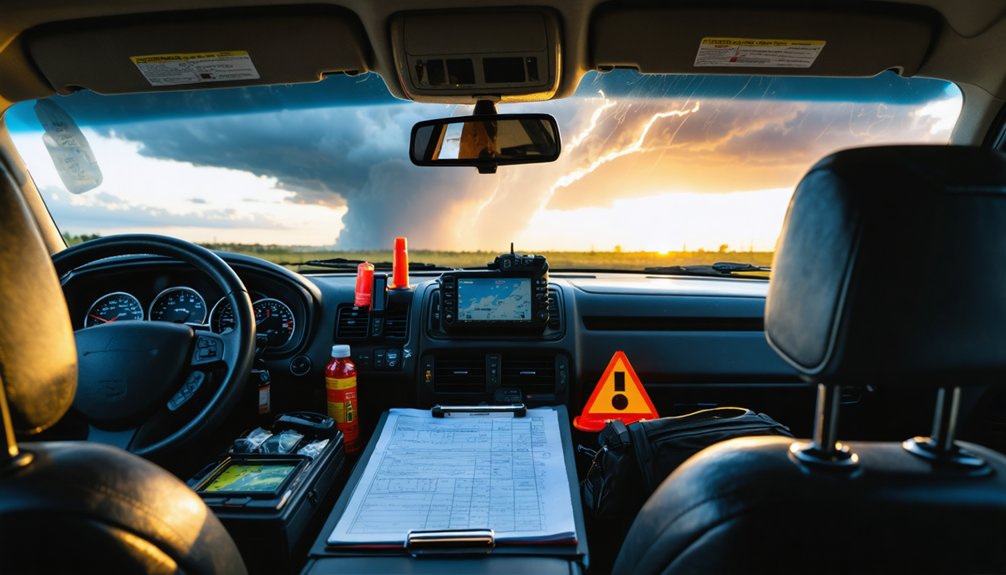
Effective storm chasing hinges on synchronized team operations where communication failures can rapidly escalate into life-threatening situations. You’ll need multiple redundant systems—HAM radios, satellite phones, and NOAA Weather Radios—functioning simultaneously.
Establish a clear command hierarchy with designated driver roles to prevent distracted operations during critical intercepts. Your data distribution network must relay real-time GPS coordinates, radar analysis, and mesoscale discussions instantly among team members.
Implement standardized check-in protocols and maintain detailed communication logs with timestamps for accountability. Equipment maintenance protocols demand pre-deployment testing of all devices, backup power sources, and signal verification. Configure one-touch distress capabilities from field positions.
Freedom to chase responsibly requires disciplined coordination—verify spotter network reports before entering warned polygons and execute rapid strategy adjustments as atmospheric conditions evolve.
Emergency Procedures and Response
When atmospheric conditions deteriorate rapidly during storm intercept operations, you’ll need established emergency protocols that prioritize immediate 9-1-1 contact and structured evacuation sequences.
Your vehicle becomes either a life-saving shelter or a dangerous liability depending on storm type—tornadoes require immediate abandonment for low-lying terrain, while lightning demands you remain inside without touching metal surfaces.
Maintain real-time situational awareness through NOAA Weather Radio broadcasts and GPS positioning to calculate safe evacuation routes before visibility drops below operational thresholds.
Immediate Emergency Contact Protocols
Storm chasers operating in severe weather environments must establish robust emergency contact protocols before deployment, as communication failures during critical incidents can compromise both personal safety and public warning systems. You’ll maximize data transmission efficiency through redundant communication channels including HAM radios, NOAA Weather Radios, and mobile push-to-talk systems with inverter-powered backups.
Your on-site coordination framework should include:
- Real-time GPS sharing with all team members before entering warned areas
- Direct 911 contact with exact coordinates when witnessing injuries, structural damage, or tornadogenesis
- SKYWARN network integration through Net Control Stations covering 30+ mile operational radii
- NWS liaison protocols for immediate severe weather observation reporting via Spotter Networks
Maintain continuous contact logs documenting your location and operational intentions throughout deployment cycles.
Vehicle Shelter Safety Guidelines
Beyond establishing communication networks, your physical survival depends on executing vehicle-based emergency protocols when atmospheric conditions deteriorate beyond safe chase parameters.
When tornadoes approach, drive immediately to the nearest sturdy structure rather than attempting vehicular escape—storms outpace and redirect faster than your maneuverability allows.
Vehicle abandonment criteria activate when buildings remain beyond reasonable distance: seek ditches or ravines as last-resort protection. Position yourself face-down below road level with hands shielding your head and neck.
Never shelter under highway overpasses—these structures create wind acceleration zones that amplify danger exponentially. Keep seatbelts fastened if remaining mobile, crouch below window level, and cover exposed areas with available soft materials.
Low ground shelter options provide critical survival advantages when conventional infrastructure proves inaccessible during rapidly-evolving meteorological threats.
Tornado Proximity Evacuation Procedures
Proactive escape route identification constitutes your primary defense mechanism when approaching tornadic supercells—establish multiple viable exit options before positioning within visual range of rotating mesocyclones. Spatial awareness considerations demand continuous road network monitoring as chaser convergence transforms rural thoroughfares into congestion bottlenecks during simultaneous repositioning events.
Your evacuation protocol requires:
- Southeast positioning angles relative to storm motion vectors (southwest-to-northeast trajectories)
- Real time decision making based on radar assessment and mesocyclone behavior patterns
- Pre-emptive repositioning before reactive evacuation cascades trigger road saturation
- Core-punch avoidance to prevent low-visibility entrapment within hail curtains
When shelter access becomes impossible, implement last-resort protocols: abandon vehicle for ditch positioning, or maintain seat belt restraint with overhead protection against ballistic debris. Monitor NOAA Weather Radio continuously throughout threat sequences.
Understanding Storm Structure and Behavior
Before you venture into the field, recognizing the fundamental architecture of severe convective systems will determine whether you maintain safe positioning or inadvertently place yourself in a life-threatening situation. You’ll need to identify updraft characteristics through radar signatures like bounded weak echo regions, where intense vertical motion suspends precipitation aloft.
Monitor mesocyclone development by tracking hook echoes that indicate rotating updrafts wrapping precipitation around the storm’s backside. Understanding coexisting updrafts and downdrafts lets you anticipate when precipitation loading will generate dangerous microbursts.
You can’t chase effectively without interpreting environmental conditions—steep lapse rates, strong wind shear, and low-level jet enhancement create the rotating supercells you’re pursuing. Recognize when downdrafts begin undercutting updrafts, signaling imminent storm collapse and your cue to reposition.
Weather Monitoring and Data Management
Effective storm intercepts depend on continuous acquisition and interpretation of meteorological data from multiple sources simultaneously. You’ll need portable weather meters like the Kestrel 5500 for real-time parameter measurement, paired with DROP D3 loggers featuring Bluetooth connectivity for wireless transmission. Mount professional anemometers on roof racks with radiation shields protecting sensors from debris impact.
Your instrument calibration requirements demand regular verification of temperature and pressure readings against known standards. Establish robust data archival processes through these critical steps:
- Configure internal SD card backup systems independent of wireless connectivity
- Deploy cellular boosters in rural coverage zones
- Utilize cloud-based AWN platforms for redundant storage
- Integrate radar applications with GPS-paired mobile stations
This multi-layered approach guarantees data integrity when infrastructure fails during severe weather operations.
Post-Chase Documentation and Reporting

Your field instrumentation captures thousands of data points during active intercepts, yet this information holds minimal value without systematic documentation protocols executed immediately after each chase concludes. Establish thorough data archiving systems that preserve GPS tracks, radar screenshots, atmospheric measurements, and timestamped photography within 24 hours of expedition completion.
You’ll maintain meteorological credibility by cataloging conditions, storm structure evolution, and verification accuracy rates. Incident reporting becomes critical when documenting near-miss scenarios, equipment failures, or hazardous road conditions that compromise future operations. Structure your reports with objective observations rather than subjective interpretations—atmospheric scientists demand quantifiable metrics.
Digital redundancy protects against data loss; upload files to multiple cloud platforms immediately. Your documentation serves dual purposes: refining personal forecast methodologies while contributing valuable ground-truth observations to the broader meteorological community pursuing severe weather understanding.
Frequently Asked Questions
What Insurance Coverage Is Recommended for Storm Chasing Vehicle Damage?
Like armor plating against nature’s fury, you’ll need broad coverage for weather damage, plus commercial-grade liability coverage and collision coverage exceeding $1 million. Standard personal policies won’t protect your chase vehicle during intentional storm intercepts.
Are There Legal Restrictions on Storm Chasing in Certain States?
Yes, Oklahoma’s SB 158 establishes state-specific permit requirements for professional chasers, though you’re exempt as a hobbyist. Licensed trackers gain emergency responder status and must follow on-site safety protocols during severe weather deployments.
What Physical Fitness Level Is Required for Storm Chasing Expeditions?
You’ll need solid cardiovascular endurance requirements for sustained driving during multi-hour pursuits, plus flexibility considerations for rapid vehicle movements and equipment handling. Maintaining athletic-level conditioning guarantees you’re operationally ready when severe weather systems develop unexpectedly.
How Much Does Typical Storm Chasing Equipment Cost for Beginners?
Breaking into storm chasing won’t break your bank—you’ll need $200-500 for mobile weather monitoring devices and storm tracking software subscriptions. Your smartphone handles basics initially, while dedicated equipment investments scale with your independence-seeking ambitions and operational requirements.
What Training Certifications Should Storm Chasers Obtain Before Starting?
You’ll need SKYWARN storm spotter certification through the National Weather Service—it’s free, requires no meteorological coursework, and grants you the knowledge to identify severe weather features independently. Professional licensing costs $500 initially but remains optional for chasers.