When you’re new to storm spotting, seven core networks give you immediate access to NOAA’s meteorologists and real-time severe weather infrastructure. SKYWARN connects you to local Weather Forecast Offices through amateur radio repeaters, while Spotter Network tracks your field position across 18 million logged reports. Free NWS training certifies you alongside roughly 300,000 active volunteers nationwide. Each network serves different gear levels, locations, and goals — and the distinctions between them are worth understanding before your first deployment.
Key Takeaways
- SKYWARN is a foundational storm spotting network connecting approximately 300,000 trained volunteer spotters directly to NOAA’s National Weather Service offices nationwide.
- Storm spotting networks organize field deployment, filling critical observational gaps that radar and satellites cannot cover during severe weather events.
- Real-time position reporting uses GPS, cellular, and APRS technology, allowing Net Control Stations to track spotters instantly across multiple devices.
- Free SKYWARN certification training covers severe weather identification, reporting techniques, and operations, available both online and in-person through local NWS offices.
- Choosing a network depends on location, equipment, and goals; rural spotters benefit from SKYWARN repeaters, while urban spotters may prefer Spotter Network.
What Storm Spotting Networks Actually Do for New Spotters
Storm spotting networks serve three core functions that directly shape your experience as a new spotter: they organize your field deployment, relay critical weather data to meteorologists, and fill the observational gaps that radar and satellites simply can’t cover.
Understanding storm spotting basics means recognizing that you’re part of an estimated 300,000-spotter infrastructure reporting tornadoes, wall clouds, hail, and flash flooding directly to National Weather Service forecasters.
Storm spotters aren’t lone observers—they’re part of a 300,000-strong network feeding critical data directly to forecasters.
Networks like SKYWARN coordinate volunteer engagement through Net Control Stations that poll operators, issue weather updates, and dispatch you to designated lookout sites.
You’re not operating independently—you’re functioning as a calibrated data node within a structured system. Your ground-level observations validate and supplement remote sensing technologies, giving meteorologists actionable intelligence that no satellite pass or radar sweep can independently provide.
SKYWARN: The Backbone of Volunteer Storm Spotting Networks
When you’re learning storm spotting basics, SKYWARN stands out as the foundational network connecting volunteer spotters directly to NOAA’s National Weather Service infrastructure.
With approximately 300,000 trained spotters nationwide, you’ll join a disciplined network reporting tornadoes, wall clouds, hail, and flash flooding where radar simply can’t reach.
SKYWARN’s community engagement model operates through amateur radio repeaters covering 30-mile radii from repeater sites.
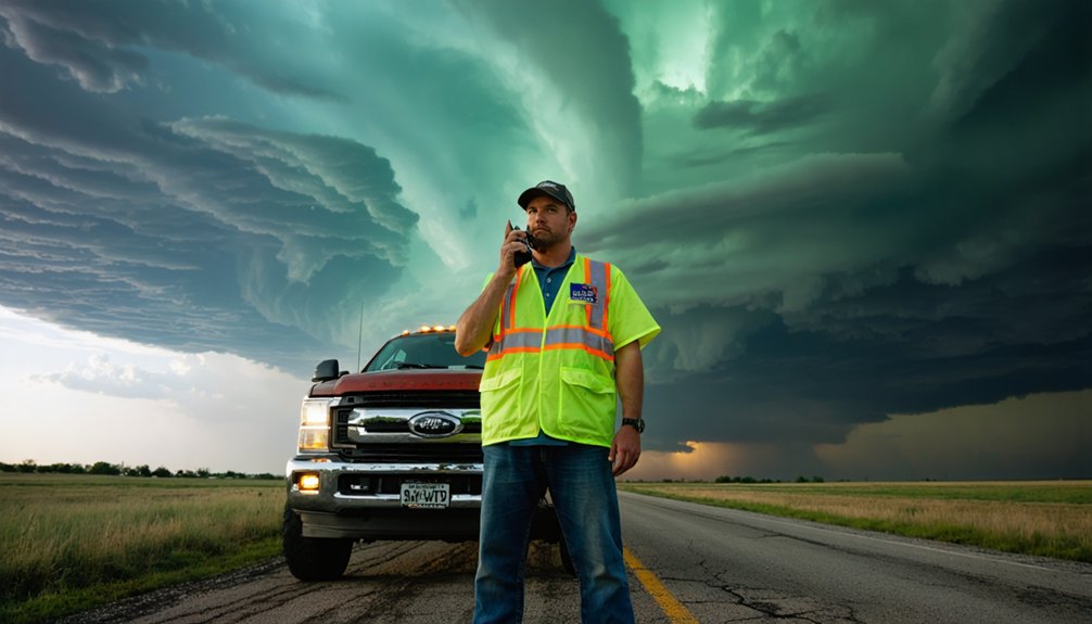
A Net Control Station coordinates your reports, delivers weather updates, and deploys you to strategic lookout positions.
Your training opportunities come through NOAA’s annual classes hosted by local Weather Forecast Offices.
These structured sessions sharpen your identification of hazardous weather signatures, making your ground-level observations genuinely valuable.
You’re not just watching storms — you’re filling critical data gaps that protect lives.
Spotter Network: Track Your Real-Time Position in the Field
When you’re deployed in the field, Spotter Network’s real-time position reporting tracks your location through cellular, Wi-Fi, GPS, and APRS, logging your movements alongside thousands of other spotters across the U.S.
You can access the platform from a Windows agent, smartphone, laptop, or tablet, making it easy to stay connected regardless of your equipment setup.
On the network’s display, you’ll appear as a green dot when active and a red dot when inactive, giving Net Control Stations and WFOs an immediate visual of who’s operational in the field.
Real-Time Position Reporting
Tracking your real-time position in the field is essential for coordinating with NWS Weather Forecast Offices and Emergency Management Agencies.
Spotter Network delivers real-time tracking through cellular, Wi-Fi, GPS, and APRS technologies, ensuring position accuracy across diverse field conditions. The platform has logged over 18 million position reports, establishing extensive U.S. spatial coverage.
You can access the system via Windows agent, smartphones, laptops, or tablets, giving you operational flexibility wherever you deploy.
Active members appear as green dots; inactive members appear as red dots, letting coordinators assess field coverage instantly.
The subgroup feature creates private feeds for WFOs, SKYWARN chapters, and EMAs, keeping your data secure and mission-specific.
Real-time tracking through Spotter Network keeps you accountable, visible, and operationally effective during critical weather events.
Multi-Device Platform Access
Spotter Network supports four access points — Windows agent, smartphones, laptops, and tablets — so you can maintain operational continuity regardless of your field setup. This multi-device accessibility eliminates platform dependency, letting you switch between devices without disrupting your position feed.
Whether you’re running a Windows agent at base or monitoring via smartphone in the field, seamless integration keeps your data consistent across every endpoint.
Active members appear as green dots; inactive members display as red dots. You’ll immediately identify who’s operational and where.
The subgroup feature extends this capability further, creating private feeds for WFOs, SKYWARN chapters, and EMAs. With over 18 million logged position reports, Spotter Network delivers proven spatial coverage — giving you reliable situational awareness across every device you deploy.
Active And Inactive Spotters
Visual clarity drives operational decisions — green dots mark active spotters, red dots mark inactive ones, giving you an immediate read on who’s deployed and where. This color-coded system eliminates guesswork, letting you assess field coverage instantly without contacting individual operators.
Active spotters appear in real time as green dots across the map interface, confirming their position is transmitting through cellular, Wi-Fi, GPS, or APRS. Inactive spotters shift to red, signaling they’ve gone offline or stopped reporting — a critical distinction when coordinating coverage during fast-moving severe weather events.
You’re not flying blind in the field. Spotter Network’s visual layer tells you exactly where human eyes are watching and where gaps exist, empowering smarter deployment decisions when conditions deteriorate and every position counts.
Free NWS Training Programs That Certify Storm Spotters
Whether you’re chasing your first storm or simply want to contribute meaningful data to meteorologists, NOAA’s free SKYWARN training program certifies you as an official storm spotter through local Weather Forecast Offices.
The certification process involves annual classes covering NWS operations, regional severe weather climatology, thunderstorm structure, and field reporting techniques. Training benefits extend beyond credentials — you’ll identify wall clouds, funnel clouds, tornadoes, and flash flooding events that radar and satellites can’t always detect.
SKYWARN certification trains you to spot what radar misses — wall clouds, tornadoes, and flash floods hiding in plain sight.
NWS offices in Amarillo, Pittsburgh, and beyond offer structured multi-part courses, some available online with thousands of verified completions. Once certified, you’ll fill critical observational gaps, directly supporting meteorologists with ground-truth data.
Your independent reporting strengthens the nationwide network of approximately 300,000 active spotters already protecting communities across the country.
How EMWIN Delivers Real-Time NWS Alerts Directly to Spotters
Once you’re certified and positioned in the field, staying informed about rapidly evolving weather conditions becomes just as critical as your observational skills. EMWIN technology strengthens NWS collaboration by delivering real-time updates directly to spotters through reliable alert dissemination channels.
- Receives NWS warnings and observations via GOES satellites
- Rebroadcasts processed data over VHF for mobile and fixed spotter access
- Monitors NOAA Weather Radio for continuous radar and meteorological data accuracy
- Supports emergency preparedness through point and mobile spotter communication channels
- Enables spotter engagement by coordinating non-amateur radio network liaisons with NWS
You’re not dependent on a single data stream. EMWIN’s multi-layered infrastructure guarantees you maintain situational awareness independently, reinforcing your operational freedom while keeping your reporting precise and actionable during critical weather events.
Amateur Radio Networks That Connect Spotters to Local WFOs

When you join SKYWARN, you’ll operate through amateur radio repeaters that extend 30 miles or more from their sites, linking you directly to your local Weather Forecast Office.
A Net Control Station manages each activation by polling operators, relaying weather updates, and dispatching you to designated lookout positions.
You’ll report critical hazards—tornadoes, wall clouds, funnel clouds, hail, and flash flooding—filling the gaps that radar and satellite data can’t always capture.
SKYWARN Repeater Network Basics
SKYWARN’s backbone relies on amateur radio repeaters, which typically extend coverage 30 miles or more from their tower sites.
These repeater coverage zones let you communicate directly with Net Control during active weather events using established communication protocols.
Net Control manages the network by:
- Polling operators systematically across the coverage area
- Providing real-time weather updates to active spotters
- Dispatching spotters to designated lookout positions
- Coordinating reports of tornadoes, wall clouds, and hail
- Relaying flash flood observations to your local WFO
You’ll need a licensed amateur radio operator credential to participate fully.
NOAA’s local Weather Forecast Offices offer annual training classes to get you qualified.
Spotters using this network fill critical data gaps that radar and satellites can’t capture independently.
Net Control Station Roles
At the center of every SKYWARN net sits the Net Control Station (NCS), the operator who keeps field spotters connected to your local Weather Forecast Office. Net Control Functions include polling operators systematically, broadcasting weather updates, and dispatching spotters to specific lookout positions.
You’ll find the NCS managing radio traffic to prevent transmission collisions and ensuring critical spotter reports reach meteorologists without delay.
Communication Protocols govern every exchange — spotters check in when prompted, transmit concise structured reports, and stand by until released. The NCS filters incoming data, prioritizes urgent reports, and relays actionable intelligence directly to WFO forecasters.
Understanding these protocols before you operate means you’ll transmit efficiently, avoid cluttering the frequency, and deliver the precise ground-truth observations that radar simply can’t provide.
Spotter Reporting Protocols
Structured reporting protocols transform raw field observations into actionable intelligence that WFO meteorologists can immediately apply to active warnings.
You’ll follow standardized communication protocols to maintain reporting accuracy and operational efficiency across the network.
Key reporting elements include:
- Location first: Provide GPS coordinates or landmarks before describing weather phenomena
- Time-stamp observations: Report exact times for tornado touchdowns, hail events, and wall cloud formations
- Use standardized terminology: Distinguish between funnel clouds, wall clouds, and confirmed tornadoes
- Quantify measurements: Estimate hail diameter using reference objects like coins or golf balls
- Relay flash flood indicators: Report water depth, flow velocity, and affected roadways immediately
Net Control Station validates your transmissions, ensuring meteorologists receive clean, reliable data supporting real-time warning decisions.
Which Storm Spotting Network Fits Your Location, Gear, and Goals?

Choosing the right storm spotting network depends on three practical factors: your geographic location, available equipment, and operational goals.
If you’re in a rural area with amateur radio licensing, SKYWARN’s repeater-based structure gives you reliable 30-mile coverage and direct NWS coordination.
Urban spotters with smartphones and internet access should prioritize Spotter Network, which integrates cellular, Wi-Fi, and GPS for real-time position reporting.
Check your local resources first — your nearest Weather Forecast Office hosts annual SKYWARN training and identifies active regional chapters.
For gear recommendations, entry-level spotters need a GPS-enabled device and a NOAA Weather Radio receiver at minimum.
Emergency managers without amateur licenses can access EMWIN through satellite feeds.
Match your infrastructure to network requirements, and you’ll operate effectively from day one.
Frequently Asked Questions
Can Storm Spotters Volunteer Without Owning Specialized Weather-Monitoring Equipment?
Yes, you can volunteer without specialized equipment. SKYWARN’s training resources equip you with observational skills, and your community involvement as a spotter relies on your eyes, judgment, and reporting—not costly monitoring gear.
How Young Can Someone Be to Become a Certified Storm Spotter?
“You’re never too young to start!” NOAA doesn’t set a strict minimum age for youth training, but you’ll typically need parental consent during the certification process. Contact your local Weather Forecast Office directly for specific requirements.
Do Storm Spotters Receive Any Compensation or Insurance During Active Deployments?
You don’t receive compensation or insurance options as a storm spotter—it’s purely voluntary. You’re responsible for your own coverage and safety during active deployments, so review your personal compensation details and policy before heading out.
Can International Spotters Outside the United States Join SKYWARN Networks?
Coincidentally, SKYWARN’s international collaboration opportunities are limited, as it’s a U.S.-based NWS program. You can still access storm spotting training resources and engage with community engagement efforts, but formal membership requires domestic U.S. participation.
How Many Hours per Year Must Spotters Commit to Maintain Active Certification?
The available knowledge doesn’t specify an annual hour commitment for maintaining your storm spotting certification requirements. You’ll want to contact your local NWS Weather Forecast Office directly, as they manage SKYWARN training and any active status obligations.
References
- http://www.caps.ou.edu/~kbrews/spothelp.html
- https://www.youtube.com/watch?v=5z0cJaNKDtE
- https://www.weather.gov/media/bis/Weather_Spotter_Field_Guide.pdf
- https://www.arrl.org/shop/files/pdfs/Storm Spotting intro copy.pdf
- https://ams.confex.com/ams/92Annual/webprogram/Manuscript/Paper202392/AMS2012_StormSpotter.pdf
- https://www.weather.gov/media/grr/brochures/nwsbasicspottersfieldguide.pdf
- https://www.spotternetwork.org/now_what.php
- https://www.youtube.com/watch?v=6kQhrih06ww
- https://www.youtube.com/playlist?list=PLhzMIjoK81fGyAj0gvvZYRjVHEJ9JNJne