We examine road networks for safe storm chasing by integrating data-driven analytics and real-time weather monitoring. We evaluate road surface materials to predict traction during adverse conditions, using GIS maps to visualize flood-prone zones. By leveraging traffic sensors and GPS data, we map potential bottlenecks and model traffic behavior. Our focus includes evaluating road infrastructure for durability and skid resistance, and using predictive modeling to forecast road obstructions. We also guarantee emergency services access and develop evacuation routes based on traffic density and road conditions. With these methodologies, you'll gain vital insights for safer storm chasing missions.
Key Points
- Utilize real-time traffic data to predict weather impacts on congestion and maintain safe storm chasing routes.
- Incorporate high-resolution radar and satellite imagery for accurate storm tracking and safe navigation.
- Employ GIS mapping to identify flood-prone areas and plan alternative paths.
- Analyze road surface quality and skid resistance to ensure vehicle traction during severe weather.
Understanding Road Conditions
To effectively pursue storms, we must first analyze the specific variables that influence road conditions, such as surface material, upkeep status, and weather impact. By examining these factors, we can optimize our routes and guarantee a smoother, safer pursuit.
Surface material affects traction, especially under adverse weather conditions. For instance, concrete might provide better grip compared to dirt roads during heavy rainfall. Moreover, understanding the upkeep status of roads helps us anticipate potential hazards like road damage or debris, which can hinder our progress or even cause accidents.
Weather predictions play a critical role in our analysis. Accurate weather forecasts enable us to anticipate changes that could worsen road conditions, such as flooding, ice formation, or fallen trees. Integrating real-time data on road congestion allows us to avoid traffic jams that could delay our pursuit or trap us in risky situations.
We rely on data analytics to create thorough road condition models. These models synthesize information on surface materials, maintenance records, and live weather updates. By leveraging such data, we can make informed decisions and maintain the flexibility to navigate through challenging environments efficiently and safely.
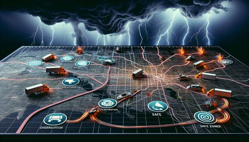
Mapping High-Risk Areas
We'll start by pinpointing flood-prone zones using historical data and topographic analysis.
Next, we'll evaluate road conditions by examining surface integrity and traffic patterns under storm conditions.
Identifying Flood-Prone Zones
By leveraging historical rainfall data and topographical maps, we can pinpoint flood-prone zones with high accuracy to guarantee safer routes for storm chasing. Our approach involves integrating flood risk assessments and advanced weather monitoring systems to offer a thorough analysis of potential hazards. This methodology enables us to anticipate areas where heavy rainfall may lead to flash floods, thereby enhancing our route planning.
In our analysis, we consider several critical factors:
- Historical Flood Data: We evaluate past flooding events to identify patterns and high-risk zones.
- Topographical Analysis: By examining elevation and land slope, we determine areas susceptible to water accumulation.
- Hydrological Models: Using these models, we predict how water will flow and accumulate during storms.
- Real-Time Weather Monitoring: Incorporating live data allows us to update flood risk assessments dynamically.
This data-driven, analytical approach grants us the freedom to chase storms with confidence, knowing we've mitigated the risks associated with flooding. By focusing on precise, real-time data, we can navigate the unpredictable nature of storm chasing safely and effectively.
Evaluating Road Conditions
Evaluating road conditions involves appraising pavement integrity, traffic patterns, and potential obstructions to map high-risk areas accurately. We need to analyze multiple data sources to understand how road maintenance impacts our route selection.
Poorly maintained roads can significantly increase the risk of accidents, especially during severe weather events. Therefore, a thorough hazard assessment is essential.
First, we collect and review data on pavement conditions using sensors and visual inspections. Cracks, potholes, and erosion can all compromise road safety. We prioritize areas with frequent road maintenance issues, as these indicate recurring problems that could escalate under storm conditions.
Next, we examine traffic patterns to identify potential bottlenecks and high-traffic zones. Traffic congestion can hinder our mobility and limit escape routes in emergencies. By integrating real-time traffic data, we can dynamically adjust our paths to avoid these risks.
Lastly, we assess potential obstructions such as construction zones, fallen trees, and debris. These elements can abruptly block roads, trapping vehicles. We map these high-risk areas using GIS technology, allowing us to visualize and anticipate hazards effectively.
Assessing Emergency Services Access
Evaluating emergency services access involves identifying and mapping high-risk areas where response times could be critically delayed due to road conditions or obstructions. By leveraging geospatial data and advanced analytics, we can pinpoint regions where emergency response might be compromised, making sure that storm chasers have a clear understanding of service availability.
Our approach involves several key steps:
- Data Collection: Gathering real-time data on road conditions, traffic flow, and existing emergency service locations.
- Risk Mapping: Utilizing GIS (Geographic Information Systems) to visually represent high-risk areas where emergency response times are likely to be delayed.
- Service Availability Analysis: Evaluating the proximity of hospitals, fire stations, and police stations relative to potential storm paths.
- Predictive Modeling: Employing machine learning algorithms to predict areas where road obstructions could occur during storms.
Analyzing Traffic Patterns

Understanding traffic patterns is important for storm chasers to anticipate potential delays and optimize their routes during severe weather events. By analyzing real-time traffic data, we can predict how weather impacts and storm behavior affect road congestion and driver behavior.
For instance, heavy rainfall often leads to slower traffic speeds and increased accident rates, while high winds can cause road closures due to fallen debris.
We utilize data from traffic sensors, GPS devices, and social media updates to create a thorough traffic model. This model helps us identify bottleneck areas and predict traffic flow changes in response to severe weather. By integrating these insights with storm behavior patterns, we can make informed decisions to avoid high-risk areas and maintain mobility.
In addition, understanding peak traffic times and common routes used by local residents allows us to plan alternative paths and reduce the likelihood of encountering gridlock. Traffic heat maps and historical traffic data provide essential inputs for this analysis, enabling us to stay ahead of potential delays.
Our goal is to make sure that our routes remain clear and efficient, granting us the freedom to chase storms safely and effectively.
Assessing Road Infrastructure
When evaluating road infrastructure for storm chasing, we must focus on road surface quality and traffic flow patterns.
By analyzing pavement conditions and data on average traffic speeds and volumes, we can identify potential hazards and best routes.
This data-driven approach guarantees we make informed decisions to prioritize safety during severe weather events.
Road Surface Quality
Accurately evaluating road surface quality is necessary for ensuring safe and effective storm chasing, as it directly impacts vehicle traction and maneuverability. Pavement durability is an important factor; roads with a high durability rating tend to withstand severe weather impacts better, reducing the risks of potholes and cracks that can compromise safety.
We need to assess the road's ability to handle both the regular wear and tear and the extreme conditions that storms bring.
To make our evaluations thorough, we consider several key metrics:
- Surface Roughness: Determines how smooth or bumpy the ride will be, affecting vehicle control.
- Skid Resistance: Measures the road's ability to prevent skidding, essential during wet conditions.
- Pavement Distress: Identifies visible damage such as cracks and potholes, indicators of underlying issues.
- Material Composition: Assesses the quality and type of materials used, influencing durability and weather resistance.
Traffic Flow Patterns
Analyzing traffic flow patterns is crucial for evaluating road infrastructure, as it helps us identify potential bottlenecks and optimize routes for safe storm chasing. By examining real-time traffic data, we can determine how weather impact alters traffic density and flow. High-resolution traffic sensors provide critical data on vehicle speeds and congestion levels, allowing us to predict how roads will behave under various storm conditions.
We need to take into account not only typical traffic patterns but also how storm behavior influences driver decisions. Sudden weather events often lead to erratic driving, increased accidents, and road closures, which can disrupt our planned routes to a great extent. To mitigate these risks, we utilize predictive modeling techniques that consider historical traffic data and current weather forecasts.
Traffic simulations offer valuable insights into how road networks respond to different storm scenarios. For example, heavy rainfall might reduce road capacity by up to 30%, while high winds can lead to lane obstructions from debris. By integrating these factors into our route planning algorithms, we can dynamically adjust our paths to avoid congested areas and maintain safe distances from severe weather zones.
This data-driven approach ensures we uphold the freedom to navigate efficiently and safely.
Emergency Evacuation Routes
Effective emergency evacuation routes are crucial for ensuring the safety of storm chasers during severe weather events. To achieve this, we must conduct a thorough examination of the road network. Our focus should be on identifying alternative routes and evaluating shelter availability. By doing so, we can create a strong evacuation plan that maximizes safety and minimizes risks.
When devising these routes, several factors should be considered:
- Traffic density: High-traffic areas can slow down evacuation efforts. We should prioritize routes with lower traffic volumes.
- Road conditions: Assessing the quality and durability of roads guarantees they remain passable even under adverse weather conditions.
- Proximity to shelters: Routes should lead to locations with confirmed shelter availability to ensure safety upon evacuation.
- Interconnectivity: Routes must offer multiple alternatives to avoid bottlenecks and provide flexibility if primary paths are blocked.
Identifying Safe Zones
While planning emergency evacuation routes, we must also identify safe zones where storm chasers can seek refuge during severe weather events. Our primary focus is on strategically locating storm shelters that are easily accessible from main road networks.
By analyzing geographic data, we can determine best locations for these shelters to ensure maximum coverage and minimal travel time during an emergency.
We'll utilize GIS mapping tools to overlay storm track data with existing road networks and population density metrics. This allows us to pinpoint areas with high vulnerability but low current shelter availability.
Additionally, integrating historical storm data helps us predict high-risk zones and plan accordingly.
Our evacuation plans should incorporate real-time data on shelter capacities and traffic flow. This way, storm chasers can make informed decisions quickly.
We'll also consider the structural integrity of potential safe zones. For instance, schools and municipal buildings often serve as suitable storm shelters due to their sturdy construction.
Monitoring Weather Systems

Leveraging advanced meteorological tools, we can continuously monitor weather systems to provide real-time updates necessary for safe storm chasing. By employing cutting-edge technology, we enhance our storm tracking and weather monitoring capabilities, allowing us to make data-driven decisions swiftly.
Our approach involves:
- High-Resolution Radar: Utilizes Doppler technology to track storm movements with precision, aiding in accurate risk assessment.
- Satellite Imagery: Provides detailed views of weather patterns, enabling us to predict storm paths and intensities.
- Mobile Weather Stations: These units offer on-the-go data collection, essential for real-time weather monitoring during chases.
- Severe Weather Alerts: Automated systems that deliver immediate warnings, aiding in proactive emergency response measures.
Frequently Asked Questions
What Equipment Do Storm Chasers Typically Use for Communication?
We typically use satellite phones and two-way radios for communication. Satellite phones guarantee connectivity in remote areas, while two-way radios provide reliable, real-time communication. These tools enhance our operational efficiency and safety during storm chasing.
How Can Local Authorities Assist Storm Chasers?
When the skies turn dramatic, local authorities can smooth our journey by ensuring road accessibility and swift emergency response. They should enhance storm tracking and communication strategies to keep us informed and safe while we chase freedom.
What Are the Legal Restrictions for Storm Chasing?
We need to understand legal restrictions and safety guidelines for storm chasing, which vary by region. Adherence guarantees our safety and avoids penalties. Data-driven awareness of local laws helps us balance freedom with responsibility.
How Do Storm Chasers Fund Their Expeditions?
How do we finance our storm chasing expeditions? We utilize diverse funding sources, including sponsorships from weather-related companies, crowdfunding campaigns, and donations from passionate supporters. This multifaceted approach guarantees financial stability and operational freedom.
What Training Is Required to Become a Storm Chaser?
To become storm chasers, we must undergo meteorology training, learn safety procedures, and master navigation skills. Emergency response knowledge is essential. This thorough training guarantees we can analyze data, make informed decisions, and safely pursue our passion.