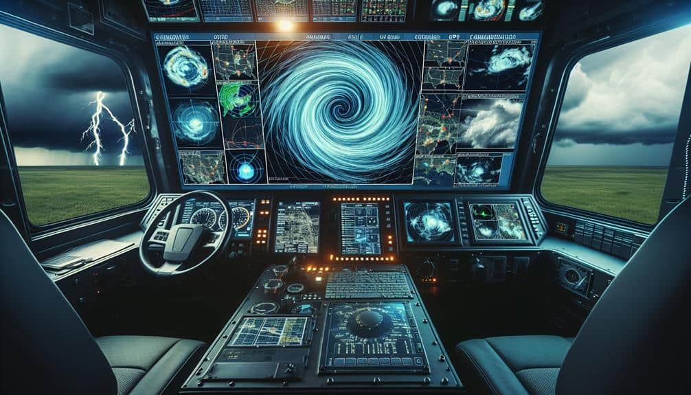
We're advancing storm prediction techniques for storm chasers using cutting-edge tools. Dual-polarization radar and Doppler radar provide critical data on precipitation and wind velocity. Satellite imagery offers high-resolution, real-time insights into storm evolution. Machine learning models analyze historical and real-time data to enhance forecast accuracy. We rely on ground-based sensors, weather balloons, and drones for thorough atmospheric profiling. Integrating these diverse data sources allows for precise storm tracking. With continuous data updates and advanced visualization, we achieve reliable forecasts essential for effective storm chasing. Explore the specifics of how these systems synergize to improve our predictive capabilities.
Key Points
- Dual-polarization radar: Enhances precipitation measurement and storm intensity prediction by providing detailed data on hydrometeors' shape, size, and composition.
- Satellite imagery: Tracks real-time storm evolution and atmospheric parameters, aiding in accurate forecasts and storm behavior understanding.
- Machine learning models: Analyze vast datasets to enhance storm prediction accuracy by recognizing severe weather precursors using historical data.
- Real-time data integration: Combines data from satellites, Doppler radar, and weather stations to refine storm predictions for reliable guidance.
Advanced Radar Systems
Advanced radar systems, leveraging dual-polarization technology, enable us to more accurately measure precipitation and predict storm intensity. This advancement enhances our storm interception strategies by providing detailed data on the shape, size, and composition of hydrometeors. Dual-polarization radar emits both horizontal and vertical pulses, allowing us to differentiate between rain, hail, and snow with greater precision.
Doppler radar advancements have revolutionized our ability to anticipate severe weather events. By analyzing the frequency shift in returned radar signals, we can determine the velocity and direction of wind within a storm. This information is essential for identifying mesocyclones and potential tornado formation. Combining Doppler radar data with dual-polarization capabilities, we gain a thorough view of storm dynamics, leading to more accurate and timely warnings.
Our storm interception strategies benefit immensely from these radar technologies. Real-time data allows us to track storm cells with high accuracy, optimizing our positioning to study and document severe weather phenomena. We can now deploy resources more effectively, minimizing risks and maximizing data collection.
This technological edge not only enhances our scientific understanding but also empowers us to pursue our passion for storm chasing with greater confidence and safety.
Satellite Imagery Analysis
While radar systems provide necessary ground-level insights, satellite imagery offers a thorough, top-down perspective on storm development and progression. By analyzing satellite data, we can observe large-scale weather patterns and cloud formations, which are essential for predicting storm trajectories and intensities. The high-resolution images allow us to track the evolution of storm systems in real-time, enhancing our ability to make timely and accurate forecasts.
Satellite imagery captures various atmospheric parameters, such as temperature, humidity, and wind speeds, across different altitudes. This data helps us identify key indicators of severe weather, like cumulonimbus clouds and mesoscale convective complexes. By examining these cloud formations, we can determine the potential for storm intensification and the likelihood of hazardous conditions.
Moreover, advancements in geostationary satellites provide continuous monitoring, offering a near-instantaneous view of storm dynamics. This real-time data is invaluable for storm chasers who require up-to-date information to make crucial decisions on the ground. By integrating satellite imagery with other meteorological tools, we gain a thorough understanding of storm behavior, empowering us to navigate and anticipate extreme weather with greater precision.
Machine Learning Models
Machine learning models enable us to analyze vast datasets, uncovering complex patterns that enhance storm prediction accuracy. By leveraging these models, we can process an immense volume of meteorological data more efficiently than traditional methods. One crucial aspect is data labeling accuracy; precise tagging ensures that our models learn from high-quality inputs, minimizing errors in storm forecasts.
We focus on model training efficiency, optimizing our algorithms to interpret data swiftly and accurately. Efficient training processes are essential, as they allow us to update models frequently with new data, reflecting the latest atmospheric conditions. This adaptability is vital for storm chasers seeking real-time, reliable information.
Utilizing supervised learning, we train our models on historical storm data, teaching them to recognize the precursors of severe weather events. By incorporating unsupervised learning techniques, we can also identify previously unnoticed patterns, further refining our predictive capabilities.
As we integrate diverse data sources, from radar to satellite imagery, our models become more robust, leading to more accurate storm predictions. Ultimately, these advancements empower us to make more informed decisions, enhancing our freedom to anticipate and respond to severe weather phenomena effectively.
Atmospheric Data Collection
To enhance our storm prediction models, we rely on extensive atmospheric data collection from a variety of sources, including ground-based sensors, weather balloons, and satellite instruments. These tools provide us with essential insights into atmospheric conditions that are necessary for accurate forecasting.
Weather Balloon Launches: By deploying weather balloons, we gather data on temperature, humidity, pressure, and wind speed at various altitudes. This vertical profile is important for understanding storm dynamics and helps us refine our models through precise data analysis.
Drones for Aerial Observations: Utilizing drones allows us to capture high-resolution, real-time data from altitudes and locations that are otherwise inaccessible. These devices can fly into the heart of a storm, collecting valuable information on wind patterns, precipitation rates, and other meteorological variables.
Ground-Based Sensors: These sensors provide continuous monitoring of atmospheric conditions at fixed locations. They offer granular data on surface conditions, which is essential for tracking storms as they develop and move.
Real-Time Data Integration
Integrating real-time data from various atmospheric sources allows us to enhance the accuracy and timeliness of our storm prediction models. By harnessing data from satellites, Doppler radar, and weather stations, we can feed a continuous stream of information into our predictive modeling strategies. This integration empowers us to identify storm patterns more rapidly and with greater precision.
We employ advanced data visualization techniques to interpret the influx of data. These techniques convert raw data into graphical representations, making complex atmospheric conditions immediately comprehensible. For instance, heatmaps can highlight areas of high precipitation, while vector fields indicate wind velocity and direction. Such visual tools are essential for storm chasers, offering them the freedom to make quick, informed decisions in the field.
Our predictive modeling strategies leverage machine learning algorithms trained on historical storm data. These models can forecast the development, path, and intensity of storms with impressive accuracy. By continuously updating these models with real-time data, we refine our predictions, offering storm chasers a reliable guide.
The synergy of real-time data integration and predictive modeling not only enhances our forecasting capabilities but also guarantees that we stay one step ahead of nature's most formidable phenomena.
Frequently Asked Questions
How Can Storm Chasers Ensure Their Safety During Severe Weather Events?
We can secure our safety during severe weather events by maintaining our vehicles, planning escape routes, identifying emergency shelters, and using reliable communication devices. These steps maximize our freedom while minimizing risks in unpredictable conditions.
What Gear Is Essential for Storm Chasers to Carry?
When discussing essential gear, we should prioritize emergency supplies and communication devices. Reliable data-driven tools like weather radios, GPS units, first aid kits, and backup power sources guarantee we stay safe and connected while storm chasing.
How Do Storm Chasers Collaborate With Local Weather Services?
We use collaboration strategies with local weather services, sharing real-time data and field observations to enhance forecast accuracy. By integrating our findings with their models, we enhance predictive capabilities, ensuring both safety and freedom for all.
What Are the Ethical Considerations for Storm Chasers?
When we chase storms, we face ethical dilemmas like ensuring public safety while pursuing our passion. We must prioritize safety precautions, adhering to scientific protocols, to balance our freedom with the responsibility of protecting lives and property.
We share our findings with the public through social media for immediate public awareness and community engagement. We utilize data sharing platforms to distribute scientific data, ensuring transparency and empowering communities with real-time storm updates.


