You’ll recognize a fair-weather waterspout by its upward spiral from the water surface—a formation sequence that defies every tornado-chasing instinct you’ve developed on land. These vortices develop beneath cumulus congestus towers when sea surface temperatures exceed 850 hPa levels by 13°C or more, generating EF0 winds below 67 mph through their hollow funnels. Unlike their tornadic counterparts descending from mesocyclones, fair-weather varieties last under 20 minutes and demand different risk calculations when you’re exposed on open water. Master the Szilagyi Waterspout Index and vertical profile analysis to transform raw observations into scientifically valuable datasets.
Key Takeaways
- Fair-weather waterspouts form upward from water surfaces under cumulus clouds, lasting under 20 minutes with winds below 67 mph.
- Waterspouts progress through dark spot, spray ring, mature vortex, and decay stages, moving at 10-15 knots for 2-20 minutes.
- Great Lakes observations reveal waterspouts materialize without warning, generating thirty-five-knot winds while remaining relatively stationary during encounters.
- Forecasting uses the Szilagyi Index, 13°C temperature differential thresholds, and 850 hPa wind parameters below 20 m/s.
- Doppler radar detects velocity couplets while ICWR coordinates global documentation through data-sharing platforms and worldwide monitoring networks.
Understanding the Different Types of Waterspouts
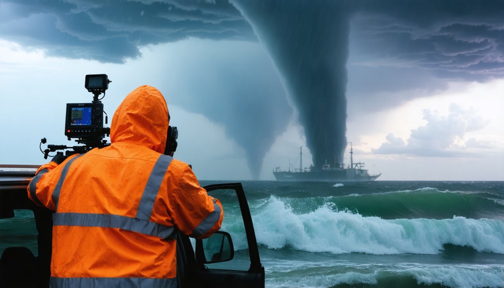
When you encounter a funnel extending from cloud to water, identifying whether you’re observing a fair-weather or tornadic waterspout determines your immediate risk assessment. Fair-weather types develop upward from the surface under cumulus congestus towers, lasting under 20 minutes with EF0 winds below 67 mph. They’re born from uneven heating and low-level convergence, not severe convection.
Tornadic waterspouts descend from mesocyclone rotation within cumulonimbus systems, matching the tornado lifecycle characteristics you’d see overland. These exceed 100 meters diameter, generate severe weather conditions, and appear on radar signatures. Satellite monitoring helps track both types, though fair-weather variants form rapidly in calm conditions while tornadic versions demand immediate severe thunderstorm protocols.
Understanding this distinction isn’t academic—it’s survival intelligence for independent marine operations.
The Five Stages of Waterspout Formation
Fair-weather waterspouts follow a predictable developmental sequence that you’ll recognize once you’ve witnessed the pattern. You’ll first spot a circular light disk on the water—the dark spot stage—marking vortex initiation beneath developing cumulus.
The first sign you’ll notice is a circular light disk on the water’s surface—the dark spot stage marking vortex formation.
Next, spiral patterns emerge as rotating air concentrates through pirouette effect. The spray ring stage follows, with dense sea spray swirling as moist air condenses into a visible funnel.
During the mature vortex phase, you’ll observe a hollow funnel extending from surface to cloud, lasting 2-20 minutes while moving at 10-15 knots. Understanding factors influencing waterspout duration—warm water temperature, light winds, atmospheric instability—helps you predict behavior.
Finally, decay occurs as warm air inflow weakens. Unlike the connection between waterspout and land-based tornado, fair-weather types rarely threaten shorelines.
My First Encounter With a Great Lakes Waterspout
Although I’d tracked hundreds of tornadoes across the Plains, nothing prepared me for the eerie stillness preceding my first Great Lakes waterspout. Lake Erie’s surface temperature exceeded the Canadian air mass by fifteen degrees—textbook conditions.
You’ll recognize the setup: puffy cumulus clouds, high humidity, winds barely registering on your anemometer.
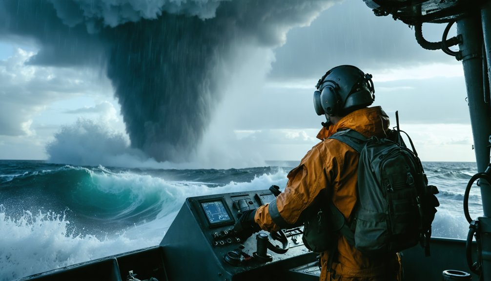
The dark spot materialized without warning, spiraling upward from the water surface rather than descending like the tornadoes dominating my storm chasing experiences. Within minutes, the condensation funnel connected water to cloud base, generating thirty-five-knot winds at the spray vortex.
These on water encounters demand different risk calculations—no shelter exists, escape routes vanish, and the waterspout’s stationary behavior becomes your greatest tactical advantage for safe observation.
Essential Forecasting Parameters Every Chaser Should Know
Zeroing in on the right atmospheric parameters separates productive waterspout chases from wasted fuel and missed opportunities. Master vertical profile analysis by calculating the sea surface temperature minus 850 hPa temperature difference—you’ll need at least 13°C for favorable conditions.
Temperature differential mastery isn’t optional—nail that 13°C threshold between sea surface and 850 hPa or stay home.
The Szilagyi Waterspout Index quantifies your odds using convective cloud depth (equilibrium level minus lifting condensation level) plotted against temperature differential. When SWI reaches zero or higher, you’re hunting in prime territory.
Instability parameter calculations demand checking 850 hPa winds stay below 20 m/s; excessive shear kills vortex formation. Don’t chase precipitation-contaminated environments—rain-cooled air destroys the delicate thermal balance.
Statistical models from Key West soundings provide your baseline, but autonomous meteorological interpretation beats algorithmic dependency every time.
Documenting 60+ Waterspouts Across Erie, Huron, and Ontario
When you’re logging waterspout encounters across multiple Great Lakes basins, meticulous documentation transforms raw observations into scientifically valuable datasets. Your storm spotter training becomes critical when recording simultaneous waterspouts—like the two concurrent EF0 events south of Featherstone on August 1st at 42.75N coordinates.
NOAA data visualization platforms integrate these reports, establishing patterns across Erie, Huron, and Ontario’s Canadian waters.
You’ll contribute to benchmark records like October 7’s extraordinary 181 waterspouts on Erie alone. The four confirmed August events near Brighton, Providence Bay, and Featherstone demonstrate how witness photography validates preliminary classifications.
When documenting 60+ encounters, you’re capturing precise coordinates, timestamps, and environmental conditions that define fair-weather waterspout climatology. Each geotagged observation expands the International Centre for Waterspout Research’s understanding of Great Lakes meteorological phenomena.
Advanced Research Tools: From Doppler Radar to Trailing Wire Probes
As you move from visual documentation to quantitative analysis, Doppler radar technology becomes your primary tool for detecting waterspout precursors before they manifest. Storm-relative velocity products reveal rotation signatures kilometers above the surface, while reflectivity imagery tracks cell initiation and rapid development patterns.
You’ll leverage the combine-up technique filtering lowest reflectivity levels to identify boundaries where waterspouts preferentially form. Real time detection methods include monitoring adjacent outbound and inbound velocity couplets indicating cyclonic rotation. Operational forecasting challenges emerge when rotation signatures appear without visible funnels—the radar shows capability, not certainty.
You’ll deploy mobile Doppler units positioned strategically near developing storms, while dual-Doppler analysis from paired radars maps three-dimensional storm structure. These systems provide quantitative measurements essential for understanding atmospheric processes driving waterspout genesis.
Collaborating With the International Centre for Waterspout Research
Where does your documented waterspout observation contribute to global understanding of these phenomena? Your field data feeds directly into ICWR’s worldwide monitoring network at www.icwr.ca, where international research partnerships aggregate reports into their interactive dashboard tracking both total events and waterspout days.
You’ll submit sightings through their YouTube channel or Facebook page at InternationalCentre, marking locations that appear in red for recent activity, blue for historical records. These data sharing initiatives power their forecasting methodology—combining your ground truth with their waterspout potential index and low-level convergence analysis.
The organization’s color-coded maps (yellow for potential, red for likely occurrence) benefit directly from your field observations, creating three-hour timestep forecasts that inform the global storm-chasing community while advancing meteorological science.
Identifying Hotspots Through Pattern Recognition and Climatology Data
Your success in contributing observations to ICWR depends on positioning yourself where waterspouts actually form. You’ll leverage atmospheric reanalysis models like ERA5 to identify favorable synoptic weather patterns before deployment. Machine learning applications now predict conditions with increasing accuracy across known hotspots.
Target these proven locations based on climatology data:
- Great Lakes – August through October when cold air masses overspread warm waters, creating critical temperature differentials
- Florida Keys – Year-round activity over tropical waters with both fair weather and tornadic varieties
- Southern Aegean Sea – Sea surface temperature gradients beneath ideal cumulus formations
You’re analyzing cumulus outflows in real-time, as vortex generation occurs within four minutes of convergence initiation. Wind speed, moisture levels, and temperature differences guide your positioning decisions for exemplary documentation opportunities.
Measuring the Power: Wind Speeds Reaching 80-90 M/S
How do you quantify the rotational intensity of a waterspout when standing at the observation threshold? You’ll face significant challenges with accurate measurement—most waterspouts exhibit winds between 18-67 m/s, yet documentation claiming 80-90 m/s (179-201 mph) surpasses verified records.
Understanding wind speed conversion factors becomes critical: 80 m/s equals 288 km/h or 155 knots, placing it firmly in EF2-EF3 tornado territory. Fair-weather waterspouts rarely exceed 36 m/s, while tornadic variants top out around 67 m/s in documented cases.
You’re operating in measurement uncertainty—no aircraft photography or radiosonde data reliably captures peak rotational speeds. When direct instrumentation fails, you’ll rely on visual Beaufort estimates and spray vortex propagation rates, accepting that extreme claims require extraordinary evidence you can’t yet obtain.
Frequently Asked Questions
What Safety Precautions Should Storm Chasers Take When Approaching Waterspouts?
You’ll maintain safe distance by moving at 90-degree angles to the waterspout’s path. Monitor weather conditions continuously through NOAA radio and visual cues like rotating wall clouds. Never core-punch through precipitation or approach closer—your freedom depends on smart positioning.
How Do You Transport and Maintain Equipment During Waterspout Chasing Expeditions?
You’ll anchor success through portable equipment storage in waterproof cases and durable camera mounts resisting salt spray. Regular maintenance—cleaning contacts, testing batteries, inspecting seals—keeps your gear battle-ready when freedom meets the water’s fury.
What Insurance or Permits Are Required for Professional Waterspout Storm Chasing?
You’ll need extensive liability insurance coverage protecting against property damage and injury claims, plus local storm chasing permits when operating in restricted coastal zones. Check maritime authorities’ requirements, as regulations vary considerably between jurisdictions and weather conditions.
How Do You Fund Your Waterspout Research and Storm Chasing Activities?
You’ll fund operations through equipment sponsorships from weather tech companies and crowdsourcing initiatives like Patreon subscriptions. However, you’re facing significant financial risks—six-figure investments rarely break even, and piracy threatens 95% of potential revenue streams.
What Career Path Led You to Become a Professional Waterspout Chaser?
Your childhood fascination with rotating columns sparked pursuit of meteorology degrees—bachelor’s then master’s in atmospheric sciences. You’ve built expertise through SKYWARN certification, field experience, and mastering radar interpretation while maintaining risk-aware protocols during marine storm intercepts.


