We combine atmospheric analysis and storm chasers' on-ground insights to predict severe weather events with precision. By monitoring atmospheric pressure, wind patterns, and temperature variations, we identify signals of impending storms. Humidity levels and moisture content play vital roles in storm formation, including tornadoes. Utilizing radar and satellite data, we gain real-time insights and leverage machine learning for dynamic predictive modeling. Storm chasers offer crucial, real-time ground data, enhancing our analytical capabilities. Interpreting cloud formations also helps refine our forecasts. Our integrated approach guarantees accurate predictions and if you stick with us, you'll uncover how we achieve this precision.
Key Points
- Atmospheric pressure changes can indicate developing wind patterns and potential storm systems.
- Wind pattern analysis by storm chasers helps identify early signs of severe weather onset.
- Temperature and humidity variations are crucial in predicting storm formation and intensity.
- Real-time radar and satellite data provide accurate tracking of thunderstorms and possible tornado developments.
Role of Atmospheric Pressure
Atmospheric pressure plays an essential role in weather prediction because it influences wind patterns and storm development. When we analyze pressure systems, we gain valuable insights into how weather behaves. High-pressure systems typically bring clear skies and calm conditions, while low-pressure systems are often associated with clouds, precipitation, and storms. Understanding these pressure systems allows us to improve forecasting accuracy, giving us the ability to predict severe weather events more reliably.
By meticulously monitoring changes in atmospheric pressure, we can detect the early signs of storm formation. For instance, a rapid drop in pressure usually signifies an approaching storm, prompting us to issue timely warnings. This data is vital for those who value their freedom, as it empowers us to make informed decisions about travel, outdoor activities, and safety precautions.
Moreover, advancements in technology, such as satellite imagery and ground-based sensors, have greatly enhanced our ability to measure and interpret atmospheric pressure. These technological tools help us refine our models and predictions, leading to greater precision in weather forecasting. By focusing on pressure systems, we not only enhance our understanding of atmospheric dynamics but also improve our ability to predict and respond to severe weather conditions.
Analyzing Wind Patterns
Analyzing wind patterns allows us to identify essential changes in atmospheric conditions that can signal the onset of severe weather. By closely monitoring wind speed and direction, we can detect shifts that may indicate the formation of storms.
For instance, sudden changes in wind direction at different altitudes often point to wind shear, a key ingredient in tornado development.
We also examine frontal boundaries, which are zones separating different air masses. When warm, moist air collides with cooler, denser air, the interaction can create thunderstorms. Our analysis of wind patterns near these boundaries helps us predict where severe weather is likely to develop.
Jet streams, the fast-flowing air currents high in the atmosphere, play an important role in storm formation. By tracking the position and strength of jet streams, we can anticipate areas of increased atmospheric instability. Strong jet streams can enhance uplift and provide the necessary momentum for storm systems to intensify.
Through precise analysis of wind speed, direction, and their interaction with frontal boundaries and jet streams, we gain valuable insights. This enables us to forecast severe weather more accurately, helping us stay prepared and maintain our freedom to navigate the elements.
Temperature Variations and Storms
Temperature variations play a critical role in the development and intensity of storms. When we analyze atmospheric conditions, we focus on temperature gradients, as they're key to storm formation. A significant difference between warm and cold air masses can create instability, leading to the development of severe weather systems.
To better understand this, let's break it down:
- Temperature Gradients: Sharp temperature differences between two air masses can enhance storm formation. The greater the gradient, the more potential energy is available.
- Heat Exchange: As warm and cold air interact, heat exchange occurs, influencing storm intensity. Rapid heat transfer can lead to stronger updrafts, fueling storm development.
- Vertical Temperature Profiles: Changes in temperature with altitude can affect storm dynamics. For instance, a steep lapse rate (rapid temperature decrease with height) can signify a highly unstable atmosphere conducive to severe storms.
Humidity and Severe Weather
Let's examine how humidity influences severe weather patterns.
We'll focus on humidity's role in storm formation.
The relationship between moisture levels and tornado occurrences is another key aspect to consider.
Moreover, the significance of the dew point in predicting extreme weather cannot be overlooked.
Understanding these factors is vital for accurate atmospheric analysis and forecasting.
Humidity's Role in Storms
Humidity plays an important role in the development and intensity of severe weather events. When we analyze atmospheric conditions, we notice that elevated humidity levels are often a precursor to storm development. High humidity means there's more moisture in the air, which can fuel storms and make them more severe.
To understand how humidity impacts storm development, let's examine three key points:
- Energy Source: High humidity levels provide the necessary moisture that converts into latent heat when it condenses. This heat is vital for storm clouds to grow taller and stronger.
- Instability: Higher humidity contributes to atmospheric instability. When warm, moist air rises and meets cooler air aloft, it creates an environment ripe for severe weather.
- Severe Weather Detection: Monitoring humidity levels helps us predict potential severe weather. Elevated moisture content in the atmosphere can indicate the likelihood of thunderstorms, heavy rainfall, or even hurricanes.
Moisture Levels and Tornadoes
Examining the relationship between moisture levels and tornado formation, we find that high humidity greatly contributes to the development of these powerful weather phenomena. When the atmosphere is saturated with moisture, it enhances the buoyancy of rising air parcels, promoting the vigorous updrafts necessary for tornadoes.
Elevated moisture levels also influence precipitation patterns, intensifying rainfall rates and creating favorable conditions for supercell thunderstorms, which are often precursors to tornado formation.
Our storm chaser observations provide invaluable real-time data, confirming that areas with higher humidity are more prone to tornado genesis. By tracking dew points and relative humidity, storm chasers help refine weather forecasting models, allowing for more accurate predictions of tornado occurrences.
This real-world data, combined with advanced atmospheric analysis, strengthens our understanding of how moisture levels impact severe weather dynamics.
In weather forecasting, recognizing the critical role of moisture aids in anticipating tornado threats. Accurate measurement of humidity levels enables meteorologists to issue timely warnings, giving communities the freedom to prepare and respond effectively.
As we continue to study the intricate link between humidity and tornadoes, our ability to predict and mitigate the impacts of these extreme weather events will unquestionably improve.
Dew Point Significance
Dew point, a critical measure of atmospheric moisture content, plays a pivotal role in forecasting severe weather events. When we examine moisture levels, the dew point provides us with essential insights into potential weather patterns.
High dew points indicate substantial moisture in the air, which can fuel severe weather phenomena such as thunderstorms and tornadoes. Understanding dew point values allows us to predict when and where these events might occur.
To better comprehend the implications of dew point on severe weather, let's consider the following:
- Thunderstorm Development: High dew points contribute to the formation of thunderstorms by providing the necessary moisture for cloud formation and storm sustenance.
- Tornado Potential: Elevated dew points, particularly when coupled with other atmospheric conditions like wind shear and instability, can increase the likelihood of tornado formation.
- Heat Index: Dew point also affects the heat index, making it feel hotter than the actual temperature, which can exacerbate heat-related illnesses during severe weather conditions.
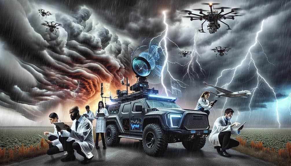
Radar and Satellite Data

Let's focus on how radar and satellite data enhance our ability to monitor weather in real time.
We can apply advanced data interpretation techniques to these data sources, enabling more accurate predictive modeling.
Real-Time Weather Monitoring
Real-time weather monitoring leverages advanced radar and satellite data to provide accurate and timely insights into atmospheric conditions. By employing satellite imagery, we can observe large-scale weather patterns and storm systems as they develop and move. This bird's-eye view enables us to track the formation and evolution of severe weather events, ensuring we stay a step ahead.
Lightning detection is another essential component of our real-time monitoring arsenal. By pinpointing lightning strikes, we can identify and anticipate the development of thunderstorms, which often precede more severe weather phenomena like tornadoes or hailstorms. Coupled with radar data, which provides detailed information on precipitation intensity and movement, we gain a thorough understanding of current weather conditions.
To make our weather monitoring more effective, we rely on:
- Satellite imagery: Offers a global perspective on weather systems.
- Lightning detection: Identifies and tracks thunderstorms.
- Radar data: Provides detailed insights into precipitation and storm movement.
Data Interpretation Techniques
As we gather real-time data, the ability to interpret radar and satellite information becomes crucial in predicting severe weather accurately. Radar data offers us insights into precipitation intensity, storm structure, and movement. By analyzing reflectivity values, we can pinpoint areas of heavy rainfall or hail.
Satellite data complements this by providing a broader view of cloud cover, temperature changes, and atmospheric moisture content. Together, these tools give us a thorough picture of the storm environment.
We rely heavily on statistical analysis to make sense of vast datasets. By applying algorithms to radar and satellite data, we identify patterns and anomalies indicative of severe weather. For instance, we can calculate the probability of tornadic activity based on specific radar signatures and historical data correlations.
Graphical representation is essential in translating complex data into actionable insights. Visual tools like contour maps and time-lapse animations enable us to track storm evolution dynamically. These graphical representations help us communicate critical information quickly and effectively to storm chasers and emergency services.
Interpreting radar and satellite data with precision allows us to make informed decisions, enhancing our ability to predict severe weather and protect communities.
Predictive Modeling Insights
How can we leverage predictive modeling to enhance the accuracy of severe weather forecasts using radar and satellite data?
By integrating machine learning applications with meteorological data, we can greatly enhance predictive accuracy. Advanced analytics allow us to process large volumes of radar and satellite imagery, identifying patterns that might elude human analysis.
To harness these capabilities, we can follow a structured approach:
- Data Collection: Utilize radar and satellite data to gather real-time meteorological data. This raw information forms the foundation for our predictive models.
- Model Training: Apply machine learning algorithms to train models on historical weather data. Advanced analytics can detect intricate patterns, enhancing the model's predictive accuracy.
- Real-Time Analysis: Implement these models to analyze incoming data continuously. This allows for dynamic adjustments and more precise forecasts.
Interpreting Cloud Formations
Interpreting cloud formations involves analyzing their shapes, altitudes, and patterns to gauge potential weather developments with precision. By scrutinizing these visual cues, we can enhance our storm prediction capabilities significantly. Recognizing specific cloud formations like cumulonimbus, which are often harbingers of severe weather, allows us to make timely and accurate forecasts. These towering clouds, with their distinct anvil-shaped tops, indicate strong updrafts and potential thunderstorms.
In atmospheric analysis, we examine not just cloud types but also their behavior and evolution over time. For instance, the presence of stratocumulus clouds can signify stable atmospheric conditions, whereas a sudden shift to more vertically developed clouds might warn us of impending severe weather. This dynamic understanding is important for effective severe weather forecasting.
Furthermore, we consider the altitude of cloud formations. High-altitude cirrus clouds, while generally benign, can sometimes indicate the approach of a warm front, leading to further atmospheric instability. By integrating these observations with other meteorological data, we refine our atmospheric analysis, offering a more detailed picture of potential weather threats.
Therefore, interpreting cloud formations is a crucial component in our toolkit for predicting and preparing for severe weather events.
Insights From Storm Chasers
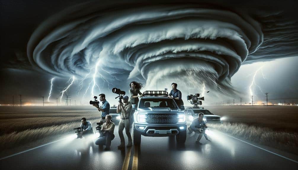
Storm chasers' firsthand observations provide invaluable data that enhances our understanding of severe weather patterns. When we're out chasing storms, we collect real-time information that aids meteorologists in refining weather predictions. This boots-on-the-ground data can be the difference between a timely warning and unforeseen disaster.
By documenting storm behavior, we gather insights that are vital for improving predictive models. While satellite data and radar offer broad overviews, our presence in the field allows for detailed observations of nuances often missed by remote sensing.
Here are three key contributions storm chasers make:
- Real-Time Data Collection: We capture live footage, wind speeds, and pressure changes, providing immediate updates that can be relayed to weather prediction centers.
- Ground-Truthing: Our measurements validate and sometimes correct satellite and radar data, ensuring the accuracy of weather predictions.
- Behavioral Patterns: Observing storm dynamics firsthand gives us unique perspectives on storm evolution, aiding in the development of more precise forecasting models.
Our commitment to chasing storms not only satisfies our quest for freedom and adventure but also plays an essential role in safeguarding communities. Through our efforts, we enhance the scientific understanding of severe weather, ultimately contributing to more reliable weather predictions.
Frequently Asked Questions
How Can the General Public Prepare for Severe Weather Warnings?
We should assemble emergency kits with essentials and create evacuation plans tailored to our specific needs. Staying informed through reliable sources guarantees we're prepared and can act quickly, maintaining our freedom and safety during severe weather events.
What Equipment Do Storm Chasers Typically Use?
Imagine the thrill of chasing storms. We use advanced equipment like camera drones and satellite imagery to capture precise data. Our gear includes radar systems, anemometers, and GPS devices, ensuring we track and analyze weather phenomena accurately.
Are There Specific Regions More Prone to Severe Weather?
Yes, there are regions more prone to severe weather. We observe that climate patterns and geographic influences create hotspots, particularly in the central United States' Tornado Alley, where atmospheric conditions frequently spark severe storms.
How Do Mobile Apps Contribute to Weather Prediction?
With weather tracking apps, we've traded our weather vanes for smartphones. Technology advancements let us predict storms with precision. We analyze real-time data, enhancing our freedom to plan and stay safe amidst nature's unpredictability.
What Training Is Required to Become a Storm Chaser?
To become storm chasers, we need extensive storm chasing education, including meteorology courses and hands-on experience. Mastering weather tracking skills is vital for safety and precision. This training empowers us to navigate and document severe weather events effectively.