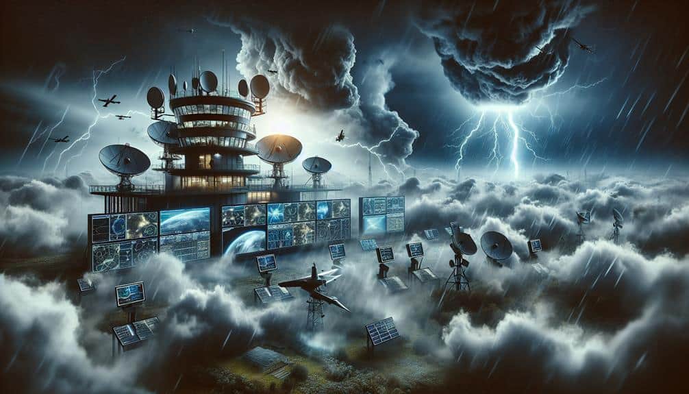
Maximizing precision in predicting storm formations involves integrating state-of-the-art meteorological tools like Doppler radar and high-definition satellite imagery. We gather detailed atmospheric data using weather balloons and satellites, then analyze temperature gradients, humidity levels, and wind patterns to comprehend storm mechanisms. Utilizing machine learning algorithms on historical data refines our predictive models, enhancing their reliability over time. Real-time monitoring with precise satellite and radar inputs provides instant updates, creating thorough forecasts. Together, these methods enhance our storm prediction capabilities, leading to improved preparedness and response strategies. For further insights, our exploration continues with innovative techniques.
Key Points
- Utilize Doppler radar and satellite imagery for real-time monitoring of atmospheric changes.
- Incorporate numerical weather prediction models for simulating future atmospheric conditions based on current data.
- Integrate machine learning algorithms to analyze historical weather data and identify significant storm indicators.
- Combine data from weather balloons and satellite imagery for comprehensive atmospheric profiling.
Advanced Meteorological Tools
To predict storm formations accurately, we rely on advanced meteorological tools like Doppler radar, satellite imagery, and numerical weather prediction models. These tools enable us to analyze atmospheric data with unparalleled precision, thereby enhancing our predictive accuracy.
Satellite imagery is indispensable in providing real-time and detailed views of weather systems. By capturing data across various spectral bands, satellites offer essential insights into cloud formation, temperature variations, and moisture content. This high-resolution imagery allows us to monitor storm development from its early stages through to its full intensity.
In conjunction with satellite data, numerical weather prediction (NWP) models play an important role. These complex mathematical models simulate the atmosphere's behavior by solving equations that govern fluid dynamics and thermodynamics. When we input observational data into these models, we can project future atmospheric conditions.
Different models, such as the Global Forecast System (GFS) and the European Centre for Medium-Range Weather Forecasts (ECMWF), provide diverse perspectives, enabling us to cross-verify predictions.
Data Collection Techniques
Understanding the efficacy of these advanced meteorological tools hinges on the robustness of our data collection techniques, which provide the fundamental inputs for all predictive models. Our primary methods include satellite imagery and weather balloons, both of which are essential for gathering high-resolution data across vast geographical expanses and altitudes.
Satellite imagery offers unmatched advantages by delivering real-time visual and infrared data, capturing phenomena such as cloud formation, sea surface temperatures, and atmospheric moisture levels. These satellites orbit the Earth, continuously monitoring and transmitting data that we can integrate into our models to predict storm formations with increased accuracy. The granularity and scope provided by satellite imagery allow us to observe macro and micro meteorological trends that might otherwise go unnoticed.
Weather balloons, on the other hand, ascend through the atmosphere, collecting vertical profiles of temperature, humidity, and barometric pressure. By deploying weather balloons at regular intervals, we obtain critical data points from various atmospheric layers, enabling us to understand the dynamics at play.
The synergy between satellite imagery and weather balloon data allows us to construct inclusive models that anticipate storm formations more precisely, offering greater freedom in planning and preparedness for potential weather events.
Analyzing Atmospheric Conditions
Analyzing atmospheric conditions involves scrutinizing key variables such as temperature gradients, humidity levels, and wind patterns to understand storm development mechanisms. We start with temperature gradients; abrupt changes in temperature can indicate the presence of fronts, which often serve as catalysts for storm formation. Monitoring these gradients allows us to pinpoint areas where atmospheric instability is likely to occur.
Next, we examine pressure systems. Low-pressure systems are particularly significant as they tend to draw in moist air, creating conditions ripe for storm activity. High-pressure systems, in contrast, can suppress storm development but also influence wind patterns that steer storm trajectories.
Wind patterns are another critical factor. By analyzing wind direction and speed at various altitudes, we can assess shear—a difference in wind speed or direction over a short distance. High shear can either tear storms apart or contribute to their rotation, depending on the conditions.
Lastly, humidity levels offer insight into moisture availability. High humidity at lower levels of the atmosphere provides the necessary fuel for storms to develop and sustain themselves.
Leveraging Machine Learning
In leveraging machine learning, we deploy sophisticated algorithms to analyze vast datasets, enhancing our ability to predict storm formations with greater accuracy and speed. Our approach involves intricate model training and continual algorithm optimization to extract actionable insights from the data.
First, we identify significant atmospheric indicators by feeding historical weather data into our machine learning models. This process involves:
- Data Ingestion: Importing large volumes of meteorological data from various sources.
- Feature Engineering: Extracting relevant features that are known to influence storm formations.
- Model Training: Utilizing training datasets to teach our algorithms to recognize patterns and correlations.
- Algorithm Optimization: Refining our algorithms to improve predictive performance and reduce error margins.
By focusing on these steps, we can harness the power of machine learning to interpret complex weather systems. Our models undergo rigorous training, continuously learning from new data to enhance their predictive capabilities. Algorithm optimization guarantees that our models remain robust, adapting to evolving atmospheric conditions and improving over time.
Freedom to anticipate storm formations with precision empowers us to mitigate risks effectively. As we continue to refine our machine learning techniques, our predictions become increasingly reliable, providing essential lead times for protective measures.
Real-Time Monitoring Systems
Real-time surveillance systems allow us to track atmospheric changes instantly, providing essential data to support our predictive models. By integrating satellite imagery and radar technology, we achieve a detailed view of storm developments.
Satellite imagery gives us extensive spatial coverage, capturing cloud formations, temperature variations, and humidity levels from space. This data is crucial for identifying early signs of storm activity.
Radar technology, on the other hand, offers fine-scale temporal and spatial resolution. It enables us to detect precipitation, cloud movement, and wind patterns with remarkable precision. The Doppler radar, in particular, measures the velocity of rain droplets, providing us insights into storm intensity and movement.
By combining these datasets, we can create a more complete picture of atmospheric dynamics.
Our ability to access and analyze real-time data empowers us to refine our predictive models continuously. This iterative process enhances the accuracy of our storm forecasts.
Additionally, real-time monitoring fosters immediate responsiveness, allowing communities to prepare and adapt swiftly to impending weather threats. By leveraging satellite imagery and radar technology, we guarantee that our predictive capabilities are both robust and adaptive, aligning with our commitment to freedom and safety.
Frequently Asked Questions
How Can the Public Stay Informed About Potential Storm Formations?
We can stay informed about potential storm formations by subscribing to emergency alerts, using reliable weather apps, and monitoring real-time updates. These tools provide precise, data-driven information that empowers us to make informed decisions swiftly and independently.
What Are the Most Common Signs That a Storm Is Forming?
Have you noticed cloud patterns changing rapidly? We often see a drop in atmospheric pressure, increased wind speed, and rising humidity levels. These indicators suggest a storm's forming, giving us a chance to prepare effectively.
How Do Storm Prediction Models Account for Climate Change?
We're continuously refining storm prediction models to factor in the impact of climate change, incorporating data on extreme weather patterns. Advanced algorithms adjust for evolving variables, ensuring more precise forecasts for those who value preparedness and freedom.
What Role Do Satellites Play in Predicting Storms?
Imagine the vast expanse of space, where satellite technology becomes our eyes. They meticulously track patterns in the atmosphere, providing critical data that enhances our storm predictions. This empowers us with the freedom to prepare and respond effectively.
How Can Individuals Prepare for a Predicted Storm?
To prepare for a predicted storm, we should stock emergency supplies, develop evacuation plans, identify shelter options, and establish reliable communication strategies. These steps safeguard our safety and autonomy during severe weather events.


