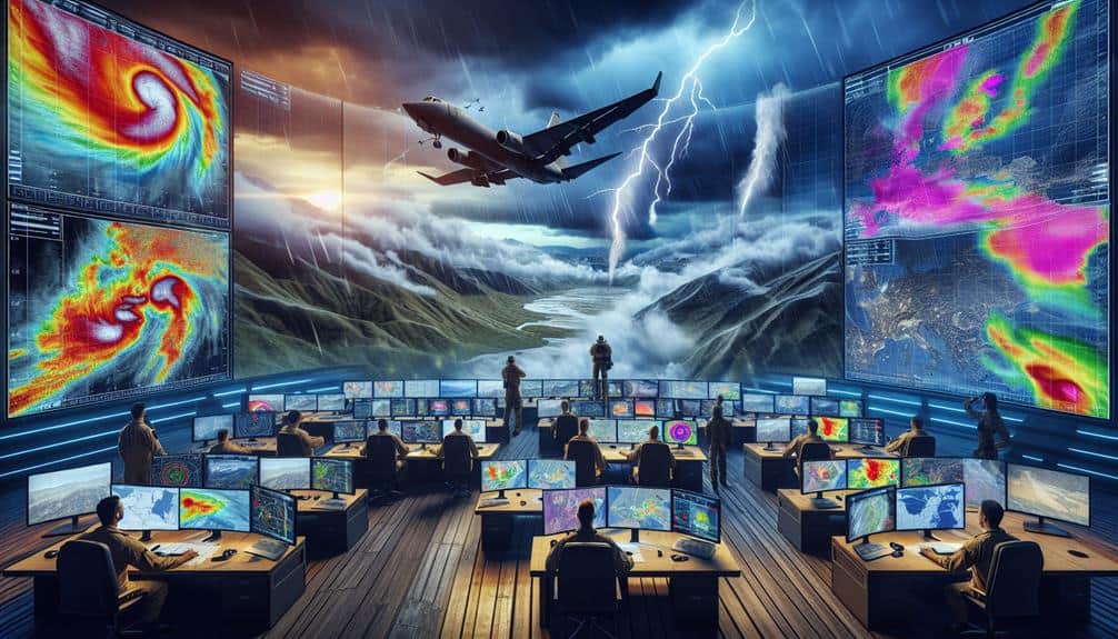
As storm chasers, we heavily depend on geospatial analysis tools like ArcGIS and QGIS for precise mapping and predicting storm patterns. These platforms allow us to overlay radar and satellite imagery, historical storm tracks, and real-time meteorological data for a multi-layered approach. Real-time weather tracking systems provide live radar data and lightning detection, while high-definition satellite images give us up-to-date storm visuals. Mobile mapping apps with high GPS accuracy and custom overlays guarantee we navigate safely. We also utilize topographic data and predictive modeling to refine our strategies and forecasts. Discover how these tools enhance our storm chasing effectiveness.
Key Points
- ArcGIS offers detailed geospatial data and real-time meteorological data for precise storm tracking.
- QGIS supports plugins for flexible spatial analysis, making it a powerful open-source tool.
- Real-time radar and satellite imagery integration enhances situational awareness and decision-making.
- Topographic data and digital elevation models aid in navigating storm-affected areas safely.
GIS Software for Storm Chasers
When we explore GIS software for storm chasers, we focus on platforms like ArcGIS and QGIS that offer robust tools for mapping, spatial analysis, and real-time data integration. These tools enable us to visualize storm patterns accurately and predict their trajectories with high precision. By leveraging spatial analysis capabilities, we can overlay multiple data layers, such as radar imagery, precipitation data, and historical storm tracks. This all-encompassing approach allows us to identify potential impact zones and prepare for emergency response effectively.
ArcGIS excels in providing detailed geospatial data and advanced analytical tools. Its ability to integrate real-time meteorological data guarantees that we stay updated on evolving storm patterns. Additionally, ArcGIS offers sophisticated modeling tools that can simulate storm scenarios, helping us devise strategic response plans.
On the other hand, QGIS is an open-source alternative that's highly customizable. It supports a wide range of plugins that enhance its functionality, making it ideal for storm chasers who need flexibility. QGIS allows us to perform in-depth spatial analysis, helping us pinpoint areas most likely to be affected and coordinate emergency response efforts efficiently.
Both platforms empower us to make data-driven decisions, ensuring we maximize our preparedness and response capabilities.
Real-Time Weather Tracking
Real-time weather tracking is necessary for storm chasers because it allows us to monitor live data feeds, such as radar and satellite imagery, to make immediate, informed decisions on the ground. Utilizing advanced weather radar systems, we can visualize precipitation intensity, storm structure, and movement in real-time. This data is essential for identifying severe weather patterns, such as supercells and tornado genesis, which helps us position ourselves safely and strategically.
Lightning detection systems enhance our situational awareness by providing real-time updates on lightning strikes. These systems use ground-based sensors and satellite technology to pinpoint lightning activity with high precision. By integrating lightning detection data, we can better predict the development and trajectory of storms, reducing the risks associated with unpredictable weather conditions.
Furthermore, combining weather radar and lightning detection provides a thorough view of a storm's behavior. For instance, radar reflectivity data can indicate heavy precipitation zones, while lightning frequency can signal intensifying storm activity. This dual approach enables us to track storm evolution minute-by-minute, making it an essential component of our storm-chasing toolkit.
Satellite Imagery Integration
Integrating satellite imagery into our geospatial tools gives us real-time access to high-resolution data, essential for tracking storm developments.
These images, sourced from advanced satellites, offer granular details on storm structure and movement.
Real-time Imagery Access
By leveraging cutting-edge satellite technology, we can access up-to-the-minute imagery that enhances our ability to track and analyze storm systems with exceptional precision. Live stream access to satellite data allows us to monitor storms in real-time, observing their development and movement as they unfold. This capability is vital for storm monitoring, enabling us to pinpoint the exact location and intensity of severe weather events.
With real-time imagery, we can implement rapid response strategies more effectively. Emergency alerts can be issued with greater accuracy, providing communities with the essential information they need to take protective actions. The integration of satellite imagery into our geospatial analysis tools ensures that our data isn't only current but also highly detailed, facilitating informed decision-making.
Our technical expertise allows us to interpret these live streams efficiently, translating raw data into actionable insights. This not only improves our situational awareness but also empowers us to predict storm trajectories and potential impact zones with greater confidence.
High-resolution Data Sources
Our storm-chasing toolkit includes high-definition satellite imagery, which provides detailed spatial data essential for accurate storm system analysis. Utilizing remote sensing technology, we access detailed data on cloud formations, precipitation levels, and thermal anomalies. This high-definition data is essential for weather pattern analysis, allowing us to predict storm trajectories with precision.
Integrating this satellite imagery with Geographic Information Systems (GIS) enhances our ability to overlay multiple data layers. By combining real-time weather data with topographical maps, we can assess potential impact zones and optimize our routes. This GIS integration is vital not only for tracking storms but also for supporting disaster response efforts.
When we anticipate severe weather, quick access to updated satellite images can guide emergency services and inform evacuation plans.
High-definition satellite imagery also aids in post-event analysis. By comparing before-and-after images, we can quantify storm damage, facilitating more efficient recovery operations. This data-driven approach ensures that resources are allocated where they're needed most.
For storm chasers, the ability to harness such detailed and timely information translates to greater freedom in navigating unpredictable weather conditions and making informed decisions on the ground.
Mobile Mapping Applications
Mobile mapping applications provide storm chasers with real-time data and precise geospatial coordinates, enhancing their ability to track and respond to severe weather events. These tools offer offline capabilities, ensuring that we can maintain situational awareness even when cellular networks are down. High GPS accuracy is critical, as it allows us to pinpoint our exact location relative to approaching storms, thereby improving decision-making and safety.
Custom overlays are another noteworthy feature of mobile mapping applications. They enable us to view additional data layers, such as radar imagery, storm tracks, and warning polygons, directly on our map interface. This layered approach helps us visualize complex weather data more effectively and tailor the information to our specific needs.
Route planning functionality is equally important. With dynamic route adjustments based on real-time conditions, we can navigate safely and efficiently through storm-affected areas. The integration of these features within mobile mapping applications empowers us to make well-informed, timely decisions. By leveraging offline capabilities and high GPS accuracy, alongside custom overlays and advanced route planning, we gain unprecedented freedom and control over our storm-chasing endeavors.
This combination of tools greatly enhances our operational effectiveness and safety.
Topographic Data Utilization
Integrating topographic data into our storm-chasing toolkit enables us to better understand terrain influences on storm behavior and optimize our navigation strategies. By leveraging remote sensing technology, we can acquire high-resolution topographic maps that reveal critical elevation changes and landforms. This allows us to conduct detailed spatial analysis, pinpointing areas where storms might intensify due to orographic lifting or where flash flooding is more likely to occur.
Using digital elevation models (DEMs), we can visualize and analyze the terrain in 3D, providing us with a thorough view of the landscape. These models can be integrated into GIS platforms, enhancing our ability to overlay other geospatial data like radar and satellite imagery. This multi-layered approach enables us to identify patterns and correlations that would be difficult to discern otherwise.
Additionally, topographic data helps us refine our navigation routes. By considering slope steepness and elevation changes, we can choose paths that maximize safety and efficiency. Advanced tools like LiDAR and photogrammetry provide even more precise terrain data, enabling us to make real-time adjustments based on the latest information. This synthesis of remote sensing and spatial analysis empowers us to chase storms more effectively and safely.
Predictive Modeling Tools
Predictive modeling tools utilize vast amounts of meteorological data to forecast storm trajectories with remarkable precision. Harnessing machine learning algorithms and advanced data analytics, we can anticipate storm development and movement, enabling us to stay ahead of the curve.
These tools rely on historical weather patterns and real-time data to generate models that predict:
- Storm intensity: By examining pressure, temperature, and wind speed data, we obtain a detailed forecast of a storm's potential strength.
- Path projections: Machine learning algorithms analyze past and current data to forecast the most probable routes a storm may follow, assisting us in planning our chase routes efficiently.
Our dependence on these predictive modeling tools guarantees that we can make informed decisions, reducing risks while maximizing our chances to capture valuable data. The utilization of machine learning algorithms continuously enhances these models, enhancing their accuracy over time.
With these tools, we aren't simply reacting to weather events; we're anticipating them, allowing us the freedom to pursue storms with confidence and precision. The fusion of sophisticated technology and extensive data sets revolutionizes how we approach storm chasing, making it both safer and more thrilling.
Data Visualization Platforms
As we utilize predictive modeling tools to anticipate storm behaviors, data visualization platforms allow us to interpret complex data sets through intuitive and interactive graphical representations. These platforms transform raw data into actionable insights, greatly enhancing our ability to understand and respond to dynamic storm conditions.
Interactive mapping tools are essential in this process. They enable us to layer various data types—such as wind speeds, precipitation levels, and temperature gradients—onto a single map. This layered approach enables a thorough spatial analysis, helping us identify patterns and correlations that would be challenging to discern otherwise.
Furthermore, spatial analytics capabilities in these platforms provide us with advanced functionalities like heatmaps, clustering, and trend analysis. Heatmaps, for example, can swiftly highlight areas of intense storm activity, while clustering algorithms can group data points to reveal hotspots of concern. Trend analysis tools help us track storm progression over time, offering predictive insights that are vital for real-time decision-making.
Frequently Asked Questions
What Safety Precautions Should Storm Chasers Take During Severe Weather Events?
Safety starts with smart strategies: we should scan for emergency shelters, study evacuation routes, and stay updated with real-time data. Prioritize preparation, plan meticulously, and protect ourselves by avoiding areas with unpredictable weather patterns.
We use real-time communication tools like satellite phones and radios for constant updates. For data sharing, we rely on mobile apps and cloud platforms, ensuring our team accesses up-to-the-minute information, enhancing our decision-making and safety.
What Kind of Training Is Required to Become a Storm Chaser?
To become storm chasers, we need Storm Chaser Certification, in-depth Meteorological Knowledge, and robust Storm Spotter Training. Our skills in Emergency Response are essential for safety, ensuring we can effectively track and report severe weather conditions.
How Do Storm Chasers Fund Their Operations and Equipment?
Steering through the financial storm, we rely on diverse funding sources for equipment upgrades. Sponsorship opportunities and crowdfunding campaigns are our main strategies, allowing us to maintain cutting-edge technology essential for our freedom to chase storms effectively.
What Are the Legal Restrictions for Storm Chasing in Different Regions?
Let's explore the legal restrictions storm chasers face. In the U.S., regulations vary by state and local jurisdictions, often requiring permits or adherence to safety protocols. Internationally, restrictions differ widely, sometimes mandating coordination with local authorities.