We're revealing crucial insights into hailstorm formation, leveraging advanced tracking tools and robust data collection techniques to comprehend and mitigate impacts under climate change. By using Doppler radar and dual-polarization upgrades, along with geostationary satellites, we accurately measure precipitation velocities and types in real-time. Our integrated satellite and ground sensor data refine predictive models, guiding effective adaptation strategies. Analyzing temporal and spatial hailstorm patterns allows pinpointing vulnerable areas and evaluating community risks. Innovative engineering solutions and policy frameworks further foster resilience. Discover more about our data-driven methodologies and how communities can adapt to increasingly unpredictable weather conditions.
Key Points
- Advanced Data Collection: Integration of satellite imagery and ground sensors enhances predictive modeling of hailstorms.
- Storm Tracking Tools: Doppler radar and dual-polarization techniques improve detection and classification of hailstones.
- Pattern Analysis: Temporal segmentation and statistical tools identify hailstorm patterns and deviations critical for climate adaptation.
- Resilient Engineering: Development of impact-resistant materials and structures mitigate damage from hailstorms.
Understanding Hailstorm Formation
Understanding hailstorm formation
begins with analyzing the atmospheric conditions that facilitate the development of these severe weather events. We need to understand how updrafts, supercooled water, and strong vertical winds interplay to form hailstones.
When updrafts in a thunderstorm are strong enough, they can carry water droplets above the freezing level, where they become supercooled. These droplets then collide with ice nuclei, forming hailstones. The hailstone size grows as it's repeatedly lifted by the updraft and collects more layers of supercooled water.
Data indicates that higher updraft speeds result in larger hailstone sizes because the hailstones spend more time in the supercooled region, accumulating additional layers of ice. Atmospheric conditions, including the temperature profile, humidity, and wind shear, play critical roles in this process.
For instance, a steep temperature gradient facilitates stronger updrafts, which in turn supports larger hailstone formation. Analyzing past events, we observe that areas with significant vertical wind shear have a higher incidence of severe hailstorms.
Tools for Tracking Storms
Advancements in meteorological technology have equipped us with sophisticated tools for tracking storms, enabling more accurate and timely predictions. Radar technology has evolved remarkably, allowing us to detect storm formations and movements with high precision. Doppler radar, for instance, measures the velocity of precipitation, helping us pinpoint the intensity and trajectory of hailstorms.
The dual-polarization upgrade further enhances our ability to distinguish between different types of precipitation, such as rain, hail, and snow, providing essential data for timely warnings.
Satellite imagery complements radar technology by offering a broader perspective. Geostationary satellites like those in the GOES series provide continuous, real-time imagery, capturing storm development and movement across vast areas. These satellites employ advanced sensors to measure cloud cover, temperature, and humidity levels, pivotal for understanding storm dynamics.
The integration of data from both radar and satellite sources enables us to create inclusive storm models, improving our predictive capabilities.
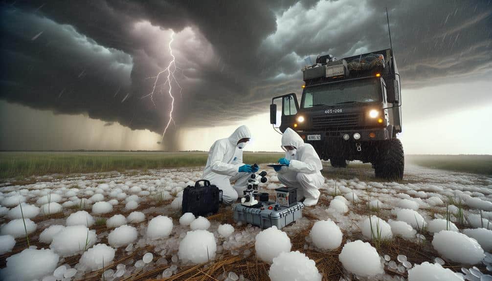
Data Collection Techniques
Leveraging advanced storm tracking tools, we employ a range of data collection techniques to gather detailed information on hailstorm characteristics and behavior. Our primary methods include the use of satellite imagery and ground sensors, both of which enable us to capture high-resolution data essential for understanding the dynamics of hailstorms.
Satellite imagery provides a macroscopic view, allowing us to monitor storm development and movement over large geographic areas. This helps in identifying the formation of hail cores and tracking their evolution in real-time. By analyzing different spectral bands, we can also assess cloud properties and precipitation rates, offering insights into the storm's intensity and potential hail size.
Ground sensors, on the other hand, deliver granular data that complements our satellite-based observations. These sensors measure variables such as wind speed, temperature, humidity, and hailstone size directly at the surface level. Deploying a network of ground sensors guarantees we capture localized variations and micro-scale phenomena that satellites might miss.
Combining satellite imagery with ground sensor data provides a detailed understanding of hailstorm behavior. This integrated approach allows us to refine our predictive models and develop more effective climate change adaptation strategies, empowering communities with the knowledge to mitigate hailstorm impacts.
Analyzing Hailstorm Patterns
To analyze hailstorm patterns, we scrutinize multi-temporal datasets to identify recurring trends and anomalies in storm behavior. By leveraging satellite imagery, radar data, and historical records, we can construct a thorough picture of hailstorm trends over different geographic regions and time periods. Our analytical approach involves several key steps:
- Data Segmentation: We divide the collected data into temporal segments to observe seasonal and annual variations.
- Statistical Analysis: Utilizing statistical tools, we detect significant patterns and deviations, helping us understand the frequency and intensity of hailstorms.
- Geospatial Mapping: By mapping hailstorm occurrences, we can visualize spatial trends and pinpoint high-risk areas.
- Impact Assessment: Combining hailstorm data with socioeconomic factors, we evaluate the potential impacts on communities and infrastructure.
Our focus on evidence-based methodologies assures that the analysis is robust and actionable. The data-driven insights we gain enable us to recognize shifts in hailstorm activity that may be linked to broader climatic changes. By understanding these patterns, we empower communities and policymakers with the knowledge needed to mitigate risks effectively.
As we continue to refine our analysis techniques, our goal remains to provide the freedom to adapt and thrive despite the challenges posed by hailstorms.
Developing Adaptation Strategies

Effective adaptation strategies rely on integrating thorough data analysis with innovative engineering and policy solutions to mitigate the impacts of hailstorms. We must start with detailed risk assessments, utilizing high-resolution climate models and historical data to identify vulnerable areas. By understanding the frequency, intensity, and geographic distribution of hailstorms, we can prioritize regions for intervention.
Next, integrating advanced engineering solutions, such as hail-resistant building materials and infrastructure designs, will strengthen our communities. Employing technologies like impact-resistant roofing and protective barriers can greatly reduce property damage. However, technical measures alone aren't enough.
Community engagement is vital to ensure the success of these strategies. We need to involve local stakeholders in the decision-making process, fostering a sense of ownership and resilience. Public education campaigns about emergency preparedness and insurance options are necessary, enabling individuals to make informed decisions and take proactive measures.
Moreover, policy frameworks must support these initiatives, offering incentives for adopting resilient practices and funding for research and development. By aligning our efforts across technological, societal, and legislative domains, we can create adaptive systems that not only withstand hailstorms but also empower our communities to thrive in the face of climate change.
Frequently Asked Questions
How Does Climate Change Influence the Frequency of Hailstorms?
Just like a ticking time bomb, climate change increases hailstorm frequency. We must adopt climate change adaptation strategies, backed by data, to address these shifts. It's important to understand and mitigate these changes for our freedom's sake.
What Are the Economic Impacts of Increased Hailstorm Activity?
The economic repercussions of increased hailstorm activity include significant agricultural implications and infrastructure damage. To mitigate these impacts, we must implement robust mitigation measures backed by data-driven strategies, ensuring our communities remain resilient and economically stable.
How Can Individuals Protect Their Property From Hail Damage?
When it rains, it pours, so let's take property protection seriously. By implementing preventative measures like impact-resistant roofing and storm shutters, we can drastically reduce hail damage, offering us the freedom to safeguard our investments effectively.
What Role Do Insurance Companies Play in Hailstorm Adaptation?
In addressing hailstorm adaptation, insurance companies play a vital role through insurance partnerships and mitigation efforts. They collaborate with communities, providing data-driven insights and financial support, empowering us to safeguard our properties while maintaining our freedom.
Are There Any Regions More Vulnerable to Hailstorms Due to Climate Change?
We recognize that regional vulnerabilities to hailstorms are heightened by climate change. Effective adaptation and mitigation strategies are essential to protect these areas. Data indicates regions like the Great Plains face increased hailstorm frequency, necessitating targeted efforts.