When you participate in citizen science storm spotting, you’re feeding real-time ground observations directly into NWS forecasting systems. Trained SKYWARN volunteers report tornadoes, large hail, damaging winds, and flash flooding, while CoCoRaHS and mPing users submit precise precipitation measurements. Over 8,700 cooperative observers supplement radar and satellite data daily, closing critical gaps AI and remote sensing can’t reliably fill. There’s far more to how these contributions sharpen severe weather warnings and save lives.
Key Takeaways
- SKYWARN-trained volunteers identify hazardous conditions like tornadoes, large hail, and damaging winds, providing ground-truth data that supplements radar observations.
- Citizen scientists submit real-time storm reports to the NWS, directly improving severe weather warning accuracy and public safety outcomes.
- Apps like mPing enable volunteers to quickly report precipitation types, helping forecasters distinguish rain from snow during mixed weather events.
- Storm chasers capture high-resolution video and imagery of severe storms, filling critical data gaps where instrumentation is sparse or absent.
- CoCoRaHS volunteers submit daily precipitation measurements, refining regional weather data and enhancing the overall accuracy of forecast models.
What Is Citizen Science in Storm Spotting?
Citizen science in storm spotting mobilizes trained volunteers to collect real-time weather observations that supplement radar and satellite data. Through programs like SKYWARN, the National Weather Service trains spotters to identify hazardous conditions and submit verified ground-truth reports.
You’re contributing directly to warning systems that protect entire communities when you participate. These volunteers document precipitation types, tornado activity, and severe thunderstorm conditions that instruments alone can’t confirm. Your observations feed directly into severe weather warnings, improving accuracy for downstream populations.
Apps like mPing and CoCoRaHS tools make data submission fast and precise. Beyond individual reports, community engagement strengthens collective understanding of regional weather patterns.
Thousands of annual spotter reports enhance forecast models, proving that distributed human observation networks remain indispensable to modern meteorological infrastructure.
How the SKYWARN Program Trains Volunteer Spotters
The SKYWARN program, administered by the National Weather Service, equips volunteers with the observational skills needed to identify and report hazardous weather accurately.
Through structured volunteer training, you’ll gain practical knowledge in storm spotting techniques that directly support real-time warning systems.
Training covers:
- Severe weather identification – Recognize rotating wall clouds, hail shafts, and funnel clouds
- Safety protocols – Position yourself effectively without endangering your life
- Accurate reporting – Transmit precise location data and storm characteristics to NWS
- Radar interpretation basics – Understand how your ground observations complement existing data
Your reports become ground truth that verifies conditions radar can’t confirm.
Thousands of spotter observations reach NWS annually, strengthening warning accuracy for communities downstream.
You’re not just watching the storm — you’re actively protecting lives.
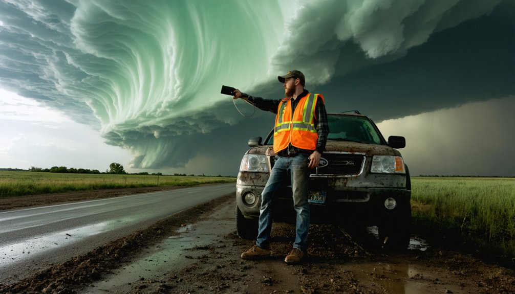
What Hazardous Conditions Storm Spotters Are Trained To Report
Once trained, you’ll focus your reporting on specific hazardous conditions that radar and satellite systems can’t reliably confirm on their own.
Your storm reporting targets conditions with direct public safety implications: large hail, damaging winds, tornadoes, flash flooding, and dangerous lightning activity.
You’ll document hail size using precise measurements, estimate wind damage severity, and confirm tornado touchdowns with exact location data.
Ground-level observations you submit become integrated directly into severe thunderstorm warnings, providing verification that remote sensing technology simply can’t replicate.
Radar identifies potential threats; you confirm actual ones.
Each hazardous conditions report you transmit gives forecasters actionable ground truth, tightening warning accuracy for communities downstream.
Your independent observations operate where institutional systems have blind spots, making your data genuinely irreplaceable in the warning process.
Can Citizen Scientists Out-Identify AI on Rain and Snow?
Beyond confirming tornadoes and hail on the ground, your observational role extends into a domain where even artificial intelligence struggles: distinguishing rain from snow during mixed-precipitation events.
Direct, real-time rain identification and snow detection remain areas where citizen scientists consistently outperform automated systems.
Here’s why your ground-level input matters:
- Sensor limitations: Radar and satellites misclassify precipitation phases during shifting atmospheric conditions.
- Human precision: You observe actual hydrometeors falling, providing unambiguous precipitation-type data.
- Scale: Over 8,700 CoCoRaHS and NWS Cooperative Observer volunteers submit daily measurements nationwide.
- App integration: The Mountain Rain or Snow project deploys 1,700 volunteers using dedicated apps, directly improving forecast accuracy.
Your independent observations cut through algorithmic uncertainty, giving meteorologists verified, ground-truth data that no machine currently replicates reliably.
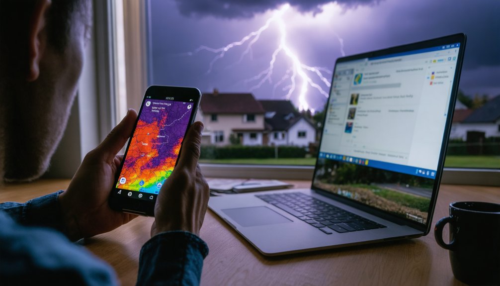
Which Apps Help Citizen Scientists Track Severe Weather?
How you submit your observations matters as much as making them. The right tools keep your data accurate and actionable. Several apps streamline weather tracking for citizen scientists like you.
The mPing app lets you report precipitation types quickly, feeding directly into NWS datasets.
The Globe Observer app captures cloud formations and atmospheric conditions using your smartphone’s camera.
If you’re in mountain terrain, the Mountain Rain or Snow project app connects you with 1,700 volunteers distinguishing rain from snow at elevation.
Each platform’s app features are purpose-built for precision. You’re not just logging conditions — you’re submitting structured data that forecasters use in real time.
Choosing the correct app for your environment maximizes the scientific value of every report you submit.
Which Citizen Science Networks Feed Spotter Reports to the NWS?
If you want to contribute precipitation data directly to the NWS, two structured networks give you that pipeline.
The CoCoRaHS network lets you measure and submit rain, hail, and snow totals that feed directly into regional weather pattern analysis.
Alternatively, you can join the NWS Cooperative Observer Program, where roughly 8,700 volunteers take daily observations that ground-truth forecast models and improve data accuracy.
CoCoRaHS Reporting Network
While SKYWARN focuses on severe weather spotting, the Community Collaborative Rain, Hail and Snow Network (CoCoRaHS) zeroes in on precipitation measurement. You can join thousands of volunteers who independently collect and submit daily precipitation data directly to the NWS, boosting reporting accuracy across diverse regions.
Key CoCoRaHS benefits include:
- Independent measurement: You report rain, hail, and snow using standardized gauges.
- Daily submissions: Consistent reporting builds reliable regional precipitation datasets.
- Direct NWS integration: Your data feeds straight into official forecasting systems.
- Broad coverage: Volunteer distribution captures hyperlocal precipitation variations radar misses.
This network empowers you to contribute precise, ground-level data that strengthens weather pattern analysis. Your observations fill critical gaps, giving meteorologists measurable, location-specific precipitation records that enhance forecast reliability for your entire community.
NWS Cooperative Observers
CoCoRaHS captures precipitation data across distributed networks, but the NWS Cooperative Observer Program (COOP) extends that data collection further, embedding 8,700 trained volunteers directly into official observational infrastructure.
As a COOP observer, you’re taking daily measurements that feed directly into regional weather pattern analysis, climate records, and forecast modeling. Your cooperative observations aren’t supplemental—they’re foundational to how the NWS validates atmospheric conditions across thousands of locales.
COOP’s strength lies in its volunteer engagement model, which distributes data collection responsibilities across independent contributors rather than centralizing operations. You control your station, submit your readings, and maintain observational consistency without bureaucratic interference.
That decentralized structure produces high-density, reliable datasets that no government-operated network could efficiently replicate alone. Your daily commitment directly strengthens forecast accuracy for your surrounding communities.
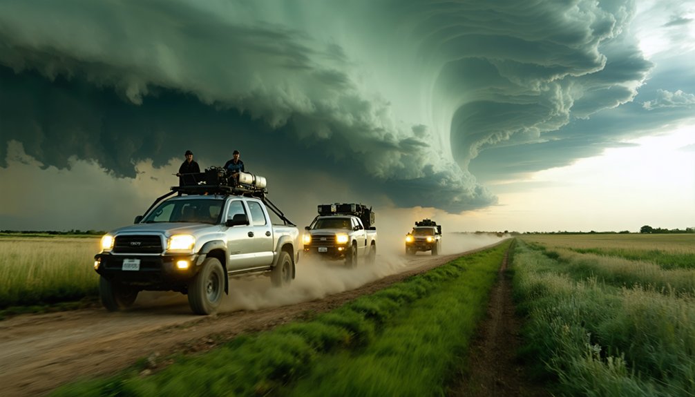
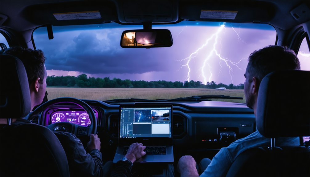
How Storm Chasers Function as Citizen Scientists for the NWS
When you chase storms, you’re not just seeking thrills—you’re feeding real-time data on tornadoes and severe thunderstorms directly into NWS warning systems.
Your video, images, and field observations correlate with lightning detection networks, expanding research coverage in remote areas that radar and satellite can’t adequately resolve.
This ground-truth data accelerates severe weather alerts and advances scientific understanding of storm dynamics at a precision that remote sensing alone can’t achieve.
Real-Time Storm Data
Storm chasers function as mobile data collectors, feeding real-time observations on tornadoes and severe thunderstorms directly to the NWS.
You’re looking at citizen scientists who extend research coverage into remote areas where instruments can’t reach, strengthening storm prediction accuracy and community engagement.
Their contributions include:
- Tornado ground truth: Confirming rotation, size, and path that radar can’t fully capture
- Lightning correlation: Matching video and imagery with lightning network data for precise storm analysis
- Early alerts: Delivering real-time severe weather reports that accelerate official warnings
- Remote coverage: Expanding datasets from locations beyond fixed sensor networks
When chasers submit observations, you get faster, more reliable warnings.
Their independent field data fills critical gaps, giving meteorologists the precise, location-specific intelligence needed to protect downstream communities before conditions deteriorate.
Advancing Severe Weather Research
Beyond real-time reporting, storm chasers advance severe weather research by functioning as mobile field scientists who close observational gaps that fixed sensor networks and remote sensing can’t fill.
When you position yourself near an active storm, you’re capturing high-resolution video and imagery that researchers correlate directly with lightning detection networks, sharpening data accuracy across multiple atmospheric variables.
These correlated datasets strengthen storm prediction models by grounding theoretical algorithms in verified field conditions. You’re also extending research coverage into remote locations where instrumentation is sparse or nonexistent.
Your observations feed directly into scientific analyses that improve how meteorologists understand tornado genesis, storm structure, and thunderstorm behavior.
Each documented event you contribute refines the datasets that forecasters rely on to issue faster, more precise severe weather warnings for your community.
How Citizen Science Makes Storm Warnings More Accurate
Citizen scientists dramatically sharpen storm warning accuracy by feeding real-time ground observations directly into the National Weather Service’s warning process.
You’re not just watching storms—you’re actively improving weather accuracy and helping forecasters decode complex storm patterns radar can’t fully capture.
Every storm you observe becomes a data point that sharpens forecasts and decodes patterns radar alone cannot reveal.
Your contributions directly impact warnings through:
- Spotter reports that verify severe conditions embedded in real thunderstorm warnings
- CoCoRaHS precipitation data refining regional rainfall and snowfall measurements
- Storm chaser imagery correlated with lightning networks for precise storm analysis
- mPing app submissions distinguishing rain from snow where automated sensors fail
Each observation you submit closes critical data gaps.
Forecasters gain ground-truth confirmation, downstream communities receive sharper alerts, and warning lead times improve.
Your independence to report freely translates directly into measurable public safety outcomes.
Frequently Asked Questions
How Do Citizen Scientists Stay Safe While Reporting Severe Weather?
You’ll stay safe by following NWS-established safety protocols and reporting guidelines during SKYWARN training. You’re taught to observe from secure locations, prioritize personal safety, and submit accurate data without compromising your position in hazardous conditions.
Are There Age Requirements to Become a SKYWARN Storm Spotter Volunteer?
With thousands of storm reports filed annually, you’ll find SKYWARN doesn’t impose strict age requirements. Your volunteer motivations drive participation, and completing NWS training requirements qualifies you to contribute precise, real-time severe weather observations that protect communities.
How Many Hours per Year Do Storm Spotters Typically Volunteer?
The available data doesn’t specify exact hours for your volunteer commitment. However, you’ll dedicate time to storm spotter training sessions and submit real-time reports during active severe weather events, making your schedule largely weather-dependent.
Can Citizen Scientists Contribute to Storm Spotting From Rural or Remote Areas?
Yes, you can spot storms, submit data, and expand coverage from rural areas. Remote training and rural communication tools let you report real-time observations, filling critical data gaps that radar and satellites can’t capture independently.
Do Citizen Scientists Receive Any Recognition or Compensation for Their Contributions?
You won’t receive monetary compensation, but recognition programs honor your contributions through certifications and community acknowledgment. Compensation models remain volunteer-based, valuing your data-driven impact on public safety over financial reward.
References
- https://www.weather.gov/media/wrn/citizen_science_page.pdf
- https://www.earthdata.nasa.gov/news/feature-articles/study-shows-citizen-scientists-crucial-observing-rain-snow-during-storms
- https://ztresearch.blog/2019/05/09/how-storm-chasers-and-storm-spotters-can-contribute-to-citizenscience/
- https://www.youtube.com/watch?v=eOD7e4ej8WI
- https://pages.scistarter.org/did-you-know-storm-spotters-in-your-community-help-keep-it-safe-during-inclement-weather/
- https://www.rainviewer.com/blog/the-role-of-citizen-science-in-meteorological-research.html
- https://inside.nssl.noaa.gov/vsecommunity/citizen-science-impacts/