We've honed our storm prediction techniques by analyzing key weather patterns, radar data, and satellite imagery. Understanding temperature gradients, humidity, and wind currents helps us anticipate weather changes. We use radar to track precipitation intensity and storm movement, while satellites provide real-time cloud formation data. Atmospheric pressure drops and high humidity signal imminent storms, and wind speed data from advanced anemometers enhance our forecasts. Monitoring temperature fluctuations and identifying cloud types like cumulonimbus clouds provide further insights. By integrating these methods, we've improved accuracy and can better predict storm paths. Following these foundational tips opens the door to deeper knowledge.
Key Points
- Analyze radar data for real-time precipitation and storm movement insights.
- Monitor satellite imagery to track cloud formations and identify potential hazards.
- Interpret atmospheric pressure drops as signals for imminent storms.
- Utilize advanced anemometers to predict storm trends through wind speed and direction data.
Understanding Weather Patterns
To predict storms accurately, we must first understand the fundamental weather patterns that drive atmospheric changes. Weather forecasting hinges on our ability to recognize and interpret these patterns. By analyzing how air masses interact, we can anticipate the development of weather systems that potentially lead to storms. Key elements include temperature gradients, humidity levels, and wind currents. These factors contribute to the formation of high and low-pressure systems, which are pivotal in shaping weather dynamics.
Climate patterns play a vital role in long-term weather forecasting. They provide a broader context for the daily variations we observe. For instance, phenomena like El Niño and La Niña have a significant impact on global weather by altering oceanic and atmospheric circulation. Understanding these climate patterns allows us to predict seasonal weather trends and identify periods of increased storm activity.
Moreover, the jet stream, a fast-flowing ribbon of air in the upper atmosphere, guides the movement of weather systems. By monitoring its shifts, we can gain insights into potential storm paths.
Essentially, mastering the knowledge of weather and climate patterns empowers us to forecast storms with greater accuracy, offering the freedom to prepare and respond effectively.
Analyzing Radar Data
Accurate storm prediction hinges on our ability to analyze radar data, which provides real-time information on precipitation intensity, movement, and structure. By understanding radar interpretation, we can efficiently track storms and anticipate severe weather events.
Let's explore how we can use radar data to our advantage.
First, we need to recognize the key components of radar images:
- Reflectivity: This measures the intensity of precipitation. Higher reflectivity values indicate heavier precipitation, which can signal severe weather.
- Velocity: This shows the movement and speed of precipitation particles, helping us track storm direction and potential rotation.
- Dual-polarization: This helps differentiate between different types of precipitation (rain, hail, snow), enhancing our data analysis.
- Echo tops: This indicates the height of storm clouds, giving us clues about storm intensity and potential for severe weather.
Utilizing Satellite Imagery
Leveraging satellite imagery allows us to observe cloud formations, storm development, and atmospheric conditions over large areas, enhancing our storm prediction capabilities. With satellite tracking, we can monitor weather patterns in real-time, providing crucial data for accurate and timely storm predictions. This satellite technology gives us the freedom to foresee potential weather hazards and take proactive measures.
By utilizing satellite imagery, we gain a thorough view of the Earth's atmosphere. We can detect the early stages of storm development, observe the movement of weather systems, and analyze temperature and humidity distributions. This continuous observation is vital for weather forecasting, as it helps us identify trends and anomalies that could indicate severe weather.
Satellite imagery also enables us to track the lifecycle of storms. From formation to dissipation, we can monitor storms' intensity, direction, and speed, which is essential for issuing warnings and preparing for impact. The precision of satellite tracking enhances our ability to predict storm paths and potential affected areas, ultimately contributing to more effective storm prediction.
In essence, satellite technology empowers us to harness vast amounts of data, transforming it into actionable insights that keep us informed and prepared.
Interpreting Atmospheric Conditions
Understanding atmospheric conditions is essential for predicting storms with accuracy and reliability. By analyzing variables such as atmospheric pressure and humidity levels, we can gain valuable insights into potential storm development.
Let's break down the key indicators we need to monitor:
- Atmospheric Pressure: Rapid drops in atmospheric pressure often signal that a storm is imminent. Low pressure areas are typically associated with stormy weather, as they encourage the ascent of warm, moist air, which can lead to cloud formation and precipitation.
- Humidity Levels: High humidity levels indicate a significant amount of moisture in the air, a critical component for storm formation. When the air is saturated, there's a higher likelihood of cloud formation and subsequent rainfall, contributing to storm activity.
- Temperature Variations: Sharp contrasts in temperature between different layers of the atmosphere can create instability, a breeding ground for storms. Warm air rising and cold air descending can lead to turbulent weather patterns.
- Cloud Types: Observing cloud formations can provide early signs of storm development. Cumulonimbus clouds, for instance, are indicative of severe weather conditions, including thunderstorms and tornadoes.
Tracking Wind Speeds

To accurately track wind speeds, we must utilize modern anemometers, which provide precise measurements.
We should also gather wind speed data from reliable sources, such as meteorological stations and satellites.
Utilizing Modern Anemometers
Modern wind speed measuring devices, with their advanced sensors and real-time data capabilities, enable us to accurately track air currents and predict storm trends. By measuring wind direction alongside speed, these devices not only enhance our understanding of imminent weather conditions but also improve our data accuracy. This means we can make better-informed decisions, which is vital for anyone seeking freedom from unexpected storms.
To fully utilize modern anemometers, we should focus on:
- Calibration: Ensuring the anemometer is calibrated correctly is vital for obtaining precise readings. Inaccurate data can lead to faulty predictions.
- Placement: Positioning the anemometer in an open area, away from obstructions, guarantees more reliable data. Avoid placing it near buildings or trees.
- Maintenance: Regular upkeep, such as cleaning and checking for wear and tear, extends the device's lifespan and maintains its accuracy.
- Integration: Combining data from multiple anemometers across different locations provides a thorough view of wind patterns, enhancing predictive accuracy.
Wind Speed Data Sources
Utilizing a variety of wind speed data sources enables us to track wind patterns with greater accuracy and reliability. By tapping into satellite data, ground-based weather stations, and buoy networks, we gather extensive information essential for precise wind speed calculations. This diversity in data sources enhances our overall data accuracy, an essential factor for effective wind speed forecasting.
Satellites provide a broad view of wind patterns across large geographical areas, while ground-based weather stations offer localized, real-time data. Buoys, strategically placed in oceans, give us vital information about marine wind conditions. Together, these sources feed into advanced meteorological models, which synthesize the data to predict future wind speeds with remarkable precision.
Our confidence in wind speed forecasting hinges on the quality and integration of these data sources. Sophisticated algorithms process the raw data, reducing noise and ensuring the highest level of data accuracy. By continually refining these meteorological models, we improve our ability to anticipate wind-related weather events, helping to protect lives and property.
In essence, the synergy of diverse data sources, coupled with advanced modeling techniques, empowers us to stay ahead of the storm, offering a sense of control and freedom in the face of nature's unpredictability.
Interpreting Wind Patterns
Interpreting wind patterns involves analyzing data from various sources to identify trends and anomalies in wind speed and direction. By examining these factors, we can gain important insights into upcoming weather events.
Wind direction analysis is necessary for storm prediction, allowing us to understand potential storm paths. Equally important is evaluating the wind speed impact, which plays a significant role in storm forecasting.
To accurately interpret wind patterns, we should:
- Utilize Satellite Data: Satellites provide extensive data on wind speeds and directions across vast areas, helping us detect storm systems early.
- Analyze Ground-Based Observations: Weather stations on the ground offer real-time data, essential for validating satellite information and understanding local anomalies.
- Employ Advanced Modeling Techniques: Computational models simulate wind patterns and predict storm development, offering a detailed forecast.
- Monitor Historical Data: Studying past wind patterns and their effects on storm development enhances our predictive capabilities.
Monitoring Temperature Changes
Tracking temperature fluctuations is crucial for accurately predicting storm development and intensity. By closely monitoring these changes, we can identify patterns that correlate with precipitation and other crucial weather phenomena. Temperature monitoring isn't just about gathering data; it's about interpreting that data to enhance our storm prediction accuracy.
When we observe rapid temperature drops, it often indicates the potential for severe weather. This is because such fluctuations can lead to atmospheric instability, which is a key ingredient in storm formation. Understanding these variations allows us to predict when and where storms might develop, giving us an edge in storm preparedness and response.
Moreover, the correlation between temperature fluctuations and precipitation is an essential component of our predictive models. Warmer air can hold more moisture, leading to heavier precipitation when the air cools and the moisture condenses. By tracking temperature changes, we can anticipate these shifts and improve our forecasts.
Observing Cloud Formations

Observing cloud formations is necessary for predicting storm developments and understanding atmospheric conditions. By mastering cloud identification, we enhance our ability to make accurate storm predictions.
Let's explore the key cloud types and their implications for weather observation.
Cumulus Clouds: These fluffy, white clouds often indicate fair weather but can develop into cumulonimbus clouds, leading to thunderstorms. Monitoring their growth is important for storm prediction.
Stratus Clouds: Appearing as a uniform gray layer, stratus clouds usually bring overcast skies and light precipitation. While less dramatic, they're an essential part of weather observation, signaling stable atmospheric conditions.
Cirrus Clouds: High-altitude, wispy clouds composed of ice crystals. Cirrus clouds often appear ahead of a warm front or large-scale storm system, offering early warnings of changing weather.
Cumulonimbus Clouds: Towering and dense, these clouds are the hallmark of severe weather, including thunderstorms, hail, and tornadoes. Identifying these clouds allows for timely alerts and preparations.
Frequently Asked Questions
How Does Climate Change Affect Storm Prediction Accuracy?
Climate change throws a colossal wrench into storm prediction! Our data collection gets trickier, and climate models become less reliable. Meteorological research and forecasting techniques must evolve rapidly to keep pace with these unprecedented changes.
What Tools Do Storm Chasers Use in the Field?
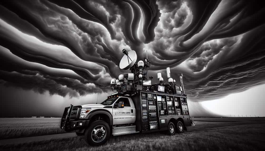
For storm chasing, we use radar technology to track storm movements and GPS tracking for precise location data. These tools give us the freedom to navigate and anticipate storm paths accurately, ensuring both safety and effective research.
Can Animals Sense an Approaching Storm Before Humans?
Can animals sense an approaching storm before humans? Indeed, animal behavior often provides early prediction. While animals rely on acute instincts, we depend on technology. Their heightened senses act as nature's warning system, complementing our own human instincts.
How Do Urban Areas Influence Storm Development?
Urban influences notably alter atmospheric dynamics, increasing heat and pollution. We observe that these changes can intensify storm development. Urban heat islands and altered wind patterns often lead to more severe and unpredictable weather conditions in cities.
What Role Do Ocean Currents Play in Storm Formation?
Ocean currents are the lifeblood of storm intensity! They dramatically shape weather patterns and atmospheric conditions, creating and fueling powerful storms. By understanding these oceanic flows, we can better predict and prepare for severe weather events.