We master supercell storm prediction by integrating high-resolution weather models, Doppler radar data, and real-time field observations. By analyzing mesocyclone dynamics, temperature and humidity levels, and wind shear effects, we gain critical insights into storm formation. High radar reflection values help us identify heavy rainfall and hail, while satellite imagery tracks cloud formations and lightning patterns. Our ensemble modeling provides probabilistic forecasts, and atmospheric indicators like pressure gradients and low-pressure systems guide our predictions. Through continuous real-time data integration and advanced storm chasing techniques, we refine our predictions, ensuring accurate and timely storm tracking for enhanced safety. Discover more about our methods and innovations.
Key Points
- Utilize high-resolution weather models and integrate real-time data from satellites, radars, and weather stations.
- Analyze Doppler radar data to identify storm structure, intensity, and mesocyclone presence.
- Monitor atmospheric indicators like temperature anomalies, wind shear, and pressure gradients for storm development clues.
- Employ advanced storm chasing techniques for direct field observations and data validation.
Understanding Supercell Dynamics
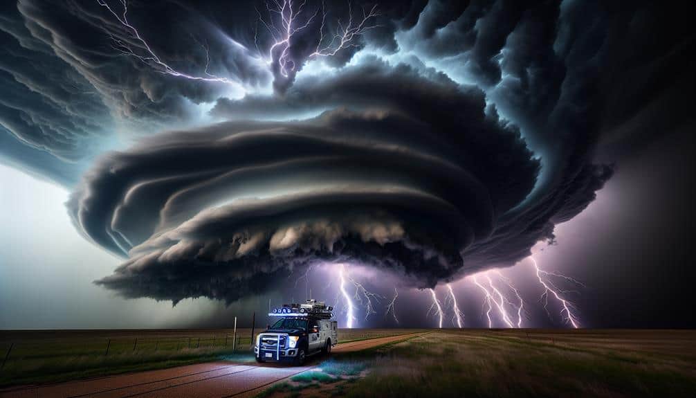
Supercell dynamics involve the study of rotating thunderstorms characterized by a persistent, deep mesocyclone. This analysis is conducted using Doppler radar data and atmospheric sounding profiles.
By leveraging storm chasing techniques, critical insights into the storm structure can be gained. For instance, Doppler radar allows us to track the rotational velocity within the mesocyclone, offering real-time data on its intensity and path. Atmospheric sounding profiles provide vertical snapshots of temperature, humidity, and wind, enabling predictions of supercell formation.
When analyzing storm structure, key features such as the updraft, downdraft, and the rear-flank downdraft are focused on. These components are integral to understanding the overall stability and motion of the supercell. Observing cloud formations, like the towering cumulonimbus, helps in identifying the storm's developmental stage and potential severity.
Additionally, lightning patterns give clues about the supercell's electrical activity, which is often correlated with storm intensity.
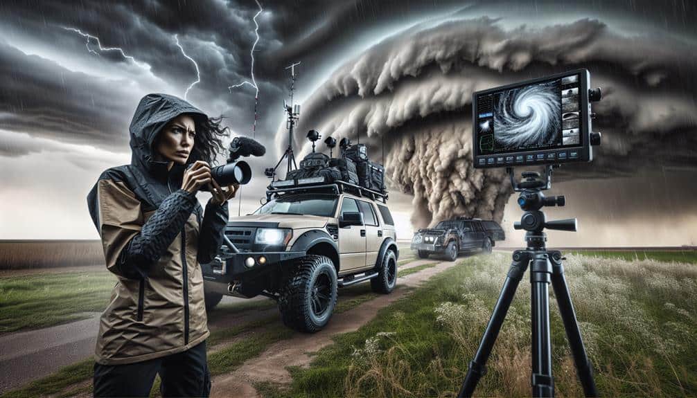
Our storm chasing techniques are designed to balance risk and data acquisition. By positioning ourselves safely, we capture high-resolution data that feeds into our storm structure analysis. In this way, we can better understand these powerful natural phenomena and enhance predictive capabilities, offering greater freedom from the unpredictability of severe weather.
Analyzing Weather Models
To enhance our predictive capabilities, we integrate data from storm structure analysis with sophisticated weather models that simulate atmospheric dynamics. These models are vital for understanding the nuances of storm formation and progression. By leveraging high-resolution datasets, we can increase model accuracy, offering a more precise forecast.
However, forecasting challenges remain. One significant hurdle is the inherent chaos of atmospheric systems, which can lead to discrepancies in data interpretation. This unpredictability mandates the use of ensemble modeling, where multiple simulations run concurrently to offer a probabilistic view rather than a deterministic one. By comparing these outputs, we can identify patterns and potential storm tracks with greater confidence.
We must also consider the temporal and spatial resolution of the models. Higher resolution models provide more detailed simulations but require substantial computational power. Balancing these factors is essential for timely and accurate predictions. The integration of real-time data from satellites, radars, and weather stations further enhances our models' robustness.
Ultimately, our goal is to refine these models continually, ensuring they adapt to new data and evolving storm patterns. By doing so, we empower ourselves with the tools needed to anticipate severe weather, minimizing risks and maximizing the freedom to act proactively.
Key Atmospheric Indicators
Let's concentrate on the key atmospheric indicators critical for predicting supercell storms.
We need to analyze:
- Temperature and humidity levels,
- Wind speed variations, and
Temperature and Humidity Levels
Accurate prediction of supercell storms hinges on meticulously analyzing temperature and humidity levels, which serve as important atmospheric indicators. By scrutinizing these factors, we can anticipate storm development with greater precision. Let's explore the specifics.
To forecast supercell formation, we need to identify key moisture patterns and temperature trends. These indicators often reveal the potential for atmospheric instability. Additionally, monitoring humidity fluctuations is vital, as they directly influence storm intensity and sustainability.
In regions prone to heat waves, elevated temperatures can worsen storm conditions, increasing the likelihood of severe supercells.
Here's what we should focus on:
- Surface Temperature Anomalies: Identifying deviations from average temperature patterns helps us detect potential storm zones.
- Dew Point Levels: High dew points are indicative of significant moisture in the air, an essential component for supercell development.
- Temperature Lapse Rates: The rate at which temperature decreases with altitude can signal atmospheric instability, a precursor to storm formation.
- Relative Humidity Profiles: These profiles give us insights into vertical moisture distribution, important for predicting storm intensity.
Wind Speed Variations
Wind speed variations play a pivotal role in diagnosing the potential for supercell storm development, providing us with essential data on atmospheric dynamics. By analyzing wind speed at various altitudes, we can identify the presence of wind shear effects, which are critical for the formation of supercells.
Wind shear, particularly directional shear, creates the necessary rotation within a storm, fostering an environment where supercells can thrive.
Utilizing advanced forecasting tools, we can detect these variations with high precision. Doppler radar, for instance, gives us real-time insights into wind patterns, allowing us to predict storm behavior with remarkable accuracy.
Combining this data with storm tracking techniques, we can monitor the evolution of wind speeds and anticipate changes that might signal supercell development.
As storm chasers, understanding wind speed variations enhances our ability to navigate the storm environment safely and effectively. By integrating data on wind shear effects, we can refine our storm chaser techniques, positioning ourselves strategically to observe and document supercell formation.
Ultimately, mastering wind speed analysis empowers us to make informed decisions, harnessing the freedom to explore and study these powerful natural phenomena.
Pressure System Changes
Changes in pressure systems serve as key atmospheric indicators that can signal the onset of supercell storms. By closely monitoring barometric pressure and pressure gradients, we can gain critical insights into storm formation. Pressure system changes play a pivotal role in weather forecasting, providing us with the necessary data to predict severe weather events.
Here's what we need to focus on:
- Barometric Pressure Drops: A sudden decrease in barometric pressure often precedes supercell storm formation. When we observe these drops, it's a strong sign that atmospheric conditions are becoming unstable.
- Pressure Gradients: Sharp pressure gradients indicate a substantial difference in atmospheric pressure between two regions. Steep gradients can lead to strong winds and vertical air movement, fostering conditions conducive to supercell development.
- Low-Pressure Systems: The presence of a low-pressure system is a red flag. These systems are associated with rising air that can enhance thunderstorm activity and potentially escalate into supercells.
- Jet Stream Interactions: When a low-pressure system interacts with the jet stream, it can significantly boost storm development. The jet stream's high-speed winds can intensify the storm, making it more severe.
Interpreting Radar Data
By analyzing radar reflection patterns, we can identify the structure and intensity of supercell storms with remarkable precision. Utilizing Doppler radar, we can assess storm intensity by measuring the speed and direction of precipitation particles. This data reveals vital information about storm movement and helps us track the path of severe weather systems. Doppler radar's ability to detect rotational movement within the storm is particularly useful for identifying mesocyclones, which are often precursors to tornado formation.
Reflection data offers insights into precipitation patterns, indicating areas of heavy rainfall, hail, or even potential updrafts within the storm. High reflection values typically suggest intense precipitation, which can correlate with the storm's overall strength. By analyzing these reflection patterns in conjunction with Doppler velocity data, we can create a detailed profile of the supercell.
Moreover, the radar's temporal resolution allows us to monitor changes in real-time, providing the flexibility to make timely decisions and take proactive measures. This analytical approach guarantees that we remain ahead of the storm, safeguarding lives and property. Through careful interpretation of radar data, we gain the upper hand in mastering supercell storm prediction.
Utilizing Satellite Imagery
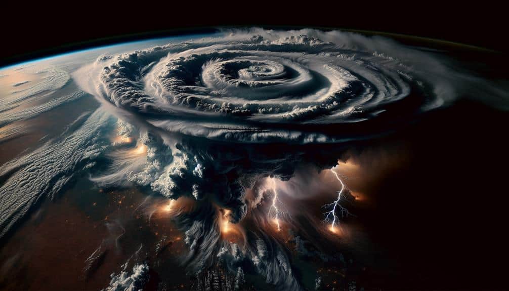
Satellite imagery provides us with a detailed view of supercell storms, allowing for the analysis of cloud formations, temperature gradients, and moisture content from a macro perspective. This bird's-eye view is essential for storm tracking and understanding the dynamic behavior of supercells.
By leveraging satellite data, we can:
- Identify Cloud Formations: Advanced sensors help us discern the structure and type of clouds, which is pivotal for pinpointing supercell characteristics.
- Track Lightning Detection: High-resolution satellite imagery can spot lightning activity, indicating the storm's intensity and potential for severe weather events.
- Analyze Temperature Gradients: Satellite thermal imagery helps us map out temperature variations within the storm, providing insights into its development stages.
- Monitor Precipitation Patterns: By observing moisture distribution, we can predict rainfall intensity and potential flooding areas.
These capabilities allow us to make informed, data-driven decisions. For those of us who value freedom, the ability to anticipate severe weather and plan accordingly is empowering.
Using satellite imagery, we gain a complete understanding of supercell dynamics, enabling better preparation and response strategies. This macro-level analysis complements other methods, offering a robust approach to predicting these formidable storms.
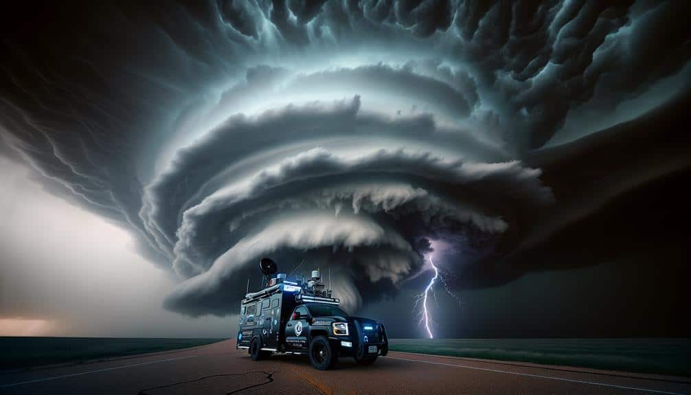
Real-time Field Observations
Real-time field observations provide us with on-the-ground data important for validating and refining our supercell storm predictions. By employing advanced storm chasing strategies, we make sure our data collection techniques are both precise and thorough. Utilizing GPS technology and mobile Doppler radar, we track storm movements in real time, allowing us to adapt our storm interception techniques on the fly.
Our team focuses on capturing high-resolution data, including wind speed, humidity, and barometric pressure. This data is vital for understanding the dynamic nature of supercells. When we deploy sensor arrays and unmanned aerial vehicles (UAVs), we gather granular data that satellites can't provide. These readings feed directly into our predictive models, enhancing their accuracy.
Storm tracking involves continuous monitoring of storm cells, identifying rotation patterns, and predicting potential tornado genesis. Our storm interception techniques involve positioning ourselves strategically to capture the most relevant data while minimizing risk. By analyzing radar reflectivity and velocity data, we can pinpoint mesocyclone formations and adjust our positioning accordingly.
Incorporating real-time field observations into our workflow not only validates our predictive models but also refines them. This approach ensures our predictions are strong, actionable, and timely, giving us the freedom to anticipate and respond to severe weather events effectively.
Safety Precautions for Chasers
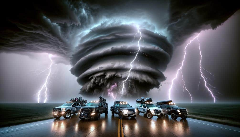
As storm chasers, we must prioritize safety by equipping ourselves with essential safety gear, including helmets and reinforced vehicles, to mitigate risks.
Real-time weather updates, accessed through advanced meteorological tools, allow us to make informed decisions and avoid hazardous zones.
Essential Safety Gear
For storm chasers, having the right safety gear, such as reinforced vehicles and GPS units, is necessary to mitigate the risks associated with tracking severe weather phenomena. Safety equipment and emergency protocols must be strictly followed in order to guarantee our safety. A well-prepared chaser team can navigate the most extreme conditions while minimizing risk.
When it comes to necessary safety gear, our focus should be on both protective gear and storm shelters. Here's a detailed list of must-have items:
- Reinforced Vehicles: Vehicles with roll cages and reinforced structures provide a strong first line of defense against debris and high winds.
- Protective Gear: Helmets, safety goggles, and heavy-duty clothing protect us from flying debris and other hazards encountered during a chase.
- Advanced GPS Units: High-precision GPS units are essential for real-time tracking of storm movements, ensuring we're always aware of our position relative to the storm.
- Portable Storm Shelters: Lightweight, deployable storm shelters offer immediate protection if conditions deteriorate rapidly.
Real-time Weather Updates
Accurate weather updates are necessary for storm chasers to make informed decisions and ensure our safety during intense weather events. Leveraging real-time data, we enhance our storm tracking capabilities, allowing us to pinpoint storm development and movement with exceptional precision.
Utilizing advanced radar systems and satellite imagery, we can interpret atmospheric conditions and predict supercell behavior effectively.
Incorporating mobile technology, we receive immediate weather alerts, guaranteeing that we remain well-informed of any rapid changes. This real-time information is pivotal for our emergency response strategies, enabling us to adapt our plans swiftly and avoid hazardous situations.
By continuously monitoring weather updates, we can identify potential threats and make strategic decisions about our positioning relative to the storm.
We must also consider the integration of geographic information systems (GIS) with meteorological data. This combination provides a detailed spatial analysis of storm paths, helping us to understand potential impact zones and plan safe evacuation routes.
Essentially, our reliance on precise, real-time weather updates isn't just a matter of convenience; it's an integral component of our safety protocols, allowing us to chase storms effectively while minimizing risk.
Frequently Asked Questions
What Equipment Do Storm Chasers Typically Use for Communication and Data Collection?
We rely on satellite technology and radar systems for precise communication and data collection. These tools empower us to track storm developments in real-time, ensuring our analyses are accurate and our movements are strategically informed.
How Do Supercell Storms Impact Local Wildlife and Ecosystems?
Supercell storms cause wildlife displacement and hinder ecosystem recovery. We must prioritize biodiversity conservation and habitat restoration to mitigate these impacts. Data shows that timely interventions greatly enhance both immediate and long-term ecological resilience and freedom.
What Are the Career Opportunities in Storm Prediction and Meteorology?
Isn't it ironic that predicting chaos can lead to a stable career? Forecasting careers offer roles like meteorology research, data analysis, and storm prediction. We can thrive in analytical environments, providing essential data for freedom and safety.
How Can Amateur Enthusiasts Get Involved in Storm Chasing Responsibly?
We can get involved in storm chasing responsibly by adhering to safety protocols, engaging with the community, and participating in citizen science. Volunteer opportunities provide data-driven insights, balancing our adventurous spirit with analytical, technical contributions to meteorological research.
What Role Does Climate Change Play in the Frequency of Supercell Storms?
Picture the skies darkening more frequently; climate change's impact is increasing supercell storm frequency. The environmental consequences are dire, with data showing more intense and frequent storms. We must analyze these trends to understand our evolving atmosphere.