To start storm chasing, you’ll need foundational meteorology knowledge, proper gear, and strict operational discipline before approaching a supercell. Learn key concepts like CAPE values, mesocyclones, and radar interpretation using free tools like RadarScope and SpotterNetwork.org. Focus on SPC moderate-to-high risk days between April and June, targeting CAPE values above 2,000 J/kg. Equip yourself with safety protocols, reliable navigation, and escape route awareness. Everything you need to chase safely and effectively is covered ahead.
Key Takeaways
- Learn essential terminology like supercell, mesocyclone, CAPE, and the Enhanced Fujita Scale to build foundational storm chasing knowledge.
- Study daily weather models, SPC outlooks, and CAPE values exceeding 2,000 J/kg to identify optimal chase days.
- Pack essential gear including RadarScope, a DSLR camera, power banks, first-aid kit, and layered weatherproof clothing.
- Always intercept storms from the south or southeast, maintain escape routes, and text GPS coordinates every 30 minutes.
- Avoid rookie mistakes like ignoring fuel levels, fixating on one storm, or skipping real-time radar updates during chases.
Storm Chasing Words You Need to Know Before You Start
Before heading out to chase storms, you’ll need to familiarize yourself with core terminology that shapes how chasers analyze and respond to severe weather.
Mastering storm chasing terminology gives you the analytical foundation to make fast, accurate decisions in the field.
Start with these essential jargon terms:
- Supercell: A rotating thunderstorm with a persistent mesocyclone, the most prolific tornado producer.
- Mesocyclone: A rotating updraft within a supercell, typically 2–6 miles wide.
- CAPE: Convective Available Potential Energy — measures atmospheric instability; higher values indicate stronger storm potential.
- Enhanced Fujita Scale (EF0–EF5): Rates tornado intensity based on damage indicators.
- Wall cloud: A localized lowering beneath a supercell’s base, often signaling tornado development.
Knowing these terms transforms raw observation into actionable intelligence.
What Storm Chasing Actually Involves Day to Day
With the vocabulary locked in, you can start applying it to what storm chasing actually looks like on an operational day — and it’s far less glamorous than highlight reels suggest.
Storm chasing routines begin early with model analysis, SPC outlook reviews, and CAPE value assessments before you’ve touched your steering wheel. Daily preparations include checking road networks, fueling up, and mapping potential target zones based on wind shear and moisture convergence data.
Most of your day involves driving, waiting, and repositioning — not photographing violent tornadoes. You’ll monitor RadarScope constantly, recalculate intercept angles, and frequently abandon targets when storms underperform.
Flexibility drives every decision. You operate independently, adapt quickly, and accept that unsuccessful days outnumber spectacular ones. That operational discipline separates effective chasers from unprepared ones chasing adrenaline.
How Tornadoes Form and Where Storm Chasers Find Them
Understanding how tornadoes form directly sharpens your ability to predict where and when to position yourself. Tornadoes develop within supercell thunderstorms when wind shear tilts a horizontal rotation axis vertical, creating a mesocyclone. That spinning column tightens as the storm’s updraft stretches it, eventually producing a visible funnel.
Mastering tornado dynamics means recognizing which storm environments breed the strongest threats. The Great Plains, particularly Oklahoma, Kansas, and Texas, deliver prime conditions between April and June. You’ll find the collision of dry continental air, Gulf moisture, and jet stream winds generating extreme instability — measured through CAPE values exceeding 2,000 J/kg.
Focus your early chases on SPC-highlighted moderate-to-high risk days. These verified setups give you maximum learning opportunities without requiring you to gamble on marginal, unpredictable conditions.
The Best Free Training Resources to Learn Storm Chasing
Learning storm chasing demands structured, sequential training — and free resources can take you surprisingly far.
Start with SpotterNetwork.org’s beginner program, which delivers structured lessons, real examples, and quizzes that build genuine competency. Follow that with Storm Analysis 101 videos to develop forecasting intuition.
For radar work, download GRLevel2 or RadarScope and analyze historical severe weather events. The 8-Minute Crash Course in Predicting Severe Storms video efficiently covers CAPE values and storm variables.
Review SPC outlook texts regularly to internalize how forecasters assess threats.
Engage with storm chasing forums to accelerate learning through experienced chasers who share real-time analysis and trip reports.
Free online courses on meteorology platforms supplement these resources effectively.
Combine these tools deliberately, and you’ll build a disciplined, data-driven foundation before your first chase.
How Storm Chasers Read Radar to Find Severe Weather
Once you’ve built a foundation in storm spotting basics, mastering radar interpretation becomes your most critical forecasting skill.
You’ll need to recognize core radar features—reflectivity, velocity, and correlation coefficient—to identify dangerous signatures like hook echoes, bow echoes, and mesocyclone rotation couplets.
Tracking a storm cell’s speed, direction, and structural changes in real time lets you position yourself safely while staying close enough to document the event.
Understanding Basic Radar Features
Radar is your most critical tool for locating and tracking severe weather, so knowing how to read it quickly and accurately can make the difference between a successful chase and a dangerous one.
Radar echoes display precipitation intensity through color-coded reflectivity, ranging from blues and greens indicating light rain to reds and purples signaling extreme precipitation cores.
You’ll also monitor storm velocity data, which measures wind speed and direction within a storm, helping you identify rotation and potential tornado development.
A hook echo signature on reflectivity scans often indicates a supercell’s rotating mesocyclone. Velocity scans showing tight couplets of inbound and outbound winds confirm dangerous rotation.
Tools like RadarScope let you access dual-polarization data, giving you sharper, more precise storm analysis than standard displays provide.
Identifying Severe Weather Signatures
Beyond understanding basic radar features, knowing how to identify specific severe weather signatures transforms raw data into actionable chase decisions.
You’ll want to recognize hook echoes—curved appendages on a supercell’s southern flank—indicating active mesocyclone rotation and potential tornado development.
Monitor velocity scans for tight couplets, where adjacent red and green pixels signal intense rotation.
Storm intensity indicators like high reflectivity cores exceeding 60 dBZ suggest large hail production. A bounded weak echo region (BWER) reveals powerful updrafts ingesting surface air rapidly.
Watch for inflow notches, where radar returns indent toward the storm core, confirming strong low-level wind convergence.
Cross-reference these signatures with SPC storm reports and mesoscale discussions to validate your radar interpretation before committing to a chase intercept position.
Analyzing Storm Cell Movement
Tracking storm cell movement gives you the predictive edge needed to position yourself ahead of developing severe weather. Understanding storm cell dynamics requires monitoring velocity data alongside reflectivity scans in tools like RadarScope or GRLevel2.
Plot successive radar frames at 5-10 minute intervals to establish precise movement vectors.
Effective tracking methods involve identifying the storm’s forward speed and directional heading, typically expressed in degrees and knots. Supercells frequently deviate 20-30 degrees right of mean wind flow, a critical variable affecting your intercept positioning.
Cross-reference storm motion with SPC mesoscale discussions to validate your independent analysis.
Calculate your intercept point by factoring storm speed against your driving distance and road network constraints. Always build in buffer time—storms accelerate unpredictably, and miscalculating approach angles puts you in dangerous positions.
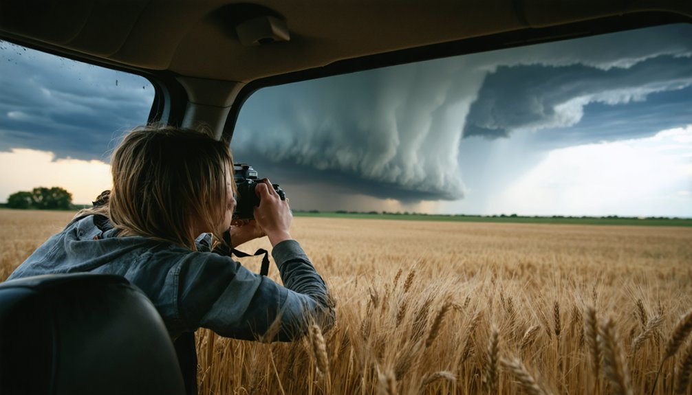
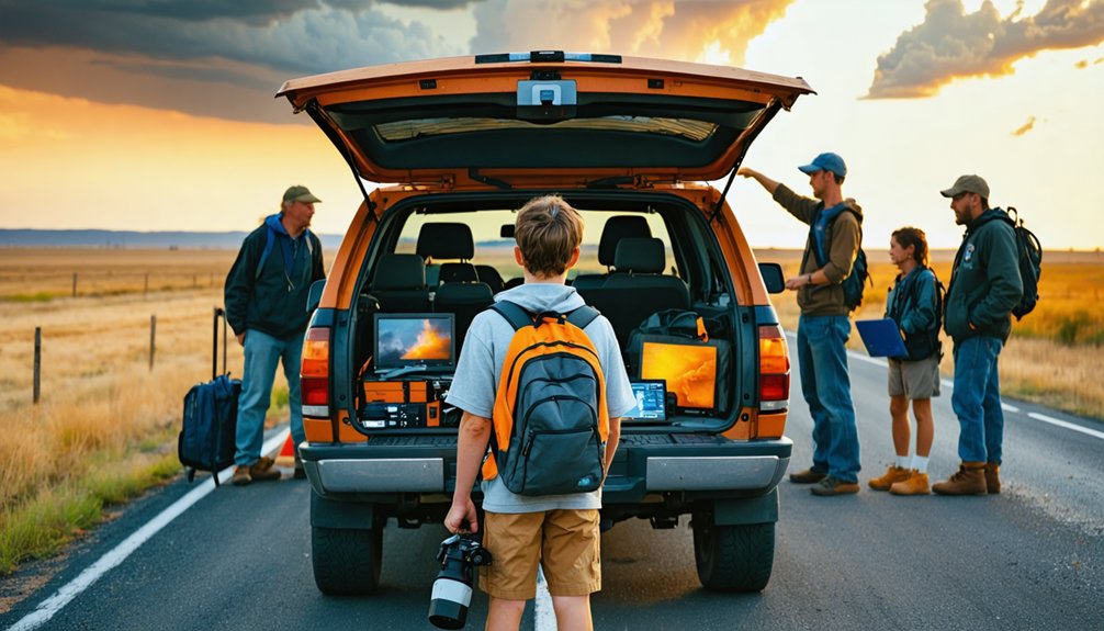
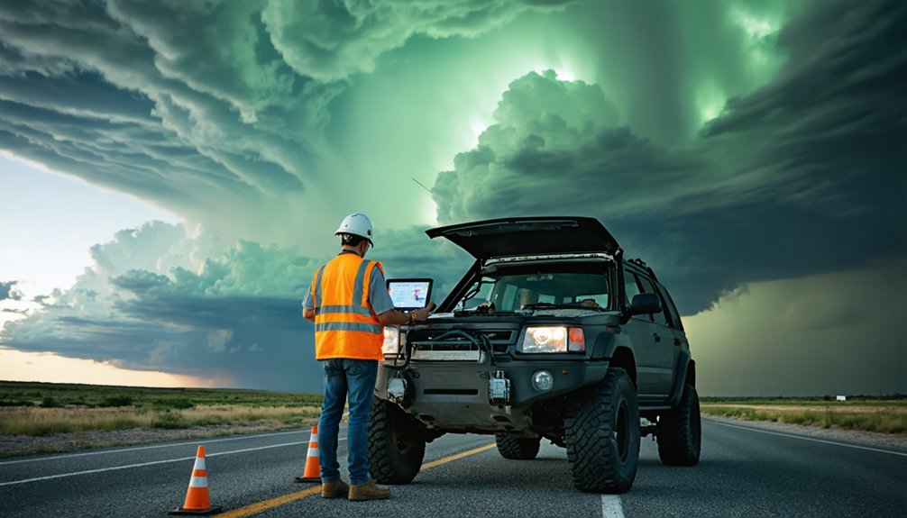
Must-Have Gear for Your First Storm Chase
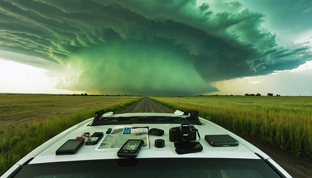
Having the right gear can mean the difference between a productive chase and a dangerous, data-starved outing. Your storm gear directly determines your operational range and survivability in the field.
- Navigation tools & communication devices: Mount a GPS unit and keep a backup paper map. A charged smartphone running weather apps like RadarScope guarantees real-time positioning.
- Camera essentials: Pack a DSLR, tripod, extra memory cards, and batteries. Set f8 aperture, ISO 100-800, and 5-15 second exposures for lightning.
- Power supplies: Carry power banks and vehicle chargers to sustain all electronics throughout extended chases.
- Safety kits & clothing layers: Include a first-aid kit, waterproof jacket, walking shoes, sunscreen, and snacks to sustain endurance during unpredictable, hours-long pursuits.
What to Wear on a Storm Chase
Clothing on a storm chase isn’t a fashion decision—it’s a functional system that directly affects your mobility, comfort, and safety across rapidly shifting conditions.
Temperature variations between morning setups and afternoon storm intercepts can exceed 30°F, demanding smart layering techniques.
Start with moisture-wicking base layers using synthetic clothing materials like polyester or merino wool. Add a mid-layer fleece for insulation, then seal everything with a waterproof, breathable outer shell.
Weather conditions shift fast, so each layer must compress and pack efficiently.
For essential accessories, include a wide-brim hat, UV-blocking sunglasses, and sturdy, waterproof walking shoes with ankle support for unstable terrain.
Comfort considerations matter during 12-hour chase days—prioritize fit over aesthetics.
Always carry spare dry socks; wet feet compromise focus and decision-making.
Beginner Safety Rules That Keep Storm Chasers Alive
Safety kills more storm chasers than storms do—not the weather itself, but poor decisions made under pressure.
Follow these four non-negotiable rules:
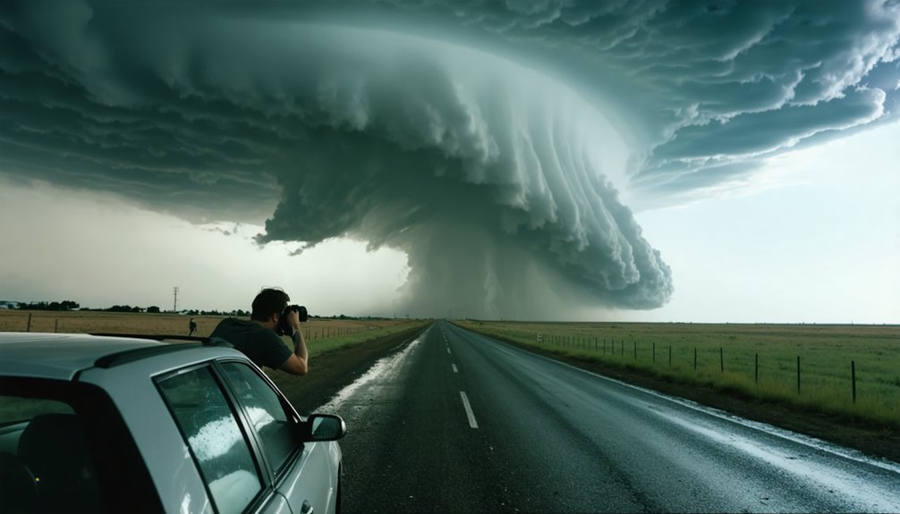
- Never position yourself directly in a tornado’s path—always intercept from the south or southeast, maintaining a clear escape route eastward.
- Monitor emergency communication channels, including NOAA Weather Radio and local spotter networks, for real-time ground truth.
- Practice strict storm chaser etiquette—don’t block rural roads, never stop on blind hills, and leave escape corridors open for other chasers.
- Establish a pre-chase communication protocol—text your GPS coordinates to a trusted contact every 30 minutes.
Your vehicle is your lifeline.
Keep fuel above half-tank, tires properly inflated, and always know your nearest paved escape route before storms develop.
How to Plan Your First Local Storm Chase
When you’re ready to chase your first local storm, start by checking the Storm Prediction Center’s (SPC) convective outlook at spc.noaa.gov by 6:00 AM on any potential chase day—a Slight (2) or Enhanced (3) risk within 150 miles of your location is a reasonable threshold for a beginner’s first intercept attempt.
Effective storm chase preparation requires monitoring CAPE values above 2,000 J/kg and wind shear parameters before committing to a target area.
Study your local weather patterns to identify terrain features that influence storm movement. Pre-load RadarScope and map two exit routes per road position. Confirm your vehicle’s fuel level, tire condition, and phone charge before departure.
Stay east of your target storm, maintain a 5-mile viewing distance, and never position yourself beneath a wall cloud.
Rookie Mistakes to Avoid on Your First Chase
Even experienced chasers trace their worst decisions back to a handful of repeatable errors that beginners make on day one. Strong chase preparation eliminates most rookie errors before you leave the driveway.
Avoid these four critical mistakes:
- Chasing unfamiliar roads — Unknown terrain kills your escape route options when a storm repositions rapidly.
- Ignoring fuel levels — Rural areas offer zero gas stations; run below half-tank and you’re stranded.
- Fixating on one storm — Locking onto a single cell blinds you to stronger development nearby.
- Skipping real-time radar — Static forecasts become useless once convection initiates; RadarScope or GRLevel2 keeps your positioning accurate.
Control your variables before the storm controls you.
Frequently Asked Questions
Do I Need a Meteorology Degree to Become a Storm Chaser?
You don’t need a meteorology degree to start storm chasing. You’ll need solid forecasting skills, proper storm chasing equipment, and strict safety precautions. Self-study resources like SpotterNetwork and RadarScope can effectively build your technical foundation independently.
How Much Money Should I Budget for My First Storm Chasing Trip?
Budget $500–$1,500 for your first trip, covering travel expenses like fuel, lodging, and food. You’ll also need storm chasing gear, including cameras, power banks, and waterproofs, so track every cost precisely.
Can I Storm Chase Alone or Do I Need a Partner?
You *can* chase alone, yet it’s no coincidence that most veterans recommend a partner. Solo chasing compromises safety protocols and equipment essentials management simultaneously. A partner monitors radar while you drive, dramatically improving your situational awareness and survival odds.
Are There Legal Permits Required for Storm Chasing in Certain Areas?
No universal permits exist for storm chasing, but you’ll need to research regional regulations before heading out. Storm chasing laws vary by location—some areas restrict road access during emergencies, so always verify local rules first.
How Do Professional Storm Chasers Make Money From Chasing Storms?
Like fish in a vast ocean, storm chaser careers offer diverse streams of storm chasing income: you can sell footage to media outlets, consult for research institutions, lead storm tours, or license weather data professionally.
References
- https://www.gabegarfield.com/blog/zerotohero
- https://www.stormchasingusa.com/blog/learning-the-basics-about-storm-chasing/
- https://stormchasing.com/the-ultimate-guide-to-planning-your-first-storm-chasing-adventure/
- https://www.youtube.com/watch?v=dCGFK8JI-mU
- https://www.youtube.com/playlist?list=PLg23mPRzqQAo68M87-pgdgOpA7rlHq0om