To use a Skew-T Log-P diagram for storm forecasting, you’ll analyze temperature and dewpoint lines to assess moisture and stability, read wind barbs for directional shear, and evaluate CAPE and CIN values to gauge convective potential. Check the hodograph’s curvature for supercell rotation risk, and cross-reference indices like the K-Index, TT Index, and SWEAT for severe weather thresholds. Master each component together, and your forecast accuracy sharpens dramatically.
Key Takeaways
- Skew-T diagrams plot temperature, dewpoint, and wind data from surface to 100mb, providing a complete atmospheric snapshot for storm forecasting.
- A narrow temperature-dewpoint spread indicates moist, near-saturated air, while convergence of lines marks cloud layer boundaries where condensation begins.
- Wind barbs and hodograph curvature reveal vertical wind shear; bulk shear ≥40 knots and curved hodographs indicate strong supercell and tornado potential.
- CAPE values exceeding 2,500 J/kg signal explosive instability, while CIN acts as a suppressive cap controlling when and whether storms initiate.
- Cross-referencing indices like K-Index, TT Index, and SWEAT alongside lapse rates and shear builds a comprehensive, accurate severe weather forecast.
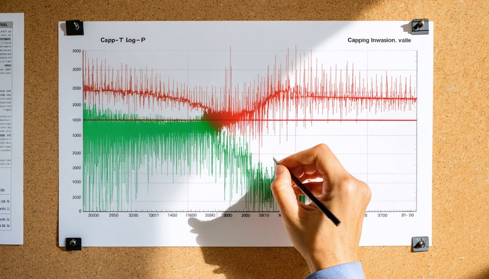
What Is a Skew-T Log-P Diagram?
A Skew-T Log-P diagram gives you an atmospheric snapshot from the surface up to 100 millibars, plotting temperature, dewpoint, and wind data collected by radiosonde weather balloons. Mastering skew t fundamentals opens up precise atmospheric profiling, giving you actionable intelligence for storm forecasting.
Skew-T diagrams turn raw balloon data into precise atmospheric intelligence, giving storm forecasters a powerful edge.
Temperature lines run diagonally southwest to northeast along a Celsius scale, which is where the “skew” originates. The logarithmic pressure scale compresses upper-level data while expanding lower-level detail, making vertical structure easier to interpret.
You’ll identify cloud layers where dewpoint and temperature converge, spot inversions disrupting convection, and assess lapse rates determining storm vigor. Wind barbs plotted along the right side reveal speed and directional changes with height.
Together, these elements give you a complete, layered picture of atmospheric structure before a storm develops.
Reading the Temperature and Dewpoint Lines on a Skew-T
When reading a Skew-T, you’ll notice the temperature lines run diagonally from southwest to northeast, so you must trace each plotted value along that slant rather than horizontally.
The gap between the temperature and dewpoint lines tells you the moisture content at each pressure level—a narrow spread signals near-saturated air, while a wide spread indicates drier conditions.
Where the two lines converge, you’ve identified a cloud layer boundary, marking the altitude at which condensation and cloud formation occur.
Temperature Line Orientation Explained
One of the first things you’ll notice on a Skew-T diagram is that the temperature lines don’t run straight up and down — they tilt diagonally from southwest to northeast, which is precisely where the “skew” in Skew-T gets its name.
This intentional tilt separates temperature values across altitude levels, making temperature gradient effects far easier to read than on traditional vertical diagrams. Without the skew, temperature and dewpoint lines would overlap constantly, obscuring critical atmospheric data.
In practical skew-T applications, this orientation lets you quickly identify whether a parcel rises freely or encounters a cap.
You’ll read temperatures in Celsius along the diagonal axis, tracking how values change with height to assess lapse rates, inversions, and overall atmospheric instability with precision.
Dewpoint Spread Indicates Moisture
Now that you understand how temperature lines run diagonally across the diagram, the next step is reading both the temperature and dewpoint lines together — because the gap between them tells you exactly how moist or dry the atmosphere is at any given level.
When the two lines run close together, the air is nearly saturated — expect clouds or precipitation. When they’re far apart, the air is dry.
You’ll track dewpoint trends vertically to identify moisture sources feeding storm development, whether it’s Gulf moisture surging northward or dry continental air aloft.
A tight spread at low levels combined with a wide spread aloft signals a sharp moisture gradient — a critical setup for severe convection.
Mastering this gap gives you immediate insight into atmospheric moisture structure.
Identifying Cloud Layer Boundaries
You’re fundamentally reading atmospheric structure directly—stability zones become visible where the temperature and dewpoint lines separate sharply, confirming drier, more stable air suppressing further cloud growth.
Wind Barbs and the Hodograph: What Every Symbol Means
When reading wind barbs on a Skew-T, you’ll interpret each symbol by its attached markings: a half barb represents 5 knots, a full barb 10 knots, and a pennant flag 50 knots.
You can assess vertical wind shear by tracking how speed and direction change with height as the barbs stack upward along the right side of the diagram.
On the hodograph, you’ll read the plotted curve’s length and curvature to evaluate shear magnitude and supercell or tornado potential, with a longer, more sharply curved trace signaling higher risk.
Decoding Wind Barb Symbols
Wind barbs and hodographs are two distinct tools embedded in the Skew-T diagram, each encoding wind data in a specific visual format you’ll need to interpret accurately.
Mastering wind barb symbols directly improves your shear analysis and storm organization assessments.
Each barb encodes both wind speed and wind direction simultaneously:
- Half barb — 5 knots
- Full barb — 10 knots
- Pennant/flag — 50 knots
- Barb orientation — points toward the wind’s origin direction
Combine multiple barbs on a single staff to calculate total speed.
The staff’s angle indicates wind direction relative to north.
Rapid changes in these values across altitude layers reveal critical vertical shear patterns, giving you actionable intelligence for predicting whether storms will organize into discrete, long-lived supercells.
Reading Hodograph Curves
Once you’ve decoded individual wind barbs on the Skew-T, the hodograph takes that same wind speed and direction data and plots it as a continuous curve, letting you assess vertical wind shear at a glance. Each point on the curve represents wind velocity at a specific altitude, and the line connecting those points forms the basis of your shear analysis.
For hodograph interpretation, focus on two key features: length and curvature. A longer hodograph signals stronger overall shear, favoring organized, long-lived storms.
Sharp curvature, particularly in the 0–3 km layer, indicates veering winds and enhances supercell and tornado potential. A straight, short hodograph suggests weak shear and disorganized convection.
Measuring the enclosed area within the curve gives you storm-relative helicity, quantifying rotating updraft potential directly.
Rain, Snow, and Icing Risk Hidden in the Temperature Profile

The temperature profile on a Skew-T reveals precipitation type and icing risk at a glance. Trace the sounding from surface to upper levels to identify where rain formation begins, snow characteristics develop, or icing conditions emerge.
Key precipitation types to identify:
- Rain – Entire profile stays above 0°C; liquid precipitation reaches the surface.
- Snow – Temperature column remains below freezing; snow characteristics persist through descent.
- Freezing Rain – Warm layer aloft melts snowflakes, but a shallow subfreezing surface layer refreezes droplets.
- Icing Conditions – Saturated air below freezing signals supercooled liquid water; dangerous for aviation.
You’ll recognize icing conditions where dewpoint and temperature converge below 0°C.
Mastering these precipitation types lets you extract critical forecast intelligence directly from the profile.
CAPE and CIN: The Instability Numbers That Drive Storms
Two numbers define whether the atmosphere will erupt into storms or stay quiet: CAPE and CIN.
CAPE significance lies in quantifying stored energy available for convective processes — higher values mean violent energy release and aggressive storm evolution. Values exceeding 2,500 J/kg signal explosive instability dynamics capable of producing severe weather.
CAPE doesn’t whisper — values past 2,500 J/kg scream violent instability, explosive energy, and severe weather incoming.
CIN impact works against convection, acting as a cap that suppresses rising parcels. You’ll find CIN represented as negative values; stronger negative numbers indicate a harder-to-break cap restraining storm prediction potential.
Read your thermal profile carefully.
Examine moisture analysis through dewpoint data at key atmospheric pressure levels — 850, 700, and 500 millibars. When heating erodes CIN while CAPE remains loaded, conditions become primed for rapid, explosive storm development you won’t want to underestimate.
Inversions and Lapse Rates: What the Shape of the Curve Tells You
Curves don’t lie — the shape of your temperature profile on a Skew-T reveals atmospheric stability at a glance. Lapse rate implications become immediately visible: steep curves signal instability, while shallow or reversed curves indicate suppression.
Temperature inversion types directly control vertical mixing, cloud formation, and storm potential.
Watch for these critical atmospheric stability indicators:
- Surface inversions — trap moisture profiles near the ground, limiting convection
- Elevated inversions — act as caps, storing CAPE beneath until explosive release
- Isothermal layers — zero lapse rate, halting thermal processes and updraft development
- Dry adiabatic segments — steep curves confirming vigorous vertical mixing potential
Understanding inversion types lets you independently assess where storms initiate, stall, or explode without relying solely on index numbers.
K-Index, TT Index, and SWEAT Thresholds Explained
When reading a Skew-T, you’ll rely on three key indices to assess thunderstorm potential: the K-Index, TT Index, and SWEAT Index.
You calculate the K-Index using the formula T850 + Td850 + Td700 − T700 − T500, where values above 35 signal numerous thunderstorm chances.
For severe weather, you cross-reference the TT Index—flagging significant risk above 52—and the SWEAT Index, where thresholds between 300–400 indicate severe storms and values exceeding 400 suggest tornadic potential.
Understanding Thunderstorm Index Thresholds
Three thunderstorm indices you’ll rely on most when interpreting Skew-T diagrams are the K-Index, the Total Totals (TT) Index, and the SWEAT Index. Each offers a distinct angle on thunderstorm formation risk, making index comparison essential for accurate forecasting.
Use these thresholds to guide your analysis:
- K-Index >35 — signals numerous thunderstorms likely
- TT Index 44–48 — scattered non-severe storms possible; >52 indicates many severe storms
- SWEAT 150–300 — slight severe weather risk; 300–400 confirms severe storms
- SWEAT >400 — tornadic potential increases considerably
No single index tells the full story. Cross-referencing all three lets you identify when atmospheric conditions are stacking toward dangerous convection, giving you a more decisive, thorough picture before committing to a forecast.
Interpreting Severe Weather Indices
Severe weather indices give you a numerical framework for translating raw atmospheric data into actionable forecast decisions. Each index captures distinct storm dynamics, letting you diagnose weather patterns efficiently.
The K-Index combines 850mb temperature, 850mb dewpoint, 700mb dewpoint, and 500mb temperature into a single value. Scores above 35 indicate numerous thunderstorms are likely.
The Total Totals Index flags severe potential when values exceed 52, while readings between 44-48 suggest scattered non-severe activity.
The SWEAT Index integrates moisture, instability, and wind shear simultaneously. Values between 150-300 signal slight severe potential, 300-400 indicate organized severe storms, and 400+ suggest tornadic environments.
Cross-referencing all three indices rather than relying on a single metric sharpens your forecast confidence considerably and reduces costly assessment errors.
SRH and Bulk Shear: Identifying Supercell Conditions on a Skew-T

Two critical parameters for identifying supercell potential on a Skew-T are Storm Relative Helicity (SRH) and Bulk Shear. These measurements directly reveal supercell characteristics and wind shear impacts across atmospheric layers.
Interpret these thresholds to assess supercell risk:
- SRH 150-299 m²/s² — Supercell development possible
- SRH 300-499 m²/s² — Significant supercell and tornado risk
- Bulk Shear ≥40 knots (0-6km) — Organized supercell structure supported
- Bulk Shear ≥50 knots — Strong, long-lived supercell potential confirmed
You’ll find SRH values displayed alongside the hodograph. A longer, sharply curved hodograph confirms strong rotational potential.
When bulk shear exceeds 40 knots alongside elevated CAPE, you’re looking at an environment capable of sustaining dangerous, organized convection.
Hail, Tornadoes, and Straight-Line Winds: What Skew-T Data Reveals
Once you understand supercell dynamics, Skew-T data lets you diagnose three distinct severe weather hazards—hail, tornadoes, and straight-line winds—each tied to specific thermodynamic and kinematic signatures.
For hail formation, check the wet-bulb zero height and freezing level within atmospheric layers; lower values favor large hail survival. High CAPE instability parameters fuel vigorous convective processes, driving hailstones through repeated updraft cycles.
Lower wet-bulb zero heights and towering CAPE values create the perfect recipe for devastating large hail.
Tornado dynamics demand curved hodographs showing strong wind shear alongside robust moisture profiles and steep lapse rates confirming storm structure organization.
For straight-line winds, identify the hydrolapse signature—a sharp dewpoint decrease aloft indicating dry air entrainment. This moisture profile characteristic drives severe evaporative cooling, accelerating downdrafts.
Precipitation types shift with temperature profiles, confirming whether severe weather threatens as frozen, mixed, or liquid hazards.
Building a Complete Storm Forecast From One Skew-T Sounding

A single Skew-T sounding contains everything you need to build a complete storm forecast, but only if you read it systematically.
Understanding atmospheric dynamics means integrating multiple parameters simultaneously rather than isolating individual values.
Work through this sequence to capture the full storm lifecycle:
- Assess stability — Check CAPE, CIN, and lapse rates to determine convective potential.
- Evaluate moisture — Measure dewpoint-temperature spreads at 850, 700, and 500 millibars.
- Analyze shear — Examine hodograph curvature and bulk shear for storm organization and rotation potential.
- Calculate severe indices — Compute TT Index, K-Index, SWEAT, and SRH to quantify threat type and intensity.
Each layer informs the next.
You’re not reading isolated data points — you’re decoding a complete atmospheric story.
Frequently Asked Questions
How Often Are Radiosonde Weather Balloons Launched to Update Skew-T Data?
Twice daily yet constantly evolving, you’ll find radiosonde frequency secured at 00Z and 12Z UTC launches. Master data interpretation at these intervals, and you’re revealing atmospheric snapshots that fuel precise, freedom-driven storm forecasting decisions.
Can Skew-T Diagrams Predict Fog Formation Near the Surface?
Yes, you can predict fog formation by examining near-surface dewpoint-temperature spreads on a Skew-T. When they converge within 2-3°C, saturation’s likely, degrading surface visibility considerably through radiation or advection fog development.
Are Skew-T Soundings Available in Real Time for Public Access?
Yes, you can access real-time skew-T soundings freely through NOAA’s University of Wyoming website. They’re updated twice daily, letting you perform skew-T interpretation and assess atmospheric stability without restriction or cost.
How Does Terrain Elevation Affect the Accuracy of Skew-T Readings?
Terrain influence skews surface data substantially—you’ll find elevation impact distorts baseline readings when balloons launch from high-altitude sites, misrepresenting low-level temperature, dewpoint, and wind profiles compared to surrounding lower-elevation terrain.
Can Skew-T Diagrams Be Used Effectively for Marine Weather Forecasting?
Yes, you can use Skew-T diagrams effectively for marine analysis by interpreting radiosonde data from coastal or ship-based launches, helping you identify storm patterns, atmospheric instability, wind shear, and severe weather risks over open waters.
References
- https://www.weather.gov/source/zhu/ZHU_Training_Page/convective_parameters/skewt/skewtinfo.html
- https://www.spot-on-weather.com/uploads/9/4/6/3/94633598/forecasting_weather_using_skew.pdf
- https://www.cs.ubc.ca/~tmm/courses/cpsc533c-06-fall/projects/sancho/proposal/documents/Skew-T-Manual.pdf
- https://www.aopa.org/news-and-media/all-news/2008/july/pilot/wx-watch-skew-t-basics
- https://flsc.org/portals/12/PDF/Read_Skew_T.pdf
- https://www.youtube.com/watch?v=2B3NPGeOQxs
- https://www.downunderchase.com/storminfo/stormguide/guide06.html
- https://vortex.plymouth.edu/~stmiller/stmiller_content/Tutorials/skew_t.html

