Hurricane chasing tracks massive oceanic systems 60-1,000+ miles wide along predictable pathways at 10-20 mph, providing 36-hour advance warnings that enable strategic coastal positioning via boats and aircraft. You’ll face fundamentally different challenges with tornado chasing, intercepting 300-400 yard vortices that form unpredictably across central U.S. plains with only 13-minute warning windows, demanding immediate road-based responses. While hurricanes expose you to 155+ mph winds and storm surge across days-long missions, tornadoes compress life-threatening encounters into seconds-minutes of rapid evolution. The operational frameworks, equipment requirements, and risk mitigation protocols diverge dramatically between these meteorological pursuits.
Key Takeaways
- Hurricanes span 60-1,000+ miles and last days/weeks, while tornadoes cover 300-400 yards and last seconds to minutes.
- Hurricanes provide 36-hour advance warnings with predictable tracks, tornadoes offer only 13-minute warnings with erratic movement.
- Hurricane chasing requires boats/aircraft over open ocean, tornado chasing uses road networks across central U.S. plains.
- Hurricane winds reach 155+ mph with storm surge causing most deaths, tornado chasing fatalities primarily result from vehicle collisions.
- Hurricanes allow strategic positioning and personnel rotations, tornadoes demand immediate real-time adjustments and rapid escape protocols.
Scale and Formation: Comparing Storm Systems
The physical dimensions separating hurricanes and tornadoes represent one of meteorology’s most dramatic contrasts. You’ll observe hurricanes spanning 60 to over 1,000 miles across, while tornadoes rarely exceed a few hundred feet at ground contact—a scale difference exceeding 1,000-fold.
Their formation mechanisms diverge fundamentally. Hurricanes extract energy through energy exchange processes over warm ocean waters above 26.5°C, where evaporating moisture drives circular wind acceleration and eye formation. Tornadoes, conversely, develop from thunderstorms in high vertical wind shear environments, typically within supercell mesocyclones. The rear flank downdraft pulls rotating air groundward, creating the characteristic funnel.
Most tornadoes span merely 300-400 yards wide, though the largest recorded damage path exceeded 2.5 miles—still minuscule compared to hurricane dimensions.
Geographic Terrain and Operational Zones
Geographic terrain fundamentally dictates your operational parameters when chasing these storm systems. Hurricane intercepts require coastal positioning along predictable tracks spanning thousands of miles across international waters and multiple nations, while tornado chasing confines you to flat continental interiors—primarily the central U.S. plains—where supercells follow erratic 10-20 mile ground paths.
You’ll navigate open ocean approaches and beachfront zones for hurricanes versus rapid road-based repositioning through Tornado Alley’s grid system, where minutes determine intercept success.
Ocean Vs Land Operations
While hurricanes and tornadoes both produce extreme weather, their operational environments differ fundamentally in geographic scale and terrain characteristics. You’ll face distinct water-based safety challenges when pursuing hurricanes across open ocean, where navigation demands boats or aircraft instead of road networks.
Ocean observation models rely on consistent water terrain enabling predictable large-scale tracking across hundreds of kilometers, yet isolation amplifies escape risks from sustained winds exceeding 160 mph. Conversely, tornado chasing grants you mobility freedom through Plains grid networks, allowing precise storm interception within minutes.
You’ll navigate land-based operations where visibility varies dramatically—flat Great Plains offer 360-degree supercell views, while Southeast trees and hills complicate spotting. These operational zones demand contrasting strategies: ocean pursuits require marine positioning, land chasing exploits road accessibility.
Predictable Vs Erratic Pathways
Beyond terrain considerations, storm pathway characteristics fundamentally reshape how you’ll approach each chase type. Hurricanes deliver consistent vs variable motion—traveling at predictable 10-20 mph speeds along forecasted tracks spanning 7-10 days. You’ll calculate interception points with precision using satellite technology and models like HAFS, positioning yourself within predictable vs unpredictable corridors confined to tropical oceanic pathways before coastal landfall.
Tornadoes eliminate this planning freedom entirely. You’re facing 13-minute average warnings with no advance trajectory data. Even when rotating thunderstorms develop, you can’t determine if they’ll spawn tornadoes or where they’ll track. These systems travel erratically across continental regions, covering merely 10-20 miles during minute-long lifespans. You’ll monitor broader geographical areas without reliable positioning strategies, responding reactively rather than strategically planning intercepts days ahead.
International Vs Domestic Access
When you chase hurricanes, you’ll operate across international oceanic basins spanning continents, while tornado chasing confines you almost exclusively to domestic US boundaries.
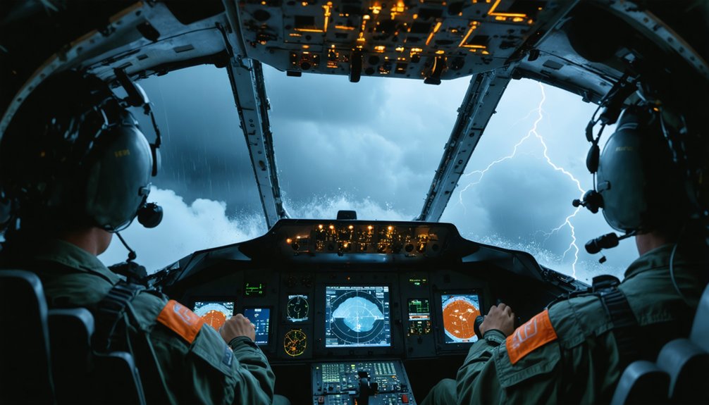
Hurricane missions deploy aircraft from Florida to track Atlantic systems, requiring international cooperation with partners like Hong Kong Government Flying Service and coordination across Bahamas, Caribbean, and African waters despite government regulations. The NHC monitors developments from Cabo Verde Islands through Yucatan Peninsula, while saildrones patrol Tropical Atlantic zones.
Hurricane vs Tornado Operational Zones:
- Hurricane flights cover 4,000+ nautical miles at 45,000 ft across international maritime territories
- Tornado chasing remains terrestrial within Great Plains’ accessible highway networks
- G-IV missions map steering currents over thousands of square miles spanning multiple nations
- Tornado Alley operations in Texas, Oklahoma, Kansas require no cross-border clearances
Chase Duration and Logistical Planning
Tornado intercepts compress the entire chase sequence—target selection, positioning, storm interception, and documentation—into windows spanning seconds to minutes of actual tornado activity, despite chasers monitoring atmospheric conditions for days in advance. You’ll face 13-minute average warning windows requiring immediate real-time adjustments, delaying fuel stops and periodic rest until storms dissipate.
Hurricane tracking extends across days or weeks from ocean formation to landfall, with 36-hour advance warnings enabling methodical personnel staffing rotations and multi-day positioning strategies. Storm diameters reaching 1,000 miles versus tornadoes’ localized footprints fundamentally alter your operational freedom—hurricanes permit coordinated evacuation timing and broad-area preparation, while tornado chasing demands high-mobility intercepts under sun-baked skies, where hazy conditions and split-second road choices determine success during brief mid-afternoon to early-evening peak activity windows.
Safety Hazards and Risk Management
You’ll face fundamentally different threat profiles between hurricane and tornado chasing, each requiring distinct risk mitigation strategies.
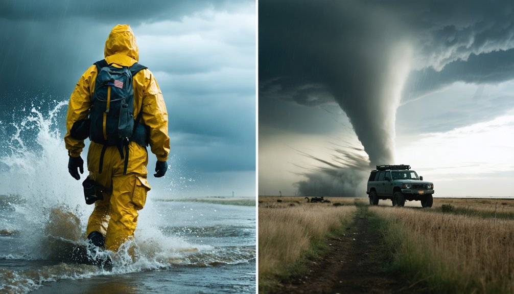
Hurricane chasing exposes you to sustained 155+ mph winds, storm surge traveling miles inland (responsible for 60% of fatalities), and rip currents reaching 5 mph that persist days after landfall.
In contrast, tornado chasing presents acute traffic risks—averaging 1 death annually from multitasking-related crashes—alongside the need for rapid escape protocols when intercepting rapidly-evolving EF4-EF5 tornadoes with minimal warning time.
Primary Threats Each Faces
Storm surge ranks as the leading cause of hurricane-related deaths in the United States, generating an abnormal rise in water levels that can travel miles inland and devastate coastal communities. You’ll face distinct hurricane hazards versus tornado impacts when pursuing these phenomena:
Hurricane Threats:
- Storm surge and flooding cause majority of direct fatalities, with drowning deaths peaking within three days of landfall
- Heavy rainfall exceeds six inches, producing deadly flash flooding that persists days after storm dissipation
- Electrocution emerges as leading death cause, with tree-related injuries and traumatic head wounds occurring post-storm
- Salt water intrusion endangers public health while high winds generate flying debris
Tornado Threats:
- Vehicle convergence increases collision risks on active chase days
- Large hail and tornadoes directly threaten chasers and equipment
- Close proximity risks being overrun by rapidly-evolving storm structures
- High-precipitation supercells and challenging terrain compound vehicle hazards
Emergency Escape Protocol Differences
Coastal evacuations for hurricanes initiate 72+ hours before landfall, while tornado chasers operate with minutes-to-seconds decision windows when storms deviate from forecast tracks. Your hurricane escape leverages evacuation infrastructure planning—designated routes, coordinated emergency management, and multi-day preparation runways. Coastal residents demonstrate 29% out-of-region movement versus 5% inland dispersion, reflecting transportation access and resource availability differences.
Tornado escapes demand real-time routing independence. You’ll face 300+ mph core winds that eliminate close-range options, requiring greater standoff distances from circulation. Ground transportation kills more chasers than atmospheric hazards—poor routing decisions on congested roads exceed wind or hail dangers.
Post disaster recovery resources support hurricane survivors through established frameworks, whereas tornado chasers self-extract immediately. Night chases amplify head-on highway encounter risks when visibility drops.
Warning Time and Preparation
Warning systems for these storm types operate on fundamentally different temporal scales that define your strategic positioning and risk exposure. Tornado warnings deliver 10-15 minutes lead time requirements, forcing immediate shelter seeking protocols when rotation appears on radar. Hurricane watches provide 48-hour windows before tropical storm force winds arrive, enabling deliberate evacuation decisions.
Critical timing disparities include:
- Tornado watches span multiple counties for several hours while warnings target single storm cells for 20-30 minutes
- Hurricane warnings trigger 36 hours before expected conditions versus tornado warnings’ seconds-to-minutes notice
- Storm Prediction Center issues tornado watches hours ahead; local NWS offices activate warnings upon detection
- Hurricane tracking allows days of logistical planning while tornado intercepts demand split-second directional adjustments
You’ll face compressed decision windows with tornadoes versus extended preparation phases for hurricane operations.
Essential Equipment and Technology
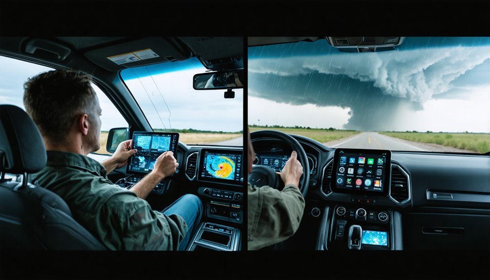
Successful storm intercepts depend on three critical technology categories: real-time weather monitoring systems, reliable communication networks, and robust power infrastructure. You’ll need Baron Mobile Threat Net or RadarScope Pro for storm tracking, while XM Weather delivers radar updates every five minutes. Weather briefing services integrate surface observations with atmospheric pressure data from portable barometers.
Communication demands redundancy—Garmin inReach Mini 2 satellite communicators function where cellular networks fail, while Yaesu FT-991A transceivers access SkyWarn observations. Camera stabilization through RAM universal adapters and windshield mounts enables quality documentation with Sony CX900 or GoPro systems shooting 1080p60 fps. Power sustainability requires Anker 737 PowerCore banks and EcoFlow Delta Pro stations.
Your 4WD vehicle becomes a mobile command center with cellular boosters, laptop mounts, and GPS-based Street Atlas mapping software.
Data Collection and Media Capture Strategies
While hurricanes and tornadoes both demand rigorous scientific observation, their data collection architectures differ fundamentally in spatial scale and temporal deployment. You’ll deploy dropsondes from aircraft penetrating hurricane cores across hundreds of miles, transmitting pressure, temperature, and wind data artifacts to forecast models. Tornado interception requires mobile mesonet vehicles and Doppler on Wheels radars positioned opportunistically along unpredictable paths spanning mere minutes.
Key instrumentation design contrasts:
- Hurricane platforms use geostationary satellites for continuous ocean tracking; tornado teams rely on rapid-deploy ground radars
- Aircraft-mounted systems generate volumetric storm imagery for hurricanes; helmet cameras capture tornado vortex dynamics at ground level
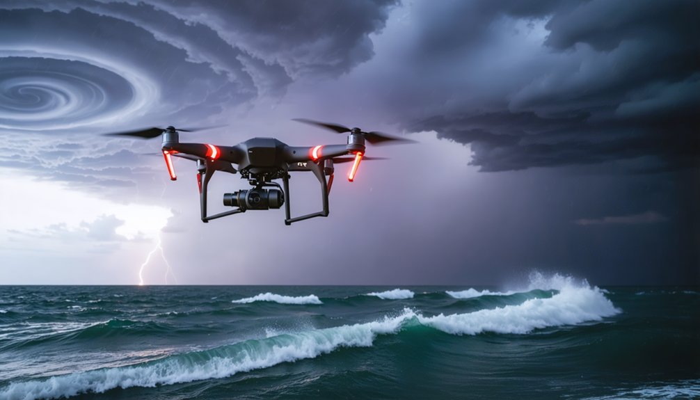
- Autonomous drones probe hurricane thermodynamics over days; tethered balloons sample pre-tornado boundary layers in hours
- StreamSondes enable mass hurricane data collection; portable disdrometers quantify tornado precipitation rates within circulation zones
Frequently Asked Questions
What Training or Certifications Are Required to Become a Professional Storm Chaser?
No formal certifications are legally required, but you’ll benefit from pursuing meteorology degrees and SKYWARN training. You’ll need expertise in operating specialized field equipment, analyzing weather data, and mastering storm dynamics to chase professionally and safely.
How Much Does a Typical Hurricane or Tornado Chasing Expedition Cost?
Like investing in adventure stock, you’ll find expedition pricing ranges $2,500-$5,050 for tornado tours (5-10 days). Budgetary considerations include $750-$1,000 deposits, with May commanding premium rates. Hurricane-specific data remains unavailable for independent pursuit planning.
Can Amateur Enthusiasts Join Organized Chase Tours for Either Storm Type?
You can join organized tornado tours with proper equipment needed like chase vehicles and radar systems, but hurricane tours are rare due to extreme risks involved—including 140 MPH winds, storm surges, and zero emergency access during peak impacts.
What Insurance Coverage Do Chasers Need for Vehicles and Aircraft Operations?
Lightning strikes symbolize your exposure: you’ll need thorough vehicle insurance coverage ($1M+ commercial liability) for ground pursuits, plus specialized aircraft liability insurance for aerial operations. Standard personal policies won’t cover storm-chasing risks—commercial-grade protection safeguards your freedom.
How Do Chasers Coordinate With Emergency Management and Meteorological Agencies?
You’ll coordinate through centralized Net Control Stations and Emergency Operations Centers, providing real-time storm data to meteorological agencies. Your coordination with first responders enables rapid emergency response, while coordination with media outlets disseminates critical public safety warnings efficiently.