We've identified the five best hurricane research missions in the Atlantic, emphasizing their contributions to the field. Project Stormfury in the 1960s aimed to weaken hurricanes via cloud seeding but had mixed results. Hurricane Hunters employ specialized aircraft to collect real-time storm data, improving predictive models. NOAA's Hurricane Research Division uses cutting-edge technology to enhance forecasting accuracy. NASA's GRIP Mission focuses on tropical cyclone formation and intensification using advanced satellite data. The PREDICT Experiment investigates pre-genesis environments to refine weather prediction models. By analyzing these missions, one can appreciate the advancements in hurricane research.
Key Points
- Project Stormfury aimed to weaken hurricanes through cloud seeding with silver iodide, showing mixed results in intensity reduction.
- Hurricane Hunters collect real-time data on storm intensity, trajectory, and structure, enhancing predictive models and disaster response strategies.
- NOAA's Hurricane Research Division uses advanced technology and data sources to refine climate modeling and improve hurricane forecasting accuracy.
- NASA's GRIP Mission focuses on tropical cyclone formation and intensification, integrating satellite data to enhance prediction capabilities.
Project Stormfury
Project Stormfury, initiated in the 1960s, aimed to weaken hurricanes by seeding their clouds with silver iodide. We sought to explore hurricane modification through controlled cloud seeding, hypothesizing that introducing silver iodide into the eyewall could disrupt the storm's structure. By injecting this compound, we anticipated inducing the formation of ice crystals, which would redistribute latent heat and potentially weaken the hurricane's intensity.
Data collected from multiple missions indicated mixed results. Initial trials suggested a measurable reduction in wind speeds, with some hurricanes exhibiting a 10-30% decrease in peak intensity. However, subsequent missions failed to consistently replicate these outcomes. The variability in results underscored the complexity of atmospheric dynamics and the challenges inherent in modifying natural weather systems.
Our analysis revealed several factors that impacted the efficacy of cloud seeding, including the storm's existing structure and environmental conditions at the time of seeding.
Despite the inconclusive results, Project Stormfury provided valuable insights into hurricane behavior and the potential for future interventions. While the project didn't achieve definitive success in hurricane modification, it laid the groundwork for ongoing research and underscored the importance of innovative approaches to disaster mitigation.
Hurricane Hunters
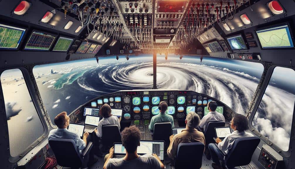
Hurricane Hunters, specialized reconnaissance aircraft crews, play a pivotal role in collecting real-time data on storm intensity, trajectory, and structure to enhance predictive models and inform disaster response strategies. Utilizing both manned and unmanned aerial reconnaissance, we gather crucial data that satellites and ground-based systems can't capture. Our missions involve flying directly into the eye of the storm, where we deploy dropsondes to measure atmospheric pressure, temperature, humidity, and wind speed.
The data collection process is meticulously designed to improve storm tracking and weather forecasting. By relaying precise metrics back to meteorological centers, we enable timely updates to predictive models. This real-time information greatly enhances the accuracy of forecasts, providing communities with essential lead time for evacuation and preparation.
Moreover, our flights offer a unique perspective on storm dynamics, contributing to the broader understanding of hurricane behavior. Each mission generates terabytes of data, feeding into sophisticated algorithms that enhance future storm predictions.
Ultimately, our work not only aids immediate disaster response but also advances long-term meteorological research. The freedom to explore and understand these natural phenomena empowers us to safeguard lives and property more efficiently.
NOAA's Hurricane Research Division
To advance our understanding of hurricanes, NOAA's Hurricane Research Division employs state-of-the-art technology and rigorous methodologies to collect and analyze vital storm data. By leveraging advanced hurricane tracking systems, we can monitor storm development in real-time, providing valuable information for predictive models. These data are essential for improving the accuracy of climate modeling, which in turn enhances our ability to forecast hurricane impacts and mitigate potential damage.
Our division utilizes a multi-faceted approach, combining airborne reconnaissance, oceanographic instruments, and satellite data. Airborne missions deploy dropsondes and radar systems to gather detailed atmospheric measurements. This data feeds directly into numerical models to simulate storm behavior.
Concurrently, ocean buoys and underwater gliders measure sea surface temperatures and salinity, parameters that greatly influence hurricane intensity. The integration of these diverse data sources allows us to refine our climate modeling techniques, providing a thorough understanding of hurricane dynamics.
NASA's GRIP Mission
NASA's Genesis and Rapid Intensification Processes (GRIP) mission focuses on understanding the underlying mechanisms that drive the formation and intensification of tropical cyclones. We dive deep into the dynamics of weather patterns by integrating advanced data collection techniques. Our goal is to demystify how these powerful storms develop and intensify, providing critical insights.
Utilizing state-of-the-art satellite technology, GRIP offers unparalleled capabilities in storm tracking. We deploy a fleet of satellites and airborne instruments to capture thorough data. This data is pivotal in mapping the progression of tropical cyclones, giving us a granular look at their evolving structures.
By analyzing these high-resolution datasets, we can identify key factors contributing to rapid intensification, such as sea surface temperatures, atmospheric moisture, and wind shear. The precision of our data collection efforts enables us to model these weather patterns with greater accuracy.
We then translate these models into actionable forecasts, offering communities valuable lead time to prepare. Through GRIP, we're not just observing storms; we're unraveling their secrets, pushing the boundaries of our understanding, and enhancing our ability to predict their behavior. It's a mission that champions both scientific exploration and public safety.
The PREDICT Experiment

While GRIP explores the mechanics of storm intensification, the PREDICT Experiment rigorously explores the conditions conducive to tropical cyclone formation. Our focus is on understanding pre-genesis environments in the Atlantic.
By leveraging high-resolution data collection and advanced storm tracking methodologies, PREDICT aims to decode the atmospheric precursors that lead to cyclone development.
We employ a fleet of aircraft equipped with state-of-the-art instrumentation to gather detailed atmospheric profiles. These instruments measure variables such as temperature, humidity, wind speed, and pressure.
By analyzing this data, we can identify the specific conditions under which tropical disturbances evolve into cyclones. Our storm tracking systems provide real-time updates, enhancing our ability to monitor and predict storm formation with greater accuracy.
The data collected during PREDICT missions are invaluable for improving numerical weather prediction models. Enhanced models lead to more precise forecasts, granting communities the critical time needed to prepare and respond.
Our rigorous analytical approach and commitment to data-driven research contribute significantly to the field of meteorology. Through PREDICT, we aim to reveal the complexities of tropical cyclone genesis, ultimately empowering individuals with the knowledge to make informed decisions in the face of impending storms.
Frequently Asked Questions
How Do Hurricanes Form and Develop in the Atlantic?
Imagine this: Hurricane formation in the Atlantic starts with warm ocean waters and humid air, feeding storm clouds. As these systems evolve, they strengthen through wind convergence and pressure drops, creating potent hurricanes.
What Role Do Satellites Play in Hurricane Research?
Satellite technology enhances our hurricane research by providing real-time data collection. We analyze this data to predict storm paths, intensities, and potential impacts, ultimately empowering us to make informed decisions and maintain our freedom in the face of nature's fury.
How Has Hurricane Forecasting Accuracy Improved Over the Years?
We've seen remarkable improvements in hurricane forecasting accuracy over the years. Improved technology and advanced data analysis have greatly enhanced our predictive models, allowing us to provide more precise and timely warnings, giving people greater freedom to prepare.
What Are the Primary Tools Used for Tracking Hurricanes?
Tracking hurricanes is like piecing together a complex puzzle. We rely on aerial reconnaissance to gather in-situ data and Doppler radar for detailed precipitation patterns, ensuring accurate forecasts and empowering people to make informed decisions for their safety.
How Do Climate Change Factors Influence Hurricane Activity?
We analyze the impact of climate change on hurricane activity by examining data trends. Rising sea temperatures and increased atmospheric moisture contribute to more extreme weather, leading to stronger, more frequent hurricanes that threaten our freedom and safety.

