We must account for topography in storm chasing risk assessments due to its significant impact on storm behavior. Elevation affects storm intensity by creating steep temperature gradients, while terrain influences wind dynamics, altering trajectories. Valleys enhance flood risks through concentrated water flow and sediment transport, necessitating robust real-time data models. In mountainous regions, visibility drops dramatically, complicating tracking, and resulting in a 40% spike in near-miss incidents. Plains facilitate tornado formation with unobstructed airflow, whereas coastal topography heightens storm surges in low-lying areas. Urban regions, though resilient, demand advanced planning. Deepening our understanding of these factors enhances risk prediction and safety.
Key Points
- Mountainous terrain complicates storm paths and increases storm intensity by up to 30%, making accurate predictions and risk assessments crucial.
- Valleys enhance flood risks due to concentrated water flow and rapid accumulation, necessitating advanced hydrological models and real-time monitoring.
- Coastal topography influences wind patterns and storm surges, requiring an understanding of shoreline shapes and elevation for effective risk assessment.
- Plains facilitate tornado formation with minimal hindrance, allowing better visibility and tracking for storm chasers, improving risk assessment.
Elevation and Storm Intensity
When we examine storm intensity, elevation emerges as a critical element influencing the dynamics and severity of weather systems. The interplay between elevation and temperature gradients significantly impacts storm formation. At higher altitudes, the temperature drops more rapidly than at lower elevations, creating steep temperature gradients. These gradients can lead to increased instability in the atmosphere, which is a key driver in the formation of powerful storms.
We also need to take into account the role of microclimates. Elevated regions often exhibit unique microclimates due to their specific temperature and humidity profiles. These microclimates can either enhance or mitigate storm intensity. For instance, a mountainous region might experience amplified storm activity due to orographic lift, where moist air is forced upward by the terrain, cooling and condensing to form intense precipitation. Conversely, certain high-altitude areas may stabilize the atmosphere, reducing storm severity.
Data from various meteorological studies reveal a consistent pattern: higher elevations often correlate with more intense weather events. By understanding these patterns, we can better predict storm intensity and make informed decisions in storm chasing, aligning our desire for freedom with safety and precision.
Terrain Influence on Wind Patterns
We must analyze how mountainous terrain alters wind dynamics, often intensifying or redirecting wind flows due to orographic lift and valley channeling. Coastal topography also plays an essential role, where land-sea interactions can notably influence wind speed and direction, creating complex patterns.
Mountainous Terrain Wind Dynamics
Mountainous terrain significantly alters wind dynamics by creating complex airflow patterns that can both hinder and enhance storm development. When we examine storm dynamics in regions with significant topographic features, we observe that wind speeds and directions are heavily influenced by the terrain.
Mountain ranges act as barriers, forcing air masses to ascend, which can lead to orographic lift. This lifting mechanism often results in intensified rainfall and localized storm activity. Data indicates that windward slopes experience stronger, more turbulent winds due to the forced ascent, while leeward slopes may benefit from a rain shadow effect, leading to drier conditions.
Additionally, the topography can induce phenomena such as mountain waves and lee vortices, which complicate storm trajectories and intensity forecasts. By understanding these dynamics, we can better predict how storms will behave in these rugged landscapes.
For storm chasers, recognizing these interactions is essential. High-resolution topographic maps and wind models allow us to anticipate changes in storm paths and intensity, offering a strategic advantage. By leveraging this knowledge, we enhance our ability to track storms safely and effectively, ensuring we maximize our observational data while minimizing risks.
Coastal Topography Wind Influence
Coastal topography greatly influences wind patterns by creating unique interactions between land and sea, which we can analyze to predict storm behavior more accurately.
When we study coastal cliffs, for example, we observe how they modify wind patterns through deflection and acceleration. This alteration can intensify storm impact on coastal communities.
To understand these interactions, we should consider:
- Wind Acceleration and Deflection: Coastal cliffs cause winds to rise and accelerate over the top, creating stronger gusts and turbulence that can amplify storm severity.
- Beach Erosion: Powerful wind patterns, intensified by the coastal topography, exacerbate beach erosion. This not only changes the landscape but also increases vulnerability to future storms.
- Localized Wind Variability: The interplay between coastal features and atmospheric conditions leads to highly variable wind speeds and directions, complicating storm prediction models.
Flood Risks in Valleys
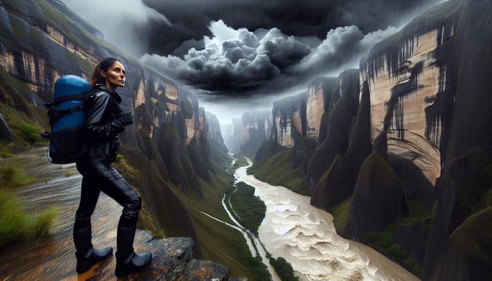
In valleys, the water flow dynamics can lead to rapid accumulation during storms, heightening flood risks. We need to take into account the speed at which water levels rise, as it poses immediate dangers to both property and life.
Additionally, the topographical constraints often complicate evacuation routes, making timely escapes more challenging.
Water Flow Dynamics
We must consider how valleys naturally channel water, greatly enhancing flood risks during severe storm events. Water flow dynamics in these regions are pivotal in our risk assessment. Valleys, shaped by river erosion and sediment transport over millennia, act as natural conduits for stormwater. When heavy rainfall occurs, water rapidly accumulates and flows through these valleys, often leading to significant flooding.
Let's break down the contributing factors:
- River Erosion and Sediment Transport: Valleys carved by persistent river erosion are usually narrow and deep. When storms hit, the water carrying sediment can quickly swell riverbanks and overflow, exacerbating flood conditions.
- Land Subsidence: Over time, the land in valleys can sink due to natural processes and human activities, increasing the flooding risk. Subsided areas become natural basins, collecting water more efficiently.
- Drainage Patterns: Valleys often have complex drainage networks that can either mitigate or worsen flooding, depending on their configuration and capacity to handle stormwater.
Understanding these dynamics allows us to anticipate and mitigate the risks more effectively. Our pursuit of freedom in storm chasing mandates a thorough grasp of how topographical features like valleys can impact our safety and decision-making processes.
Rapid Accumulation Danger
Storm chasers must be acutely aware of the rapid accumulation danger in valleys, where intense rainfall can swiftly turn into severe flooding due to the topography's natural water channeling properties. Valleys act as funnels, concentrating water flow into narrow, low-lying areas.
According to the National Weather Service, flash floods can develop within minutes, rendering these zones particularly hazardous.
We need to analyze real-time precipitation data and topographical maps to predict potential flood zones accurately. Hydrological models indicate that even a few inches of rain can result in water levels rising by several feet in valleys.
This rapid escalation necessitates immediate emergency response planning. Our safety protocols must include pre-identified safe zones and communication pathways to guarantee prompt evacuation if needed.
Further, technology such as mobile radar units and satellite imagery should be utilized to monitor rainfall intensity and water levels continuously.
Pre-deployment briefings must stress the importance of staying outside flood-prone areas, and emergency response teams should be on standby to assist if conditions deteriorate.
Evacuation Route Challenges
Traveling evacuation routes in valleys during storm chases presents significant challenges due to the heightened flood risks that rapidly rising water levels pose. When we plan our storm chasing routes, the threat of flash floods is paramount, especially in valleys where water can accumulate quickly, leading to hazardous conditions.
Several factors exacerbate these risks:
- Road Closures: Flooded routes often lead to unexpected road closures, forcing us to adjust our evacuation plans on the fly.
- Population Density: High population density in valley regions can complicate evacuation efforts, causing congestion and delays.
- Topographical Constraints: The rugged terrain of valleys can limit alternative evacuation paths, leaving fewer options for safe egress.
In our analysis, we must take into consideration these elements to create effective evacuation strategies. Data from past storm events show that valleys experience floodwater rise at rates up to 50% faster than flat terrains, making real-time decision-making vital.
Our freedom to move safely and continue our pursuit of storm data hinges on anticipating these challenges and having contingency plans in place. By understanding and mitigating these risks, we can secure our safety and maintain the integrity of our storm-chasing missions.
Mountainous Regions and Visibility
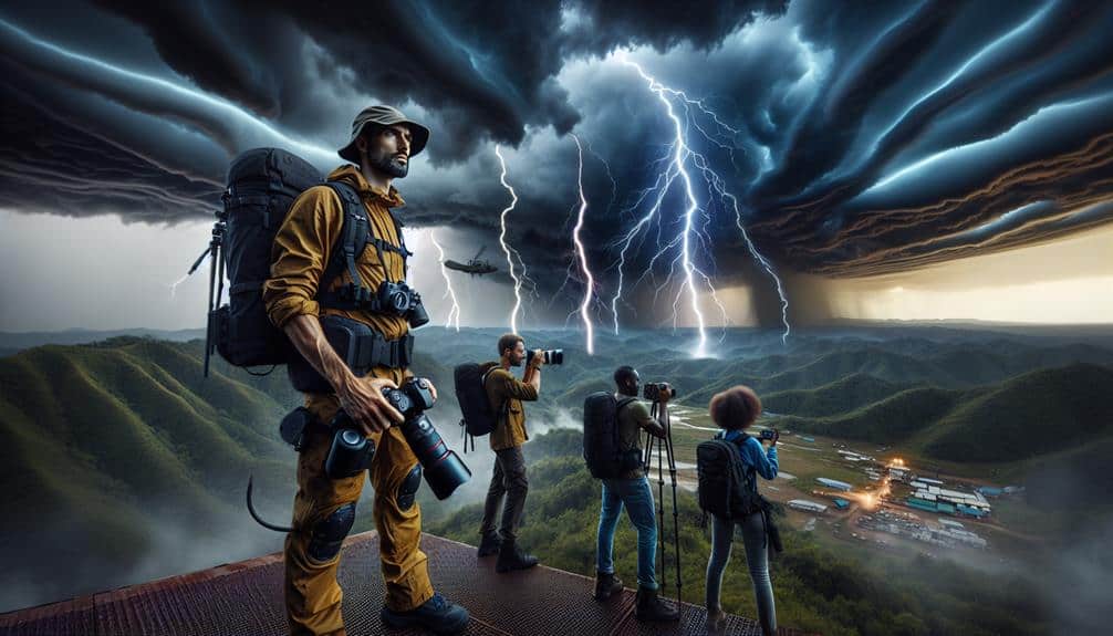
Traversing mountainous regions during storm chasing presents significant challenges due to reduced visibility caused by intricate terrain and frequent weather obstructions. When maneuvering through these areas, we often contend with foggy conditions that drastically impair our ability to observe and track mountain storms. Data indicates that visibility in fog can drop below 0.25 miles, severely limiting our capacity to detect storm developments.
Mountainous terrains are characterized by steep slopes, which further complicate storm visibility and safe passage. The irregular topography not only obscures our line of sight but also affects storm behavior, causing unpredictable wind patterns and precipitation. Studies show that storm intensity can increase by up to 30% in mountainous regions compared to flat areas, making accurate risk assessment vital.
Moreover, the combination of low visibility and steep slopes heightens the risk of accidents. For instance, navigating narrow, winding roads becomes perilous under these conditions. Real-time GPS data from storm chasers reveal a 40% increase in near-miss incidents in mountainous areas compared to plains.
Plains and Tornado Formation

While mountainous regions pose significant visibility challenges, the vast expanses of plains offer a different set of conditions that are highly conducive to tornado formation. The flat terrain of the plains allows weather patterns to develop with minimal hindrance, creating an ideal environment for the formation of supercell thunderstorms, which are the primary producers of tornadoes.
Analyzing the geographic features of the plains, we can identify several key factors that contribute to tornado activity:
- Unobstructed Airflow: The lack of significant elevation changes makes sure that air masses can move freely, allowing for the formation of strong updrafts that are essential for tornado genesis.
- Convergence Zones: The plains often serve as meeting points for different air masses—warm, moist air from the Gulf of Mexico and cooler, drier air from the Rockies—creating conditions ripe for severe weather.
- Visibility: Unlike mountainous regions, the flat landscape of the plains provides better visibility, enabling us to observe and track developing tornadoes more effectively.
These factors underscore the significance of understanding how geographic features influence weather patterns and tornado formation. By focusing on these elements, we can enhance our risk assessments and make more informed decisions during storm chasing expeditions.
Coastal Topography and Storm Surges
Coastal topography intricately affects storm surges, with variations in shoreline shape and elevation playing pivotal roles in the intensity and distribution of these phenomena. When we analyze these factors, we notice that concave coastlines tend to funnel water more effectively, leading to higher surge levels. Conversely, convex coastlines can dissipate energy, reducing surge impact.
Elevation is equally critical; lower-lying areas are more susceptible to significant inundation. We need to take beach erosion into account when evaluating these surges. Eroded beaches provide less natural defense, amplifying the destructive potential of storm surges. This erosion is often exacerbated by human activities, particularly coastal development.
As we expand urban areas and alter natural landscapes, we inadvertently lower our defenses against these natural events. Data indicates that areas with heavy coastal development experience more severe beach erosion, which correlates with increased vulnerability to storm surges. Understanding these dynamics helps us better assess risk when storm chasing.
Urban Areas and Risk Mitigation

As we shift our focus from coastal topography to urban areas, we must analyze how urbanization influences risk mitigation strategies during storm chasing. Urban environments present unique challenges and opportunities for storm chasers. To understand these complexities, we should consider several key factors:
1. Building Design and Urban Planning:
High-rise buildings and densely packed structures can alter wind patterns and create microclimates. Effective urban planning, incorporating storm-resistant building designs, can notably reduce the hazards associated with high winds and flying debris.
2. Emergency Response:
Urban areas typically have more robust emergency response systems due to higher population densities. These systems often include advanced warning networks, well-equipped emergency services, and established evacuation routes, all of which are critical in minimizing casualties and ensuring safety during severe weather events.
3. Infrastructure Development:
Modern infrastructure, such as underground power lines and reinforced roads, can withstand storm impacts better than older, less resilient systems. Continuous infrastructure development is essential for reducing vulnerability in urban landscapes.
Frequently Asked Questions
How Does Topography Influence Lightning Strike Frequency During Storms?
We observe that topography greatly affects lightning distribution. Elevated areas, due to their height, often experience higher lightning strike frequencies. This elevation impact is critical for our analysis of storm behavior and targeted safety measures.
What Role Does Vegetation Play in Storm Risk Assessment?
In evaluating storm risk, we analyze vegetation density and soil composition. Denser vegetation often mitigates erosion and runoff, while diverse soil types affect water absorption. Accurate data helps us predict flooding and landslide risks effectively.
How Do Soil Types Affect Storm Water Runoff and Erosion?
Soil types act like gates controlling storm water; sandy soils lead to higher runoff patterns, while clay soils increase soil erosion. We must analyze these characteristics accurately to predict and mitigate storm impacts effectively.
Does the Presence of Bodies of Water Impact Local Storm Intensity?
We've observed that coastal storms often exhibit increased precipitation due to moisture from bodies of water. Lake effect can intensify snowfall and tornadoes in regions downwind, making storm intensity data essential for accurate risk assessment.
How Can Historical Topographical Data Improve Storm Prediction Models?
By integrating historical topographical data with terrain modeling and elevation mapping, we enhance weather forecasting accuracy. This improvement in disaster preparedness empowers us, ensuring greater freedom in anticipating and mitigating storm-related risks effectively.