We're transforming tornado prediction with Doppler radar technology by analyzing the phase shift of returned signals to determine wind speeds. The Doppler effect helps us decode complex weather patterns and identify tornado formations. By continuously tracking storm intensity and movement in real-time, we enhance early warning systems, improving detection accuracy and providing longer lead times. This reduces tornado-related fatalities by up to 40%. High-definition velocity data and advanced algorithms allow us to pinpoint severe weather conditions precisely, facilitating efficient emergency response protocols. Want to learn more about how this technology can save lives?
Key Points
- Doppler radar accurately predicts tornado formation by analyzing wind speed and rotational patterns.
- Real-time data analysis enables timely initiation of emergency protocols and evacuation procedures.
- High-definition velocity maps track storm intensity and movement, enhancing forecasting accuracy.
- Continuous operation offers real-time weather updates, crucial for dynamic weather forecasting.
Understanding Doppler Radar
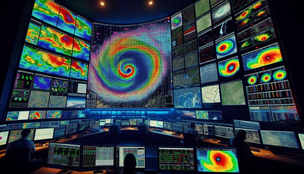
Doppler radar, a cornerstone in meteorological technology, measures the velocity of precipitation particles to predict severe weather events like tornadoes with remarkable accuracy. By analyzing the phase shift of returned radar signals, we can determine the motion of rain droplets and, in turn, infer wind speeds within storm systems. This radar technology allows us to decode complex weather patterns and identify potential tornado formations before they touch down.
Let's delve into how this works.
When radar waves hit precipitation particles, they bounce back to the radar dish. The frequency shift, or Doppler effect, tells us whether the particles are moving towards or away from the radar. We can then map out wind velocities and detect rotational patterns indicative of tornado genesis. This data-driven approach enhances our understanding of severe storm dynamics and bolsters our predictive capabilities.
Using Doppler radar, we gain real-time insights into evolving weather patterns. This grants us the freedom to take proactive measures, safeguarding lives and property. By staying ahead of nature's most volatile phenomena, we transform raw data into actionable intelligence, empowering communities to respond swiftly and effectively to impending tornado threats.
Key Features of Doppler Radar
As we explore the key characteristics of Doppler radar, it's vital to highlight the high-definition velocity data that enables precise tracking of storm intensity and movement. This radar technology offers unmatched capabilities in data interpretation, allowing meteorologists to discern the intricate details of a storm's wind patterns. By analyzing these complex wind movements, we can predict tornado formation with exceptional accuracy, an important aspect of weather forecasting.
Another fundamental feature is the radar's ability to detect varying precipitation rates. Doppler radar distinguishes between light rain, heavy rain, and hail, providing in-depth insights into storm composition. This granularity aids emergency response teams in making well-informed decisions, ultimately safeguarding lives and property.
Furthermore, Doppler radar operates continuously, offering real-time updates. This continuous data stream is essential for dynamic weather forecasting, as it allows us to monitor storm systems closely and react swiftly to changes. The radar's range and sensitivity also enable the detection of distant storm systems, giving communities ample time to prepare.
How Doppler Radar Works
By emitting radio waves and measuring the frequency shifts that occur when these waves bounce back from moving objects, we can comprehend the fundamental principle behind how Doppler radar operates. Essentially, Doppler radar mechanics rely on the Doppler effect, where the frequency of a wave changes in relation to the motion of the source or the observer.
When we direct radar waves towards atmospheric particles like raindrops or hail, the movement of these particles causes a change in the frequency of the reflected waves. This frequency shift offers crucial data on the speed and direction of these particles.
Advanced radar technology enables us to create high-resolution velocity maps, providing us with a detailed snapshot of wind patterns and storm structures. The continuous improvements in radar technology—such as dual-polarization radar—enhance our ability to differentiate between various types of precipitation and even debris, improving the precision and dependability of our observations.
Our analytical approach involves sophisticated algorithms that process this data, translating raw frequency shifts into actionable meteorological insights. By utilizing Doppler radar mechanics, we gain a deeper understanding of atmospheric dynamics, empowering us to predict severe weather events with greater accuracy.
Benefits for Tornado Prediction
By harnessing Doppler radar, we can greatly enhance early warning systems, providing essential lead time for at-risk populations.
This technology's improved detection accuracy allows us to pinpoint tornado formation with greater precision.
As a result, community preparedness receives a substantial boost, potentially reducing casualties and property damage.
Early Warning Systems
Utilizing advanced Doppler radar technology, early warning systems greatly enhance our ability to predict tornadoes with greater accuracy and lead time. By integrating real-time data, these systems facilitate emergency response and significantly improve public safety.
The enhanced lead time, often extending up to 30 minutes before a tornado strikes, enables us to initiate evacuation protocols and disseminate alerts efficiently.
Early warning systems leverage Doppler radar's capability to detect rotational velocity within storms, enabling meteorologists to distinguish between benign weather patterns and potentially deadly tornadoes. This precision is vital for timely alerts, reducing false alarms that can lead to public complacency.
With a more accurate prediction window, local authorities can mobilize resources, activate sirens, and broadcast warnings through multiple channels, ensuring that the public is well-informed and can take necessary precautions.
Moreover, the effectiveness of these systems is evident in statistical analyses. Studies indicate that areas equipped with advanced early warning systems experience a 40% reduction in tornado-related fatalities. By empowering individuals with essential information, these technologies not only save lives but also uphold our collective right to safety and preparedness in the face of natural disasters.
Enhanced Detection Accuracy
Enhanced detection precision provided by Doppler radar technology allows us to pinpoint the exact formation and trajectory of tornadoes, improving our predictive capabilities. By leveraging advanced data analysis, we can interpret complex weather patterns more precisely, leading to significant enhancements in storm tracking and forecasting.
The enhanced storm tracking capabilities offered by Doppler radar guarantee that we can monitor storms with unparalleled precision. This accuracy is essential for improved forecasting, allowing meteorologists to issue more timely and reliable warnings.
Here are three key benefits of this improved detection precision:
- Early Identification: Doppler radar can detect the initial stages of tornado formation, giving us a head start in predicting potential threats.
- Accurate Path Prediction: By analyzing data in real-time, we can chart the likely path of a tornado with greater precision, helping communities to prepare effectively.
- Detailed Analysis: The technology provides detailed insights into the storm's characteristics, such as wind speed and direction, which are essential for understanding the tornado's potential impact.
Community Preparedness Boost
Doppler radar's precision not only aids meteorologists but also empowers communities to enhance their preparedness strategies, reducing the potential loss of life and property. By providing accurate, real-time data, Doppler radar enables emergency response teams to mobilize swiftly and efficiently. This rapid deployment is vital in minimizing casualties and structural damage during tornado events.
We can pinpoint high-risk areas, prioritize resource allocation, and execute targeted evacuations, optimizing our emergency response efforts.
Moreover, Doppler radar data serves as a cornerstone for public education initiatives. Through clear and timely dissemination of information, we can raise awareness about tornado risks and appropriate safety measures. Educational campaigns leveraging Doppler radar insights can guide the public on how to interpret warnings, recognize signs of impending tornadoes, and take necessary protective actions.
This knowledge equips individuals and families to make informed decisions, fostering a sense of autonomy and security.
In essence, the integration of Doppler radar into community preparedness frameworks enhances our collective resilience. By translating sophisticated meteorological data into actionable strategies, we empower ourselves to safeguard lives and properties more effectively. This technology not only predicts tornadoes but also fortifies our readiness, ensuring we face these natural threats with confidence and competence.
Real-Time Data Analysis
By processing real-time data, we can rapidly identify and track the formation of tornadoes with unprecedented accuracy. This capability hinges on sophisticated data interpretation techniques that dissect the Doppler radar signals, transforming raw data into actionable insights. These insights are pivotal for initiating timely emergency response protocols, ultimately saving lives.
Our analytical approach leverages the high-frequency updates from Doppler radar to monitor atmospheric changes continuously. Here's how we do it:
- Data Filtering: We sieve out noise to focus on the meaningful radar echoes that indicate severe weather patterns.
- Velocity Calculation: By analyzing the speed of wind patterns within a storm, we can detect rotation, a precursor to tornado formation.
- Pattern Recognition: Advanced algorithms recognize specific patterns associated with tornado genesis, enabling quicker and more accurate warnings.
This real-time analysis empowers communities by providing them the freedom to act swiftly and decisively. The immediacy of data interpretation guarantees that emergency response teams are mobilized without delay, minimizing the potential for damage and loss of life.
Enhancing Storm Chasing Accuracy
Utilizing advanced radar information, we can significantly enhance the precision and effectiveness of storm chasing efforts. By integrating Doppler radar technology with real-time storm tracking systems, we can pinpoint the location, intensity, and movement of severe weather phenomena. This allows us to deploy storm chasers with unprecedented accuracy, minimizing the risks associated with unpredictable weather patterns.
Our analytical approach leverages high-resolution radar imagery and velocity data to identify rotational signatures and wind shear that indicate potential tornado formation. With this data, we can forecast storm paths with greater accuracy, enabling chasers to position themselves effectively for both observation and safety. The integration of GPS technology further enhances chaser safety by providing real-time updates on their proximity to severe weather cells.
Moreover, our data-driven strategies ensure that storm chasers are well-informed about changing conditions, reducing the likelihood of sudden, dangerous encounters. The precision of modern storm tracking technology not only aids in collecting crucial scientific data but also mitigates the inherent risks involved in storm chasing.
Case Studies of Success
Through our analysis of several high-impact tornado events, we've identified key instances where Doppler radar technology played a pivotal role in accurate and timely predictions.
These case studies highlight how this technology has significantly contributed to improved response and disaster preparedness.
- Joplin, Missouri (2011): In this devastating EF5 tornado, Doppler radar enabled meteorologists to issue a warning 24 minutes in advance. This early warning facilitated better disaster preparedness, prompting emergency services to act swiftly, which saved countless lives despite the extensive damage.
- Moore, Oklahoma (2013): Another EF5 tornado struck Moore, but Doppler radar provided critical data that led to accurate predictions. The improved response resulted in efficient evacuation protocols and timely alerts, notably reducing potential fatalities and injuries.
- Tuscaloosa-Birmingham, Alabama (2011): During this EF4 tornado, Doppler radar technology was instrumental in tracking the storm's path in real-time. The precise data allowed for targeted warnings, which enhanced public safety measures and optimized emergency response efforts.
These examples illustrate the transformative impact of Doppler radar in tornado prediction. By providing accurate, real-time data, we can bolster disaster preparedness and improve response times, ultimately protecting lives and granting communities the freedom to recover and rebuild efficiently.
Frequently Asked Questions
How Does Doppler Radar Handle Interference From Non-Weather-Related Objects?
Let's investigate how signal processing manages interference detection. Doppler radar systems analyze weather patterns while employing advanced algorithms for clutter elimination. This guarantees accurate readings by distinguishing weather-related data from non-weather-related objects, enhancing prediction reliability.
What Are the Maintenance Requirements for Doppler Radar Systems?
We're discussing the maintenance requirements for Doppler radar systems. They include regular system calibration, detailed data analysis, precise antenna alignment, and consistent power supply maintenance. These steps guarantee peak performance and accuracy, empowering us to predict severe weather reliably.
Can Doppler Radar Predict Tornado Intensity Accurately?
Did you know Doppler radar can estimate tornado intensity with up to 70% accuracy? While it's not perfect, our ability to enhance tornado intensity prediction through Doppler radar accuracy continues to improve, giving us more freedom and safety.
How Do Geographical Features Affect Doppler Radar Performance?
Geographical influences, like mountains and valleys, can have a notable impact on radar accuracy. We must analyze terrain data to adjust radar positioning and compensate for signal blockages, ensuring we maximize the radar's efficiency and accuracy in tornado prediction.
Are There Any Limitations to Doppler Radar in Predicting Nighttime Tornadoes?
Yes, Doppler radar has limitations in predicting nighttime tornadoes. Nighttime visibility is reduced, and storm chasers can't provide ground verification as effectively. This combination makes accurate, timely predictions more challenging, highlighting the need for advanced technology.


