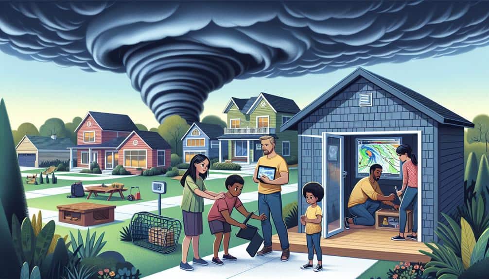
Real-time weather data is essential for storm chasers because it improves our safety and decision-making. It provides us with immediate updates on storm trajectories, intensities, and potential hazards, enabling us to adjust routes and avoid life-threatening situations. By analyzing live data from radar, satellite imagery, and sensors, we can predict storm movements with high accuracy, enhancing our operational efficiency. This continuous analysis also allows for efficient resource allocation, minimizing property damage and increasing the accuracy of our predictions. Exploring these elements further will provide more insights into the technical intricacies and benefits of real-time weather data in storm chasing.
Key Points
- Immediate updates on storm trajectories and hazards enhance safety and decision-making.
- Real-time data helps in predicting and tracking storm intensity, direction, and speed.
- Instantaneous information allows for route adjustments to avoid dangerous tornado formations.
- Accurate data ensures efficient resource allocation and minimizes response times.
Enhancing Safety Measures
Incorporating live weather data into our storm-chasing operations greatly enhances our safety measures by providing immediate updates on storm trajectories and potential hazards. This capability allows us to conduct thorough risk assessments in real time, enabling us to make informed decisions about our positioning and movements.
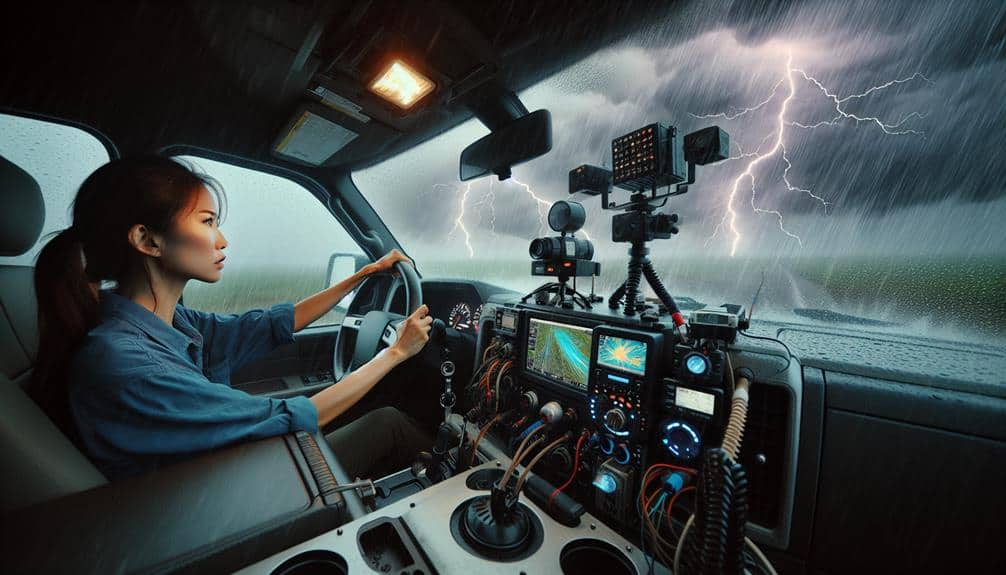
By analyzing real-time data feeds from radar, satellite imagery, and ground-based sensors, we can identify changes in storm intensity, direction, and speed with analytical precision.
With this data at our fingertips, our emergency response protocols become notably more effective. We can preemptively identify high-risk areas and avoid potentially life-threatening situations. For example, if our data indicates an unexpected tornado formation, we can immediately adjust our route to make sure we're not in its path. This proactive approach minimizes the risks associated with storm chasing and maximizes our operational safety.
Moreover, incorporating live data allows us to communicate more effectively with local emergency services. By sharing our findings, we can aid in broader community safety efforts, ensuring that both we and the public remain informed and prepared. Essentially, real-time weather data isn't just a tool for observation—it's a critical component of our risk management and emergency response strategies.
Improving Decision-Making
Real-time weather data greatly enhances our decision-making capabilities by allowing us to analyze storm patterns and predict their movements with high accuracy. This precision is crucial for conducting thorough risk assessments. By leveraging up-to-the-minute data, we can identify potential hazards and adjust our strategies accordingly, ensuring we're always one step ahead of the storm.
When it comes to strategic positioning, real-time data enables us to pinpoint the safest and most effective locations for observation and data collection. For instance, radar updates and satellite imagery help us determine the storm's trajectory and intensity, allowing us to position ourselves in best-fit locations. This not only maximizes our data-gathering efforts but also minimizes unnecessary risks.
Moreover, the integration of various data sources—such as Doppler radar, weather satellites, and ground sensors—provides a thorough view of the storm environment. This multi-faceted approach allows us to make informed decisions quickly, reducing the margin for error.
In an environment where conditions can change rapidly, having real-time data means we can adapt our plans instantly, enhancing our overall operational efficiency.
Optimizing Resource Allocation
Harnessing live weather data not only sharpens our decision-making but also enables us to allocate resources more efficiently by determining the best deployment of personnel and equipment in response to evolving storm conditions.
Utilizing live data for time management and data analysis guarantees that we can react swiftly, optimizing our response strategies. By continuously analyzing incoming weather data, we can predict storm paths more accurately, prioritizing areas that require immediate attention.
Effective communication and coordination are critical in these high-stakes situations. Live data allows us to relay updates instantaneously to all team members, confirming everyone is aligned with the latest information. This synchronization minimizes response times and maximizes the effectiveness of our efforts.
Moreover, real-time data analysis aids in resource allocation by identifying gaps and redundancies in our deployment plans. We can allocate personnel and equipment where they're needed most, avoiding unnecessary expenditure of resources in less critical areas. This precision not only conserves resources but also enhances our overall operational efficiency.
Minimizing Property Damage
By leveraging accurate, up-to-date weather information, we can implement targeted actions to minimize property damage during severe storms. Real-time data enables us to pinpoint high-risk areas and deploy resources efficiently, focusing on damage prevention and risk reduction.
For example, advanced radar and satellite imagery allow us to identify the path of a tornado or hurricane with remarkable precision. This information is vital for issuing timely evacuation orders and reinforcing vulnerable structures.
Our approach relies on data analytics to assess potential damage scenarios. By analyzing historical data and current weather patterns, we can predict which areas are most likely to experience severe impacts. This allows us to prioritize actions, such as deploying emergency services and alerting the public.
Additionally, real-time updates ensure that our strategies remain adaptive and responsive to changing conditions.
Using precise weather data, we can also inform homeowners and businesses about proactive measures they can take, such as boarding up windows or securing outdoor objects. This not only reduces the immediate risk but also mitigates long-term damage costs.
Essentially, real-time weather data is an indispensable tool for storm chasers dedicated to safeguarding lives and property through effective damage prevention and risk reduction.
Increasing Prediction Accuracy
To increase prediction accuracy, we employ advanced algorithms that analyze vast datasets from various meteorological sources. By leveraging these sophisticated tools, we can dissect and interpret real-time weather data to make more accurate forecasts. This precision is essential for storm chasers who rely on timely and accurate information to stay safe and effective in the field.
Our data analysis integrates information from multiple sources, including satellite imagery, radar data, and atmospheric sensors. These diverse inputs allow us to apply cutting-edge forecasting techniques and model potential storm paths with greater accuracy. The goal is to predict changes in weather patterns before they become hazardous.
- Machine Learning Models: We use these to identify patterns in historical and real-time data, improving our predictive capabilities.
- High-Resolution Satellite Imagery: Provides detailed views of cloud formations and storm development in real-time.
- Integrated Sensor Networks: Collects ground-level data on temperature, humidity, and wind speed, offering a fuller picture of the storm environment.
Frequently Asked Questions
How Does Real-Time Weather Data Influence Storm Chasers' Route Planning?
Real-time weather data influences our route planning by enhancing data accuracy and tracking technology, allowing us to take safety precautions and optimize emergency response. This guarantees we're making informed decisions for both safety and effective storm tracking.
What Tools Do Storm Chasers Use to Access Real-Time Weather Data?
When the storm's fury is a beast we chase, we rely on weather radars and satellite images. These tools provide us with precise, real-time data, enabling us to chart our course with technical expertise and analytical precision.
Are There Any Legal Restrictions on Storm Chasing Activities?
We must navigate safety regulations and liability issues to guarantee our storm chasing activities remain lawful. These legal restrictions aim to protect both us and the public, ensuring responsible pursuit while preserving our freedom to collect vital data.
How Do Storm Chasers Communicate Their Findings to the Public?
We communicate our findings to the public through social media, leveraging data visualization and technology advancements. This boosts public awareness, helping people make informed decisions and stay safe, while promoting our freedom to share real-time information.
What Training Is Required to Become a Professional Storm Chaser?
To become professional storm chasers, we need a solid meteorology education and extensive field experience. Mastering weather models, understanding atmospheric dynamics, and honing observational skills are critical. This expertise empowers us to predict and navigate severe weather events accurately.