Doppler radar’s velocity algorithms detect pre-storm atmospheric conditions 20-40 minutes before initial lightning strikes, providing you with vital lead time when paired with lightning mapping networks that achieve 95-99% detection efficiency. You’ll find that integrating radar-derived CAPE measurements above 1000 J/kg with real-time lightning detection systems like OKLMA (10-50 meter precision) creates extensive storm analysis. Modern forecasters combine WSR-88D reflectivity data with GLM’s 70-90% flash detection efficiency to identify severe weather development, and exploring these integrated methodologies reveals advanced techniques for enhancing warning accuracy.
Key Takeaways
- Doppler radar captures 3D storm structure and vertical development, revealing atmospheric conditions conducive to lightning formation and electrical activity.
- Integrating radar reflectivity with lightning networks confirms storm electrical maturation and extends detection range beyond radar coverage limitations.
- VHF lightning data at 60 MHz reveals vertical charge structures that correlate with radar-detected hail cores and updraft intensification.
- CAPE-derived parameters from radar observations predict lightning potential, with flash density correlating linearly with CAPE^{1/2} over land.
- Combined GLM flash-extent density and WSR-88D reflectivity overlays provide real-time storm electrical confirmation with 20-second product latency.
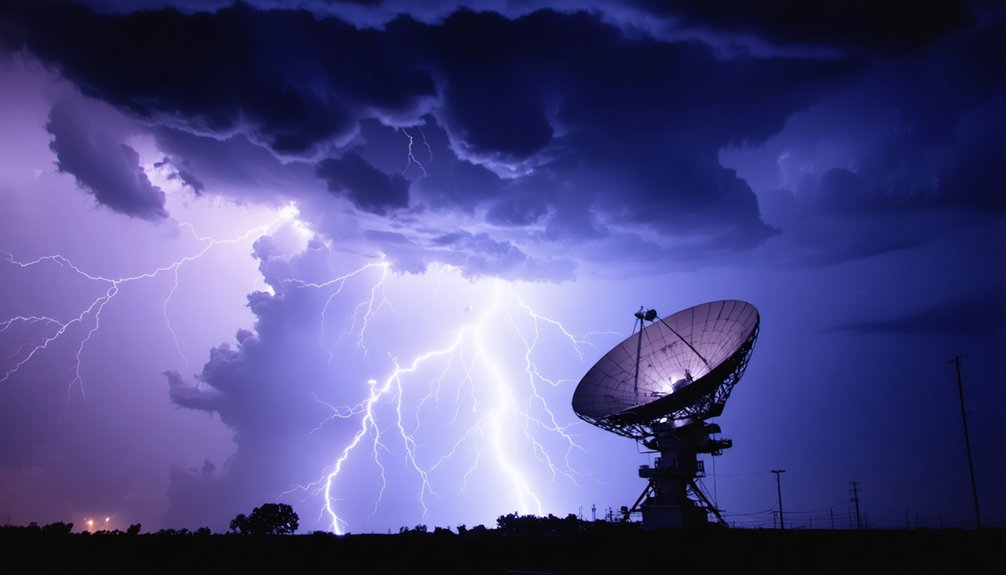
How Doppler Radar Technology Detects Storm Development
When Doppler radar systems emit electromagnetic pulses at microwave frequencies, the returning signals provide quantifiable measurements of both precipitation characteristics and atmospheric motion. You’ll access real-time phase shift calculations that determine radial velocities up to 70 m/s, revealing wind patterns and rotation within developing thunderstorms.
The dual-polarization capability enables precise hydrometeor identification by analyzing particle shapes, distinguishing between rain, hail, and debris signatures. NEXRAD’s enhanced resolution captures 3D storm structure analysis through rapid volume scans, tracking vertical development and feeding mechanisms.
You’ll monitor storm-relative motion data that isolates wind shear from general precipitation movement, identifying tornado rotation and microburst signatures. Advanced algorithms process reflectivity and velocity data simultaneously, providing quantifiable metrics that forecast lightning probability based on updraft intensity and ice crystal formation rates.
Lightning Detection Methods and Their Precision Capabilities
- NLDN achieves >95% cloud-to-ground flash detection with 200-meter median location accuracy
- OKLMA delivers 10-50 meter source location precision with 95-99% detection efficiency in its central coverage area
- ENTLN provides both CG and IC detection with 86-93% flash classification accuracy
- GLM maintains 88 ± 9% daily flash detection efficiency from geostationary orbit
Lightning classification precision depends on sensor density and frequency selection. VHF systems like OKLMA excel at spatial resolution but don’t differentiate IC/CG events, while low-frequency networks distinguish strike types for threat assessment autonomy.
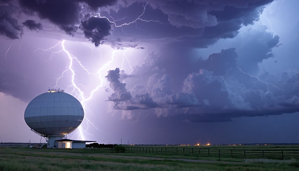
Combining Radar and Lightning Data for Enhanced Storm Tracking
When you integrate Doppler radar’s precipitation-based reflectivity measurements with lightning detection systems like LMA or GLM, you gain complementary data streams that validate storm intensity in real time. Radar identifies structural features such as mesocyclones and reflectivity cores exceeding 70 dBZ, while lightning networks confirm electrical activity within those same volumes at resolutions down to 8 km for GLM and sub-kilometer for LMA.
This dual-sensor approach enables you to verify thunderstorm severity immediately, as radar detects the storm’s physical characteristics and lightning data confirms its electrical maturation.
Complementary Detection Capabilities
Lightning detectors and Doppler radar systems capture fundamentally different atmospheric signatures—high-frequency electromagnetic pulses from electrical discharges versus precipitation-based reflectivity and velocity data—creating a complementary detection framework that addresses each technology’s limitations.
You’ll gain enhanced prediction accuracy through these integrated capabilities:
- Range Extension: Lightning networks detect strikes at 200 nm while confirming radar’s severe VIL thresholds
- False Echo Elimination: Active electrification zones validate radar returns, filtering ground clutter artifacts
- 3D Charge Mapping: VHF radio noise at 60 MHz reveals vertical charge structures aligning with radar-identified hail cores
- Triangulation Precision: Multi-antenna time-of-arrival data cross-referenced with radar range measurements resolves strike locations to sub-kilometer accuracy
This fusion directly overcomes lightning monitoring limitations—single-sensor bearing ambiguity and radar’s inability to detect electrical activity without precipitation.
Real-Time Storm Confirmation
Operational meteorologists achieve storm confirmation within 30-second update cycles by overlaying GLM flash-extent density data onto WSR-88D reflectivity products, creating synchronized visualization frameworks that distinguish between developing convection and mature thunderstorm cells.
You’ll access real time monitoring through integrated NLDN and Earth Networks systems that detect cloud-to-ground strikes alongside intra-cloud discharges at 60 MHz VHF frequencies.
Flash rate trends reaching 55 events per second provide quantitative hazard confirmation when correlated with radar-derived vertically integrated liquid measurements exceeding 50 kg/m². NSSL applications combine GLM spatial coverage with Lightning Mapping Array 3D source points to validate updraft intensification patterns.
These multi-sensor frameworks enable you to track precipitation formation sequences and downdraft development across data-sparse oceanic regions, supporting autonomous decision-making for severe weather warnings without bureaucratic delays.
Forecast Models Using CAPE and Convective Parameters
Thunderstorm forecasters rely on convective available potential energy (CAPE) as the primary metric for evaluating atmospheric instability and lightning potential. You’ll find cape thresholds for convective storm development begin at 1000 J/kg for strong storms, while values exceeding 2500 J/kg indicate severe weather environments. The atmosphere becomes extremely volatile at 3000-4000 J/kg, supporting updraft velocities reaching 50 m/s.
When applying convective indices for lightning prediction, you should consider:
- CPTP parameter combining CAPE-20 (0°C to -20°C layer) with equilibrium level temperature
- Lightning flash density correlating linearly with CAPE^{1/2} over land
- MLCAPE requirements of 500-1000 J/kg for supercell formation
- Lightning Potential Index (LPI) outperforming traditional CAPE × precipitation methods
These measurements enable you to forecast convective severity independently.
The Role of Geostationary Lightning Mapper in Satellite Monitoring
The Geostationary Lightning Mapper (GLM) operates as a single-channel near-infrared optical transient detector at 777.4 nm, achieving 2 ms frame rates with 70-90% flash detection efficiency across day and night conditions.
You’ll observe total lightning activity—including in-cloud, cloud-to-cloud, and cloud-to-ground discharges—at 8-14 km spatial resolution spanning a near-hemispheric field of view up to 52°N latitude.
This continuous monitoring capability provides critical aviation safety data through 20-second product latency, enabling you to detect intensifying convection and lightning threats minutes before traditional radar-based warning systems.
High-Speed Optical Detection Capability
How does satellite technology capture the rapid optical pulses of lightning from 35,786 kilometers above Earth’s surface? The GLM’s staring CCD array monitors lightning event characteristics at unprecedented speeds, operating at 2 ms frame rates to capture 500 images per second.
This configuration enables detection of up to 100,000 events per second, including 40,000 lightning-specific events.
The system’s optical energy signatures manifest through these technical parameters:
- Detection wavelength: 777.4 nm near-infrared spectrum
- Spatial resolution: 8 km at nadir, degrading to 14 km at coverage edge
- Energy measurement: Radiant output quantified in Joules per event
- Temporal precision: Energy-weighted centroid timing with 20-second product latency
You’ll observe 70-90% flash detection efficiency maintained continuously, independent of solar illumination conditions.
Total Lightning Monitoring Benefits
Unlike ground-based networks that detect only cloud-to-ground strikes, GLM’s continuous total lightning monitoring captures in-cloud, cloud-to-cloud, and cloud-to-ground discharges across the Americas and adjacent oceans with 70-90% flash detection efficiency maintained regardless of solar illumination.
You’ll gain critical advantages for lightning strike risk assessment through 8-14 km spatial resolution and 2 ms frame rates that track discharge frequency, location, and extent.
The system delivers short term forecast improvements by detecting significant total lightning increases minutes before radar identifies severe weather development. This lead time enhances your warning capabilities for damaging winds, hail, and tornadoes while reducing false alarm rates.
When combined with radar data, you’ll achieve superior monitoring in data-sparse regions during network outages, particularly across mountainous terrain and oceanic areas where conventional detection fails.
Aviation Safety and Forecasting
When aircraft traverse oceanic routes where ground-based radar coverage remains absent or degraded, GOES-R series satellites equipped with Geostationary Lightning Mapper (GLM) instruments deliver continuous total lightning detection across the Americas and adjacent ocean regions at 10 km spatial resolution with 20-second temporal updates.
You’ll benefit from this operational capability through:
- Turbulence identification via updraft location detection within convective cells
- Hurricane intensity monitoring through eyewall lightning analysis during rapid intensification
- Storm development tracking across radar-sparse mountainous and oceanic regions
- Enhanced routing efficiency supporting optimizing flight route planning with real-time convective hazard data
GLM’s near-infrared optical transient detection enables you to navigate fuel-efficiently around developing thunderstorms while evolving aviation regulations increasingly incorporate satellite-derived lightning data for safety protocols across trans-oceanic commercial and private operations.
Machine Learning Applications in Lightning Threat Predictions
Machine learning algorithms have transformed lightning prediction capabilities by leveraging complex meteorological datasets to capture the stochastic nature of thunderstorm electrification. You’ll find random forest models achieving 76.9% accuracy with an AUC of 0.850, utilizing eight independent meteorological variables including geometric cloud thickness, rain rate, and CAPE.
These data-driven approaches outperform traditional empirical parameterizations in cloud to ground lightning prediction, particularly for dry thunderstorms across western United States.
Neural networks like SALAMA provide 30-minute lead-time warnings by analyzing surface pressure, temperature, humidity, and wind speed from ERA5 reanalysis and TRMM products. You’re no longer constrained by simplified physical models—machine learning excels at improving lightning density modeling through superior spatial and temporal variability capture, enabling autonomous decision-making for wildfire risk assessment.
In-Cloud Lightning as an Early Warning Indicator
While machine learning models optimize predictions through retrospective pattern analysis, real-time operational systems require immediate detection of developing electrical activity within storm cells. In cloud strike location mapping delivers actionable intelligence by tracking the 80% of lightning pulses occurring within thunderstorm structures.
Your monitoring network’s intra cloud charge rearrangement detection provides critical lead time through these operational capabilities:
- 5-30 minute advance warnings from electric field changes preceding cloud-to-ground strikes
- 200-meter precision for individual intra-cloud flash locations integrated with Doppler radar cell analysis
- 35-kilometer detection range enabling threat assessment before overhead lightning arrival
- Real-time mapping of charge buildup patterns indicating imminent high winds, hail, and tornado conditions
This detection methodology transforms atmospheric electrical processes into quantifiable threat metrics, giving you autonomous decision-making authority before dangerous conditions materialize.
Cost-Effective Alternatives for Developing Regions
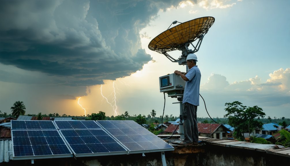
Standard weather station infrastructure deployed across Switzerland demonstrates how developing regions can achieve 80% lightning prediction accuracy without expensive radar networks. You’ll find the EPFL method requires only atmospheric pressure, air temperature, relative humidity, and wind speed measurements—data that basic weather station networks already collect. This approach trained on 10 years of data from 12 stations enables real-time calculations within 10-30 minutes and an 18-mile radius.
Community based monitoring models leverage existing infrastructure, eliminating radar or satellite dependencies costing dramatically more. You can deploy these systems in remote areas lacking communication networks, where traditional detection remains unavailable. The method processes simple meteorological inputs through machine learning algorithms, providing scalable protection for regions previously underserved by lightning detection technology.
Real-Time Data Integration for Dangerous Thunderstorm Alerts
When dangerous thunderstorms develop, you’ll need real-time data integration systems that combine multiple detection technologies to deliver actionable alerts within seconds. Advanced platforms merge NEXRAD Doppler radar, NLDN lightning networks, and GLM satellite data through sophisticated data visualization techniques, updating at 0.05 to 5-second intervals for localized thunderstorm monitoring.
Critical integration components include:
- Multi-radar mosaics layering storm-based warnings with precipitation estimates on 1.1 nm × 1-degree grids
- Lightning networks delivering strike coordinates with <5-second latency, distinguishing cloud-to-ground from intracloud activity
- Dual-polarization QPE generating Storm Total Precipitation (NTP/80) for flood assessment
- VCP 112 scans completing 20 azimuths in <8 minutes using MPDA velocity dealiasing
You’ll access thorough thunderstorm intelligence without bureaucratic delays, enabling independent safety decisions backed by NWS-grade precision.
Advancing Severe Weather Warnings Through Total Lightning Analysis
Total lightning detection revolutionizes severe weather warning operations by capturing both intracloud (IC) and cloud-to-ground (CG) flashes, delivering 5-30 minute lead times through flash rate analysis that CG-only networks can’t match. You’ll gain critical storm initiation characteristics through 2σ algorithms that evaluate flash rate changes across storm intensity categories.
The Earth Networks Total Lightning Network achieves 95% classification accuracy with <100m location precision, processing 50 pulses per second globally. You can identify severe thunderstorms through lightning precipitation relationships—among 470 lightning-dominant storms studied, lightning jumps preceded 85 severe events.
The NALMA network provides real-time 3D visualization across multiple forecast domains, enabling you to track convective development without relying solely on radar coverage in remote locations.
Frequently Asked Questions
How Does Precipitation Affect the Accuracy of Lightning Detection Systems?
Precipitation intensity and precipitation type don’t noticeably degrade your lightning detection systems’ performance—Vaisala sensors maintain >98% cloud-to-ground flash detection accuracy and >90% IC/CG discrimination regardless of rain rates, ensuring you’ll capture reliable data even during intense storms.
What Maintenance Requirements Do Ground-Based Lightning Detectors Have Annually?
You’ll need annual ground resistance testing below 10 Ω, sensor recalibration schedules, and system uptime monitoring. Visual inspections verify detector integrity, while continuity tests guarantee proper grounding. High-risk locations require semi-annual checks for ideal performance.
Can Lightning Data Improve Tornado Warning Lead Times?
Ironically, you’d think radar alone suffices, yet lightning data extends your warning lead times from 13-14 minutes to 75 minutes. Real-time data integration with satellite-based monitoring detects updraft intensification 15-20 minutes pre-tornado, revolutionizing your emergency response freedom.
How Do VHF Lightning Mapping Arrays Perform During Winter Storms?
You’ll find VHF lightning mapping arrays effectively detect winter storm signatures during thundersnow events, capturing 34 flashes across four storms. They identify VHF radiation from electrified snowfall, though source power decreases with frequency squared, complementing radar reflectivity thresholds.
What Training Do Forecasters Need to Interpret Total Lightning Data?
Knowledge is power—you’ll need training on storm dynamics-microphysics-lightning relationships, interpreting total lightning data through AWIPS sampling tools, understanding total lightning patterns via source density products, and recognizing lightning jumps 5-30 minutes before severe weather occurs.


