By embracing advancements in Doppler radar technology, we can dramatically improve storm chaser safety. This technology tracks real-time wind velocity and precipitation intensity, providing high-resolution data that enhances situational awareness. Integrating machine learning algorithms refines storm and tornado prediction models, reducing errors and optimizing response times. Storm chasers benefit from continuous data streams on mobile devices, ensuring connectivity and quick decision-making. Improved detection of rotation within storm systems enhances early warning capabilities, safeguarding lives and property. Understanding these technological advancements provides a clear path to operating more safely and effectively in volatile weather conditions. Discover these innovations in more detail.
Key Points
- Doppler radar offers real-time wind velocity data, enhancing storm chasers' situational awareness.
- High-resolution radar imagery improves storm structure analysis, aiding storm chasers in identifying safe routes.
- Machine learning algorithms refine threat identification, providing storm chasers with accurate and timely warnings.
- Early tornado detection through Doppler radar provides storm chasers more time to implement safety measures.
Understanding Doppler Radar
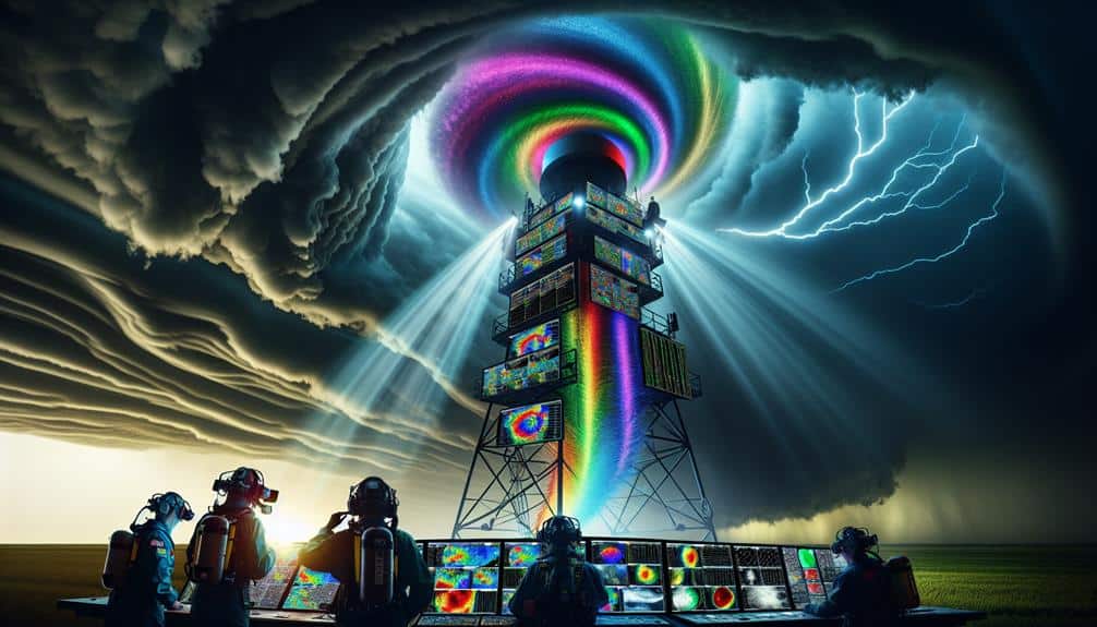
Doppler radar, an essential tool in meteorology, operates by sending out microwave signals and analyzing the frequency shift of the returned signal to measure the velocity of objects like raindrops and snowflakes. By leveraging Doppler technology, we gain detailed insights into atmospheric conditions, which is vital for accurate weather monitoring.
Understanding how Doppler radar works allows us to fully appreciate its capabilities. When the radar emits a microwave pulse, it travels through the atmosphere, striking precipitation particles. These particles then reflect the signal back to the radar. The frequency shift—or Doppler effect—between the transmitted and received signals indicates the motion of the particles. This data translates into velocity measurements, revealing the intensity and movement of weather systems.
Our ability to interpret this data effectively is essential for storm chasers and meteorologists. Equipped with Doppler radar, we can detect rotation within storm systems, identify severe weather phenomena, and predict storm paths with greater precision.
The advanced weather monitoring provided by Doppler technology empowers us to make informed decisions, enhancing safety and offering a sense of freedom through knowledge. By understanding the science behind Doppler radar, we enhance our capacity to monitor and respond to dynamic weather conditions efficiently.
Real-Time Weather Tracking
Real-time weather monitoring capitalizes on continuous data streams from advanced radar systems, enabling us to closely monitor evolving storm conditions with unmatched accuracy. This capability greatly enhances storm chaser safety by providing live updates and detailed information on storm dynamics.
Advanced technology in Doppler radar systems allows us to detect wind velocity, precipitation intensity, and potential tornado formations in real time. By analyzing this data, we can make informed decisions swiftly, adjusting our positions to avoid hazardous situations.
Our ability to monitor weather continuously means we can observe shifts in storm patterns as they happen. Advanced radar's high-resolution imagery and volumetric scanning provide a three-dimensional view of storm structures, offering insights into their development and trajectory. These live updates are vital for storm chasers who rely on precise, up-to-the-minute information to navigate safely.
Furthermore, integrating real-time weather monitoring with mobile devices and communication networks ensures that storm chasers are always connected and informed. This seamless flow of information maximizes our situational awareness and enhances our ability to respond to sudden changes in weather conditions.
With these advancements, we can pursue our passion for storm chasing with greater freedom and confidence, knowing that we're equipped with cutting-edge tools to guarantee our safety.
Predictive Storm Patterns
Harnessing predictive storm patterns empowers us to anticipate severe weather events with greater precision, enhancing our proactive measures and strategic planning. Through advanced technology, we can leverage Doppler radar systems and sophisticated algorithms to refine our storm prediction capabilities. This involves integrating vast amounts of weather data, including temperature, humidity, wind speed, and atmospheric pressure, into inclusive models.
By employing cutting-edge data analysis techniques, we can identify trends and anomalies that indicate the formation of severe storms. These models are continuously updated with real-time data, allowing us to refine our weather forecasting and make more informed decisions. This proactive approach not only optimizes our ability to predict storm paths and intensity but also grants us greater flexibility in planning our storm-chasing activities.
Our reliance on advanced technology notably reduces the margin for error, providing us with a clearer understanding of potential hazards. This analytical rigor guarantees our strategies are grounded in solid, data-driven insights. With these tools, we navigate the unpredictable nature of severe weather with confidence, thereby enhancing our safety and efficiency in the field.
Improved Warning Systems
How do we guarantee that our warning systems aren't only timely but also accurate enough to save lives and mitigate damage during severe weather events?
The answer lies in leveraging advancements in Doppler radar technology to enhance emergency response and public safety. By integrating high-resolution radar data with real-time analytics, we can issue warnings that aren't only faster but also more precise.
Our current systems now deploy machine learning algorithms to interpret vast amounts of radar data, identifying potential threats more quickly than traditional methods. This allows us to disseminate alerts to the public and emergency services in a matter of minutes, providing essential time for preparation and action.
For instance, by refining our storm tracking capabilities, we can predict the exact impact zones with greater accuracy, minimizing false alarms and making sure that resources are allocated where they're most needed.
Moreover, public safety is amplified through these improved systems as they offer localized alerts tailored to specific communities. This way, residents receive pertinent information relevant to their immediate surroundings, empowering them to make informed decisions.
Enhanced Data Accuracy
With advancements in Doppler radar, we can now obtain real-time wind speeds, enhancing our ability to predict storm behavior accurately.
These improvements also lead to better tornado detection, reducing false alarms and increasing response times.
Additionally, more precise precipitation pattern analysis helps us understand storm structure in greater detail, informing safer storm-chasing strategies.
Real-Time Wind Speeds
Doppler radar advancements now enable us to measure real-time wind speeds with unparalleled accuracy, enhancing the data storm chasers rely on for safety and analysis. By capturing precise wind direction and velocity, we can enhance storm prediction models. This level of detail allows us to anticipate storm paths and intensities more reliably, enhancing our ability to strategize and implement effective safety measures.
The primary benefit of Doppler radar lies in its ability to provide continuous, high-resolution data. This enables us to analyze wind patterns dynamically, observing changes in real-time. Consequently, we can identify hazardous conditions early, ensuring that storm chasers are well-informed and can make rapid, informed decisions. The accuracy of real-time wind speeds also aids in validating and refining our predictive algorithms, resulting in more robust storm forecasts.
Incorporating these advanced Doppler radar capabilities into our toolkit not only elevates our situational awareness but also fortifies our safety protocols. By leveraging this technology, we embrace a greater degree of freedom in our storm-chasing endeavors, confident in the data's reliability and the enhanced protective measures it supports.
Improved Tornado Detection
Advancements in radar technology have greatly improved our ability to detect tornadoes with greater accuracy and precision. With the integration of Doppler radar technology, we can now monitor tornado formation and storm tracking in real-time, providing us with vital data that enhances storm safety protocols.
Doppler radar systems measure the velocity of precipitation particles within a storm, allowing us to identify rotation patterns indicative of tornado development. By analyzing these patterns, we can forecast tornado formation much earlier than traditional methods allowed. This early detection is essential for storm chasers, as it offers more time to take necessary precautions and reduce risk.
Moreover, Doppler radar technology has enhanced the resolution of storm tracking data. High-resolution data enables us to pinpoint the exact location and movement of tornadoes, assisting in precise storm safety measures. Improved data accuracy translates to better-informed decisions and timely warnings, ultimately safeguarding lives and property.
In essence, leveraging these advancements in Doppler radar technology not only refines our understanding of tornado dynamics but also strengthens our storm safety strategies. By staying ahead of nature's fiercest phenomena, we empower ourselves with the freedom to explore while mitigating potential dangers.
Precipitation Pattern Analysis
Analyzing precipitation patterns allows us to extract very accurate data, which is essential for refining storm tracking and prediction models. By examining these patterns through advanced Doppler radar technology, we can better understand storm behavior. This understanding enables us to improve forecasting accuracy to a great extent, giving storm chasers the freedom to make more informed decisions.
Advanced Doppler radar systems deliver high-resolution data that breaks down precipitation types, intensities, and distributions. By doing so, we can identify potential storm developments earlier and with greater precision. The accuracy of this data helps us predict not just where a storm might go, but also how it will evolve, which is pivotal for storm chasers who rely on real-time information.
Furthermore, the integration of machine learning algorithms with Doppler radar data enhances our ability to interpret complex precipitation patterns. These algorithms can sift through massive datasets quickly, identifying trends and anomalies that human analysts might miss. As a result, our forecasting models become more robust, reducing the margin of error.
Future Radar Innovations
As we look ahead, integrating machine learning algorithms with next-generation radar systems promises to enhance storm chaser safety and data accuracy to a large extent. By leveraging these advancements in radar technology, we can greatly improve storm prediction models. Machine learning allows us to analyze massive datasets quickly, identifying patterns that traditional methods might miss. This approach enhances our ability to predict severe weather events with greater precision, providing storm chasers with the crucial information they need to make informed decisions in the field.
Future radar advancements will also revolutionize weather forecasting. Dual-polarization radar, for example, offers more detailed information about precipitation type and intensity, which is essential for accurate storm tracking. Further, phased array radar technology can scan the atmosphere more rapidly than conventional systems, delivering near real-time data that's priceless during fast-developing weather scenarios.
Incorporating these cutting-edge technologies into our weather forecasting arsenal won't only improve the accuracy of our predictions but also empower storm chasers to operate more safely and effectively. With continued innovation in radar systems, we can look forward to a future where our understanding of severe weather is more exhaustive than ever before.
Frequently Asked Questions
How Do Storm Chasers Communicate During Severe Weather Conditions?
During a severe tornado outbreak, we relay critical updates via radios and satellite phones. Emergency protocols require using multiple communication devices to guarantee information reaches all team members, maintaining safety and operational coordination under extreme conditions.
What Training Is Required to Become a Storm Chaser?
To become storm chasers, we need meteorology courses for foundational knowledge and hands-on experience in severe weather conditions. This combination guarantees we're well-prepared, enhancing our ability to make informed decisions and maintain our freedom in the field.
Are There Legal Restrictions for Storm Chasing Activities?
In 2013, Oklahoma imposed regulations requiring storm chasers to obtain permits. We must follow safety protocols and consider liability concerns. These regulations guarantee our safety while we maintain the freedom to pursue our passion responsibly.
How Is the Data From Storm Chasers Used by Meteorologists?
We gather critical data that meteorologists use for data analysis and meteorological research. This improves forecast accuracy and provides real-time updates, helping them predict storm behavior more precisely and allowing everyone to make informed decisions for their safety.
What Equipment Do Storm Chasers Carry Besides Doppler Radar?
Oh, besides Doppler radar, we storm chasers pack more safety gear than a paranoid astronaut. We've got helmets, goggles, and sturdy boots. Communication devices like radios and satellite phones guarantee we stay connected while nature throws a tantrum.


